Address Data Management
GIS to improve location accuracy in your computer-aided dispatch
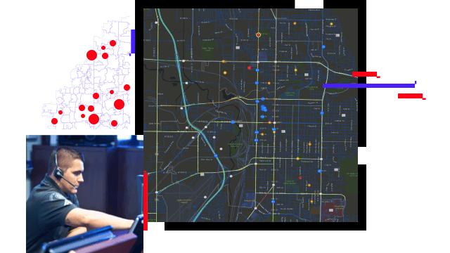
Emergency calls for service contain location information. Validated, dispatchable locations improve a telecommunicator's ability to appropriately assign first responders and ensure a timely response. Real-time, smart GIS maps improve computer-aided dispatch (CAD) and call routing so police, fire, and emergency medical services (EMS) professionals can get to those in need faster and with better situational awareness.
911 emergency calls include GPS coordinates with varying certainties. GIS translates this information into dispatchable addresses that can be reconciled with caller and other location information. Combining this intelligence on maps increases readiness and provides a geographic reference with overall situational understanding.
Share information more efficiently and provide a framework for communication, best practice collaboration, and pertinent training initiatives. ArcGIS Hub for the PSAP provides an easy-to-configure stakeholder engagement platform that organizes people, data, and tools through information-driven initiatives.
Next Generation911 data will soon incorporate z-axis information (elevation) with GPS coordinates for dispatchers. Maps and applications need to be able to consume, analyze, visualize, and intelligently share 3D information, including building information models (BIM) that provide floor plans, indoor routing, and improved operational understanding.
First responders need powerful GIS capabilities at their fingertips to complement computer-aided dispatch systems. Mission-based web applications are available for police, fire, and EMS. The apps are easy to customize and can be configured to meet agency needs. Mobile apps provide a powerful, seamless way to communicate from the field while enjoying operational awareness in real time.
Public Safety Answering Points (PSAPs) and command and control centers around the world collect, store, analyze, and share huge volumes of data. Having visual insight into your data makes command decisions easier. Connect directly to your data and transform it to uncover patterns, trends, correlations, and relationships.
INDUSTRY BLOG
Embracing a strategy that includes an enterprise approach utilizing 2D and 3D maps will keep your PSAP prepared for NG911 z-axis information.
INDUSTRY BLOG
Esri's Address Data Management solution provides tools for managing road centerlines with address ranges and site addresses required for NG911.
INDUSTRY BLOG
ArcGIS Hub can help you share information efficiently and provide a framework for communication, collaboration, and pertinent training initiatives.
ESRI BLOG
The Illinois State Police spread access to GIS with the aim to create consistent and accurate data statewide and ensure rapid emergency response.
INDUSTRY BLOG
Greater Salt Lake Municipal Services District decided it was time to improve its addressing functions using the Address Data Management solution.
ArcUser
The shift from Enhanced 911 to NG911 places a lot more importance on your GIS data because accurate street and address layers are crucial.
Address Data Management
Daily Activity Dashboard
Fire Incident Dashboard
Community Data Aggregation
Road Closures
AED Inventory
Warming and Cooling Centers
3D Basemaps