


INDUSTRY BLOG
3D GIS data migration for the PSAP
Embracing a strategy that includes an enterprise approach, utilizing 2D and 3D maps will keep your PSAP prepared for NG911 z-axis information.
Explore resources for public safety agencies and connect with industry experts.
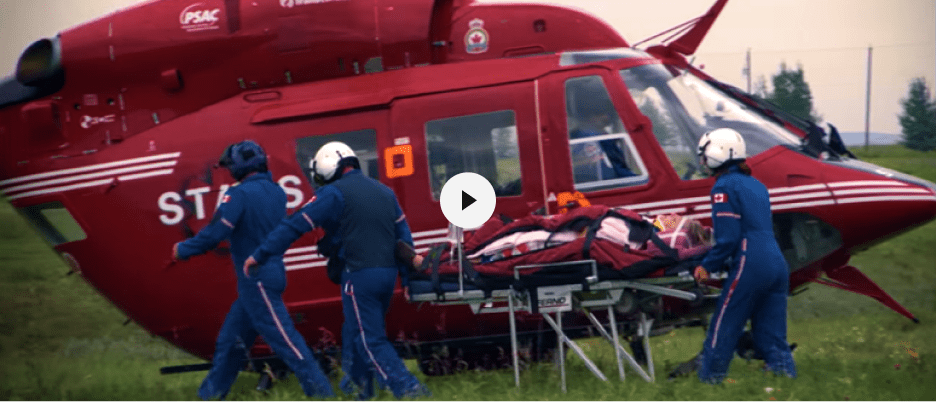
Discover how Shock Trauma Air Rescue Service (STARS) enhanced operations at its Emergency Link Centre with Esri's ArcGIS technology.
3D GIS data migration for the PSAP
Address Data Management for the PSAP

Using ArcGIS Hub for the PSAP
Industry blog

Next Generation 911finds people in crisis

GIS for 911, an enterprise approach

Getting data ready for Next Generation 911

Using ArcGIS Insights for the PSAP

Web applications for the PSAP

New GIS solutions for public safety agencies

Sussex County, Emergency Calls and Dispatch

Field-tested—Building a common operating picture

Steeplechase race gets real-time GIS for safety

Real-time field operations on the FirstNet network
Oklahoma state police save miles and travel time
Join the geospatial conversation with others in the global community of Esri users. Find solutions, ask questions, share ideas, or browse the forums and collaborate to solve problems with GIS.

Safety and Security Summit @Esri UC | Watch the proceedings and save the date

Instructor-led and self-paced options help individuals apply best practices and quickly learn ArcGIS software. Esri offers these ArcGIS courses, designed for public safety workflows, to help you gain deeper insight into your organization's data for making well-informed decisions.

Esri partners offer specialized solutions built on ArcGIS to solve your real-world challenges.
Speak with a representative.