Disaster debris removal is often the first visible step a community takes in the recovery phase. Esri's ArcGIS Solution for Emergency Debris Management expedites initial debris removal operations; assesses debris volume; and monitors the removal of debris accumulated on roads and at public facilities by following the Federal Emergency Management Agency's (FEMA) standard guidelines.
ArcGIS solutions for debris management
Prepare for emergencies
Speed initial debris clearance
Assess debris removal needs
Monitor debris removal
Train personnel and prepare for deployment
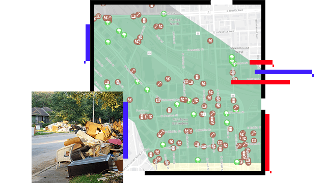
Effective organizations train in advance of a disaster, using mock exercises to familiarize personnel with processes and technology needed during a real disaster. The Emergency Debris Management Center trains mobile workers, based on security requirements, on the apps they will use to perform assessments and debris removal operations.
Triage road obstructions and clearance needs
After a disaster strikes, emergency managers must rapidly identify and clear roads for medical and search and rescue teams. The Emergency Debris Management solution includes a series of information products to report roads obstructed by debris, assign reports to field clearance crews, and monitor and update the status of clearance assignments.
Collect, analyze, and assess from the field
Recovery begins by assessing how much debris has been generated, where it's located, and what types of debris exist. This information can be used to support requests for federal disaster assistance under the Stafford Act. Esri's debris management solution can also be used to perform debris assessments and manage and monitor progress.
Provide transparency and accountability
Organizations managing debris removal face many documentations and community transparency challenges. The Emergency Debris Management solution supports a variety of debris removal workflows—certification of trucks, load and unload tickets, management of removal provider work areas and status, and overall removal process monitoring.
ESRI BLOG
Key West collects assessments after hurricane
After Hurricane Irma hit Key West, Florida, the city collected damage assessments and monitored debris removal with GIS, expediting recovery.
Read the blog
ARCNEWS
A Plan for Cleaning Up Disaster Debris
Following Hurricane Sandy, the City of Philadelphia, Pennsylvania, began developing its first comprehensive debris management plan using ArcGIS.
Read the article
DASHBOARD
Cal OES debris operations dashboard
View how Cal OES and Cal Recycle are assessing and removing debris after wildfires in a real-time dashboard created using ArcGIS Dashboards.
View the dashboard
ArcGIS StoryMaps
Salem, Oregon, manages ice storm tree damage
With debris from storms creating hazardous situations throughout the city, staff turned to ArcGIS to help manage and communicate about the process.
See the ArcGIS StoryMaps story
ArcGIS Solutions and products for debris management
Explore the ArcGIS Solution for Emergency Debris Management and other products to enhance debris management for emergency and disaster management.