Manage public information and collaborate with stakeholders
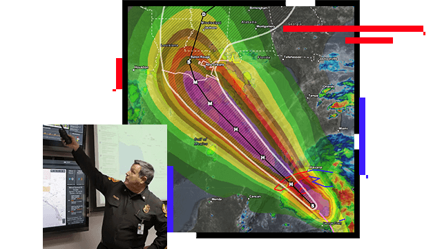
GIS maps are designed to scale when the public and the media need them most. Give your community the necessary information to assess risks, see where hazards exist, and know when and where to act. For stakeholders, GIS provides a secure, collaborative emergency management and information sharing environment for data, maps, and apps.
Tools for information sharing and collaboration
Collaborate and engage
Inspire action
Use maps to share information
Connecting people, data, and tools
Sharing information and engaging with your community ensures an inclusive and grounded approach to building resilience. ArcGIS Hub connects people, data, and tools through information-driven initiatives and encourages collaboration that can inform and drive action across all phases of emergency management.
Provide context to your work
Telling your story using interactive maps, multimedia content, and your own narrative can inspire action. ArcGIS StoryMaps combines these elements to help you drive awareness of key preparedness initiatives. Use visual storytelling to influence stakeholders and provide context during an active response or for critical risk reduction activities within your community.
Share maps with the public
Maps provide context that increases situational awareness and drives action in an emergency. ArcGIS Online is a world-class cloud infrastructure that allows critical maps and apps to scale, so thousands of people can concurrently interact with them. ArcGIS Online is resilient, redundant, and built from the ground up with security in mind.
ARCUSER
Creating the Dashboard for the Pandemic
The Johns Hopkins COVID-19 Dashboard has received as many as almost 5 billion requests a day, providing critical information around the world.
Read the article
ESRI BLOG
Urban search and rescue network gains awareness
The United Nations International Search and Rescue Advisory Group (INSARAG) put a new system into operation, unlocking collaboration and coordination.
Read the article
ESRI BLOG
American Red Cross and partners work from one map
The American Red Cross's Disaster Partner Hub enables a new level of coordination as partners respond to a 500 percent increase in the need for aid.
Read the article
ESRI BLOG
Map connects earthquake victims with critical aid
Needs Map created an interactive humanitarian platform that connects people in need with the individuals or institutions that wish to help.
Read the article
ESRI BLOG
WFP guides operations with online GIS apps
The World Food Programme (WFP) uses maps, apps, and dashboards to gather contextual information to guide its operational planning.
Read the article
Products for information sharing
Explore ArcGIS products that enhance information sharing in emergency and disaster management.