Skip to Content

Preparedness

Location intelligence and spatial data analytics support wildland fire preparedness planning

Fire agency planners working on plans, wildfire map

Understand the landscape

Taking a geographic approach to wildland fire preparedness allows leaders to holistically plan for wildland fires and successfully reduce risks. This data-driven approach uses ArcGIS to understand wildland fire risk to communities, critical infrastructure, and the environment. GIS-based tools help determine where to conduct mitigation work such as hazardous fuel treatments.

Prepare for wildland fire with location intelligence

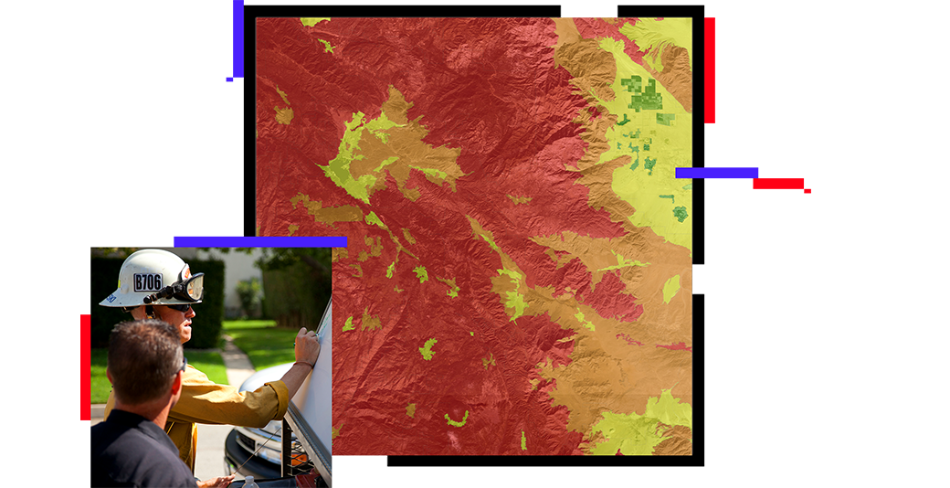
Understand relationships that influence fires

Fire staff can use GIS to map factors such as weather conditions, topography, fuel moisture, vegetation type, land management, and fire history. Layering that information with the location of high-value resources such as critical habitat, infrastructure, and housing developments reveals areas at greatest risk.

Risk map of average wildfire hazard potential in the United States

Visualize patterns to gain insights

Fire staff can use GIS to map, analyze, and prioritize fire prevention and detection programs. Preparedness mapping for at-risk areas informs initial attack plans. These maps also support evacuation modeling by showing population shifts, social inequities, and traffic patterns that influence evacuation strategies.

Fire Safety Survey on a desktop, tablet, and smart phone

Inform plans with reliable data

Accurate data is key to effective planning. Staff can use GIS to collect data on defensible spaces and promote community education, while utilities use the same technology to assess network vulnerabilities related to infrastructure, weather, and clearances. This data, along with the resulting preparedness maps, transforms holistic plans like community wildfire protection plans (CWPP).

Average wildfire risk map and a sign showing today’s fire danger as very high

article

As wildfire risk grows, so does business concern

Businesses use locational and operational awareness to plan for wildfire risk.

Read the article

Solutions for wildland fire preparedness

Previous
Next

Reimagining CWPPs: Embracing the digital era

Transforming community wildfire protection plans from paper-based to digital plans with ArcGIS Hub makes them more accessible, engaging, and user-friendly. Intuitive, cloud-based GIS technology fosters community involvement and streamlined planning processes for wildfire prevention.

Read about digital CWPPs
Go to the CWPP Hub Template

Wildland fire strategies

Previous
Next

Contact sales