ArcWatch: GIS News, Views, and Insights
May 2011
Mapping an Arctic Adventure
By Carla Wheeler
Esri Writer
Esri UK Ltd. developed an online interactive map that allowed people to follow a historic trek to the North Pole by seven men, four of whom were ex-service members injured in war. The Walking with the Wounded (WWTW) team from the United Kingdom arrived at the North Pole on April 16, 2011, after a 13-day trip across the Arctic. A red line on the map traced the journey. Viewers could see the team's location in near real time based on GPS coordinates. The interactive map also included maps, charts, and stories related to famous polar expeditions. "We wanted people to see that the Walking with the Wounded team members are following in the footsteps of some incredibly notable Arctic explorers," said Peter Wilkinson at Esri UK. Read this article.

This online interactive map developed by Esri UK shows the route the Walking with the Wounded team took to the North Pole.

Tip of the Month
Easily Add GPS Data to ArcMap
You can use ArcGIS Explorer Desktop to add waypoints and tracks from your GPS into ArcMap, where you can do further analysis. Read this tip to learn how.
Connect with ArcWatch
ArcWatch is published monthly by Esri and contains GIS news, practical advice, and updates about the company's software and events. To submit article ideas, e-mail editor Carla Wheeler at arcwatch_editor@esri.com.
Blog Spotlight
In this interview on the Esri Training Matters blog, Esri education specialist Ryan Otto talks about the skills review course he authored that will help people prepare for the ArcGIS Desktop Professional Certification exam.
-
Newsroom
Assessing Damage with GIS

Maps created using Esri's ArcGIS Online were included in the EQECAT Inc. Catastrophe Watch (CatWatch) report on the current crisis in Japan. CatWatch, presented via a webinar, gave the company's clients in the insurance, financial, and commercial industries a better understanding of the damage that was caused by the magnitude 9.0 earthquake and resultant tsunami in March 2011. The maps from Esri displayed data such as population information and the tsunami flood zone. Read the article.
Crowdsourcing in a Disaster

Today, crowdsourcing and social networks help to quickly fill the information gap when a disaster strikes. Location-aware social networks let people caught in the midst of a crisis post what kind of help they need and where. In this article, Esri's Bronwyn Agrios discusses the power of location and spatial analysis in relation to crowdsourcing and social networks.
Advantages of ArcGIS in the Cloud
In this video, Esri information technology strategies architect Victoria Kouyoumjian shows examples of GIS applications in the cloud and explains why a cloud solution can translate into time and money saved. She also details Esri's cloud offerings, including a private cloud solution called Portal for ArcGIS.
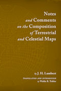
Cartographic Classic Republished
Notes and Comments on the Composition of Terrestrial and Celestial Maps is a historically significant work on modern map projections and their mathematical basis. Esri Press published this new edition of Waldo Tobler's 1972 translation of the original book, written by eighteenth-century cartographer and mathematician J. H. Lambert. Buy the book.
An Augmented View of Reality

Do you own an iPhone, Android, or other smartphone? Then you probably have an app that uses augmented reality (AR). This technology superimposes digital information on whatever you're looking at through your phone's camera. Esri staff are experimenting with using AR to visualize GIS content. See what they're doing, and get ideas about how to start developing your own AR GIS apps.
A New Era for Imagery
Esri collaborated with the US Department of the Interior to make 1975–2005 Global Landsat (GLS) imagery available on ArcGIS Online. Read the article and watch the video.
ArcPad 10.0.2 Released
The latest version of ArcPad gives you more customization options and annotation capabilities, simplifies tasks, and increases access to key geographic data. Find out what else is new.
Try Esri Business Analyst Online for Free
Take Business Analyst Online (BAO) for a 14-day trial. BAO is also now available on the Apple iPhone or iPad. Download the free app.
Download Geoportal Server 1.1
The latest version of this free and open source product features an improved metadata editor.
Edit OpenStreetMap Data in ArcGIS
Get ArcGIS Editor for OpenStreetMap, a free, open source add-on for ArcGIS Desktop.
Accuracy and Volunteered Geographic Information
"GPS is the Casio watch of positioning," says Brent Jones, Esri surveying and engineering manager in this talk on how citizens using smartphones can play a role in gathering accurate information.
Capture Knowledge with GIS

Thousands of utility workers in the United States are nearing retirement. Their knowledge about assets and other aspects of the utility business are priceless. Bill Meehan, director of utility solutions for Esri, says it's important to harness the wisdom of these experienced employees. One way to do that is to have the workers validate and supplement the GIS database before they leave so utilities can truly build a knowledge infrastructure. Read Meehan's article.
ACS in Business Analyst

The American Community Survey (ACS) data collected by the US Census Bureau is now available in two reports on Esri Business Analyst Online. Data includes marital status, education, language spoken at home, income, home value, and number of vehicles. Esri's new color-coded reliability symbols help users better understand the margin of error (MOE) in the ACS data. Read the article.
Chesapeake's Accountability Tool

Restoration of the Chesapeake Bay in the eastern United States can be tracked using a web mapping application called ChesapeakeStat. The Chesapeake Bay Program (CBP) collaborated with Esri and others to build the web-based accountability tool. "ChesapeakeStat is a geoaccounting tool," said John Wolf, US Geological Survey (USGS) and GIS team leader of CBP. "People can see in a geographic context how an agency's goals, strategies, and outcomes are being accomplished." Read the article.
-
Technical Talk
-
-
Web Resources and More
-
-
Hardware Offers

Esri offers US customers a new ArcPad Solution with a Juniper Mesa Rugged Notepad. Mesa Rugged Notepad features advantages of both a Tablet PC and a rugged handheld computer and includes an integrated digital 3.2-megapixel color camera. Mesa is a data collection handheld device with a large 5.7-inch video graphics array (VGA) active viewing display, but it feels like a compact handheld.
Visit the Esri Store to find more software and extensions, upgrades, data, books, and hardware bundles.
FanMap: Bracketography

The National Collegiate Athletic Association (NCAA) Men's Basketball Championship is over. The University of Connecticut Huskies beat the Butler University Bulldogs. Esri's FanMap: Bracketography Edition let members of the public vote on which teams they thought would advance in the tournament. In this article, take a look at the spatial distribution of the teams' fan bases, find out how the web map was created, and learn how an application like this can be used for other types of polling.
Fort Sumter at the Brink of Civil War

This Esri online map lets you compare a map of Fort Sumter in Charleston, South Carolina, at the start of the American Civil War with today's imagery of the area. The first shots of the war were fired at Fort Sumter on April 12, 1861. Click the yellow dots on the historic map to view war-era maps and drawings of Fort Sumter and nearby Fort Moultrie and photographs of the area today. This GIS Education Community Blog post explains more about the map and how you can tap into other geographic resources about the Civil War.
Spatial Roundtable
Easier Access to Historical and Current Remotely Sensed Data
![]()
Lawrie Jordan, director of imagery at Esri, launches a discussion of how to best improve accessibility to imagery, now that it is a readily available data source. Join the conversation at the Spatial Roundtable.
Analyze the Location of Population Centers over Time
This exercise shows you how to use the spatial statistics tools in ArcGIS Desktop to conduct mean center analysis and find out how the population shifted geographically in the United States over the last 200 years.
Demos: ArcGIS for Smartphones
Watch these three video demonstrations as Esri staff show you how to view maps and collect and edit GIS data in the field using Windows Phone or iOS devices.
Top 10 Reasons to Use Terrain Datasets
In this article, Esri's Colin Childs delves into 10 reasons why it's a good idea to use terrain datasets to manage surface data.
Making the Scale Bar the Right Length in ArcMap
Read this tip from the Esri Mapping Center on how to make sure that your scale bar is the correct length for your map.
Top Three ArcGIS 10 Geoprocessing Time-Savers
More Ways to Organize information with ArcGIS 10
Convert Existing Projects to ArcGIS Add-ins
Read GIS for the Oceans

How is GIS being used to protect, explore, study, and better manage our oceans and the resources therein? The best practices book GIS for the Oceans details stories from around the world. Examples include the use of the technology to respond to the oil spill in the Gulf of Mexico and to study the collapse of an ice shelf in the Arctic.
Podcast: The Geography of Retail Operations
"Location, location, location" may be real estate's mantra, but Esri director of commercial industry Simon Thompson says, "I would argue that [location is] even more relevant to retail." In this podcast, Thompson explains why geography and retail go hand in hand and why using GIS makes good business sense.
Map of Protests in the Middle East
This online Esri map employs social media such as YouTube videos and Flickr photographs that are tied to protests throughout the Middle East.
Sign Up for Skills Review for ArcGIS Desktop Professional
This course will help you prepare to take the ArcGIS Desktop Professional Certification exam.
Display Your Work at the Esri UC Map Gallery
Submit your hard-copy or digital maps for display at the 2011 Esri International User Conference (Esri UC) Map Gallery. You can also share a project at the User Software Applications Fair. Submissions are due June 10, 2011.
Wildfire Watch
This Esri interactive map shows the locations and perimeters of current wildfires in the United States, along with precipitation information and social media content related to the fires.