GIS Success Stories Take Center Stage at the Esri User Conference
The opening day of the 2025 Esri User Conference included product demos and updates and notable examples of work from the GIS user community.
August 2025

The opening day of the 2025 Esri User Conference included product demos and updates and notable examples of work from the GIS user community.

Use elevation data in ArcGIS Pro to map storm surges and predict which areas will flood when a hurricane hits.
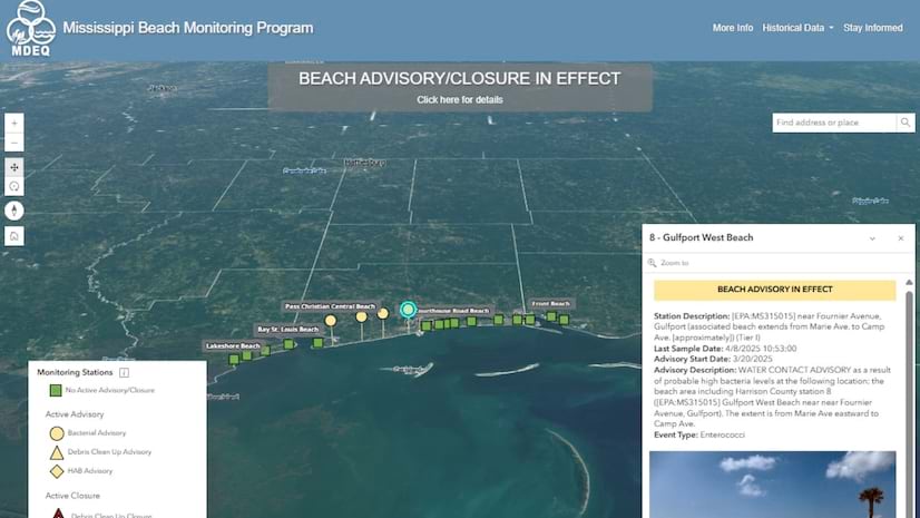
The Mississippi Department of Environmental Quality partnered with The Geospatial Group to transform the analysis of water quality data.
Learn about a practical framework designed to help organizations manage their GIS program and develop their GIS capabilities.
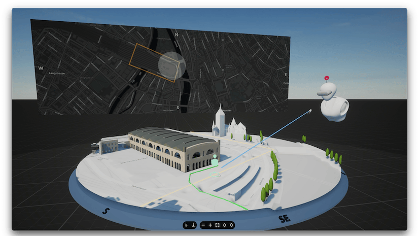
The St. Louis Development Corporation partnered with Houseal Lavigne to create an interactive city model and help revitalize an underserved area.
Discover how organizations are powering greater automation, prediction, and optimization with GeoAI in this new book from Esri Press.
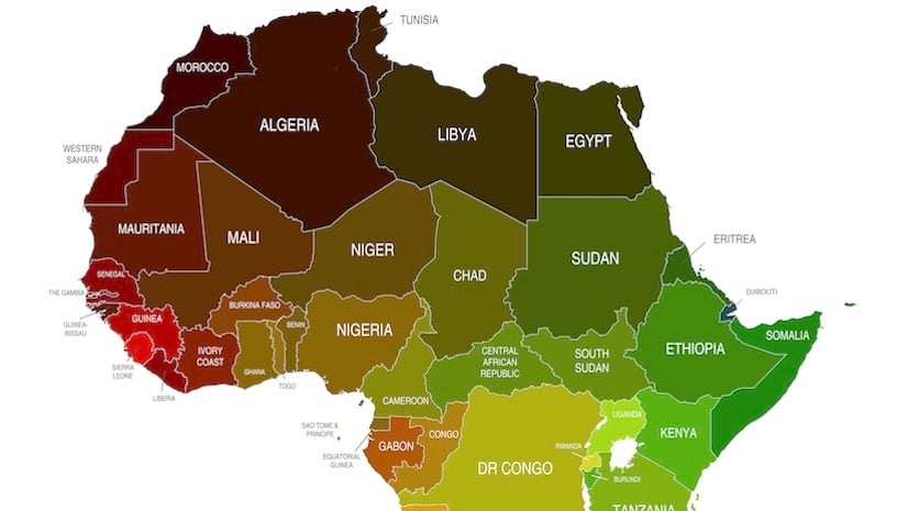
This joint effort is part of a five-year endeavor to produce the most comprehensive basemap of Africa to date.
This September summit lets water utilities from across North America connect with industry leading vendors and network with peers.
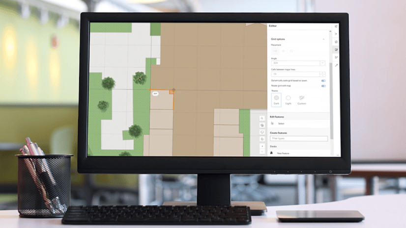
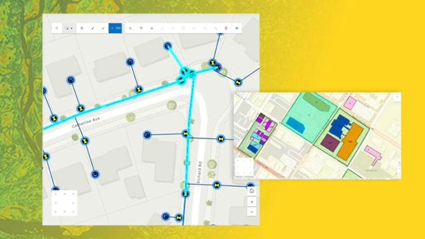
New tools are available in Map Viewer to simplify editing workflows, including new drawing tools for creating features.
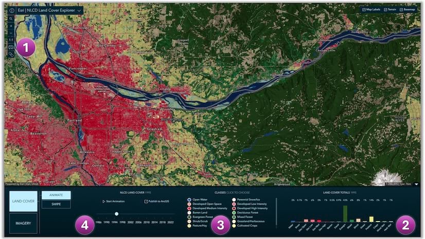
Access land cover mapping data in the form of a ready-to-use imagery layer and a web mapping application, the NLCD Land Cover Explorer.
From immersive XR exploration to real-time analytics, here is a curated list of eleven highlights from the Esri User Conference.
Law enforcement utilizes real-time data, a mobile-optimized dashboard, and pre-planning tools for enhanced situational awareness.
Mick Dunn from Nottingham City Council in the UK explains how the digital twin approach to city planning saved the city money and time.
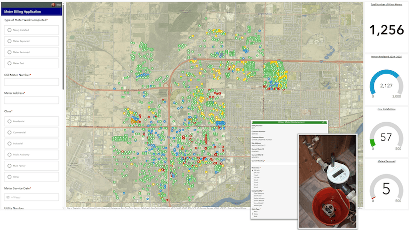
The use of technology such as ArcGIS Pro enables this Wisconsin water utility to streamline work and improve transparency.
Discover ArcGIS capabilities for acquiring and managing imagery through 2D and 3D visualizations in this new MOOC opening on October 22.
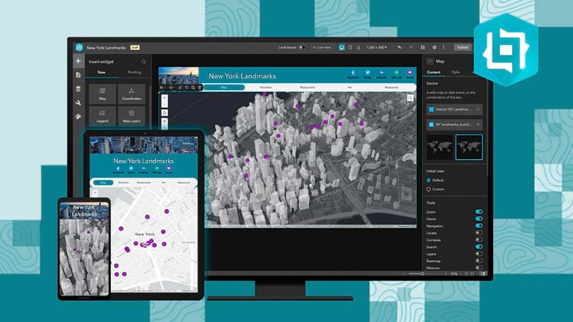
Explore the intuitive interface of ArcGIS Web Editor and watch live demonstrations of its popular editing tools in this September seminar.
In this instructor-led course, learn advanced concepts and workflows to create web apps enriched with GIS content—all without writing code.