November 19, 2020 |
Ryan Lanclos | Public Safety
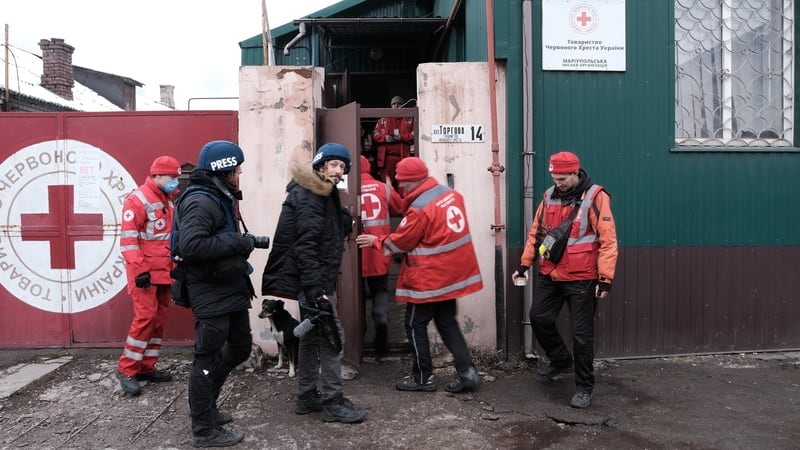
As the conflict in Ukraine continues, a growing number of humanitarian assistance organizations have gathered in Rzeszow, Poland to aid displaced people and rebuild as soon as the fighting stops.
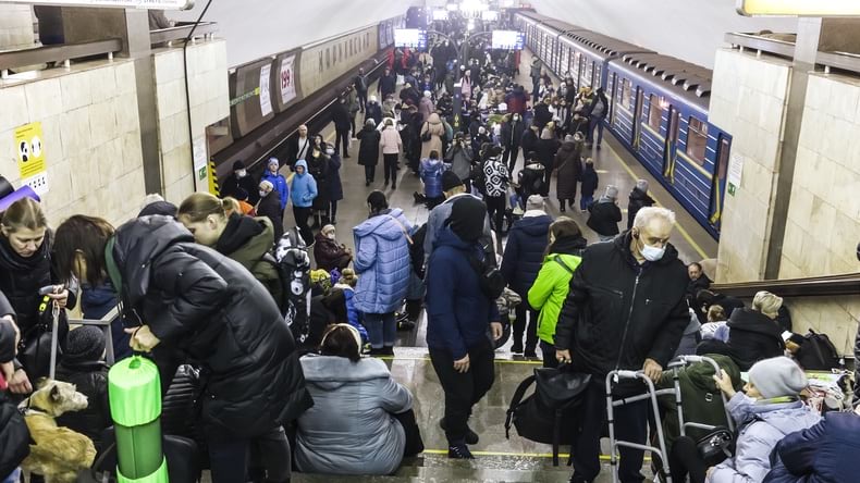
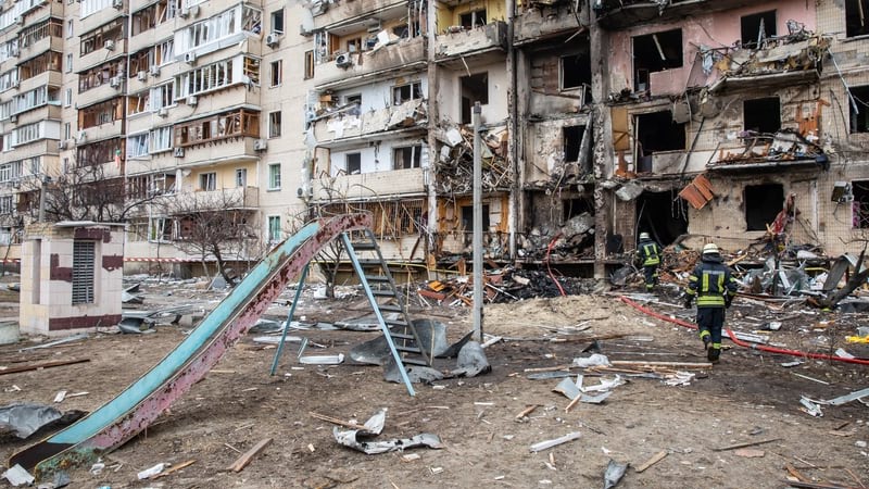
Rather than just wait, many have been mapping the damage to prioritize the reconstruction and resettlement necessary to safely return Ukrainians to their homes. Over the first month of the conflict, more than 4 million people have fled the country, and an estimated 6.5 million people are internally displaced.
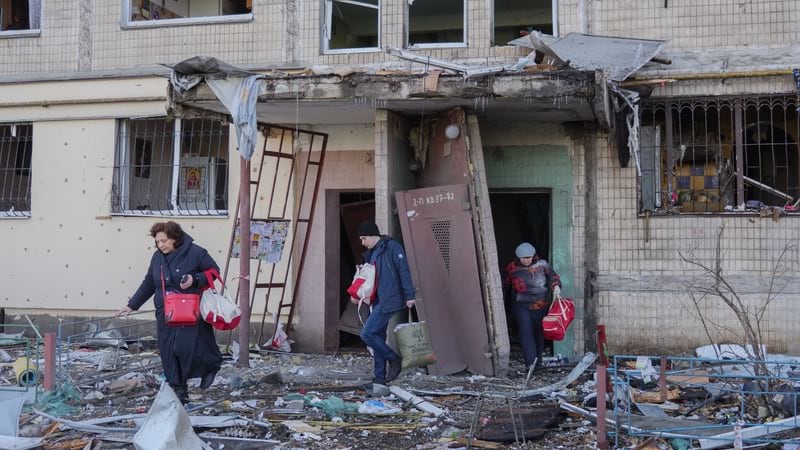
For The HALO Trust (HALO), the largest demining organization in the world, the mapping effort is focused on identifying the presence of explosive remnants of war as well as damage to homes and infrastructure.
A geographically dispersed team is using a geographic information system (GIS) to detail the impacts and the ongoing dangers.
“What we do is critical to reconstruction and resettlement post-conflict, because you cannot just deal with the damage straight away,” said Luan Jaupi, head of information and communications technology at The HALO Trust. “We enable other humanitarian organizations and national authorities to safely conduct their activities by informing them where it’s safe to go and making places safe by clearing the explosives that are littered around.”
Unlike past conflicts where the aggressor had the element of surprise, social media and commercial satellite imagery have allowed the world to see and document Russia’s invasion of Ukraine. These so-called open-source intelligence sources differ from classified intelligence that can only be shared through diplomatic channels.
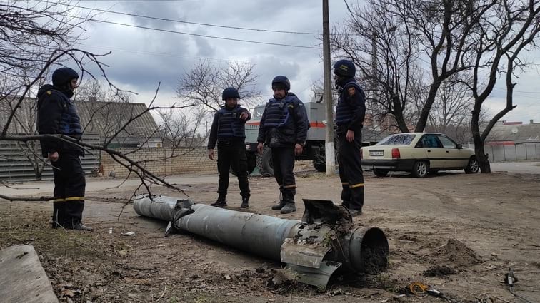
“We’re collecting information from internet sources such as Twitter, Telegram, and Facebook,” said Jesse Hamlin, global GIS and database officer at The HALO Trust. “We’re finding lots of tanks and armored personnel carriers that have been destroyed, and they’re potentially booby-trapped with landmines around them. We’re also seeing mines being littered across a road and vehicles just driving past them, because there’s a panic to get out.”
HALO’s explosive ordnance experts review a variety of datasets flowing into its database from social media and news outlets, verify whether the data is relevant to the mine action sector, identify the model of the munitions if possible, and then place the dangers on a smart map to be shared with others.
“We’re finding lots of bridges that have been blown up by both sides, which means you may have been able to cross that bridge at one point, either to leave Ukraine or to come back in after the conflict is finished, but now you physically can’t cross the bridge until it is repaired,” Hamlin said. “This will impact the delivery of aid and the return of the people to their communities.”
The HALO team has worked to streamline the steps of geolocating an event on social media and speed the flow of information. Experts can now go through a stream of evidence and filter out just the events they feel need to be investigated, rather than manually searching the internet for social media and news articles.
“Looking at the map, the areas in red show the line of contact, where Russians are pushing forward and getting pushed back on a daily basis,” Hamlin said. “The dots show events we pulled from social media that are color coded for unexploded ordnance, landmine, improvised explosive device, cluster munitions, and other bomb types.”
Each social media post is explored by HALO’s explosive ordnance disposal experts who examine the image to see what they will be dealing with. “They know right away if it’s a FAB-500 aircraft bomb, which provides an evidence point we can investigate in the future,” Hamlin said.
Mapping the bombs and bomb types has helped HALO educate the public in Ukraine about the munitions being dropped.
“We’re interested in cluster munitions for one, because they’re dispersed over large areas and children often pick them up and play with them,” Hamlin said.
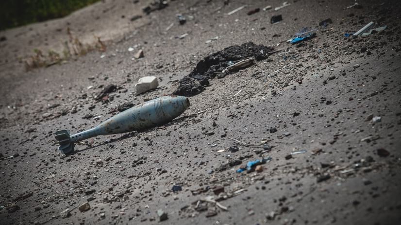
HALO has also received evidence of a new Russian landmine called the POM-3, with sensors that detect human footfall rather than being triggered when disturbed. This new type of mine is launched by rocket and falls to the ground by parachute. When it senses a person, it detonates an explosive that spreads fragments in a circle 50-yards across.
The POM-3 adds great complexity and danger to the demining effort because it will require bomb squad robots to dismantle them at a distance, and HALO will need to acquire that technology.
HALO first did this advanced mapping work in Tripoli, Libya, in 2019, for a conflict that lasted a year.
“We asked ourselves what we could be doing during the conflict to aid our post-conflict intervention, and we decided to record and map the presence of explosive ordnance,” Jaupi said. “We learned a lot of lessons, and we’re doing things a lot better now.”
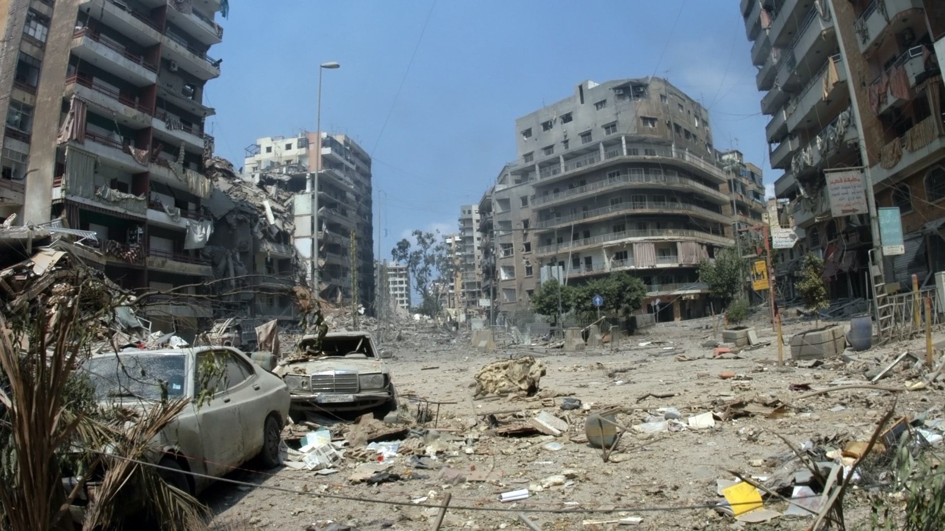
In some of the cities in Ukraine, such as Mariupol, recent imagery is showing massive damage from excessive and constant shelling. An effort is underway to apply the artificial intelligence approach of machine learning to train computers to detect the damage from the imagery. HALO has been working for some time with machine learning experts at Esri to analyze the damage in countries such as Sri Lanka, Afghanistan, and Libya. Being able to detect damage programmatically helps HALO to understand where to find unexploded bombs and landmines.
Work is still in progress to refine the dataset and maps that will be shared with other humanitarian organizations and the international community. As HALO continues to process and refine the dataset, this will provide more clarity on the contamination inside Ukraine.
HALO has more than 8,000 explosive ordnance disposal experts operating in 28 countries. It has been active in the Donbas region of Ukraine since 2016, removing explosive remnants of war from the 2014 conflict. And now there’s a much larger job ahead because the conflict spans much of the country—the second-largest in Europe, behind Russia.
When the situation begins to de-escalate, HALO will use the map to prioritize its work and keep its own staff safe. A simple GIS-based form is being developed that Ukrainians will be able to use to report what they find and where it is located so that experts can follow up and dispose of it. And HALO mappers plan to continue monitoring social media.
“Our goal is to ensure families can return and rebuild their lives in safety, and maps help us do this,” Hamlin said.
Read more about how GIS is used to prepare, manage, and deliver effective humanitarian assistance.