
August 2, 2022 |
Anthony Schultz | Public Safety
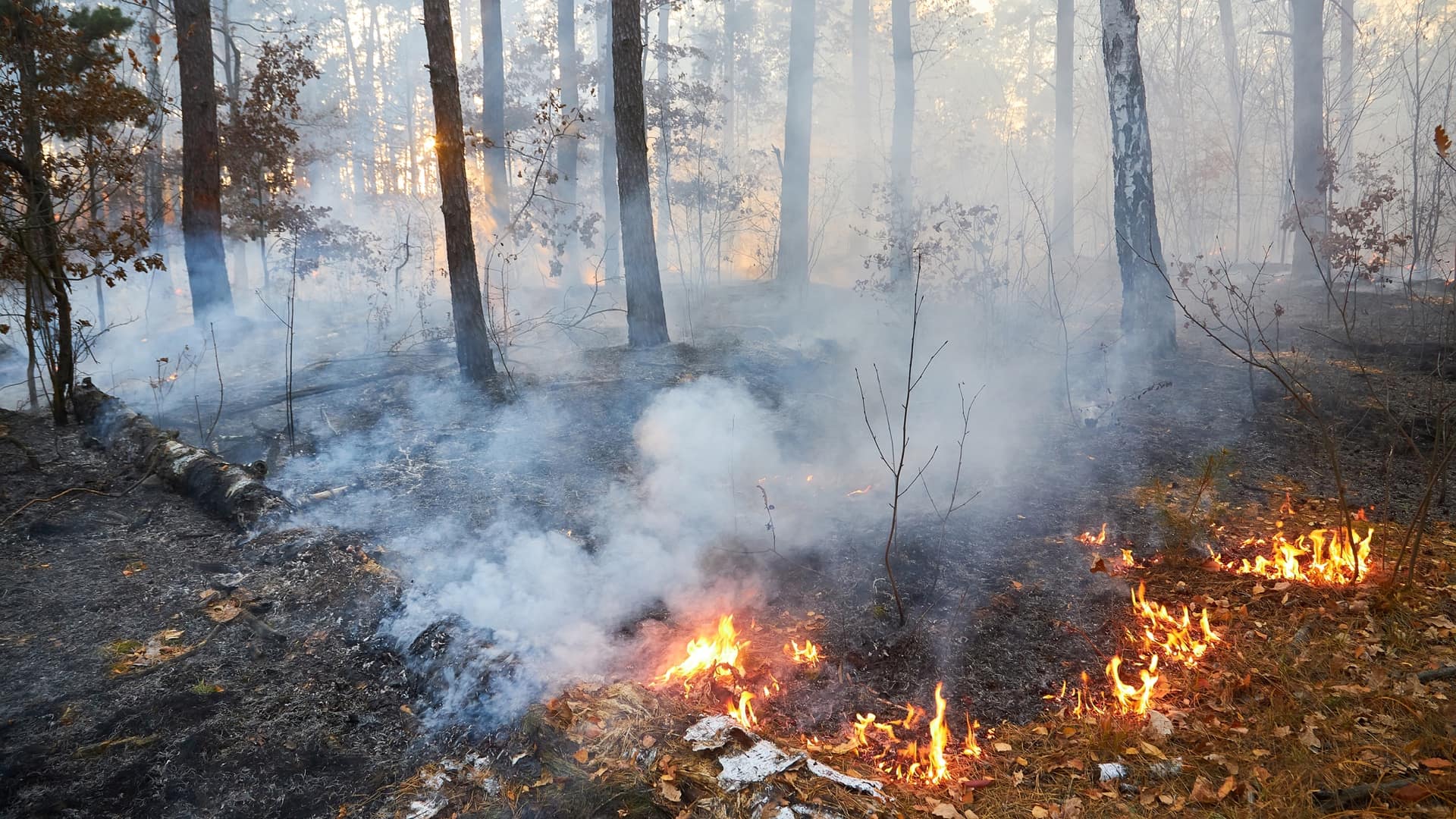
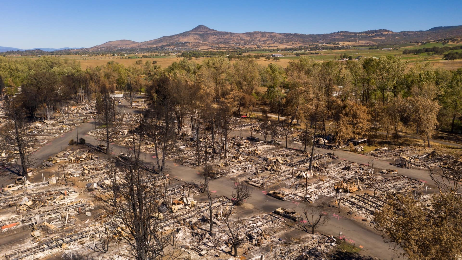
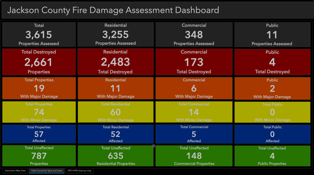
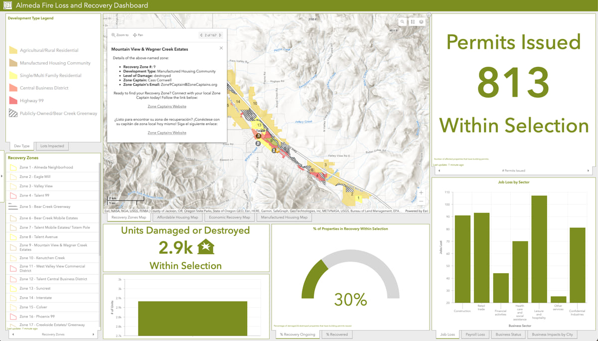
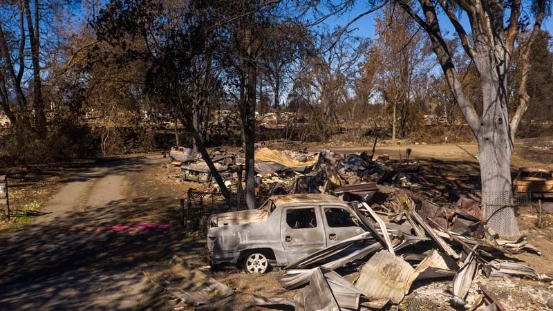
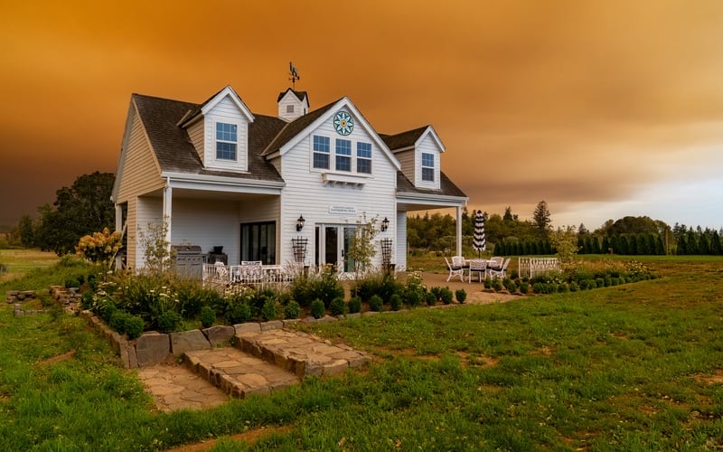
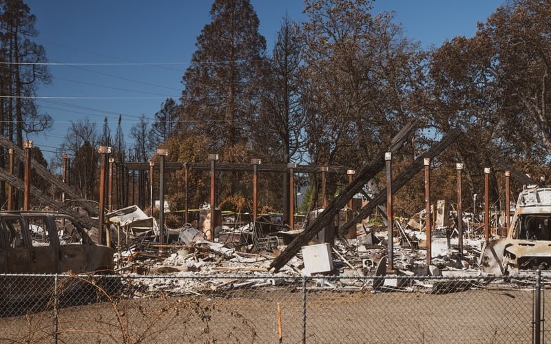
When the Almeda Fire swept through Oregon’s Rogue Valley in September 2020, it destroyed or damaged over 2,750 structures including 2,400 homes in the region between the towns of Ashland, Talent, and Phoenix. The disaster reinforced a greater need for wildfire mitigation for each home and every neighborhood—a measure the City of Ashland is taking using smart maps and risk modeling.
Ashland Fire & Rescue’s Wildfire Division Chief Chris Chambers recalled the devastation. “I drove right into the flames of an entire neighborhood burning. The initial priority had to be getting people out, not putting the fire out.”
Jason Wegner, the City’s GIS Manager at the time, assigned to a damage assessment team, was also haunted by the wreckage. “When I drove home that day, I thought to myself, ‘oh wow, that car driving toward me has paint on it.’ It seemed strange since I’d been looking at so many cars burned to bare metal.”
In Ashland, where both Chambers and Wegner work, only a few structures were damaged, and during the fire many people were going about business as usual. As Wegner recalls, “There were people hanging out in the park and walking around with their lunches, with complete destruction happening mere miles away.”
While strong southeasterly wind spared the city from the devastation suffered by neighboring Talent and Phoenix, Ashland residents, firefighters, and city officials knew it was just a matter of luck, and the fire served as a wakeup call for the community. They emerged from the experience with added motivation to protect themselves against the next inevitable wildfire—when the winds might not blow in their favor.
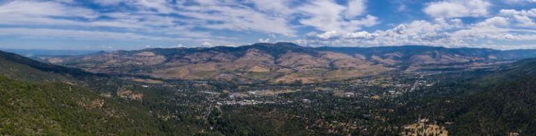
The verdant forest surroundings that coax people to call Ashland home also represent an ever-present wildfire risk. For residents, the Almeda Fire taught many things—among them that firefighters may not have the time or ability to protect every home. That keeping the city and its people safe in the future will require a community effort. And that the actions of each homeowner affect the safety of their neighbors and entire neighborhoods.
Fortunately, Ashland Fire & Rescue had already been diligently working on these issues for years—researching the public’s understanding of wildfire risk, planning and coordinating mitigation efforts, and engaging homeowners about improving defensible space on their properties.
In 2018, fire department officials went house to house doing baseline curbside risk assessments of all single-family residences in Ashland. They performed the risk assessments utilizing Esri partner Intterra’s firefighting software, powered by geographic information system (GIS) technology.
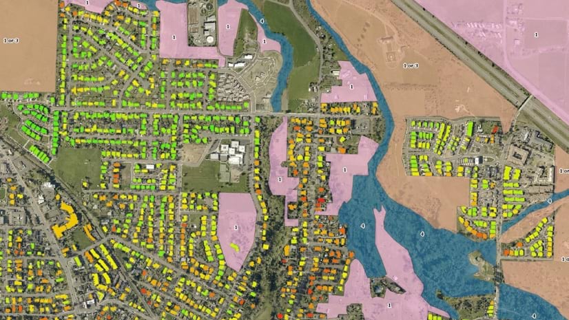
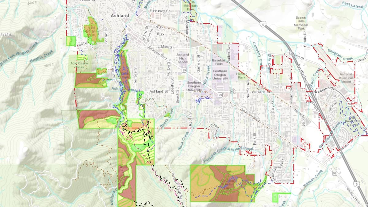
Data from the curbside assessments combined with other data and analysis delivered a more accurate picture of risk. City of Ashland GIS professional Rickey Fite worked with fire department staff to build a model to calculate a risk level for each property, accounting for factors such as slope, aspect, road condition, types of vegetation and maturity, home construction, and vegetation proximity.
The model accounted for other external variables as well, drawing on custom maps of all wildland vegetation within one mile of Ashland, building footprints, and a “nearby neighbor” analysis showing how a home’s closeness to other homes could affect its chances of igniting. Whereas a typical calculation might apply the same risk score to a house whether it was located downtown or in the forest, the Ashland team developed this advanced model to better measure true risk exposure.
After the fire department used the model to assign each home a wildfire risk score, they communicated those details to residents to encourage home hardening and defensible space improvements around homes.
The city-wide assessments directly contributed to the application and award of a $3 million FEMA Pre-disaster Mitigation grant. The funding is being used to assist with the creation of defensible space through vegetation removal and wood shake roof replacement at the top 1,100 at-risk home parcels to help reduce wildfire risks for everyone in Ashland.
Individual homeowners can protect their homes against wildfire by creating defensible space—removing flammable surface vegetation within 100 feet of their home, eliminating ladder fuels that transfer fire from the ground to taller trees, and increasing spacing within the tree canopy. Special attention is given to the zero-to-five-foot zone, which is the most critical to keep a house from igniting.
In Ashland, the work starts by removing flammable vegetation such as juniper bushes and making wood attachments to the house, such as decks and fences, more fire resistant. Material choices for roofs and siding make a big difference, as does hardening any areas where sparks could enter a home, for example by installing 1/8-inch metal mesh screening on crawlspace and attic vents. During the Almeda Fire, many homes were spared initially only to burn down hours or even a day later, because bark mulch that was placed against the house caught fire. New construction code in Ashland requires bark mulch be at least five feet away from buildings.
Brian Hendrix, Fire Adapted Communities coordinator for Ashland Fire & Rescue, was involved in the initial data collection for the curbside inspections in Ashland, and also assisted with damage assessments in Talent and Phoenix after the Almeda Fire. Drawing on those two experiences helped him understand how comparable hazards and risks in Talent and Phoenix affected structure survivability—what types of defensible space and home hardening techniques worked and what didn’t. In many instances, homes that were lost had issues identified as wildfire hazards that increase structure ignition risks.
Hendrix says, “GIS has helped track hazards in Ashland, such as excess vegetation and combustible storage near homes, and seeing post-fire remnants of those same hazards around the homes that burned confirms we’ve been giving residents the correct mitigation recommendations and wildfire risk warnings.”

It’s a virtuous cycle—assessing and mapping an area with GIS before a fire helps build data that can inform mitigation efforts, response, and recovery, which then informs future mitigation efforts. Fire departments can use a geographic approach, building a map of homes and vegetation that highlights risks as a foundational step to support action.
Nikki Hart-Brinkley, a GIS consultant serving the Rogue Valley, describes how a core set of data (vegetation health, building footprints, site addresses) are needed for all phases of a disaster. “If we’re in resiliency building, if we’re in recovery, if we’re in response—it’s critical to maintain these GIS resources so that we’re ready to respond, and we’re effective in our mitigation planning.”
Ashland Fire & Rescue has found the most effective way to encourage residents to harden their homes and improve defensible space has been through one-on-one engagement. When specific hazards on and around a home are identified and explained, the resident is more motivated to respond.
Ashland residents can request a personalized, in-depth wildfire risk assessment from the fire department, conducted largely by trained volunteers. Due to its popularity, there is currently a 3-month waiting list and training for more volunteers is already scheduled. Residents who have completed an assessment gain a better understanding of general wildfire hazard concepts along with specific mitigation needed.
Inspections can help residents be more mentally prepared for a fire by identifying areas of risk around their property and discussing ways to reduce those risks. Other topics covered during an assessment include receiving emergency alerts, evacuation protocols and “go bags,” and encouraging productive conversations between neighbors to enhance mitigation actions within areas that share topography and landscaping. Hendrix says, “The people we engage with appreciate the direct conversation and tend to feel less anxious after an assessment, which means they are less likely to panic during an event.”
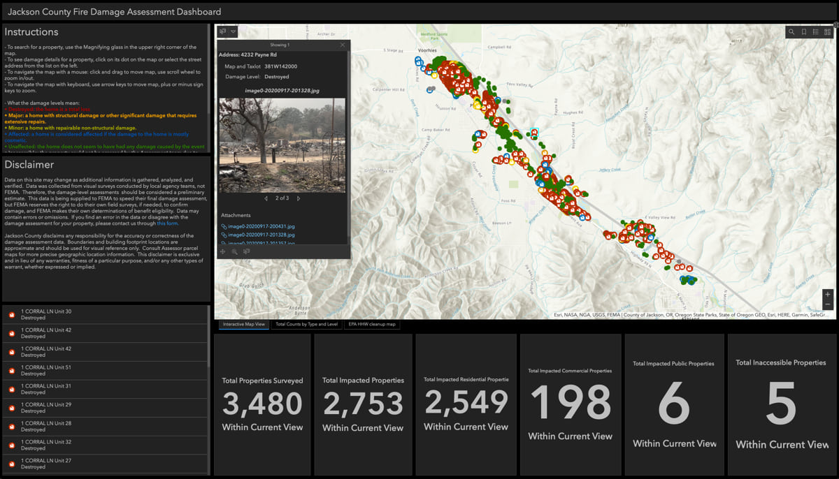
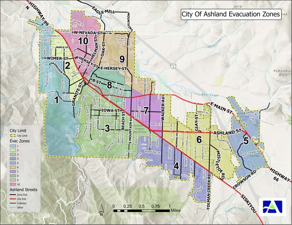
Ashland Fire & Rescue is also incorporating the use of GIS maps to track and share where risk assessments have happened in public maps, to help fire officials and concerned citizens in these communities identify areas where more outreach is needed.
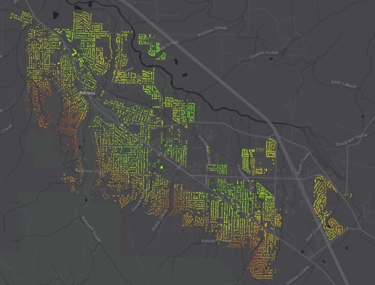
One of the keys to Ashland’s success is the level of detail and rigor applied to risk assessments and mitigation efforts. Rather than classify large swaths of the city at high or low risk, the fire department has leveraged GIS to capture specific risk and hazard details at the parcel level on over 6,800 residential properties through expert curbside assessments combined with exposure modeling.
Chambers explains the advantage this gives Ashland: “The wall-to-wall data we have is unusual with over 6,800 data collection points that help map wildfire risk to people’s homes. We have a better picture of risk with site-specific data of fuels and homes and vegetation across a broad area within the city and the areas that surround it.”
Ashland’s next goal is to reassess the entire city, including businesses, schools, and multi-unit dwellings to further improve the dataset and better target resources for mitigation and education efforts.
That rich dataset has helped the fire department secure mitigation funding grants, inform the critical work people must conduct to make their lots and homes safer, facilitate the department’s response to fires, and ultimately save more buildings and put fewer firefighters in harm’s way during future wildfires.
Learn more about how first responders use GIS to build resilience, respond, and recover from disasters.