Amid EV Boom, Illinois Town Embraces Data-Driven Infrastructure Investment
By Christopher Thomas
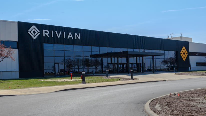
The town of Normal, Illinois has long aspired to be part of the electric vehicle (EV) revolution. They dubbed themselves “EVTown” in 2011 after landing a Mitsubishi plant to build the i-MiEV, an innovative car that proved too early to market. Then Rivian, an EV company backed by Amazon, arrived in Normal in 2017, buying and expanding the shuttered manufacturing plant, and buoying the city’s vision.
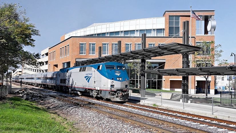
Since 2011, the town has been moving forward on its Sustainable Normal plan which includes tree-lined walking and biking trails, nature-based stormwater solutions, and the multimodal Uptown Station. Residents and Illinois State University students can catch five daily Amtrak trains at the station (and soon highspeed rail) to Chicago and St Louis. The town also invested in renewable energy and installed EV charging stations.
This work on sustainability initiatives—guided by technology to make plans and decisions and measure progress—is what, town leaders believe, attracted Rivian.
“Normal, Illinois, is a secret gem in the Midwest, people don’t quite know about the vibrant environment we have going on here,” said Vasudha Gadhiraju, director of the town’s Innovation and Technology (I&T) department.
The Rivian plant recently expanded to cover more than 9 acres, to accommodate the assembly line for Amazon’s order of 100,000 electric delivery vehicles.
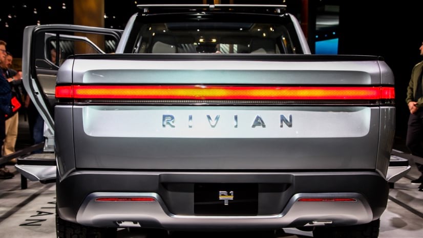
Rivian calls its products Electric Adventure Vehicles. The Rivian R1T is an electric truck that boasts up to 835 horsepower.
Becoming a Sustainable Smart City
Normal planners have guided their place-based decisions and tracked progress on sustainability projects, using the city’s geographic information system (GIS) technology. GIS maps and dashboards enable project visualization and analysis across teams and departments, and support data-sharing with the public. Recently they extended their use of GIS to the town’s Community Investment Plan, lending transparency to important projects.
“Leaders told us they wanted our plan to have a more user-friendly interface that encouraged collaboration and was easier to update,” said Gadhiraju.
For 15 years, Normal released its community investment plan via an online spreadsheet. The rows and columns, though, failed to easily explain what projects were proposed and approved. It was also time consuming for staff to enter or update information or to see overlapping projects in the same place.
Historically, the Community Investment Plan has served to coordinate the town's efforts to enhance its infrastructure and public services. With this platform, we achieved a visually appealing and intuitive tool for residents to learn about planned improvements.
City Manager, Town of Normal
Pamela Reece
The I&T team created a GIS-powered dashboard to visualize plans, working with both finance and communications teams. The solution utilizes off-the-shelf software and was customized to meet the town’s need to track multi-year and muti-funded projects.
“Coordination between departments had been challenging with a lot of back-and-forth since the prior system’s data was not location-based or visually represented,” Gadhiraju said. “With the GIS-based tool, we were able to provide every department visibility to what other departments have planned not just in the current year, but in the upcoming year.”
In addition to the single dashboard where everyone can see all the plans, the GIS coordinator for Normal, Cassidy Killian, built department-level dashboards. Each department can filter their data, record projects in motion as well as their wish-list, and see tallies by project type.
“The biggest benefit is who is doing what and where, getting that overall picture in one place,” Killian said.
Defining Objectives and Reporting Progress
The town and its largest manufacturing employer share the values of transparency and sustainability, one of the many reasons Rivian decided to call the Town of Normal home. The town takes the same “collaborative culture” approach outlined in Rivian’s sustainability strategy, as both deliver transparent reporting based on data from daily operations.
Because each town department shares its data, staff can identify project conflicts and track funding sources to coordinate project phases. For example, if a water main project has approval, the water department can view the scope and timetable for road improvements at the same location to eliminate the frustration of having to cut into freshly paved roads. Staff is working toward tracking project estimates against actual expenses by comparing data from the plan with data in the town’s financial system.
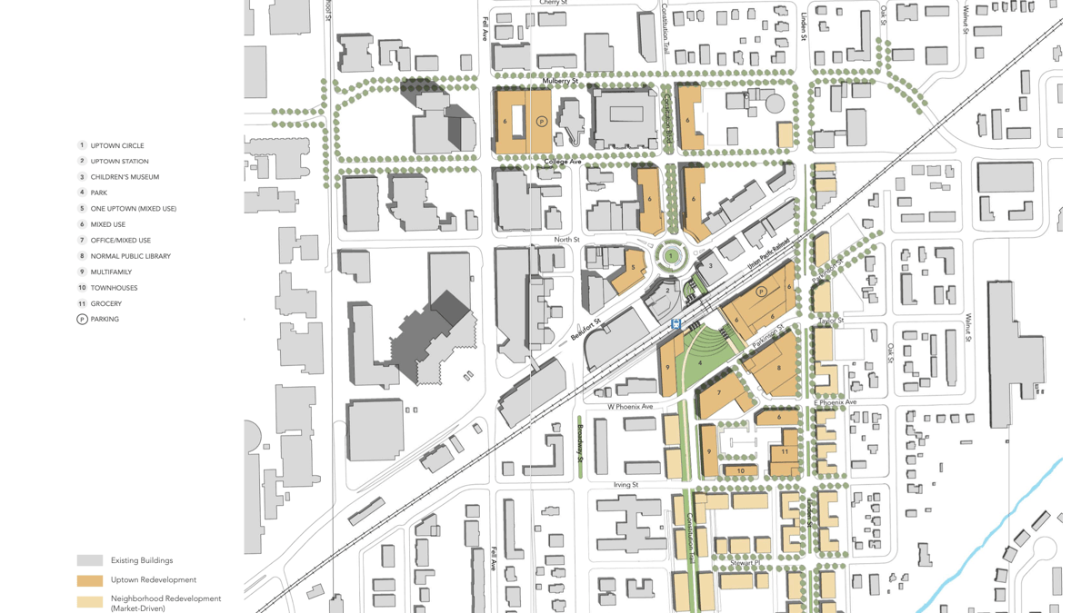
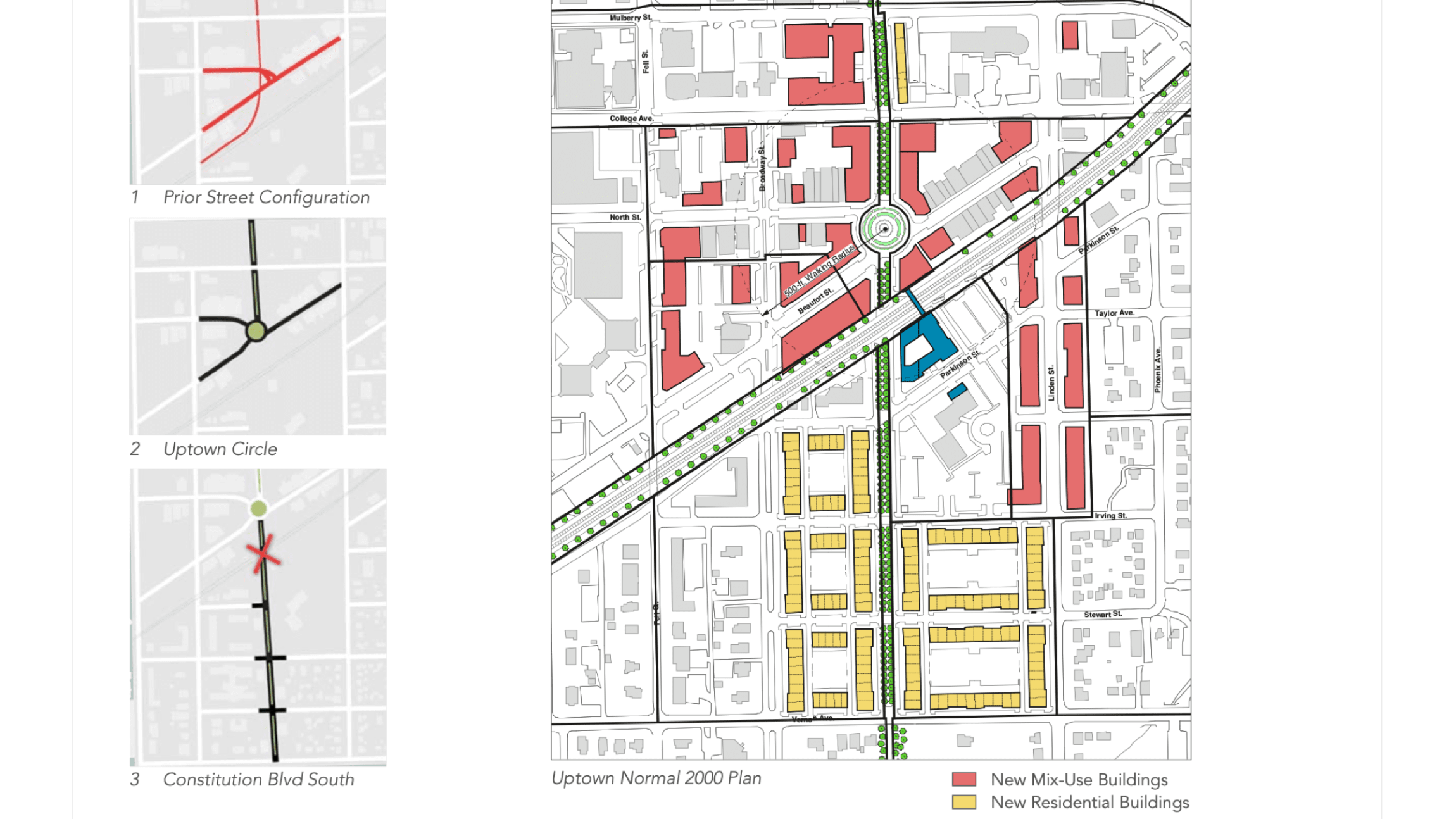
The Uptown Normal Master Plan is one project-heavy example of the town's transformation. (Image courtesy of the Town of Normal)
The Uptown Normal project timeline shows how they often overlap. The new community investment planning tool gives town staff and the public a way to track progress. (Image courtesy of the Town of Normal)
Reconfiguration of a confusing intersection kicked off the redevelopment process. (Image courtesy of the Town of Normal)
“The more data we can feed into this system, the better we can plan and spend our capital project dollars,” Killian said. “As we build on this, we hope that departments continue to collaborate more closely on projects, and that it becomes natural to interact to further streamline the process.”
For residents, seeing the city’s project plans reassures them that investments are equitable across the city. “The purpose of this tool is to make it easier for the public to know exactly what’s going on in their neighborhood,” Gadhiraju said.
Foundational Tool for Smart City Efforts
Normal planners are applying their GIS-based planning and analysis to a renewal of the city center, called Uptown Normal. The work started with a replacement of a dangerous five-way intersection with Uptown Circle, a pedestrian-friendly roundabout and community plaza. The traffic calming effect has made Uptown Normal a more attractive setting for businesses and housing, increasing property values while triggering new investment.
The I&T department created a GIS-powered business directory that shares Uptown Normal’s dining, shopping, entertainment, and lodging options—useful to visitors, residents, and the 21,000 students at Illinois State University. The directory also automates the business licensing process because the information comes from the form each company is required to submit. If a business is not on the map, its license isn’t current.
As part of its sustainability commitment, Normal invests in projects that promote active and multimodal transportation. For instance, the extension of a trail network to new suburbs and expansion of the Historic Route 66 bike trail that links the town to five other communities. Additionally, the new Uptown Connector Underpass project will provide pedestrian, bicycle, and passenger access beneath the railroad tracks, increasing access to passenger platforms and enhancing safety for higher-speed trains.
The town is now well-poised to take advantage of federal funds to continue its infrastructure improvements. Building better in Normal has shown remarkable results. “We’ve received great excitement about the community investment planning tool because it has demystified the planning process,” Gadhiraju said. “But like any technology once you build it you have to constantly keep getting feedback to make it better.”
asset managementeconomic developmentelectric vehicleinfrastructuresmart city
Christopher Thomas
Christopher Thomas is the director of government markets at Esri and a founding team member of the Industry Marketing Department. Prior to joining Esri in 1997, he was the first GIS coordinator for the City of Ontario, California. Thomas frequently writes articles on the use of GIS by government. Follow him on Twitter @GIS_Advocate.