
August 2, 2022 |
Anthony Schultz | Public Safety
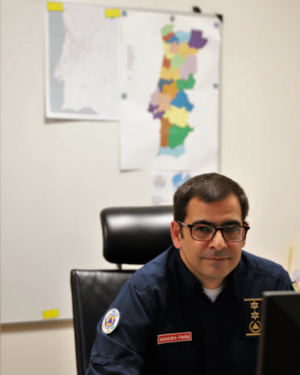
Territory maps cover a wall in Alexandre Penha’s office, providing a constant reminder of how much has changed since he became operations deputy at Portugal’s National Authority for Emergency and Civil Protection (ANEPC).
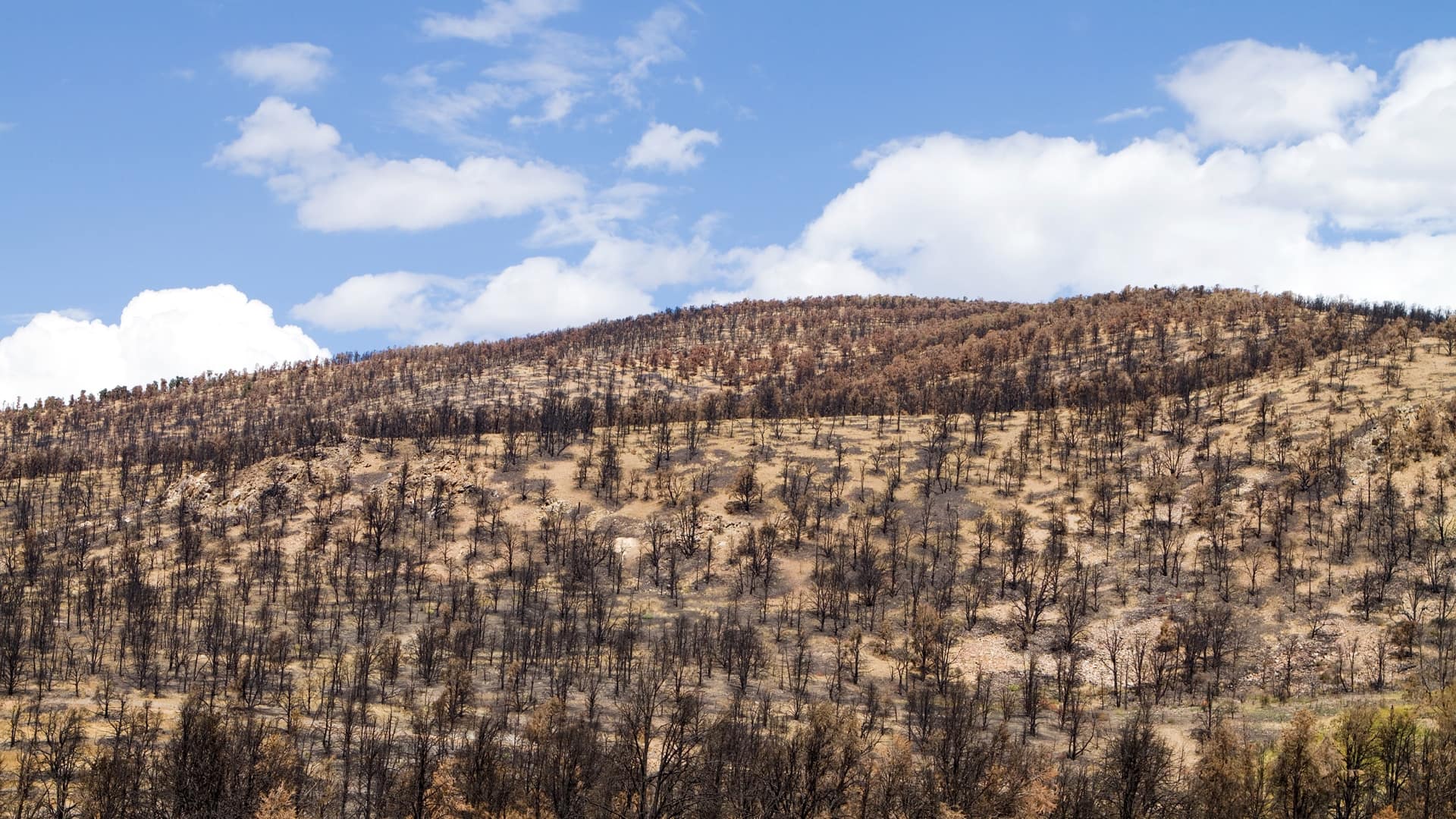
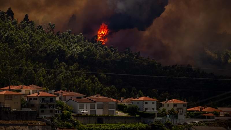
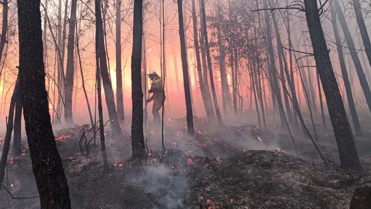
Seventeen days after Penha took over the post in 2017, the country experienced its deadliest wildfires. Drought, high temperatures, and strong winds combined to spread 156 fires that June. Blazes burned 100,000 hectares, killed 66 people, and injured 200. Fast-moving flames destroyed enough crops and livestock to impact the country’s economy. Many people lost everything.
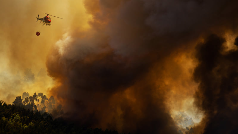
In response, Portugal passed laws to reduce risk and better respond to emergencies. Penha’s organization, ANEPC, redesigned its territories, adding five new regional operational commands. The added areas are designed to improve response times and the capacity to cope with increasing risks. ANEPC hired more firefighters, added aerial assets (helicopters and airplane), purchased fire engines, and equipped firefighters with more protective equipment.
Penha looks at the wall maps to remember redrawn district lines that took effect last year: “There were 18 district commands and now there are 24 subregions, and each has a new name. It’s not an easy test to remember each one yet.”
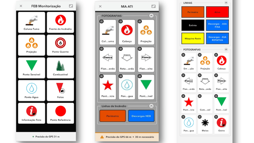
These are some of the only paper maps he looks at these days because ANEPC has undergone a digital transformation. Penha now uses advanced wildfire mapping technology, including an early warning system aided by satellite and radar data to quickly detect wildfires. Real-time maps—powered by geographic information system (GIS) technology—provide a live operational view of every fire. Drones and helicopters populate maps with high-resolution images for up-to-the-minute awareness of fire locations and behavior.
After the 2017 fires, upgrading the decision support system was the top priority. “At that time, information flowed in a text system, and someone was always trying to put that information on a map,” Penha said.
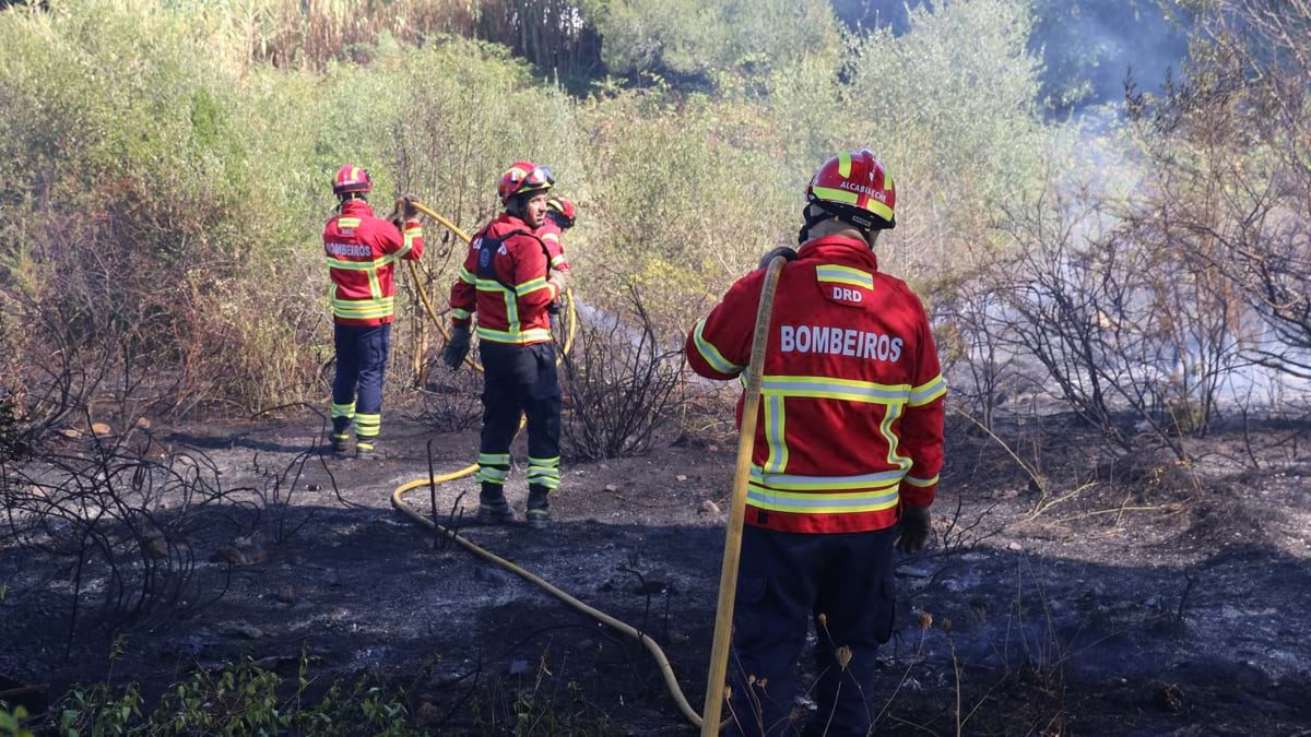
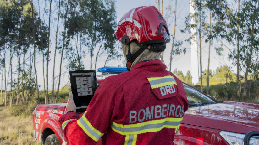
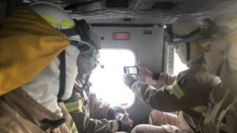
Now a shared map captures incidents and activity so regional, sub regional, and local stakeholders can see current conditions. The civil protection authority, the National Guard, the Forestry Institute, local authorities, and more, provide input and gain awareness via ArcGIS Online. Firefighters and the National Guard collect data on smartphones with ArcGIS Survey123. Helicopter crews use ArcGIS QuickCapture to gather images and make updates about fire behavior.
“They can send important information to the fire analyst—the type and inclination of the smoke, the wind, the type of fuel,” Penha said. “The results were huge, not only for the flow of information but also our ability to predict the evolution of each fire.”
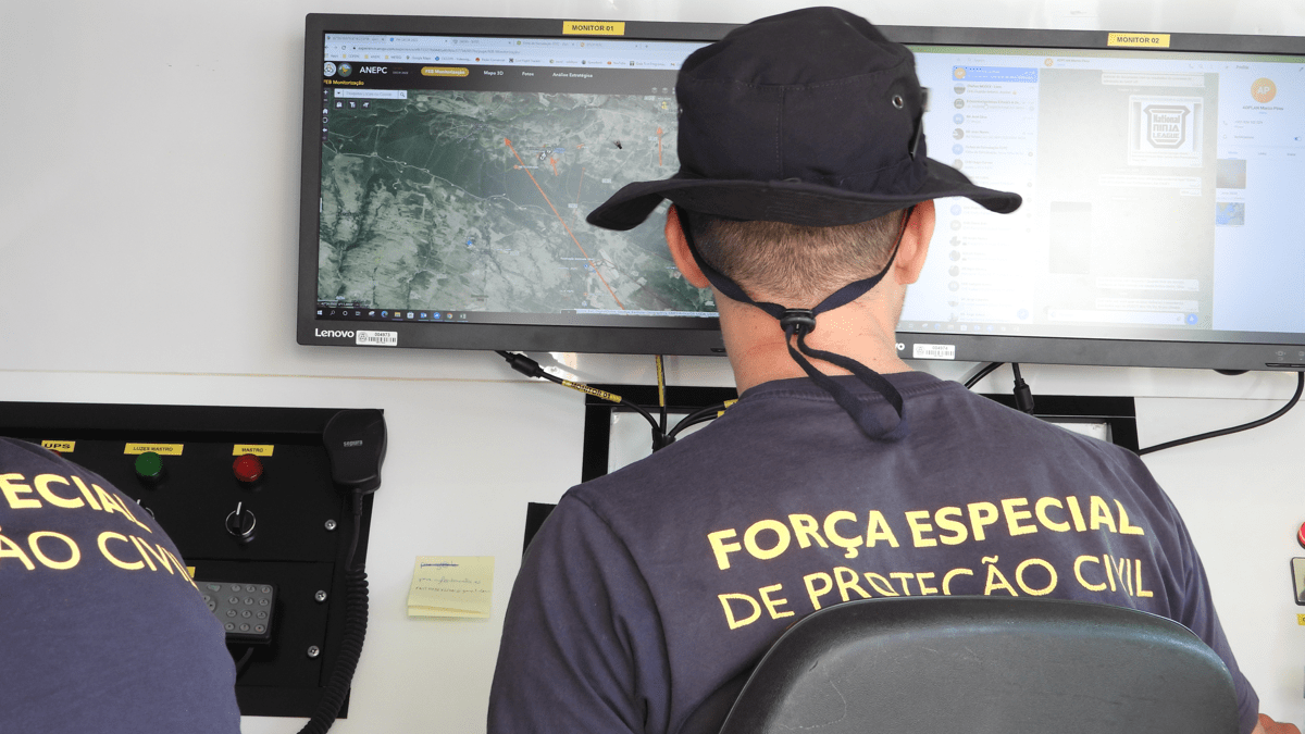
The system provides a national overview along with a view of each subregion. It reports the events of the last few days, shows where fires are occurring, and tallies the energy released by each fire.
“Right now, on my screen, I have one fire with crews that have been dispatched, one where crews are working, one that has been contained, and one we’re watching,” Penha said. “I can keep an eye on each one. I can see how many men are there, how many trucks, how many aerial assets.”
The map view integrates with other operational platforms, including weather predictions and dispatch centers. When a fire crew is sent to help, they know what to expect, and they can use the system to report their work. Later, administrative and financial details are added so all aspects of response can be assessed after each fire.
One of the first laws to pass after the 2017 fires was a mandate that farmers must clear their fields after harvest. The National Guard maps each farmer’s preparations for the fire season.
“National Guard teams go from field to field to collect data,” Penha said. “On the one hand, this work compels farmers to clean their fields. It also gives us an overview of what vegetation and fuels are present, so we know what to expect if fires occur.”
In forests, prescribed burns reduce fuel loads. The mapping system identifies areas that should be burned and, in real time, supports firefighters in keeping each burn under control.
Penha was a firefighter in the Lisbon Fire Brigade for 20 years before coordinating a national response. With his new job, he has gained a national awareness of what’s needed—beyond the use of high-tech maps.
“We have a huge problem in that the people who care for the forest are getting too old,” Penha said. “Younger people want a different life. Even if the government has the money, if there’s nobody there, nobody will take care of the forest.”
Penha sees this problem not only with fires, but also with floods. Without people in rural areas to keep an eye on things, the pace of climate change overwhelms land managers.
Regions with a Mediterranean climate are among the first threatened by growing wildfires. Portugal collaborates closely with other European countries, especially Spain, France, Italy and Greece as each has suffered major fires. But the threat is spreading.
“This year, Italy deployed aerial assets to Germany and Romania because they are starting to suffer from climate change and have big fires,” Penha said. “In 2019, we sent planes to Sweden, one of the countries that we never expected to have problems with forest fires. That’s the way things are now.”
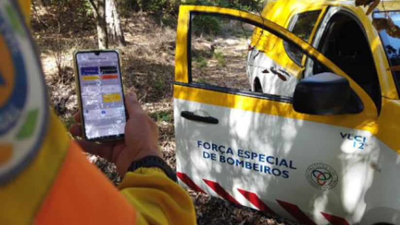
In March of this year, ANEPC sent a team to Chile as the country was dealing with several big fires during its summer months. Portugal’s firefighters arrived equipped with the command-and-control system on smartphones. The 140 firefighters used QuickCapture to collect images and share information.
Drought and winds continue to plague forests in South America, as they do in Europe. In Portugal, the summer of 2022 was difficult. Fires burned July through October inflict widespread damage. Hundreds of people were injured, and hundreds of structures were destroyed. The military was called to help with firefighting.
In preparation for this summer, ANEPC is developing artificial intelligence workflows to help determine where best to apply its resources. Teams are anticipating a need to battle between 80 and 120 forest fires every day.
“The number of fires will certainly not be fewer this year, and we won’t have more firefighters,” Penha said. “We’ll have some new sensors on our reconnaissance airplanes that will give us more information and we have to do a rapid analysis of it. We’re always moving volunteers and firefighters from the coast to the interior of the country and from the south to the north. If we don’t have timely evidence, the places in need won’t have firefighters.”
Learn more about how GIS is used to map and analyze wildland fires and learn how GIS provides a solution for community wildfire protection plans.