April 27, 2023 |
Karen Sullivan | GIS for Good
April 13, 2024
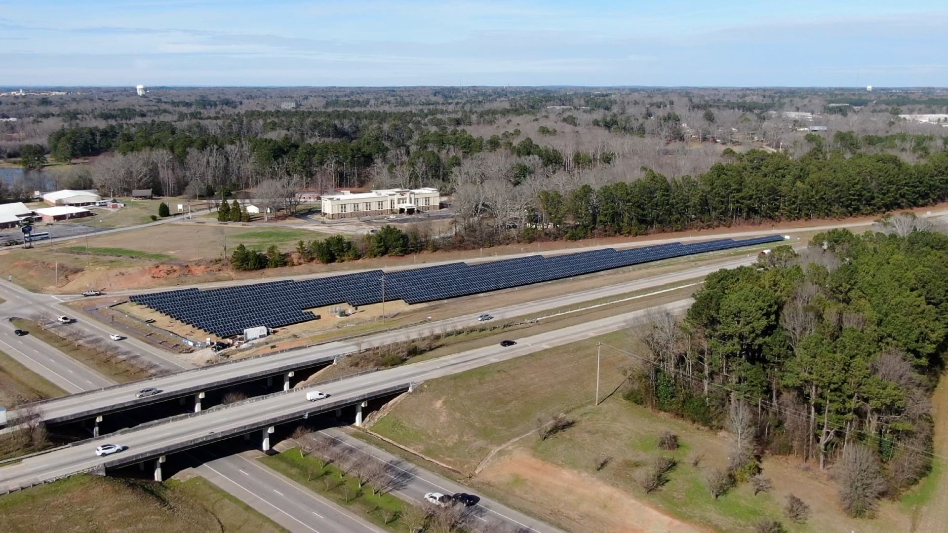
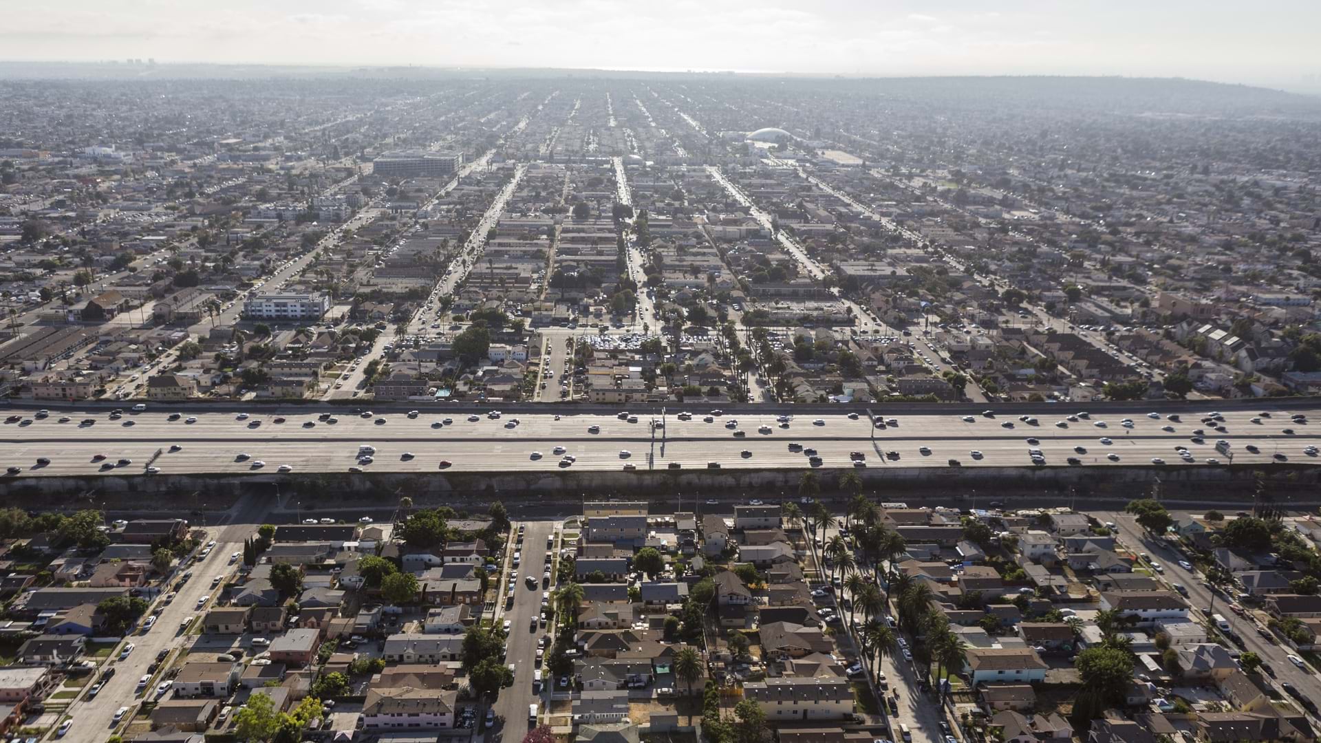
Saturday, November 11, 2023, Los Angeles residents awoke to news that a fire had forced the closure of a two-mile stretch of one of the city’s vital transit networks—US Interstate 10.
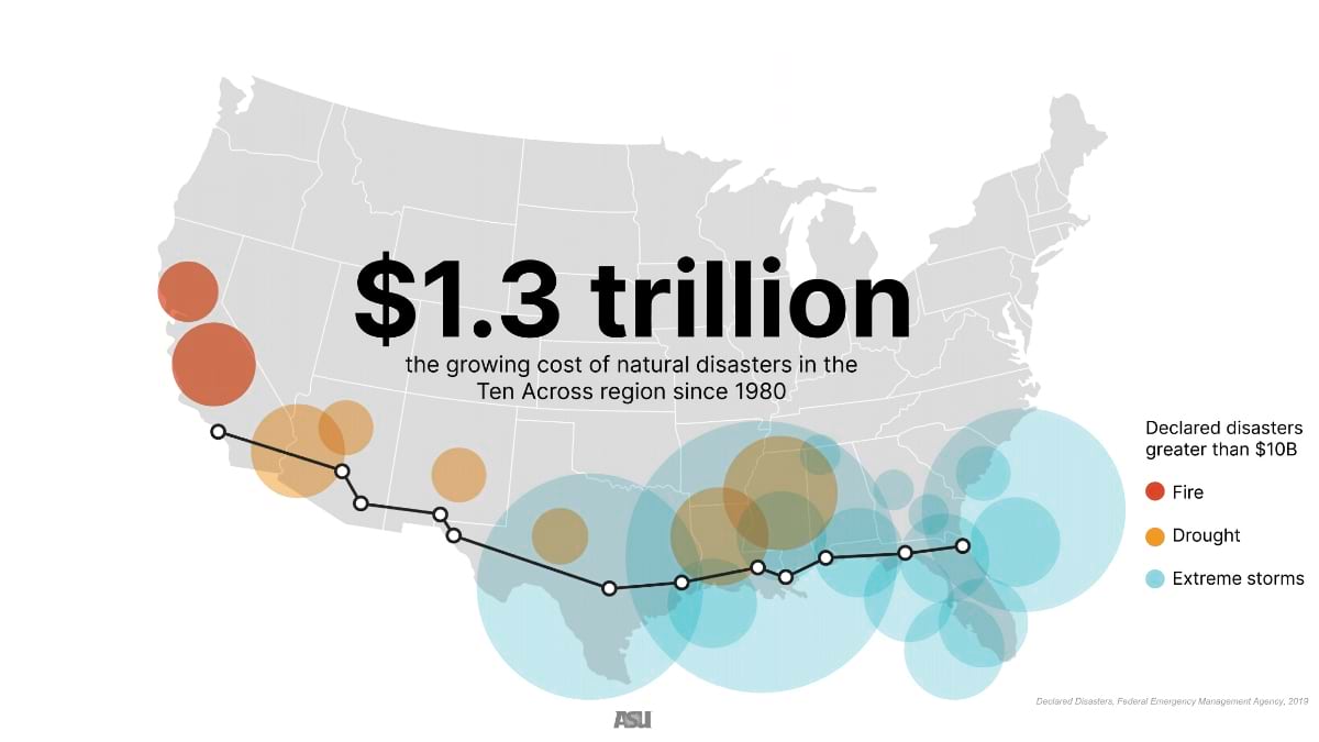
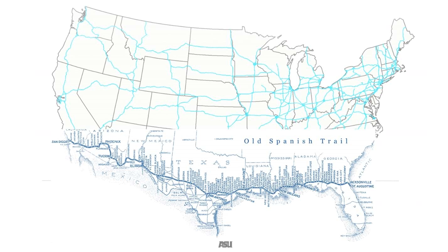
At the time of the incident, Dan Walters, of Cal Matters reported, “If any freeway is a cultural icon, it is Interstate 10, which stretches more than 2,460 miles through eight southern tier states, from the Pacific Ocean in Santa Monica to the Atlantic in Jacksonville, Florida.” Though the freeway shut-down in LA didn’t impact everyone along US I-10, it did call attention to our dependence on the infrastructure we take for granted, the enormity of this particular highway, and especially, its vulnerability.
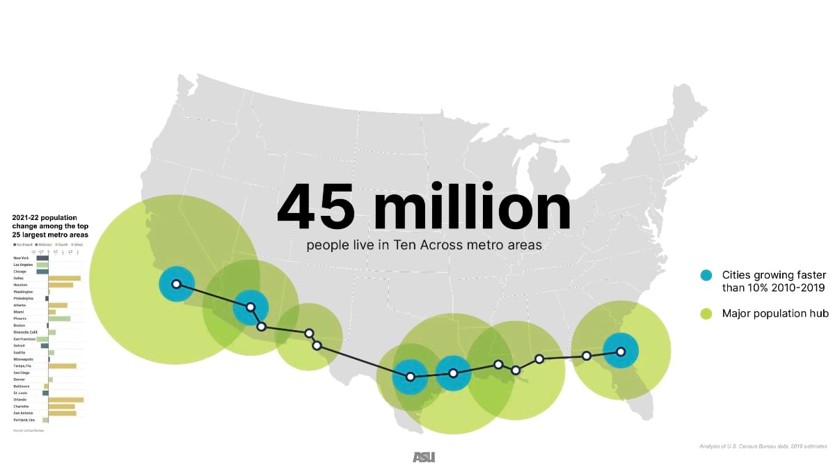
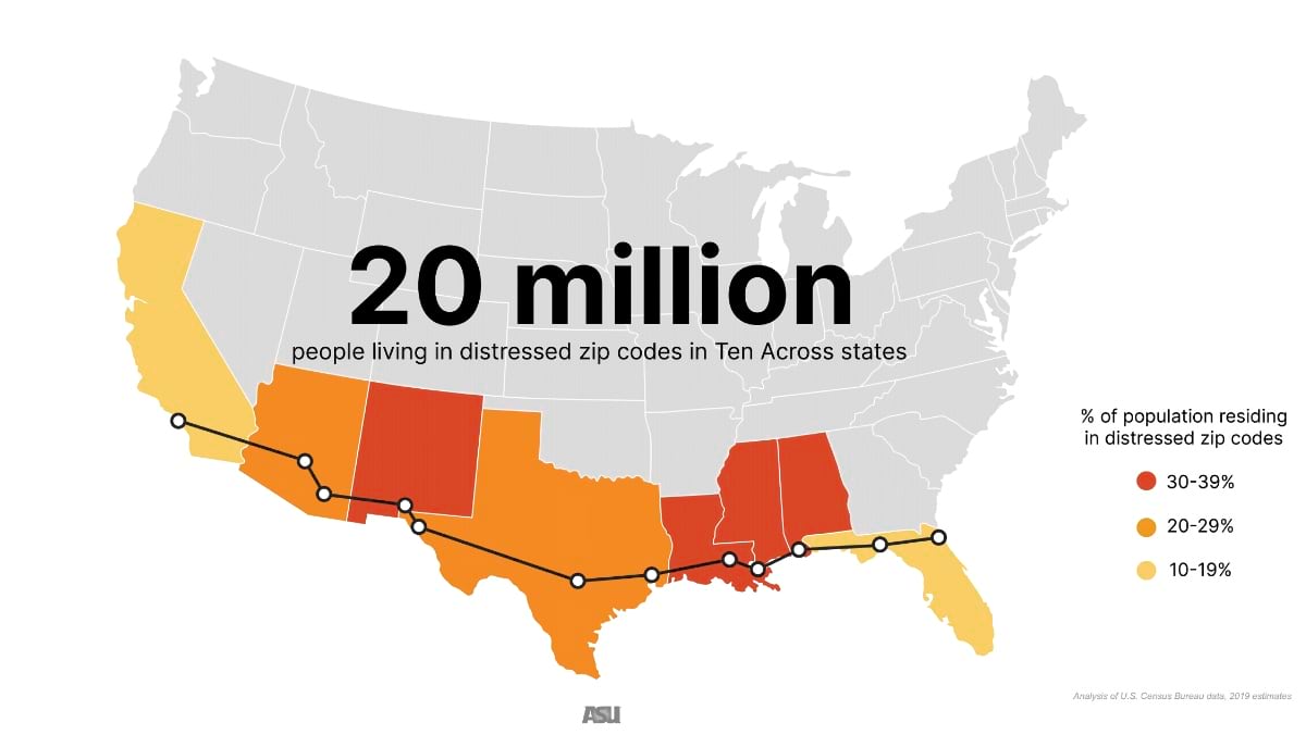
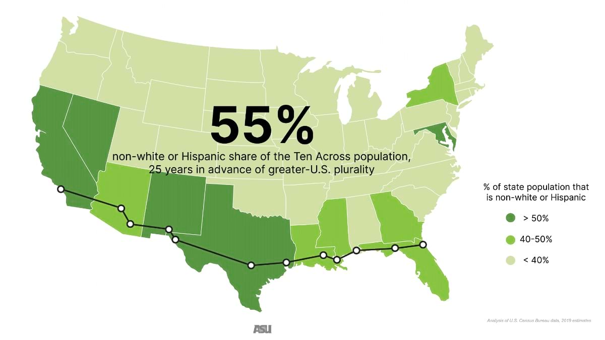
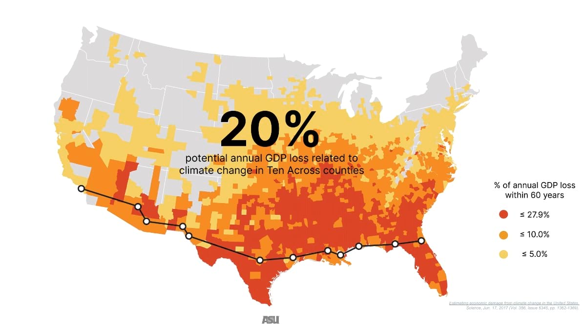
“The 10 passes through the region of the country that is on the front lines of demographic, social, economic, and climate change,” said Wellington “Duke” Reiter, who founded Ten Across an initiative that focuses on the US I-10 region as a living laboratory for resilience and innovation. “The geography may vary but we are confronting many of the same challenges.” Having lived in both New Orleans or in Phoenix, Reiter noticed that “We’re on the same street, in multiple ways, and the fragility of our respective futures connects us.”
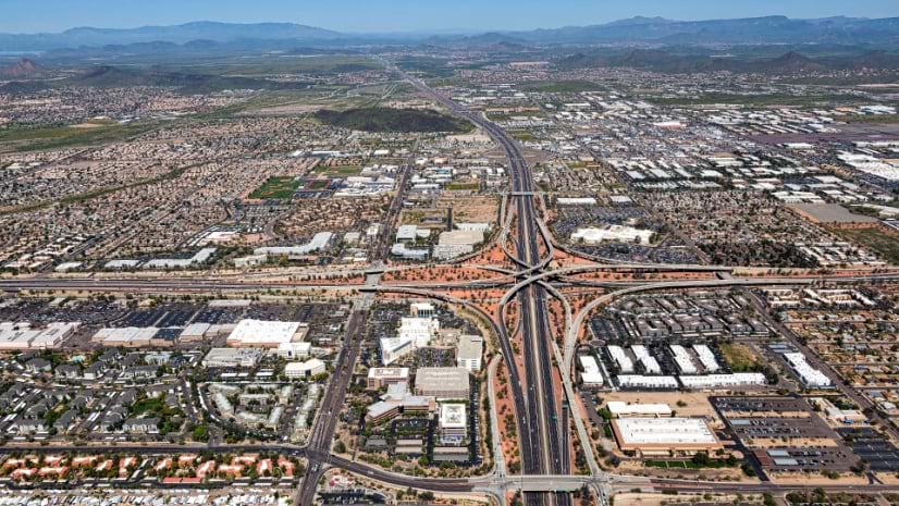
The Ten Across initiative is working to unite mayors, federal officials, urban planners, engineers, subject experts, community groups, and chief resilience, sustainability, and heat officers to address shared concerns and solutions. The group’s conversations center around data and science to address shared challenges, especially in the 12 major cities in the corridor that use smart maps made with geographic information system (GIS) technology to understand present conditions and future scenarios.
“Unfortunately, we have major issues that we are not fully prepared to address. What we are hoping to do at Ten Across is to illuminate them and work together towards proactive responses and the necessary adaptability,” Reiter said.
Reiter was inspired to create Ten Across having lived in two cities with existential water issues—New Orleans and Phoenix—one has too much and the other faces scarcity. He worked with colleagues at Arizona State University (ASU) and the Water Institute, to host Ten Across’ first major summit in Baton Rouge, Louisiana.
“What was fascinating about this event is that we had people from very different locations on the corridor experiencing different challenges, and yet they found common denominator issues, such as policy, infrastructure, climate science, and leadership at various levels of government,” Reiter said. With this proof-of-concept, three additional summits followed in Phoenix, Houston, and Los Angeles.
With a background in architecture and planning, Reiter leads ASU’s University City Exchange to support community-based urban and environmental projects. In these initiatives, just as with Ten Across, Reiter embraces a place-based approach informed by GIS technology.
“We work to combine lived experience and supporting data; both are true and valuable,” Reiter said. “While sharing personal experiences is important to us, it’s visualizing the data and its tie to place that tells us something more.”
In Fall 2022, Ten Across and the ASU College of Global Futures joined forces to launch Resilient American Futures: An Academic Road Trip, an online course focusing on sustainability and resilience along the I-10 corridor. Students study 12 major cities and specific challenges like water, energy, transportation, and important societal shifts. In the process, students are introduced to nearly 70 academic disciplines and career paths. For example:

Students use ArcGIS StoryMaps for an interactive learning experience with web maps, videos, and digital media. Benjamin Stanley, who leads the course, worked with his team to create 50 distinct maps to examine issues across place and time. “Using sustainability issues in real world places as the starting point of class material—as expressed through popular media narratives—allows an instructor to begin teaching as close as possible to a student’s own lived experience. Once they have a concrete, place-based example of something, and can relate it to their own life, they seem more motivated to learn the underlying academic concepts and pursue additional learning on their own.”
Based on the popularity of Resilient American Futures: An Academic Road Trip, Ten Across is developing additional courses using data from the ArcGIS Living Atlas of the World. With journalism being a key component of the initiative, Ten Across is working with ASU’s Walter Cronkite School of Journalism, to equip future journalists with GIS mapping skills to enhance their reporting.
“Students today have many reasons to feel despondent about their futures,” Reiter said. “We wanted to offer an opportunity to supply them with the knowledge and tools to actively participate in solving these problems.”
Often the problem-solving work begins in the face of a disruption—such as the closure of a major stretch of I-10 in Los Angeles. But Reiter aims for a more proactive approach, using GIS to inspire positive change through Ten Across and ASU.
“We are six years into this journey, and we are working to empower future generations to make necessary and transformational changes now,” Reiter said. “It’s amazing how GIS comes up in nearly every conversation. It’s naturally embedded into how [we] work together to find solutions.”
Learn more about how GIS helps future generations address sustainability and climate challenges to create more resilient communities.