September 27, 2017 |
September 10, 2019
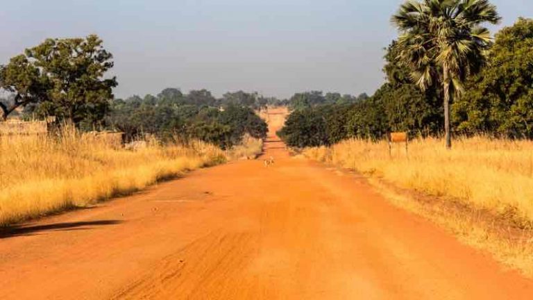
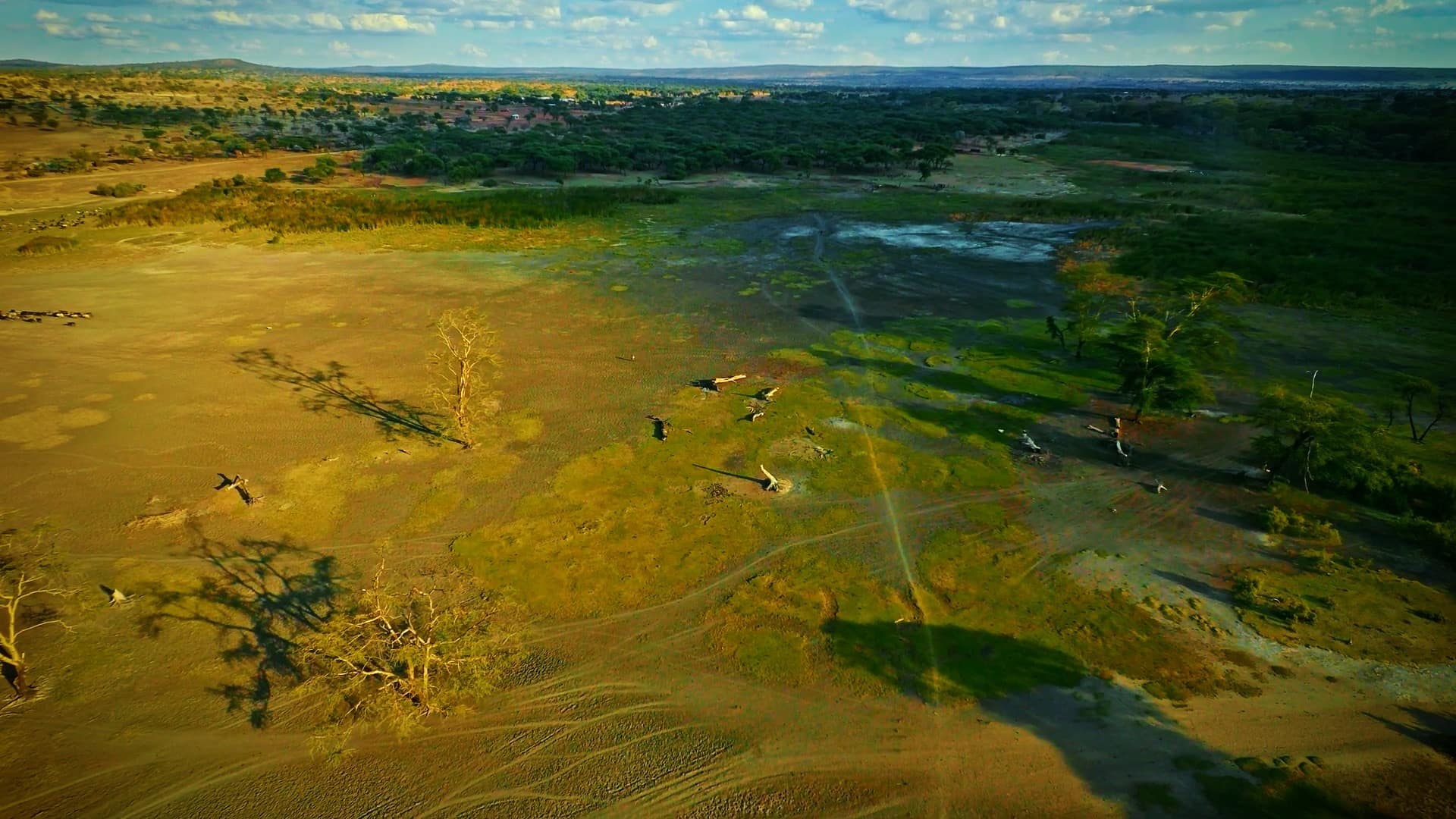
Burkina Faso, a sub-Saharan country in Africa, is one of the poorest and most vulnerable to climate change. With limited natural resources across more than 100,000 square miles of arid land, its 20 million inhabitants rely on subsistence farming to survive. Periods of drought have increased anxiety and uncertainty of harvests, causing many to migrate.
With support from the World Bank, farmers in this region have embarked on a large-scale effort of tree planting, or afforestation, to infuse new life into their land. The effort is part of the United Nations’ collaborative program on reducing emissions from deforestation and forest degradation (REDD+) in developing countries.
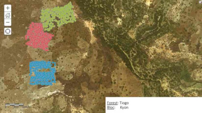
The investment in Burkina Faso’s agricultural region, in both state-owned and community-owned forests, aims to increase the carbon sequestration of forests while reducing poverty and bolstering food security through participative management of the land by local villagers. The project, funded by the Climate Investment Fund, targeted 12 forest reserves across Burkina Faso that span 300,000 hectares of land.
Guigonan Serge Adjognon, an agricultural economist in the Development Impact Evaluation Department of the World Bank, supports the impact evaluation of a smaller afforestation intervention imbedded in this project on 500 hectares of land.
“The main focus is getting communities living in this forest to plant and look after trees in a program that uses a conservation approach called Payment for Ecosystem Services,” Adjognon said. “The hope is that those trees will grow and increase the forest coverage for all the benefits of carbon sequestration and climate change mitigation.”
Driving their efforts is a firm belief that a tree can fundamentally change a landscape. But it’s not easy. Bringing life back to the forest—through sustainable collective management of the land—requires strategic planning, coordination, execution, and monitoring.

Empowering Community Members with Mobile GIS Technology
The Sahel region of Africa experiences some of the most radical climatic changes in the world. Severe droughts are commonplace and temperature increases are projected to be 1.5 times higher than the global average, according to the United Nations. The annual population growth rate of 3 percent is one of the highest in Africa. This key demographic trend accelerates degradation of the forest due to expansion of farms and agricultural intensification.
The addition of more trees helps combat these trends. Trees conserve soil and water, effectively capturing and storing carbon and improving soil and crop health. The reforestation effort also provides livelihoods to the local populations, supporting families in the short term and paving the way to more sustainable agricultural practices.
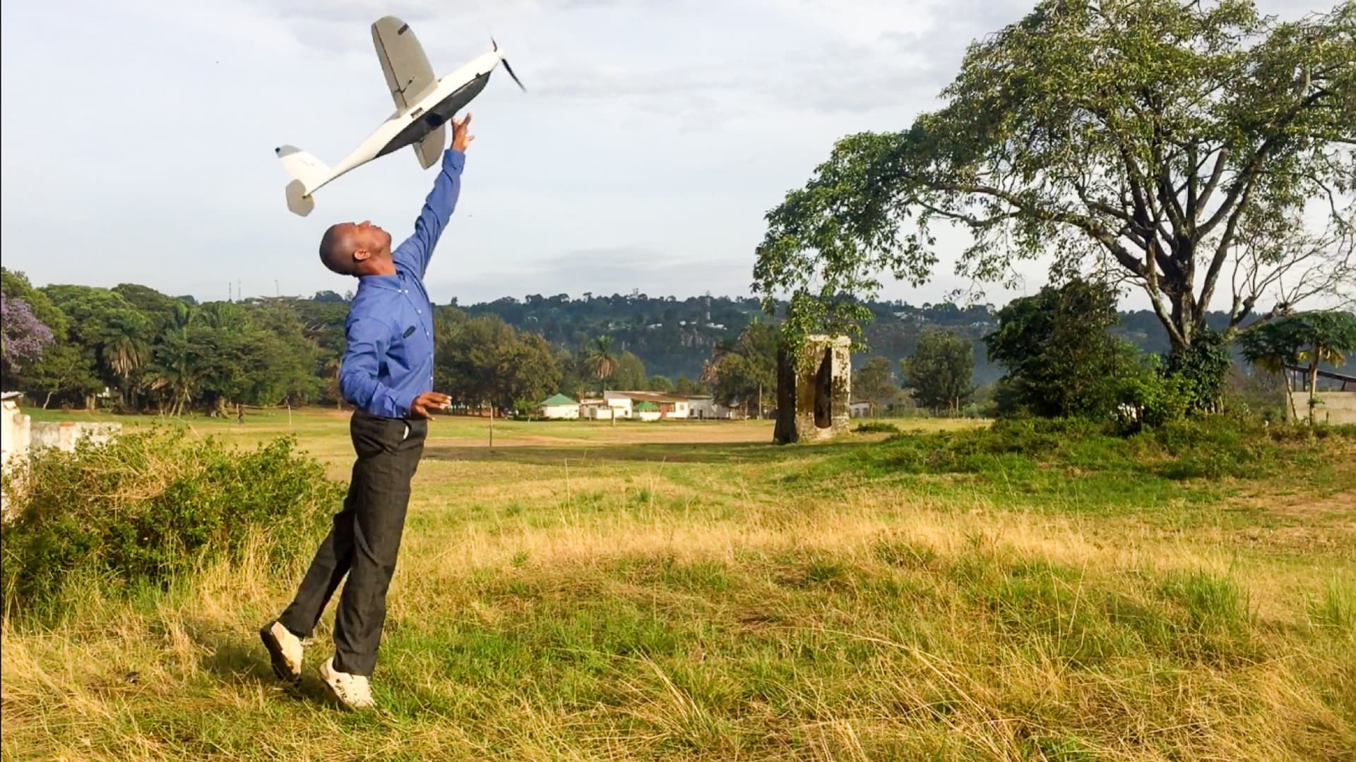
The World Bank, in conjunction with the Burkina Faso government, provides technology tools for educated but jobless young people to support data collection in all phases of this project. Specifically, they use a geographic information system (GIS) to plan, deploy field workers, track progress, and analyze and share results.
“As the data is being collected and synced to the server, we can get access to that data in real time,” Adjognon said. “So, if there is any sort of mistake or anything that doesn’t make sense, we can communicate with them right away in the field before it becomes too late.”
Initially, the survey team used a GIS field app from Esri to record the species of each of the 33,000 trees they planted. Nine months into the project, they used the app to locate each tree and and record its measurements along with survival rates.
They are effectively re-growing forest coverage, as opposed to simply limiting deforestation, as had been done previously.
An Evidence-Based Approach to Reforestation and Climate Resilience
The use of GIS for tree planting and nurturing activities is part of a broader effort to monitor and measure new forest coverage and outcomes, including tracking wider social and environmental changes resulting from conservation and reforestation programs.
“Our goal is to be able to provide actionable evidence to the local government and the World Bank with reliable data,” Adjognon said.
Prior to employing mobile GIS tools in the field, decision makers were limited by their inability to precisely assess and share outcomes. Now they can use GIS data collection and analysis to understand their progress.
For instance, farmers are trying multiple strategies, such as building zai—a grid of pits used for deeper planting across plots of land to enhance water retention. Villagers also built stone barriers around their fields to help contain runoff and increase infiltration from heavy rain. Using GIS, they can measure the success of these approaches.
“These technologies give us a better understanding of which intervention works, and what doesn’t,” Adjognon said.
GIS also provides the means to analyze the ecosystem services provided by new tree growth, thanks to a new level of geospatial data being captured in the field.
“It’s more of an evidence-based approach, which requires access to reliable and critical data to provide the details needed by project managers and policy makers,” Adjognon said.
The Road Ahead—Putting Trees Back on the Map
The Burkina Faso REDD+ project centers around leadership and training, while implementing multiple decentralized community endeavors to help local governments manage critical resources. In the complex and challenging environment of the Sahel, a better way to track progress and outcomes can go a long way.
A shared map allows both decision makers and field workers to visualize and share updates. The collected data helps determine the most effective next steps. For example, an effort is now underway to pursue ongoing forest monitoring via remote sensing inputs and automated analysis.
“We are working on developing algorithms to help predict forest cover changes in the drylands and then support how we monitor progress,” Adjognon said. “The plan is to use the data points collected to develop an artificial intelligence model.”
Project organizers hope innovations will continue, and the information captured can help inform subsequent efforts.
“Ultimately, the long-term goal is to allow other teams working in Burkina Faso to use the data to help them in their work,” Adjognon said.
Read more about how Esri applications for the field jumpstart workflows and integrate activities.
September 27, 2017 |
March 7, 2018 |
June 13, 2019 | Multiple Authors |