displaying 994 results
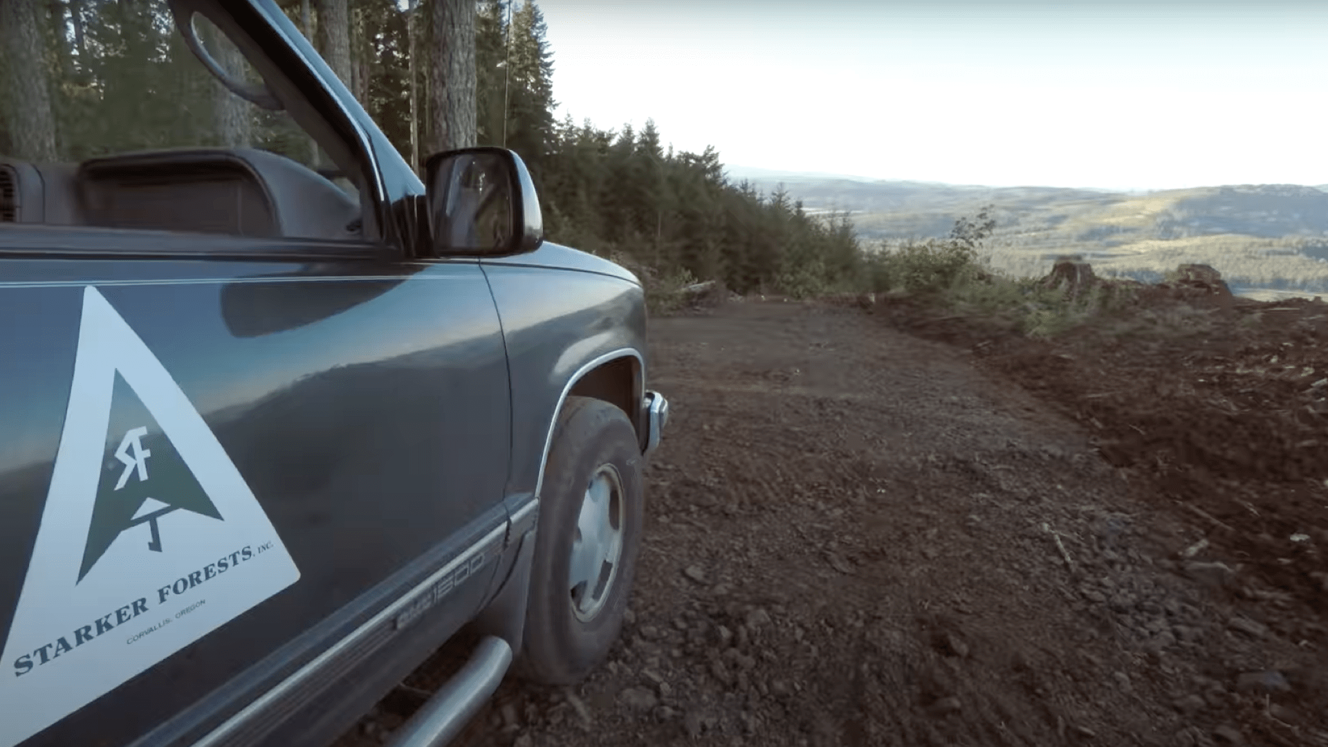
Oregon’s regulation of herbicide spraying led Starker Forests to adopt Web GIS to capture workflows to meet notification requirements.

GIS is critical to adopting a sustainable approach to living and working as the challenges to the Earth increase.
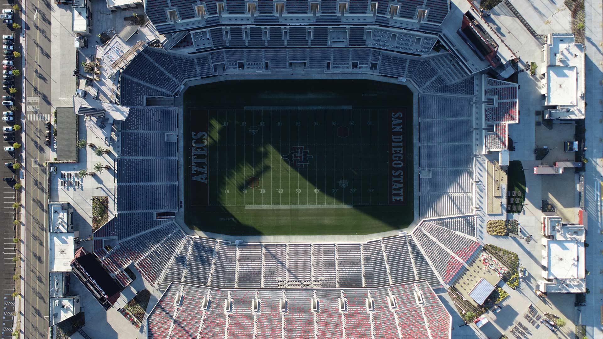
The project involved recycling concrete from an old stadium to use at the new venue. Site Scan for ArcGIS was key to monitoring materials.
Renowned economist Jeffrey Sachs talks about the crucial role advanced technologies can play in sustainability and crisis resolution.

Nespresso, the Louisville/Jefferson County Information Consortium, and the University of Michigan won the top awards at the 2021 Esri UC.

Numerous geodesign projects, including one to make a US Air Force base more climate resilient, were presented at the Geodesign Summit.

Esri partner Thomson Reuters used GIS to help indigenous communities in Sierra Leone’s Upper Guinean rain forest map their land and property.

The new team will support a growing user community in government, business, and nongovernmental organizations.
The United Nations (UN) has undertaken an ambitious challenge to help countries achieve an extensive collection of social and economic...
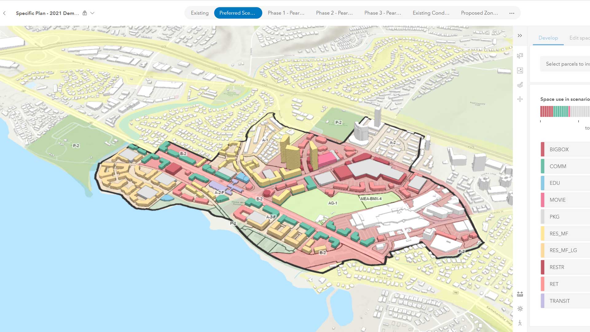
The emergence of web-based GIS has evolved the role of planners.

Ecological coastal units (ECUs) were created by USGS, Esri, and others for mapping and analyzing the world’s coastal regions.