Featured Article
Multiple Authors | May 07, 2024
Model realistic water flow, share your GIS story, add hyperlinks to your text elements, and more with the ArcGIS Pro 3.3 release.

Multiple Authors | July 18, 2024
Esri provides versatile tools for chart automation.
Multiple Authors | July 15, 2024
Planning a city block, a neighborhood, or maybe a whole new city is a multifaceted task with no universal recipe to use. Can Generative AI help?
Belle Pandya | July 15, 2024
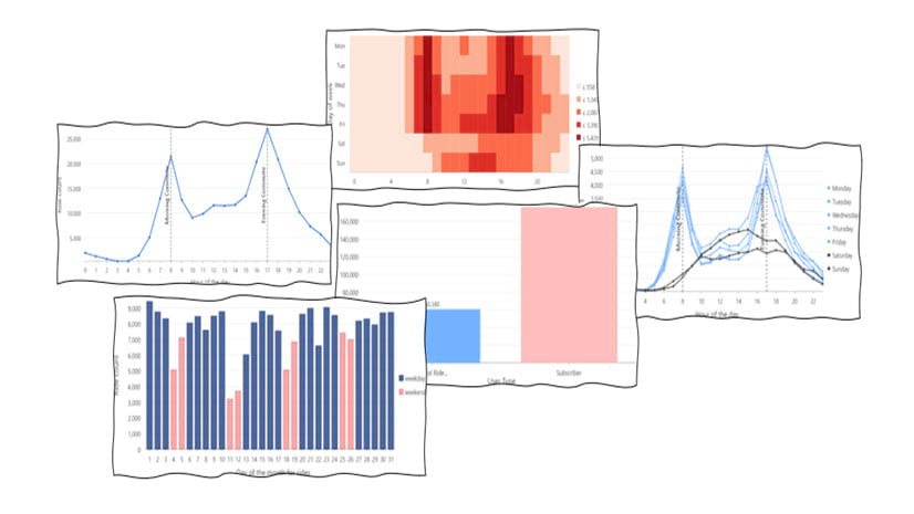
In this blog article, we'll explore BlueBikes data, a bike share service in bustling Boston, and uncover hidden insights through the power of viz

Deane Kensok | July 12, 2024
Esri is working with partners (Maxar, TomTom) to enhance our 3D basemaps with high-quality commercial data for elevation and buildings layers.

Multiple Authors | July 12, 2024
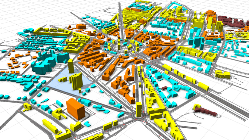
Creation of a Digital Twin in Seven Days with ArcGIS in Zurich

Ivonne Seler | July 12, 2024
3D layers are building blocks of digital twins and 3D applications. ArcGIS offers workflows to create large 3D web layers.

Maria Jordan | July 10, 2024
Use this quick guide to find all the Open Platform focused sessions and activities at the 2024 Esri User Conference.

Multiple Authors | July 10, 2024
Esri users can leverage the Planetary Computer data catalog for geospatial analysis with ArcGIS for Microsoft Planetary Computer.

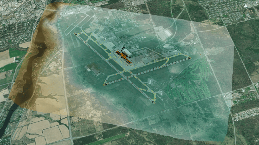
Robert Krisher | July 7, 2024
Learn about recent enhancements released by the ArcGIS Solutions team that streamline and simplify the utility network migration process.

Lea Harper | July 5, 2024
Learn more about the robust collection of data models, workflows, and planning tools tailored for flooding in ArcGIS Pro 3.3.
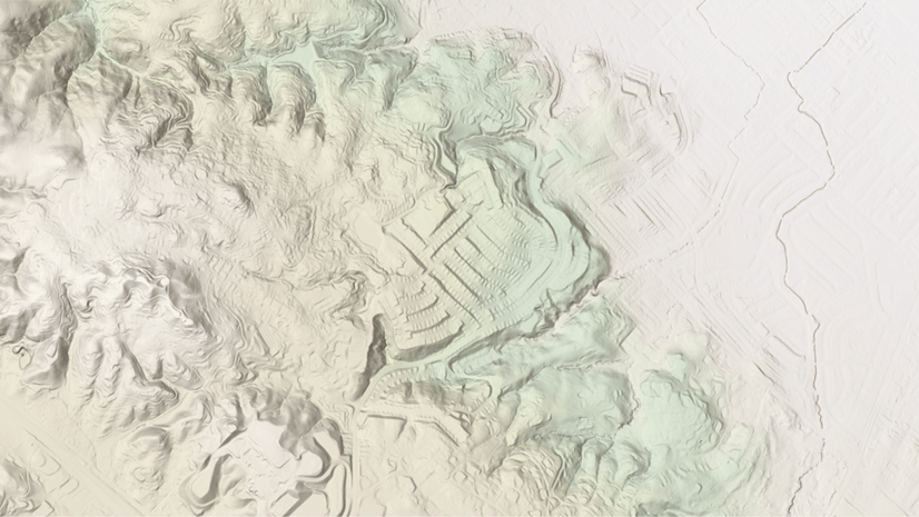
Rajinder Nagi | June 30, 2024
In June 2024, elevation layers have been updated with lidar derived DTM’s of Slovakia, Belgium, San Mateo County (USA) along with USGS 3DEP.

Christian Tait | June 28, 2024
UC 2024 is already here, and we have all the details on how to check out GIS and BIM/CAD integrations at this year's conference.
Multiple Authors | June 28, 2024
A list of frequently asked questions for the 3D Analyst extension.
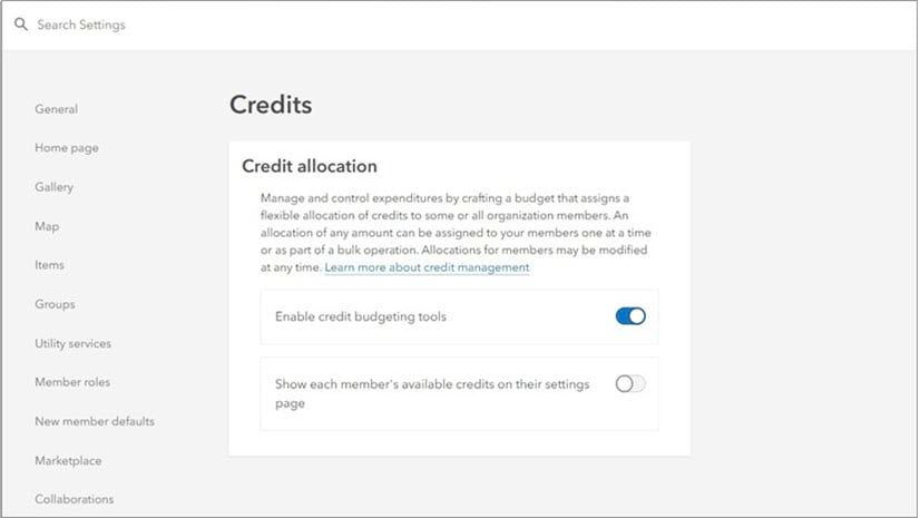
Jennifer Wrightsell-Hughes | June 28, 2024
ArcGIS Online users and administrators - learn best practices and tricks for managing credits in ArcGIS Online.
Steve Kopp | June 27, 2024
ArcGIS Online now includes a global 10-day streamflow forecast layer, and Instant App to easily create custom streamflow web applications.
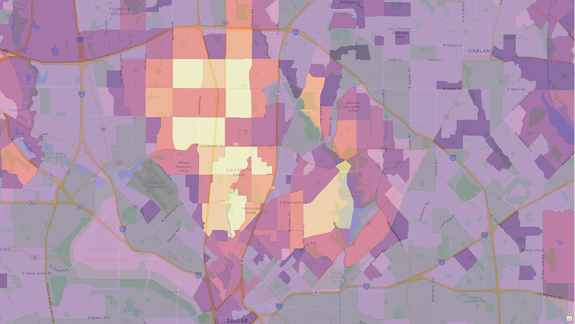
Multiple Authors | June 24, 2024
Learn about color-coded mapping techniques in ArcGIS Business Analyst Web App and ArcGIS Business Analyst Pro.

Ryan Danzey | June 24, 2024
Quickly deliver ArcGIS Pro into Azure AVD
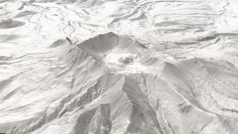
Rajinder Nagi | June 20, 2024
Esri's World Elevation 3D and Hillshade Layers are now enhanced with Maxar's Precision3D DTM's covering an over ~ 27 million sq kms area
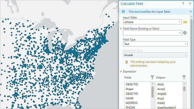
Margaret Crawford | June 17, 2024
Prefer using a different expression language for field calculations? Learn how to change parameter defaults for geoprocessing tools.
Michael Davidson | June 17, 2024
ArcGIS Pro 3.3 supports road, rail, and surface modeling workflows through direct-read of Civil 3D Corridors, Revit Toposolids, and IFC surfaces.

Diana Muresan | June 15, 2024
Here is what is new with spatial data management at the 2024 Esri User Conference.
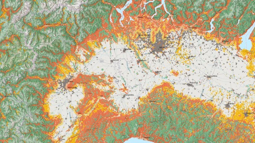
Multiple Authors | June 13, 2024
The Wildland-Urban Interface (WUI) is the area where urban development occurs near wildland vegetation.

Multiple Authors | June 11, 2024
The Living Atlas team publishes a lot of web layers. Here's some of our favorite tips and tricks for customizing your layers and maps.
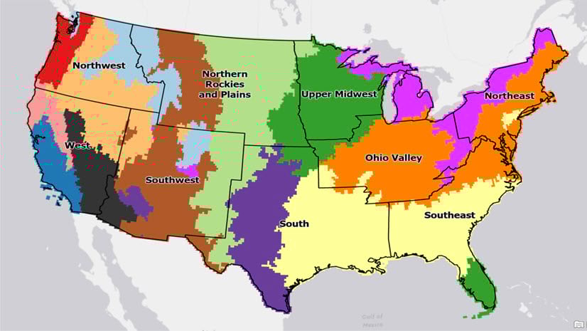
Nicholas Giner | June 11, 2024
This is the fifth in a series of blogs that showcase an end-to-end spatial data science workflow for clustering US precipitation regions.
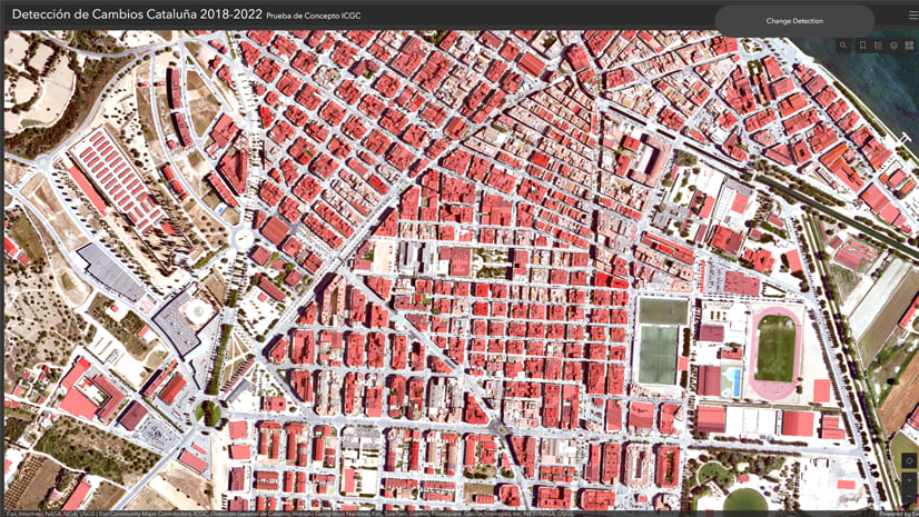
Rami Alouta | June 11, 2024
Revolutionizing GIS: Streamlining Change Detection for Mapping Agencies.