The ArcGIS Q2 2023 release roundup includes ArcGIS Enterprise 11.1, plus all related product updates for this quarter.
ArcGIS Enterprise 11.1
ArcGIS Enterprise is critical to making informed decisions efficiently at your organization. This release is full of enhancements and new functionality to help you and your organizations make high-quality decisions, quickly. This long-term support release is available to all customers worldwide on Windows & Linux. Some of the highlights in this release include member categories, service webhooks, and more.
- For the latest updates to Map Viewer and Scene Viewer, new options for content and data management, enhancements to administration and ArcGIS apps, and more, read the What’s New in ArcGIS Enterprise 11.1 release blog or watch this 5-minute video.
- For a comprehensive look at all server capabilities, licensing, databases and cloud environments, and more, take a look at the newly-updated ArcGIS Enterprise 11.1 Functionality Matrix.
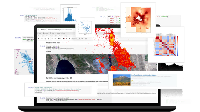
- We’re extra-excited about custom data feeds because they allow developers to create feature services from any data source for use across the ArcGIS system and beyond. Take a deep dive into custom data feeds with this blog.

ArcGIS Enterprise on Kubernetes
ArcGIS Enterprise on Kubernetes is releasing in May, so you can expect this blog to be updated with some new information about that soon.
In the meantime, we’re going to share a new success story from one of our early adopters, the United States Army Corps of Engineers, and an ArcNews article about enterprise organizations that are making the transition to cloud-native computing and Kubernetes.
A Digital Twin of Ports and Channels Helps Army Corps Maintain US Waterways
Using congressionally directed funds, the US Army Corps of Engineers integrated datasets and tools and modernized its processes using a cloud computing platform. They used GIS technology and data from the National Channel Framework, an enterprise geodatabase that captures the conditions for more than 25,000 miles of US navigation channels and 400 ports and harbors. Then, the team was able to implement ArcGIS Enterprise on Kubernetes, which uses microservices and containerization to provide a cloud-native architecture. “We need to see the worst trouble spots forming before they become full-blown emergencies,” said Ned Mitchell, a research civil engineer at the US Army. Read the full story here.
Cloud-Native GIS, Ready for Your Enterprise
Working with Kubernetes impacts many areas of business, from the IT and GIS departments to anyone who uses GIS data. Early adopters of ArcGIS Enterprise on Kubernetes are seeing significant improvements in system performance. They can provide geospatial insight to stakeholders more quickly than before and deliver better GIS experiences to their users. For example, Esri partner Managed Business Solutions, LLC (MBS) found that using a map service that contained more than 26 million records, the system processed an impressive 38,000 requests in less than three minutes. Their GIS team said that “MBS, the client, and Esri were extremely impressed. ArcGIS Enterprise on Kubernetes deserves strong consideration when architecting high-load GIS systems.” Read the full story here.
For a look at what else is new across ArcGIS, read on!

ArcGIS Utility Network
If you are a user who is planning to migrate to the ArcGIS Utility Network in 2023 or have already deployed the utility network using an earlier Network Management Release, jumping directly to this 2023 Network Management Release will help you maximize the benefit of migration with the latest tools and user experiences available in ArcGIS Enterprise and ArcGIS Pro. If your migration is already underway or complete, you are more than welcome to continue to utilize any Network Management Release as dictated by your goals and plans. Read on for highlights in ArcGIS Enterprise 11.1 that improve the user experience working with the ArcGIS Utility Network across your enterprise.

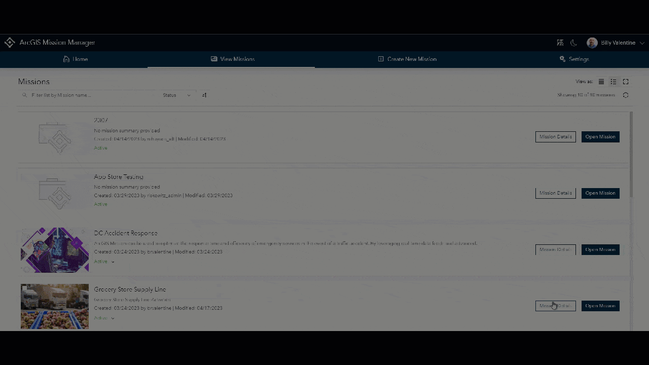
ArcGIS Mission
Optimize your safety and security operations with your own organizational data. As a part of the ArcGIS system, ArcGIS Mission can integrate and inform vital information in your portal. Use member bios to identify field personnel’s skill sets, inform operational analysis in real-time using field report data, and gain a birds-eye-view of one, or all, of your organization’s operations utilizing dashboards and other ArcGIS applications. Learn more about what 11.1 has to offer in our blog.
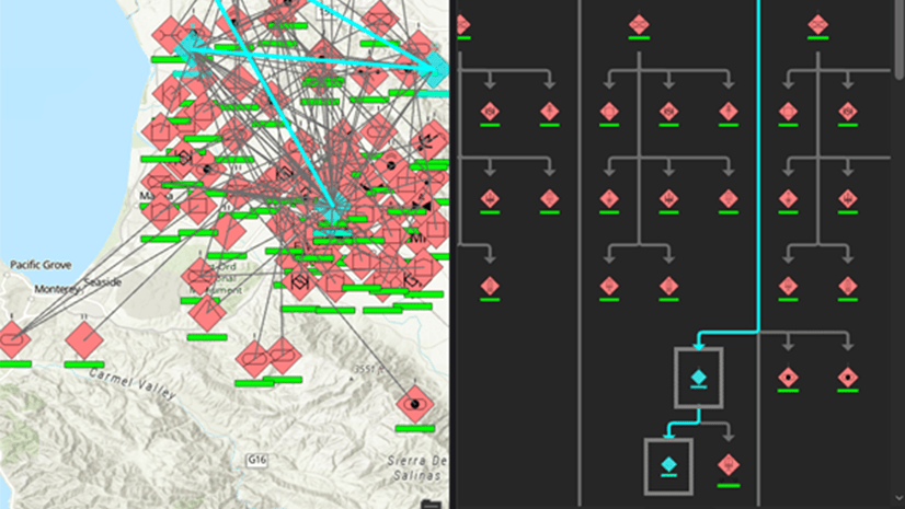
ArcGIS AllSource
Extend ArcGIS to the intelligence analysts, research specialists and auditors in your organization with software built just for them. ArcGIS AllSource is interoperable and extensible supporting your data integration strategy across connected and disconnected environments. AllSource synthesizes all sources of information with link analysis, timelines, imagery exploitation, graphs, and maps to visualize and uncover relationships that would remain unseen. Check out this blog to learn how to get started with ArcGIS AllSource.
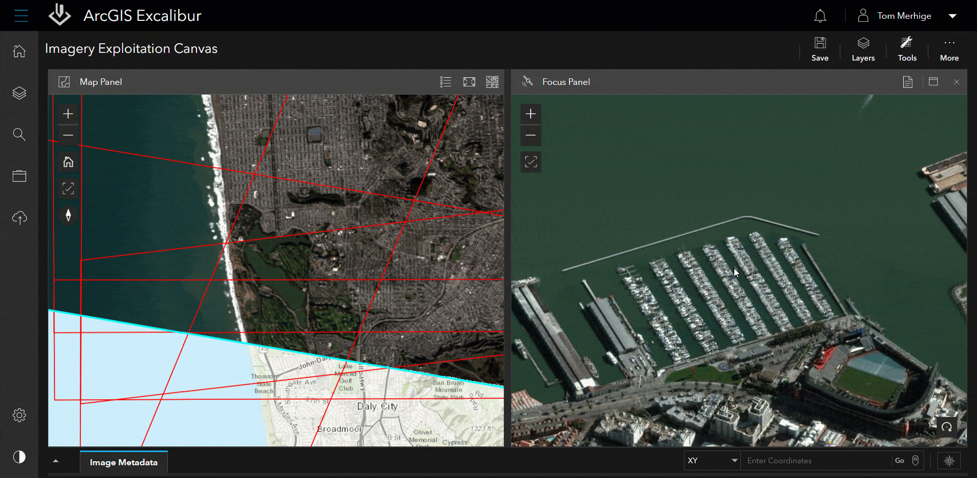
ArcGIS Excalibur
In this release of ArcGIS Excalibur, we’ve made updates to help analysts quickly navigate to and identify locations from images. Also, there are enhancements to comparison tools that provide better orientation when viewing imagery side-by-side – making it easier to pull precise insights.
Key Highlights Include:
- The new Flash Tool allows you to identify a location between the map or image when viewing imagery side-by-side.
To better see change between two or more images, we’ve updated the Swipe Tool and Flicker Tools to include the display of labels that will further distinguish the primary image from the comparison images. Learn more about this release on the blog.
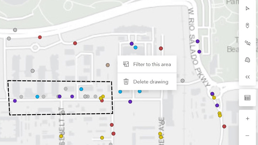
ArcGIS Enterprise Sites
ArcGIS Enterprise Sites is a powerful capability included in ArcGIS Enterprise that allows you to create focused web pages for specific audiences. If you plan to upgrade to ArcGIS Enterprise 11.1, you will also be unlocking the following improvements to ArcGIS Enterprise Sites. Updates include a re-designed upload experience with better error handling, new file types accepted, custom location extents, draw/filter/buffer capabilities, and visualization of data over time. Learn more from this community post here.
ArcGIS Notebook Server
This release of ArcGIS Notebook Server includes several new features and capabilities. One of the new features introduced in ArcGIS Notebook Server 11.1 is user-created code snippets. This feature allows users to create, edit, and share their own custom code snippets, which can be easily shared with other notebook authors in their organization. Users will also be able to search for, find, and use notebook code snippets shared with them or their organization.
Another new feature introduced is enhancements to notebook web tools. Users who do not have notebook authoring/editing privileges can now run web tools with the new “Run web tool” privilege, which requires a “Creator” user type or above. Previewing a notebook web tool and creating a snapshot for a notebook web tool are also now supported.
Windows Container support is another significant feature in ArcGIS Notebook Server 11.1. Windows containers were released as a beta feature in ArcGIS Enterprise 11.0 and are now fully supported in this release. Windows containers are now the default notebook runtime for new installations on Windows, making it easier for Windows-based customers to set up Notebook Server on Windows when using Docker Desktop on Windows.
Overall, ArcGIS Notebook Server 11.1 brings several new features and enhancements that improve the user experience, enable better collaboration and sharing of reusable Python code snippets, and make it easier for Windows-based customers to set up and use Notebook Server.
For a comprehensive list of all the new features in the release, check out the What’s new in ArcGIS Notebook Server help topic.
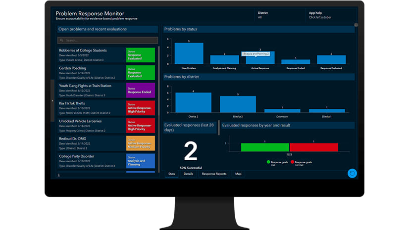
ArcGIS Solutions
The ArcGIS Solutions March 2023 release includes many new and enhanced solutions, spanning across the industries ArcGIS Solutions supports. Three new solutions: Crime Problem Management, Curb Regulation Management, and Gridded Reference Graphic, are now available in Enterprise 11.1. To learn more about these solutions, explore the Release Blog.
ArcGIS Workflow Manager
The latest release of ArcGIS Workflow Manager includes features and enhancements to enable you to better standardize GIS and non-GIS processes across web, mobile, and desktop. Read the blog for more information on what’s new at 11.1.
That’s all for now, folks! We encourage you to upgrade to ArcGIS Enterprise 11.1, since it brings you new features, newly released products, updated apps, and performance improvements that will help drive value for your organization.
The next generation of ArcGIS Enterprise software is available now, but we highly encourage all organizations to upgrade to ArcGIS Enterprise 10.9.1 before you make the jump to 11.x. This blog details the exact changes that were made and how to prepare for your upgrade. When you are ready to upgrade, please be sure to follow the upgrading documentation topic for specific information on how to move to the next version.
If you’d like to receive the latest product updates for ArcGIS Enterprise, sign up for our monthly email newsletter here. It includes information on how to use the latest features in ArcGIS Enterprise, helpful technical papers, expert tips for you and your IT manager, and more. You can also follow us on Twitter for additional information and to see how our Operational Intelligence product suite can be used to extend your GIS.


Article Discussion: