

The people we work for need all these inputs in one view right in front of them.
Research Civil Engineer, US Army Engineer Research and Development Center
Ned Mitchell
April 25, 2023
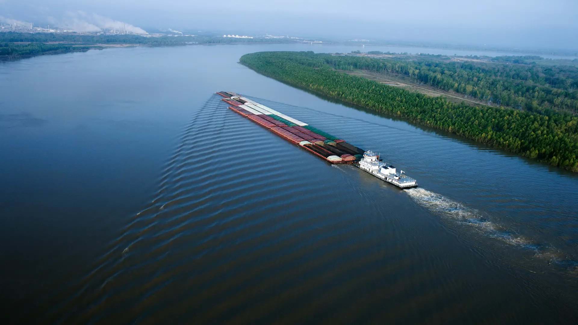
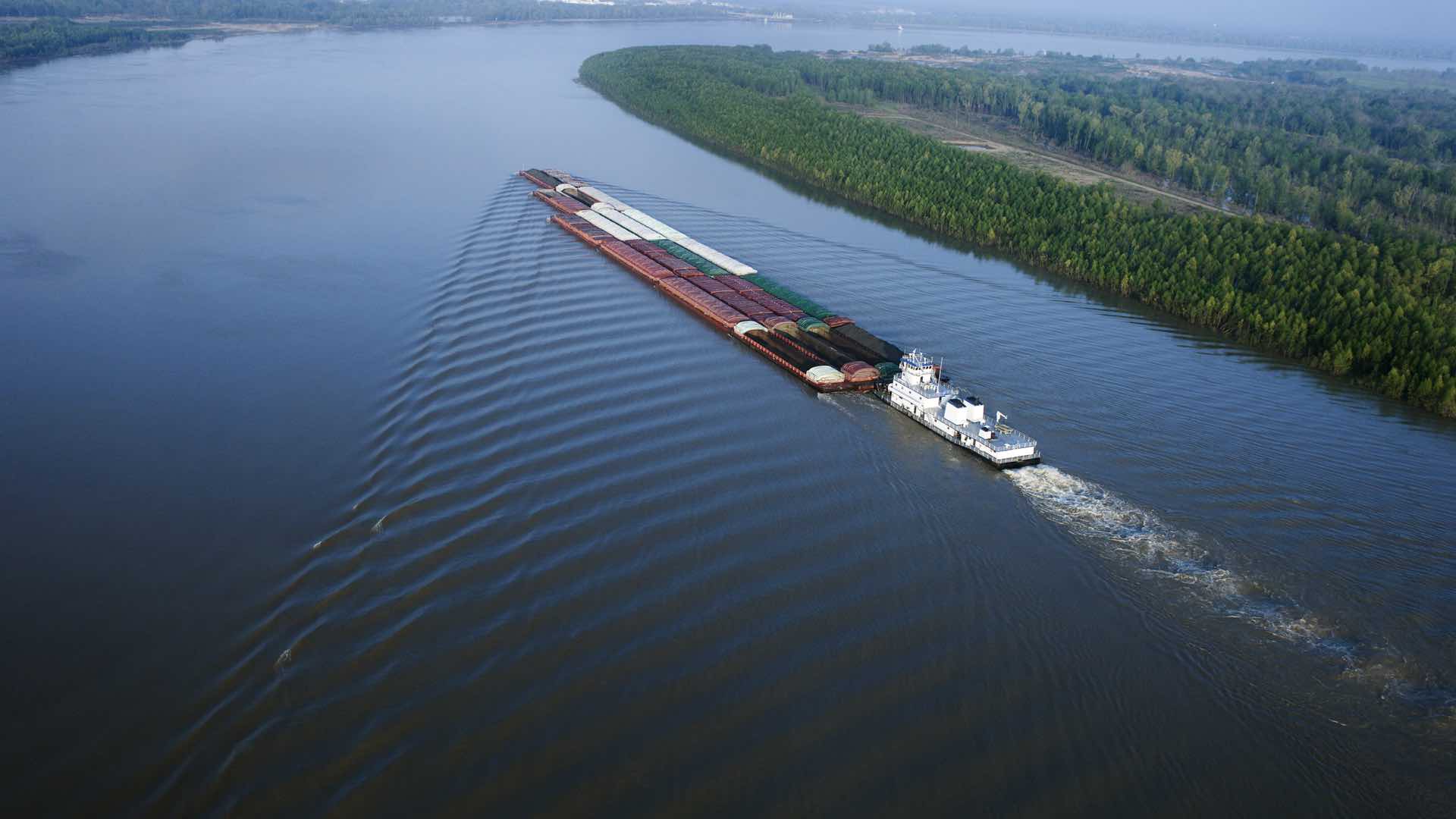
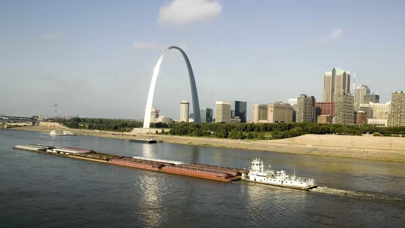
The Mississippi River, America’s most important inland waterway, moves essential commodities to market, including most grain exports, at lowest cost. Wild shifts in this mighty river’s water levels have often caused national concern and uncertainty. But a newly crafted digital twin, designed to monitor and simulate river behavior and operations, reveals trouble spots.
In 2019, record precipitation kept the river above flood stage for more than 235 days. Then in summer 2022, water levels fell 11 feet below average due to protracted drought. Low levels caused barges to run aground and forced vessels to carry less cargo. Trucks had to take on loads in some spots. As freight costs rose, difficulties moving goods to market drove down the domestic price of grain and farmers faced losses.
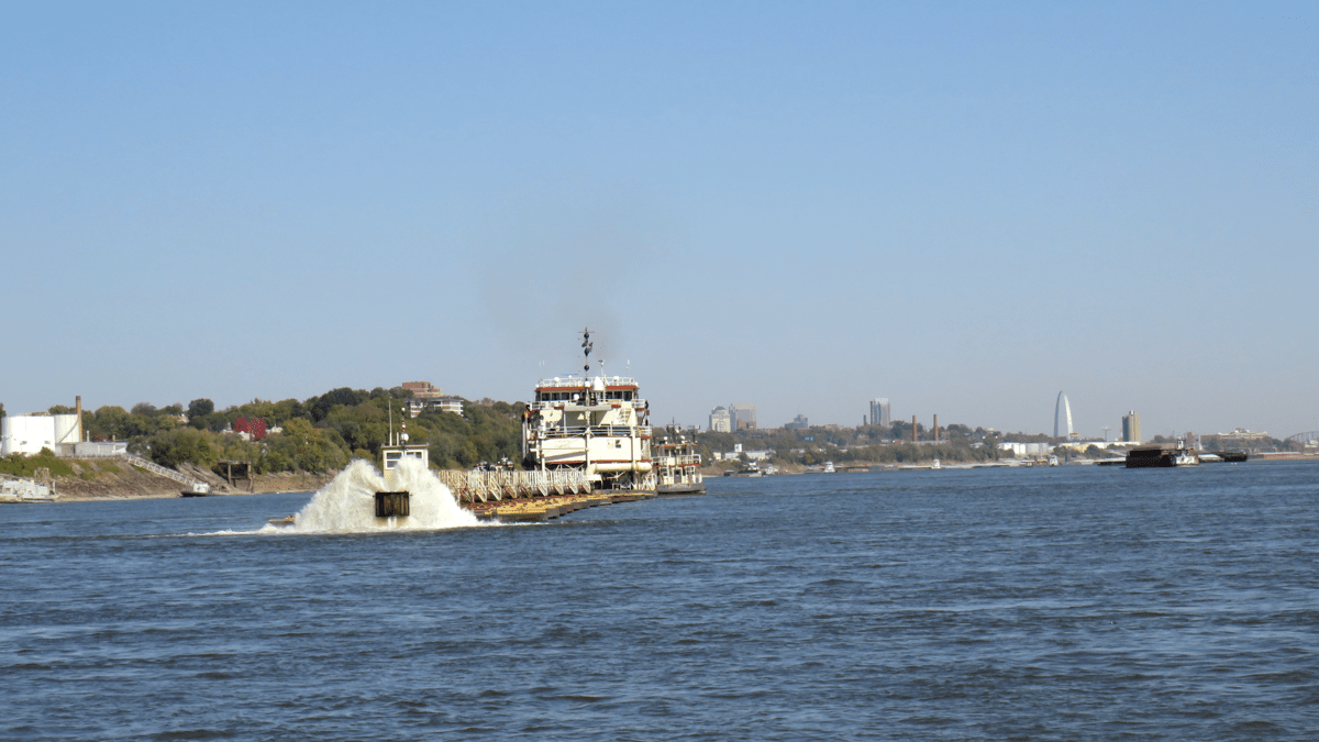
To help keep barge traffic and commerce flowing, the US Army Corps of Engineers directed crews to dredge the river around the clock. For six straight months they worked to maintain the nine-foot-deep channels barges require. They managed this endeavor—keeping an eye on river conditions, operations, and vessel traffic—using geographic information system (GIS) technology.
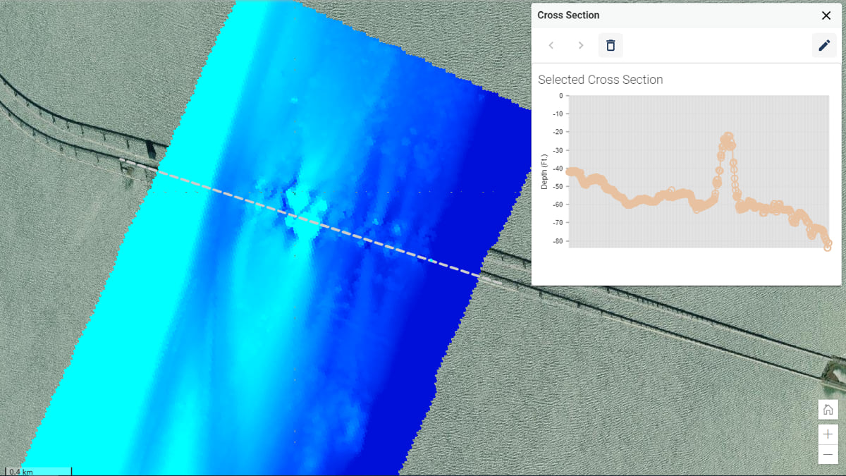
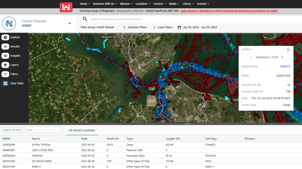
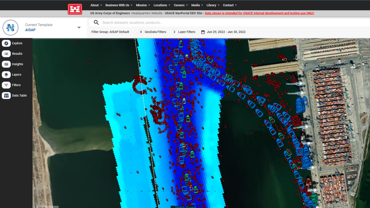
To monitor this work, the corps uses many purpose-built GIS-powered systems (see sidebar) that monitor conditions and analyze vessel traffic. A new navigation portal, NavPortal, combines these data inputs to provide an operations-wide digital twin. NavPortal combines cloud computing, ship tracking, and artificial intelligence to process and present huge volumes of data. It shows current channel conditions and compares that information to river traffic.
“We’ve got hundreds of dredge locations nationwide, and we need a tool like NavPortal to be our early-warning indicator,” said Ned Mitchell, a research civil engineer at the US Army Engineer Research and Development Center and NavPortal product manager. “We need to see the worst trouble spots forming before they become full-blown emergencies.”
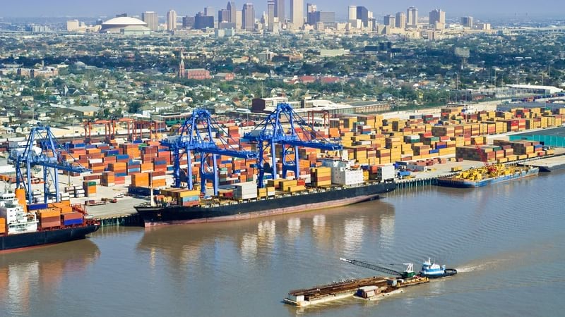
Along the Mississippi there are six corps districts from Saint Paul to New Orleans. Each district manages a stretch of river with a mix of dams, locks, levees, and dredged channels. In all, there are 4,200 miles of channel, 62 locks, 51 shallow-draft ports, and 7 deep-draft ports. That’s a lot to maintain. Complexity increases with flood or drought, particularly at harvest time when river traffic spikes.
Drought conditions in October 2022 caused a back-up of 3,000 barges. The delayed loads could have filled more than 200,000 semitrailer trucks (if that many were available). Farmers were only able to move half the volume of corn shipped the previous year. Shipments of fuel, chemicals, and building materials also stalled.
Congress stepped in, directing funds to address the inherent knowledge management problem that results from so many data feeds tracking so many volatile parameters. That’s when the NavPortal team created the operations digital twin using a federated systems approach, combining feeds from legacy systems that each play a part.
The people we work for need all these inputs in one view right in front of them.
Now, NavPortal provides clarity. It affords each corps district a current view of its stretch along with the entire river. When there’s little time to gather data and conduct in-depth analysis, NavPortal delivers ongoing awareness. It empowers staff to identify problems and plan fixes before channels clog.
The corps’ project engineers have a tough job to understand channel depths and sediment buildup. In the midst of drought, for instance, intermittent rains can make any stretch of the river viable for barges one day and impassible the next. “Trying to chase the bottlenecks in a system like that is a real challenge,” Mitchell said.
Some veteran project engineers know intuitively how the river will change. But with more volatile weather due to shifting climate patterns, river behavior can defy even the sharpest instincts. And for novice engineers, surprising shifts over just a few years have set no reliable patterns.
NavPortal reveals the dynamic nature of the situation. “Now we have a digital twin to lay it all out for them,” Mitchell said.
The portal’s mix of map visualizations, charts, and graphs provide a holistic view of navigation projects and alternatives. “The idea is to make all the data accessible and understandable,” said Josh Pritchard, a GIS and NavPortal manager for the USACE Mobile, Alabama district office.

This comprehensive resource proves crucial as channel blockages can multiply quickly, with one or two choke points turning into dozens across many states. It gives engineers insight into current and historical patterns, plus predictions about what’s likely to happen.
“NavPortal lets us see trends through time,” Mitchell said. “We can plot time series charts at particular locations where we’ve seen trouble before. And we can anticipate seasonal shoaling events that tend to create trouble.”
The corps spends roughly $1.5 billion each year on its hundreds of maintenance dredging projects across the country. Shippers want greater depth at ports to carry more cargo per voyage. Producers need open waterways to get their goods to market. And funds are never enough to cover all areas in need of upkeep.
NavPortal helps surface the most cost-effective maintenance strategies. The digital twin approach of scenario planning can consider more variables and answer more complicated questions.
Timing is critical. The corps owns some dredges, but most projects involve contractors. It’s a time-consuming, multistep process to procure a dredge. Each permit undergoes environmental review. And most places have months when they can’t dredge because of threatened species, such as sea turtles. Sediment will accumulate and channels can become impassible if there are delays with dredge contracting or if infilling rates exceed historical norms.
Better coordination with awareness of conditions can make the most of each investment. By sequencing projects based on proximity, the engineers become proactive rather than reactive. They can also align projects with areas that need the dredged material, such as eroded beaches or shrinking wetland habitat. Another strategy maintains channels at depths greater than required for shipping to allow for more time between dredging.
These complex constraints and opportunities provide a lot to consider when the conditions can’t wait. The NavPortal digital twin helps corps’ analysts account for more variables, allowing them to test and iterate before committing to a plan.
“We’re hoping data can inform and, in some cases, change some long-standing ways of thinking,” Mitchell said. “Now that we have data and quantitative trends, we can look at the life cycle equation. We can follow where the data leads to know if new approaches are cost-effective.”
Learn how electronic charts build a growing awareness of navigation channels and maritime activities.