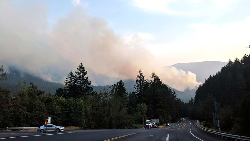
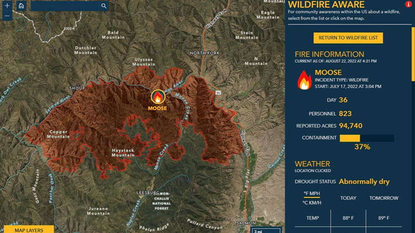
You might have already used the Esri Wildfire Aware app to track wildfires in the United States. What’s subtle about the app is the way that it allows people with no GIS knowledge or experience to use the power of GIS and understand the scope of wildfires anywhere in the US (except territories) in near real time.
It is the first fire app of its kind, one which uses 22 authoritative demographic and natural resources layers from the Esri’s Living Atlas of the World to contextualize wildfires as they happen.
Since then, developers have been hard at work enhancing the map. First, we released the layer that the app uses to summarize information about people and the environment, allowing people to access the enriched information for their own custom maps and apps.
Second, a measure tool was added. This gives people precise distance information between the latest wildfire perimeter and points of interest in a few clicks.
Third, the demographic data has been updated with the most current information available in the Living Atlas, the 2023 demographics! This demographic data is produced by Esri in combination with the latest US Census Bureau American Community Survey from December 2022.
Finally, the colors of the widget were improved for better web accessibility and these were made available at all scales.
Esri wishes you a very uneventful wildfire season. Should anything happen, the Wildfire Aware App will keep you current. Please reach out to us with comments or questions.
Jim Herries is a geographer with Esri in Redlands, California. He serves as Senior Principal GIS Engineer, GIS Engineering Lead, Cartography on the team responsible for ArcGIS Living Atlas of the World.
Jim works with teams on thematic mapping and other types of maps that bring data to life, reflecting a drive to help GIS users find insights as they go along. He constantly looks for ways to create clear, focused map information products that incorporate meaningful spatial analysis and evocative visualizations.
When he started in GIS at Ohio State, he walked over to the campus library to transcribe census data by hand to paper so that he could hand-enter it into spreadsheets for upload into Arc/INFO for mapping and analysis. Today, he appreciates how web GIS brings everyone access to good data in useful layers and maps as a starting point for great work.
Michael Dangermond has over 25 years experience in GIS in such diverse fields as cartography, agriculture, international boundary delineation, environmental protection, regional planning, park planning, land and wildlife conservation, and forestry. He has been working for ESRI since 2010.
Gonzalo Espinoza is a Principal GIS Engineer at ArcGIS Living Atlas of the World. Gonzalo specializes in hydrologic modeling, real time climate and hydro-informatic tools such as flood mapping and forecasting using National Water Model data. He masters the full geospatial tech stack required to develop scalable and operational services relying on large volumes of EO data in the fields of water and environment. At Living Atlas, he also supports the development of workflows for automation of data updates known as Live Feeds, technology used at Esri’s Disaster Response Program. Before ESRI Gonzalo worked in the development of Water Accounting at UNESCO IHE. He holds a PhD in Civil Engineering from the University of Texas at Austin.
With over two decades of GIS experience Emily has mapped elephants in Thailand, wildlife poachers in the Republic of Palau, land use related issues around Yosemite National Park, and active wildfire incidents for the State of California. Presently she is a Senior Product Engineer and Cartographer with the ArcGIS Living Atlas of the World where she styles and designs layers, maps, and apps with the Environment Team. When not making maps, she is a true geographer and loves traveling with her family.


Article Discussion: