This blog is a republishing of an article in Directions Magazine. It was contributed by Karen Sullivan, Kyle R. Cassal, Brooke Brinkley, and Lucy Guerra.
…
In many ways, data drives the world economy. Decision-makers rely on it to help them recognize patterns and trends and plan for the future. Demographic data from US Census counts is a preferred and trusted resource for many organizations, especially those with teams using geographic information system (GIS) technology. Census data is valuable, for example, for spatial analysis to determine the makeup and character of US communities. The data also make it possible to quantify how those places are changing.
With delays in the release of most 2020 census data because of the coronavirus pandemic and new rules over privacy, many GIS teams are eager to find a second option for reliable, authoritative statistics. The solution for filling the data void is Esri’s demographic data.
Esri’s June 2022 library of proprietary demographic data can be used much the same way as statistical information from the US Census Bureau. As part of a series of 2022 data releases, this catalog is especially convenient for organizations that use GIS technology. Among its functions, Esri’s GIS software has features for organizing statistical data by location on shareable, digital maps. This format is visually dynamic and adds geographic context to spatial analysis work, making it easier to recognize patterns and correlations.
“Users will have much more data to choose from,” said Lucy Guerra, Esri product manager. “They will be able to easily compare populations by location and year—2010, 2020, 2022, 2027—and understand how communities are changing over time.”
To make its new release even more GIS-friendly, Esri has packaged the data in multiple ways. The new release also puts greater focus on market data and consumer preferences.

Data gives us snapshots of US neighborhoods
Populations across the US are continuously shifting. The US Census Bureau conducts a national census every 10 years to count the population, as required by the US Constitution. The bureau also publishes American Community Survey (ACS) data, an annual estimate of social and economic characteristics based on a 60-month average.
Careful analysis of demographic data gives organizations valuable insights about current conditions in America. Comparing data from one decade to the next makes it possible to uncover trends for forecasting. GIS technology offers processes for data analysis and prediction.
Dots or clusters of dots on a digital map, for example, make it easy to compare the number of US households based in urban versus rural areas, or in the North versus the South. These types of insights can help communities choose suitable locations for new schools, supermarkets, and hospitals. Private organizations use the data in similar ways, often to determine optimal markets for housing, retail, or office space.
2022 data releases emphasize GIS-friendly libraries
To simplify data analysis for a diverse group of users, Esri has organized its demographic data in two configurations, with datasets that follow Census geographic boundaries from 2010 as well as 2020. The Census Bureau redraws neighborhood boundaries each decade, but the once-a-decade process of transitioning workflows from one geographic framework to the next is far more complex than flipping a switch. Having datasets for each decade streamlines temporal analysis that is valuable for detecting change over time.
In June, data users who anticipate working with 2020 census geography will have access to Esri’s newest datasets for 2022:
- Esri Updated Demographics: annual current-year and five-year forecasts of key demographic topics.
- Esri Tapestry Segmentation: classifies neighborhoods as unique consumer markets.
- Esri Consumer Spending: current-year and five-year forecasts of household spending.
- Esri Market Potential: consumer demand for product and services.
- Census 2010 and 2000 data converted into Census 2020 geography and expanded to over 1,000 attributes.
- American Community Survey (ACS) 2016-2020 data: the latest 5-year data from the Census Bureau.
Data users still working with 2010 census geography will continue to have access to the following datasets from 2021:
- Esri Updated Demographics, Market Potential, Consumer Spending, and Tapestry Segmentation.
- Census 2010 and 2000 data.
- American Community Survey (ACS) 2015-2019 data.

New standards for privacy
By law, responses to US Census Bureau household and business surveys are confidential. Census 2020 launched a new era of privacy protection called differential privacy. This system for masking individual identities can produce statistics that are unfamiliar. For example, some statistics are impossible, including reports of areas with zero households but more than zero household population. Other statistics are improbable, such as references to areas where all residents are under 18 years of age.
In addition to intentionally adding noise to the 2020 statistics, the Census Bureau is expected to release a more limited set of statistics this decade compared to 2010. The next decennial census data release, the Detailed Housing Characteristic (DHC) file, is scheduled for 2023.
Esri’s Updated Demographics use Census 2020 data as a base. Esri demographers used imagery and other Census data to adjust impossible and improbable reporting. This helps ensure that 2022 estimates have a more accurate base for population and housing.
With 32 tables of Census 2010 data converted into 2020 geography, users will have access to small area data that otherwise would not be available as part of Census 2020.
Expanding knowledge of US consumers
Esri has expanded its Market Potential Database by more than 800 items. The data now include more than 2,000 variables that explore consumer attitudes and preferences. Topics include shopping and online spending, food, health, and finance. Users can compare consumer preferences by location while evaluating appropriate locations for services or amenities.
Sample questions include:
- I think healthy food and a healthy lifestyle are better than dieting.
- I take an active role in my retirement planning.
- I prefer to shop at a local store versus a national chain.
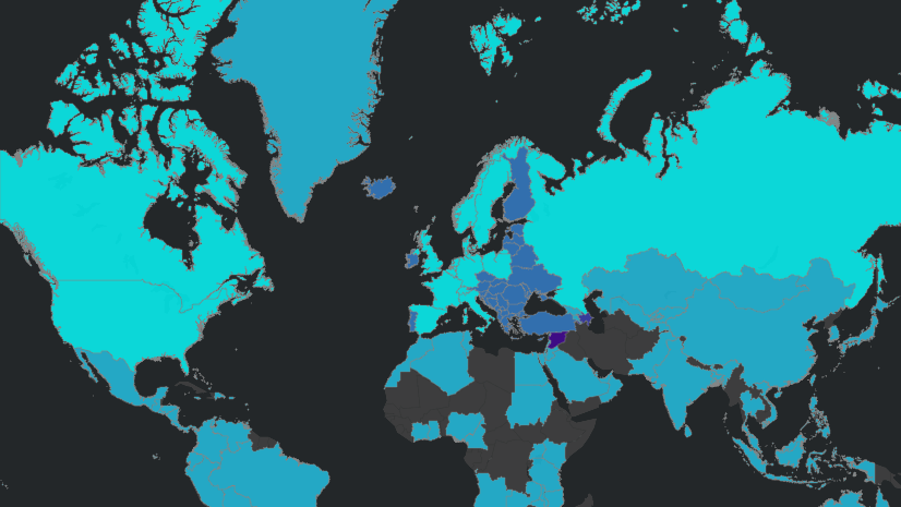
Global demographic data can expand your lens
Understanding changes in the American population is valuable for many organizations, but some serve markets spread out over greater distances. Esri offers a comprehensive set of ready-to-use demographic maps and services for more than 150 countries and areas. Topics include population, income, age, education, and consumer spending for a variety of products and services. Data come from a broad collection of providers who specialize in developing demographic data around the world.
When is demographic data worthwhile?
Organizations that find value in demographic data are a diverse group. What they have in common is an interest in learning about features and characteristics that define communities. Entities that invest in demographic data include:
- Corporations. Planners for a major coffee retailer can use demographic data to help determine a new store location. Designers for an enduring brand of athletic shoes might analyze demographic data in deciding which markets to include for the next product launch.
- Small businesses. Business owners can acquire a few targeted reports per year to learn about trends in a specific location.
- Nonprofit sector. Service organizations want to identify locations where people need help and where need is likely to exist in the future. Which regions are most likely to be affected by drought or flooding? When and where are hurricanes likely to cause damage? Data analysis can help answer these questions.
Weighing options for accessing the data
Ready-to-use formats are an efficient way to work with demographic data. They require less preparation and allow users to focus on their primary objective: decision-making. Esri makes demographic data available in GIS maps layers, reports, infographics, and tabular format. These formats are compatible with GIS technology, which is valued for rendering data in easy-to-understand, shareable digital maps.
- GIS professionals using ArcGIS Pro can visualize this data through ready-to-use map layers and perform analysis by enriching their map data. Your organization must have licenses that provide access to ArcGIS Pro.
- Business professionals using the ArcGIS Business Analyst web app can access global demographics and business data for tasks such as site selection. The application also offers capabilities for data analysis and creating digital maps.
- Demographic data that the Census Bureau makes available to the public is archived in Esri’s ArcGIS Living Atlas of the World and offered at no cost. Many of Esri’s newly released, ready-to-use datasets are offered as premium content.
- Esri Reports provides access to individual reports on socioeconomic, demographic, behavioral, and business data. Users of this web-based service are able to provide an address and define the surrounding area for their reports.
- Developers can build custom apps and workflows with this data using the GeoEnrichment Service in ArcGIS Platform.
- Data is available in tabular formats for use in other data tools.
To learn more about using demographic data to meet business and organizational goals, see Esri Demographics.


Article Discussion: