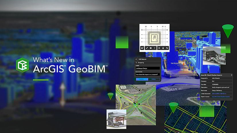
Overview
ArcGIS GeoBIM delivers an innovative, easy-to-use web-based experience for teams to collaborate on building information modeling (BIM) projects and address issues in a geospatial context. Architecture, engineering, construction (AEC) and operations teams can make better decisions by securely accessing up-to-date project and asset information, including 3D digital models, documentation, issues, and reality capture.
The November 2023 release extends collaboration to the field by integrating ArcGIS GeoBIM with ArcGIS Field Maps. Enhancements have also been made to georeference documents even faster and save users time.
Release Highlights
New support for field collaboration with ArcGIS Field Maps
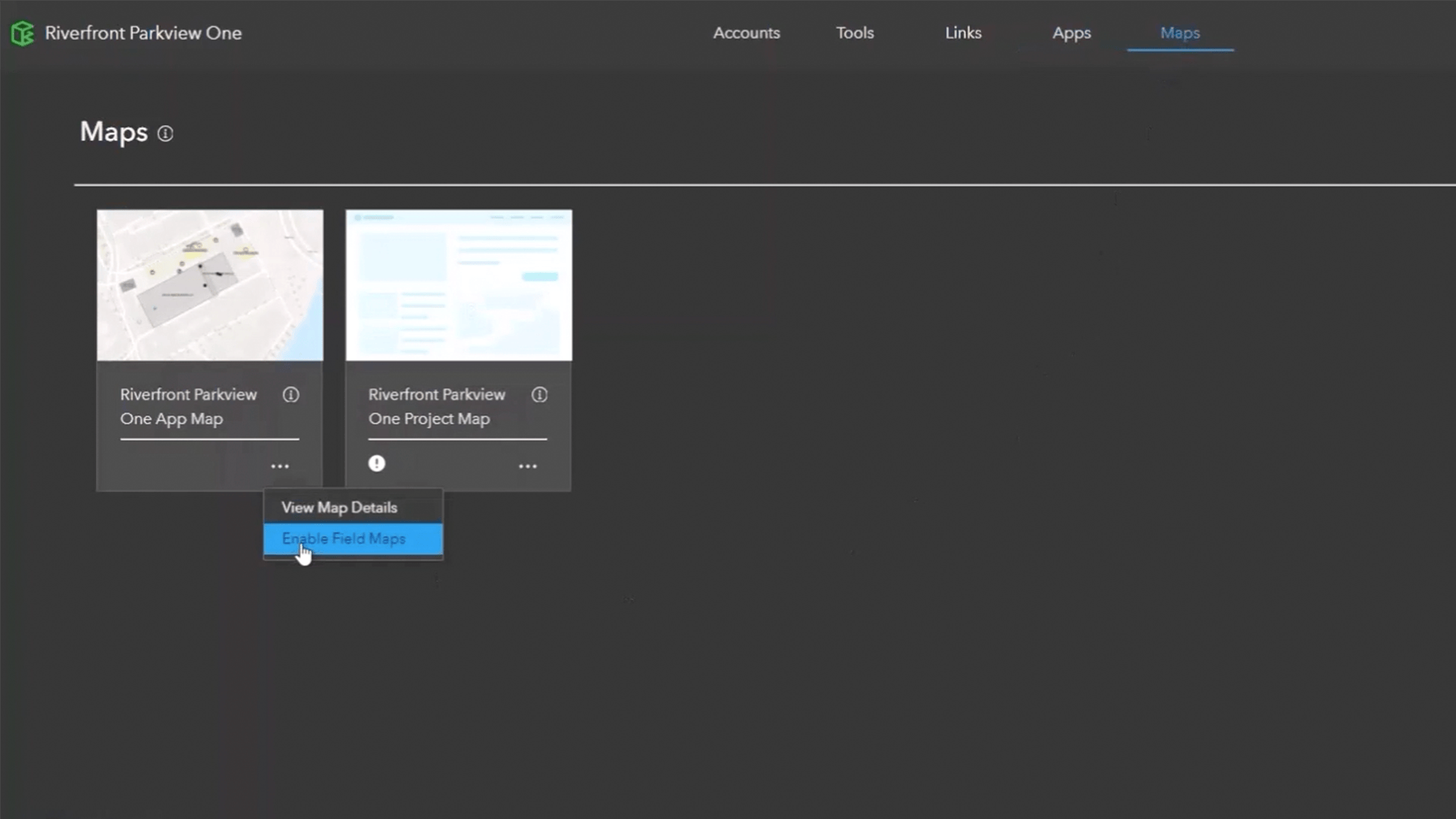
ArcGIS GeoBIM now integrates with ArcGIS Field Maps to improve GIS and BIM collaboration between the office and the field on projects and assets. Teams can easily access accurate information in the field while staying on top of site logistics and accelerating issue turnaround.
 and the ArcGIS Field Maps mobile app (left-center) for collecting issues and notes.")
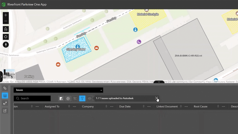
Project managers can collect issues and notes from the field for projects in ArcGIS GeoBIM with field maps enabled. They can verify collected issues in ArcGIS GeoBIM and make edits when needed. When ready, project managers can easily upload reviewed issues to Autodesk Construction Cloud or BIM 360 using the new Issue tools in ArcGIS GeoBIM apps.
Mobile workers now have access to an expressive mobile map of the project site and the latest BIM documents and issues from Autodesk Construction Cloud and BIM 360 when connected. Using the ArcGIS Field Maps mobile app available for iOS and Android devices, they can create issues and notes with GPS coordinates or by simply pointing to a location on the field map.
If you want to take a deeper dive into this integration, check out the blog post: Extend ArcGIS GeoBIM to the field with ArcGIS Field Maps. You can also watch this video playlist of the demos contained within the blog post to see the integration in action.
-
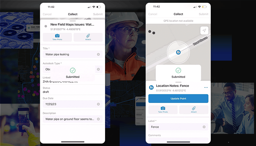
Using the ArcGIS Field Maps mobile app for iOS and Android devices, field workers can quickly create issues and collect location, line, or area notes for review in ArcGIS GeoBIM.
With ArcGIS Field Maps and ArcGIS GeoBIM working together, a streamlined digital workflow replaces inefficient paper-based processes and extends BIM integration to the field, enhancing engineering and construction workflows with a geographic approach. By adding ArcGIS Field Maps to projects in ArcGIS GeoBIM, AEC and operations teams can boost productivity, accuracy, and collaboration with on-site teams.
ArcGIS Field Maps is an all-in-one app that uses data-driven maps to help field workers collect and edit data, find assets and information, plus report their real-time locations. Because it is built on the ArcGIS platform, everyone — in the field and the office — benefits from using the same data.
Discover more resources about ArcGIS Field Maps or sign up for a free trial.
Faster georeferencing of BIM documents and issues
This release also brings new enhancements to georeference BIM documents and issues in less time. Industry Foundation Classes (IFC), Autodesk Revit, and DWG documents are now georeferenced up to 40% faster than before. Issues are also georeferenced up to 2x faster.
For maximum performance, we recommend using Revit Cloud and Cloud Workshared models whenever possible and upgrading RVT files created with Revit 2021 or earlier.

Ask our ArcGIS experts
Have a question or want to suggest ways to make ArcGIS GeoBIM even better? Visit the Esri Community to post your questions and participate in product discussions. If you’d like to help us drive new capabilities or enhancements in future releases, post your product ideas for consideration.
Ready to learn more?
Find out more about ArcGIS GeoBIM
You can learn more about GIS and BIM collaboration by visiting the ArcGIS GeoBIM resources page and video channel. Upcoming webinars and past recordings presented by Esri and Autodesk can be found on the ArcGIS GeoBIM webinars page.
Discover the possibilities with ArcGIS Field Maps
Check out other blog posts to learn more about the possibilities of ArcGIS Field Maps, or start with these five:
- 5 things to try in ArcGIS Field Maps
- Create a map in ArcGIS Field Maps
- Get started with geofences in ArcGIS Field Maps
- Collect data in ArcGIS Field Maps
- Build forms with ArcGIS Field Maps
Sign up for the upcoming GIS and BIM MOOC
Running from February 14 to March 13, 2024, Esri is offering a massive open online course (MOOC) tailored to GIS and AEC professionals looking to improve project decision-making, gain critical insights, and deliver more sustainable infrastructure, more efficiently. Register today for Transform AEC Projects with GIS and BIM before registration closes on February 22, 2024.


Article Discussion: