ArcGIS Indoors and Americans with Disabilities Act (ADA) accessible audio, text, and high-contrast maps are helping blind and low-vision travelers build confidence, navigate independently, and experience more of the airport.
More than 7 million people in the US are blind and low-vision Individuals (BLVIs), though no government agency or airline tracks how many BLVI travelers use US airports each year. Regardless of the exact number, in a time when division and exclusion are resurging, intelligent airports should remain committed to delivering inclusive accessible, high-quality experiences for every passenger.
For most travelers, an indoor map of the airport is a source of reassurance, an intuitive way to plan their trip, save time, locate a check-in counter, security checkpoint, gate, restrooms, shops, and restaurants. For BLVIs, the map itself is the barrier. Most airport maps are completely “blank” to screen reader users. This fact affects far more than navigation. It can limit a BLVI traveler’s ability to prepare for their trip, make independent choices while in the terminal, safely evacuate in an emergency, respond to gate changes, find and navigate to amenities, and participate fully in the passenger experience.
From curbside to gate, BLVI passengers often rely on human assistance to navigate rather than independently deciding where and when to go. Many remain stuck in chairs by themselves at the gate for hours until boarding. When their assistance leaves, they are unable to independently find the restroom, get something to eat, find a changed gate, or evacuate in an emergency. This dependence can isolate BLVI travelers, leaving them feeling discriminated against while exposing airports to lost revenue, safety concerns, and impending noncompliance.
Not just a Good Idea, Accessibility is a Law
Accessible digital experiences are increasingly important and are becoming required by law. Updated US Department of Justice requirements under Title II of the Americans with Disabilities Act establish technical expectations for accessible web content and mobile applications.
As implemented through 28 CFR Part 35, Title II prohibits disability-based discrimination by public entities and establishes requirements for accessible digital services. Public airport authorities must ensure that applicable web content and mobile applications including digital terminal maps conform to Web Content Accessibility Guidelines (WCAG) 2.1 Current compliance dates vary by entity size (either April 2027, or April 2028), so you should work with legal and accessibility specialists to determine how the requirements apply to your airport.
When the Journey Depends on Someone Else
Compliance is one reason to act; safety and revenue are equally important justifications. Airport terminal maps and navigation tools should give blind, low-vision, keyboard-only, and other travelers with disabilities full access to the shapes, directions, distances, and spatial information needed for an equitable passenger experience.
For all passengers, air travel can be chaotic and time sensitive. For BLVI travelers, a delayed escort or an unannounced change can quickly become a missed flight. Visual signs, Flight Information Displays (FIDs), and maps continuously orient sighted passengers. Yet a BLVI traveler does not receive the same contextual information.
The challenge is not simply reaching a gate. It is participating in the complete journey: identifying the correct entrance, understanding where check-in is located, estimating travel time, finding restrooms and dining, and selecting landmarks that make a route easier to remember. Independence also preserves privacy and safety by reducing the need to repeatedly ask strangers for basic directions.
Although human assistance remains important, particularly at security checkpoints and all-to-often when flights don’t operate as planned, it does not replace the freedom to explore, make personal decisions, and adapt as conditions change.
Turning Indoor Data into an Accessible Experience
Geographic Information System (GIS) technology provides a foundation for mapping, managing, and navigating complex facilities and interior spaces. ArcGIS Indoors organizes floor-aware data on terminal entrances, corridors, emergency exits, gates, check-in counters, security checkpoints, concessions, elevators, restrooms, assets, and other points of interest. These detailed maps improve wayfinding, operations, maintenance, safety, security, and space management.
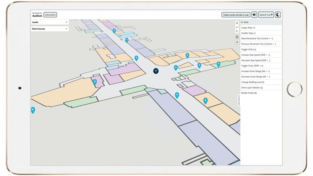
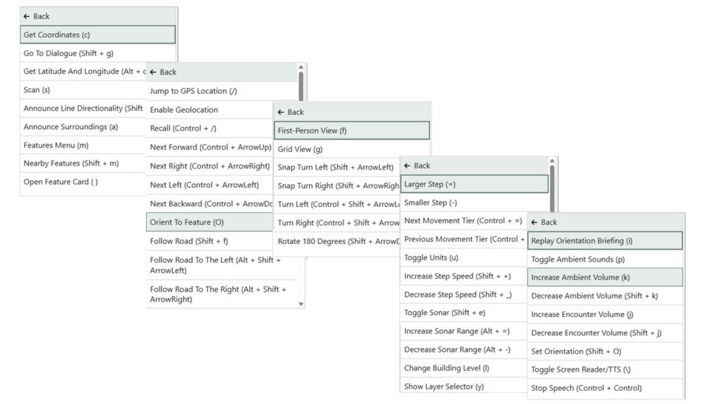
When an ADA accessible audio, text, and high-contrast map is connected to ArcGIS Indoors, the same authoritative data can be delivered in a nonvisual form. A traveler can use a keyboard, screen reader, headphones, or braille display to virtually explore the terminal like a video game. As the User moves across the map, the application can identify nearby features and communicate their shape, orientation, distance, direction, and relationship to other places.
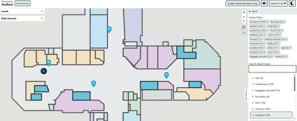
This is more than a searchable list of destinations. It gives BLVI travelers the context needed to build a mental map; beginning at a terminal entrance, locating an airline counter, understanding the relationship between security and the gate, identifying evacuation routes, and identifying meaningful landmarks along the way.
Landmarks Build Confidence
For a BLVI person, useful landmarks may differ from those emphasized on a conventional map. A bench, drinking fountain, column, doorway, row of seats, or change in flooring can provide tactile or audible confirmation of location. Information that may seem secondary on a visual display can become an essential reference point in an accessible map.
Consider a passenger preparing for a trip. Before arriving, the traveler explores the airport’s ADA accessible map, identifies an entrance near the airline’s check-in area, and learns that the counter is 10 feet beyond the second bench on the right. The passenger can give a rideshare driver a precise drop-off location, enter with greater confidence, and request assistance at a known point rather than beginning the journey without context.
When routing is enabled, this mental map complements distance, estimated travel time, and turn-by-turn directions. Routing can move someone from point A to point B; contextual knowledge helps the traveler understand and orient to the surrounding environment. Together, these capabilities create a more resilient wayfinding experience when a route changes, or an unplanned stop becomes necessary.
With ArcGIS, there is no need for duplicate data or to maintain multiple sources of truth to power separate applications. The indoor maps that give airport teams a common operating picture of people, spaces, assets, incidents, access points, and evacuation routes also help BLVI passengers travel safely by clarifying exits, routes, and nearby landmarks in both routine and emergency situations.
There is also a direct connection to customer satisfaction and non-aeronautical revenue. Reducing uncertainty can turn delays into productive dwell times while building confidence, loyalty, and a more positive perception of the airport. A passenger who can easily and independently find a restaurant, shop, lounge, or restroom has more opportunity to use airport amenities.
The Curb-Cut Effect
Accessibility improvements often extend beyond their original audience. Curb cuts were created to remove barriers for people using wheelchairs, yet they also help travelers pulling suitcases, parents pushing strollers, delivery workers, cyclists, and many others. Closed captions support people who are deaf or hard of hearing, but they are also useful in noisy terminals and quiet public spaces.
Accessible indoor maps create a similar “curb-cut” effect. Keyboard navigation can help people who cannot use a mouse. Clear text descriptions support travelers with cognitive or text disabilities, or situational limitations. High-contrast and built-in speech help passengers with low-literacy or low-vision. Detailed landmark information can help any passenger who is unfamiliar with a terminal. Designing for the people who face the greatest barriers often produces a clearer and more flexible experience for everyone. Accessibility works!
One Source of Truth – Build on the Indoor GIS You Already Have
For intelligent airports already using ArcGIS Indoors, the most important asset is high-quality indoor data. An accessible interface consumes existing hosted feature layers and attributes rather than requiring GIS staff to create duplicate interior data that may become outdated the moment they are published. When the underlying indoor map changes, the accessible experience reflects those updates in the instant when the app is refreshed.
Cutting Edge Innovation
XRNavigation – an innovative Esri Startup Business Partner developed Audiom, the very first Experience Builder widget that connects to any published feature layer and makes them fully ADA accessible and usable to everyone. Users access the Audiom widget visually, auditorily, and through text on any platform through headphones, a screen, or via a braille display.
As their airport terminal proof of concept (POC), XRNavigation used floor plans of Hartsfield-Jackson Atlanta International Airport to demonstrate the value of this application. The accessible map experience was configured through a web application using ArcGIS Indoors data hosted in ArcGIS Online.
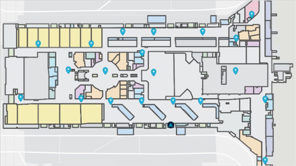
The most important ingredient was not a complicated new technology stack; rather, it was existing indoor data that could be shared through an accessible interface. This approach created a practical pathway for airports: start with authoritative Indoor GIS, include details that matter to travelers, configure an accessible experience, test it with people who use assistive technologies, and maintain accessibility as part of a broader program rather than treating it as a one-off separate project.
Lead the Way – A Practical Path Forward
Begin by treating digital accessibility as an enterprise responsibility rather than a single project. Bring together accessibility coordinators, passenger-experience teams, GIS and IT staff, emergency managers, and people with disabilities. Evaluate current digital maps to make sure they guarantee accessibility and verify it is possible to “hear” shapes and access all information through text, identify barriers, and prioritize the journey that matter most – from curb to check-in, through security, and onward to gates and amenities.
Next, review the accuracy and completeness of your indoors data. Accessible wayfinding depends on more than barriers, pathways, and polygons. Meaningful points of interest, furniture, physical landmarks, entrances, flooring transitions, columns, and operational updates all improve a passenger’s mental model. Most importantly, test the experience with people who use screen readers, keyboards, braille displays, and other assistive technologies. These passengers need to be able to understand the shape, size, orientation, topological relationships, distance, and direction of all points, lines, and polygons on the digital terminal map.
Maps have always helped people understand where they are, what is around them, and how to reach what matters. The next generation of airport wayfinding should not ask passengers to adapt to the map. It should expect the map to “show the way” for every passenger. By combining detailed ArcGIS Indoors data with ADA accessible audio and text-based experiences, intelligent airports give more travelers the confidence to prepare, explore, shop, navigate, make decisions independently, and see what others can’t.
“Sustineo Alas”