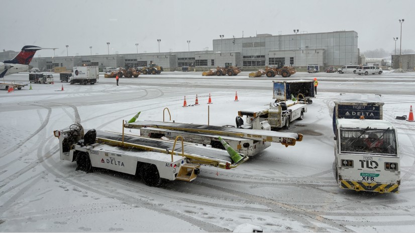
The FAA’s Safety Management System (SMS) rule asks airports for something a periodic walk-around was never built to give – a continuous, auditable, forward-looking picture of airfield conditions. A growing number of airports are meeting the mandate by pairing Geographic Information Systems (GIS) with Artificial Intelligence (AI).

Key takeaways
- The FAA’s SMS rule for certificated airports (14 CFR Part 139, Subpart E) shifts safety from periodic inspection toward continuous, documented, and predictive workflows.
- SMS is data-hungry by design: it needs hazards caught as they appear, and safety performance measured over time.
- ArcGIS paired with Airwai’s AI technology captures each finding as a located, dated record, computes the determination on the vehicle during the pass, and delivers the outcome straight into ArcGIS, where it can generate reports, link to work orders, and notices that SMS runs on.
Airside inspections, safety, and compliance used to be monitored solely by trained airport employees casing movement areas, searching for discrepancies, logging what stood out, and filing reports. Now the FAA’s SMS rule asks for more. Their policy on hazard identification and risk mitigation expects airports that fall under this ruling to shift from a reactive stance on safety management to a proactive, preventative, data-informed approach that identifies hazards and mitigates risks early, before they occur. The expectation is for airports to actively collect operational data to spot safety issues before they cause incidents.
To be clear, SMS is defined as a standing, formal management system with four parts:
- Policy that sets accountability
- Management that identifies risks before they cause harm
- Assurance that continuously measures how the system is performing
- Promotion that strengthens and sustains the practice
Together they require safety to become a formal, continuous, documented, and forward-looking practice. The rule now reaches roughly 277 certificated airports. The question is no longer whether an airport inspects. It is whether the observational data they collect can feed the system the FAA expects them to maintain.

A manual inspection is a sample in space and a snapshot in time. During a typical shift, inspectors log 20 to 40 observations, prioritizing the most serious discrepancies. While this helps keep runways open, it provides a limited foundation for SMS. As conditions appear and evolve, early-stage issues are the easiest to miss. Severity can be subjective, a judgment call, often recorded from memory. Without a map, location is descriptive, so separate inspections, months apart might not reliably identify the same issues – cracks, distortions, joint failures, or seal damage. A trend you cannot track is a trend you cannot assuage.
Location-based, dated observations: the foundation for assurance
Land surveying crossed a technology threshold when GPS replaced the transit-and-chain, transforming location from something described into something precisely measured. Until now, airfield condition assessments have not fully ventured into that realm. SMS is the reason it now should.
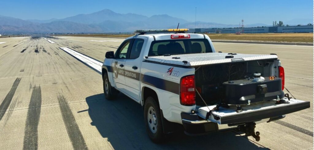
Combined with Esri’s ArcGIS, Airwai’s AI-powered inspection platform, Layered Autonomous Inference and Reasoning Agents (LAIRA) helps airports innovate by automating the process, expanding the scale and precision of each inspection. During a single pass on any airside surface, LAIRA can capture more than two million machine-ready data points describing surface features, visual patterns, and spatial context that manual inspections often miss.
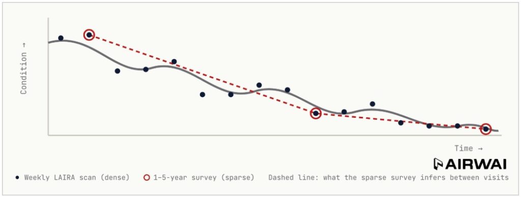
LAIRA tags each observation with a precise GPS location while algorithms simultaneously transform them into queryable GIS data points. Those observations are compared with past and subsequent data. Repeated inspections accumulate data that LAIRA uses to analyze trends and forecast repairs. This analysis tracks how every issue changes over time. Instead of treating an entire pavement section based on its average condition, LAIRAs multi-temporal precision enables teams to focus on very specific discrepancies and act with greater accuracy. It provides consistent logging and record keeping that supports Risk Management and Safety Assurance.
LAIRA is analogous to anti-lock brakes
Safety-critical decisions must happen in real-time. No one would buy or drive a car that recorded wheel slip to a flash drive then email it to an office to decide whether to release the brakes. LAIRA applies this logic to inspections. Detection runs autonomously, so a determination is evaluated instantly as the sensor on the vehicle “sees” FOD or defects.
This is exactly what SMS expects. Because the determination is computed on board, only the outcome leaves the vehicle. The approach also works in secure and disconnected environments. This is what Airwai calls “the autonomous civil engineer”: a system that shifts the time and responsibility from collecting data to making decisions about it.
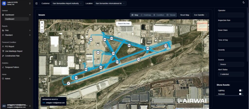
The operations and maintenance teams at San Bernadino manage an expansive airside of more than 1,300 acres and a 10,000-foot runway. Using ArcGIS Online, Airwai’s team and SBD’s airside staff built a workflow covering this entire area, turning LAIRA’s inspection outcomes into map layers that show where issues cluster, recur, or accelerate. A single pass can capture more than two million machine-ready data points. In side-by-side comparisons, AI-based inspection identified three to seven times more surface anomalies per mile than manual methods, with the biggest gains among early-stage issues. What moves into ArcGIS is the decision to act on issues, mapped and dated, not raw labels or scores that require interpretation.
SBD estimates that this approach cuts field-validation time by 50% or more, and it gives every shift the same objective baseline.
“An important part of SMS is the ability for our teams to show their work through time, not just on the day of an inspection. A consistent, located, map-based record of airfield condition is something our team can help support across every shift and every season, without substantially adding to their workload.”
Mike Burrows, CEO, San Bernardino International Airport
ROI: meet mandates and gain an operational advantage
Location-based condition data attributed with date/time strengthens the case for funding maintenance, shortens safety response, and resolves site-specific conditions rather than larger pavement sections. Because the outcomes flow automatically into ArcGIS, the same records generate what an SMS produces: condition reports, maintenance work orders, and safety notices that also feed notices to airmen (NOTAMs).
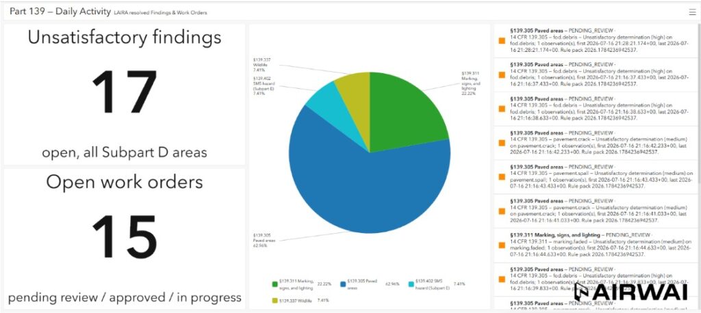
The Activity Dashboard rolls unsatisfactory findings, and open work orders up by Subpart D. Each record in the list is generated automatically; citing the rule it addresses.
Keeping the human in the loop
Airport personnel remain accountable for SMS. LAIRA provides location and date/time-stamped evidence, while trained staff interpret the findings and determine the appropriate response. The platform complements the airport’s existing inspection program by supplying additional data and records; it does not replace inspectors or automate compliance.
LAIRA changes the information available to the airport team. Its outputs align with the FAA Part 18-B data model, so condition, location, and historical records are automatically mapped into the schema. As a result, inspections keep the information current without requiring separate data entry.
SMS is driving a shift from reactive operations to predictive, data-driven oversight, with ArcGIS bringing the necessary information together. This approach turns regulatory compliance from a burden into an operational advantage.
See how airports meet FAA Part 139 requirements. Read the San Bernardino International Airport story, then explore the ArcGIS for Airports Industry website.
An optimist invented the airplane, a pessimist the parachute