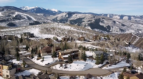
Building a broadband utility in Colorado
Video
With ArcGIS as a foundation, the City of Loveland used a variety of key Esri products and services to build fiber infrastructure from scratch.
As leaders and proven problem solvers in the telecom community, these heroes have gained deep respect from their colleagues by inspiring others to use GIS in innovative ways.

Learn about GIS methods that can enhance your organization's ability to analyze and visualize geographic information.
Building a broadband utility in Colorado
Video

Mapping digital equity activities
Blog post
Telecoms join effort to close the digital divide
Article

Understanding rural broadband deployment
Blog post

Revolutionizing connectivity with 3-GIS
Blog post

GIS for sustainability and climate action
Blog post

GIS and the power of location-based analysis
Technical paper
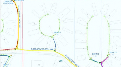
Supporting the deployment of Loveland
Case study

Next generation network management
Story

ArcGIS–A foundation of operations excellence
Blog
Esri Community members—customers, partners, Esri staff, and others in the GIS and geospatial community—connect, collaborate, and share experiences. We invite you to join the conversation or ask a question of the community.

Instructor-led and self-paced options help individuals apply best practices and quickly learn ArcGIS software. Esri training consultants provide complimentary planning services to identify the options that will best meet an organization's immediate, short-term, and long-term workforce training needs.

Attend Esri’s Infrastructure Management & GIS (IMGIS) Conference to discover how ArcGIS models, connects, and enhances relationships between the built, social, and natural environments. The comprehensive geospatial platform offers advanced visualizations and analytics throughout the entire infrastructure life cycle.

The Esri Partner Network is a rich ecosystem of organizations that work together to amplify the value of location intelligence. Partners deliver solutions, content, and services to help you meet your goals. Increase the value of your GIS with Esri partners.
Speak with a representative.