Get the Most out of ArcGIS Living Atlas Subscriber Content
Technology evangelist Bern Szukalski walks you through how to access and best use subscriber content on ArcGIS Living Atlas of the World.
Technology evangelist Bern Szukalski walks you through how to access and best use subscriber content on ArcGIS Living Atlas of the World.
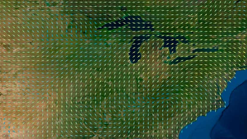
Learn the ArcGIS capabilities and workflows that give you the ability to visualize wind and ocean current data.
Esri cartographic designer Andy Skinner teaches you how to use sketch layers to enhance features in your ArcGIS Online maps.
Kenneth Field, author of Thematic Mapping, writes about the importance of ethics in mapping as well as the core set of values to follow.
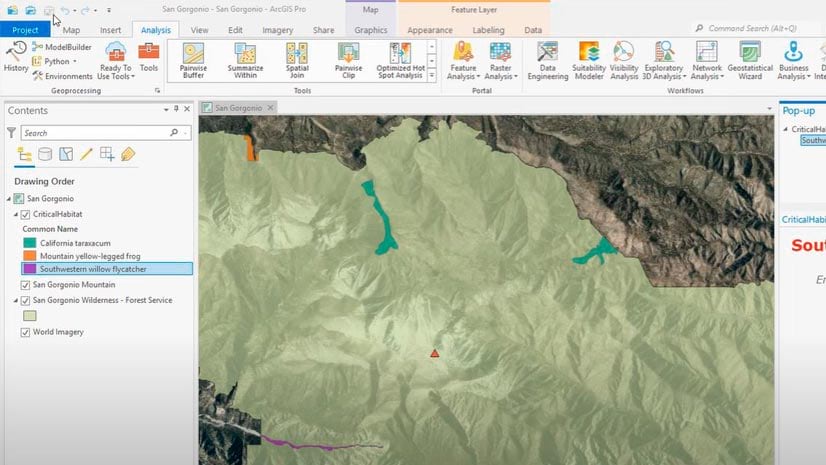
A tutorial clearly shows every step in the process of creating a project using ArcGIS Pro.
Here's a reminder from ArcGIS content chief technology officer Deane Kensok to make sure all Esri basemaps in your maps are current.
D’Maia Curry and Joshua Clifford from Esri talk about the emergence of the mobile worker and mobile GIS.
Cartographer Kenneth Field's book Thematic Mapping is just one of three new Esri Press books worth picking up soon.
William Shuart uses drones and the latest Esri technology to help students at VCU bolster their skills for their future careers.
Esri just released a crop of additional color ramps in Map Viewer, including some with colors that are bright and others that are subdued.
D'Maia Curry from Esri shows you all the features and capabilities you can access from the Maps list in ArcGIS Field Maps.
United States customers can configure or upgrade their GIS by packaging ArcGIS with a Dell EMC PowerEdge Server.