Drone Mapping and Local Voices Help Preserve Ancient Maya Cities
Drones let researchers see places they can’t reach on foot. The new visuals have helped preserve Mayan sites and share them with the world.
Drones let researchers see places they can’t reach on foot. The new visuals have helped preserve Mayan sites and share them with the world.
You’re a scientist in search of biodiversity data for Guatemala. Find out how to get data from a global layer and target it to your region.
The state pioneers the first combined approach to seafloor mapping, fusing airborne lidar, sonar-equipped boats, and autonomous vessels.
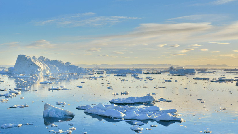
Mapping the underwater topography of remote fjords reveals how glacier dynamics and ocean interactions are impacting warming Arctic waters.
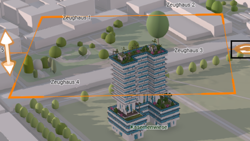
Learn how to turn a 3D web scene into a guided presentation that people can use to explore your story.
New enhancements streamline the analysis of hyperspectral imagery and simplify how users can extract meaning from complex imagery datasets.
Reach new heights. Learn how to create and add a feature layer to an interactive web map in ArcGIS Online.
Watch this video to learn the three key elements of assembling a well-balanced map layout and how to create your own stunning design.
From streamlined predictive modeling to advanced AI integrations, new capabilities are transforming spatial data analysis.
This tool allows you to identify and select specific images within an imagery layer and create a new one based on that selection.
Watch this in-depth conversation about the role maps play in Ken Burns’s PBS documentary The American Revolution.
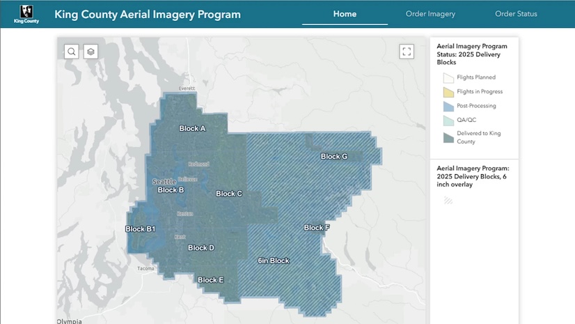
The interactive app increases awareness of the county’s imagery acquisitions and makes the data accessible in a single platform.