


November 17, 2020 |
Steve Snow | Mapping
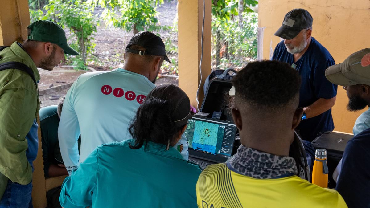
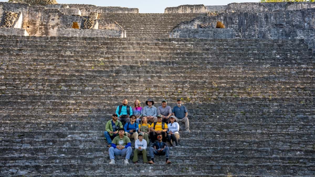
Deep in the lush lowland forest of Belize, a small group of researchers, archaeologists, and students huddled around a computer in June 2025. Damp with sweat and exhausted, covered in mosquito bites, they anxiously waited for images to appear on the screen. After two days spent collecting drone imagery, the results would determine the future of the newly formed Maya Mapping Collaborative.
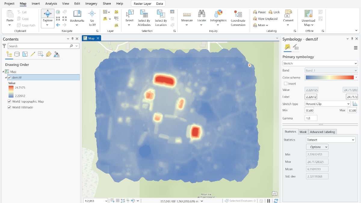
As a 3D model took shape before them, a collective cheer rang out. The Collaborative—led by experts from Auburn University, the University of Belize, and Belize’s Institute of Archaeology (IA)—had its first result: A 3D model of Altun Ha, forming the foundation of an archaeological digital twin. This spatially accurate model would be used to analyze site structure, terrain, tourism management, and environmental risk without disturbing the landscape.
The model, built with geographic information system (GIS) technology, showed astonishing details, some that had been hidden for centuries. Onscreen, the team could move freely across the site, zooming in to places they couldn’t see or reach on foot.
“We were seeing unexcavated parts of Altun Ha,” said Dr. Timothy Hawthorne, one of the collaborative’s cofounders. “We were seeing areas where it might flood and need mitigation strategies . . . It felt like we just won the Super Bowl, everybody was so happy.”
Beyond the excitement, the moment validated that drone‑based lidar and GIS could support a scalable digital twin approach to documenting complex Maya landscapes.
Hawthorne, a professor and chair of the Department of Geosciences at Auburn and a National Geographic Explorer, had spent years envisioning a research initiative that combined drone mapping and archaeology. These ideas closely align with the National Institute of Culture and History (NICH) in Belize, which had already begun documenting sites digitally. Through this shared vision and partnership, the Maya Mapping Collaborative allowed for a broader scope of work. By combining local storytelling with digital architecture, their efforts amplify oral histories, cultural insights, and lived experience alongside drone imagery.
Under its legal mandate, the IA is directly responsible for the research, protection, preservation, and sustainable management of Belize’s archaeological heritage. The Maya Mapping Collaborative advances those objectives by bridging documentation with public engagement.
“Geospatial technology enhances the IA’s enforcement and compliance strategies,” said Josue Ramos, a senior archaeologist at the IA. “We can collect baseline data and compare it to previous geospatial archaeological baselines. Spatial analysis also helps us develop a targeted approach for ground truthing and responding to any possible illicit activities, such as looting or site destruction.”
Ramos emphasized that the processed data helps the public better understand why the IA protects these archaeological landscapes. “It’s not just about the monumental structures,” he noted, “but about highlighting the ancient roads, canals, terraces, and reservoirs that provide crucial information about a particular ancient Maya city.”

The result is a record of Maya heritage unlike any other, accessible to educators, students, and the public worldwide. More people can now explore these sites to appreciate them and help protect them.
“That was a big motivator for the project—bringing these treasures to the world,” Hawthorne said. “These are hugely important sites.”
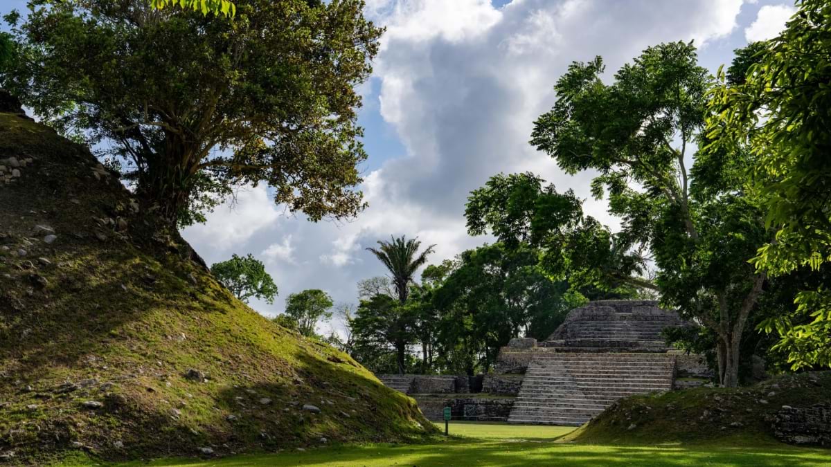
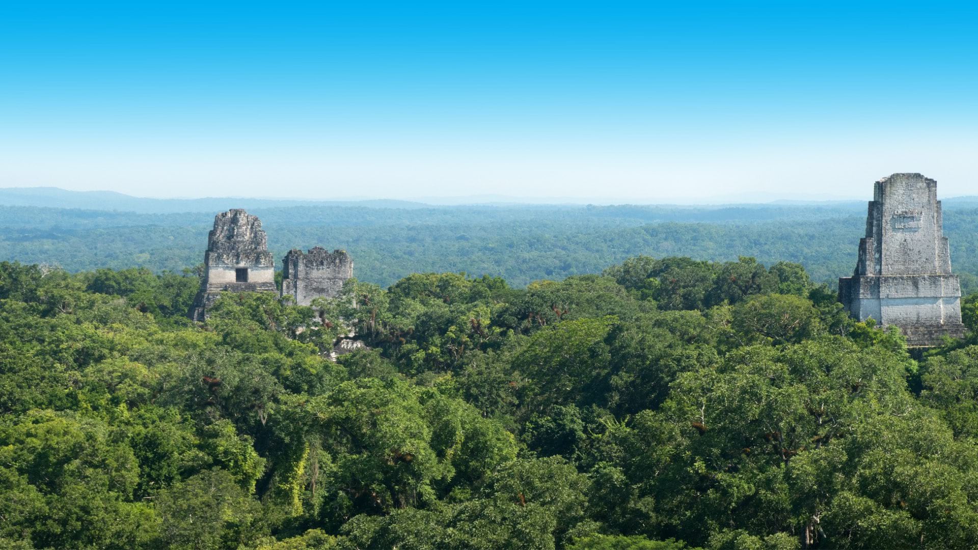
Since that breakthrough moment at Altun Ha, the Maya Mapping Collaborative has documented two more iconic Maya cities: Cerro Maya and Caracol. Efforts like this are critical to ensuring archaeological sites are not lost to future generations as flooding, extreme heat, and both coastal and inland erosion threaten Belize’s ancient cities.
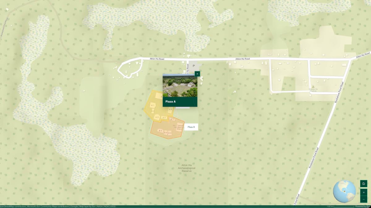
At its core, the Maya Mapping Collaborative is a storytelling initiative. It intertwines one of humanity’s oldest traditions—oral history—with advanced spatial technologies. GIS‑based digital twins provide the research framework, while interactive stories share location-specific knowledge with broader audiences. Through this juxtaposition of ancient and cutting-edge, immersive digital narratives document Maya history, culture, and landscapes (see this interactive story for Altun Ha).
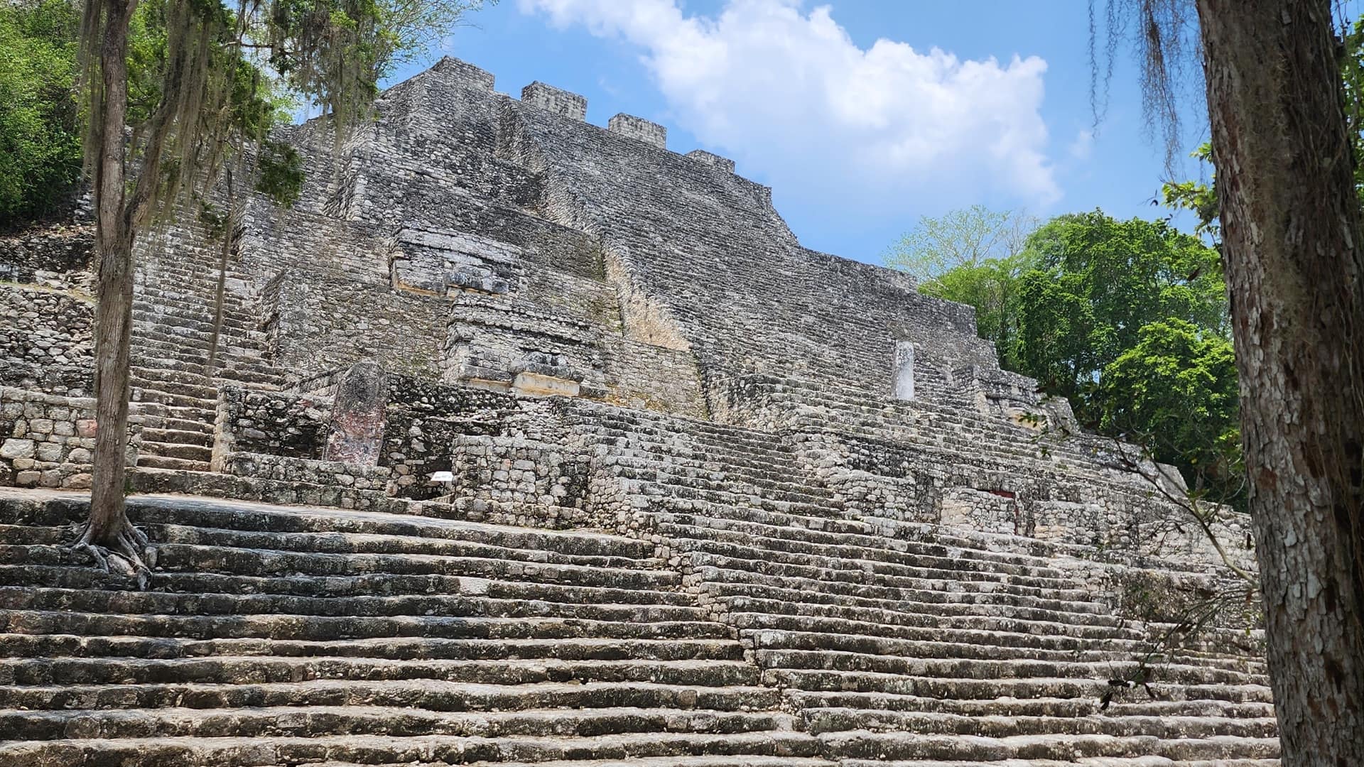
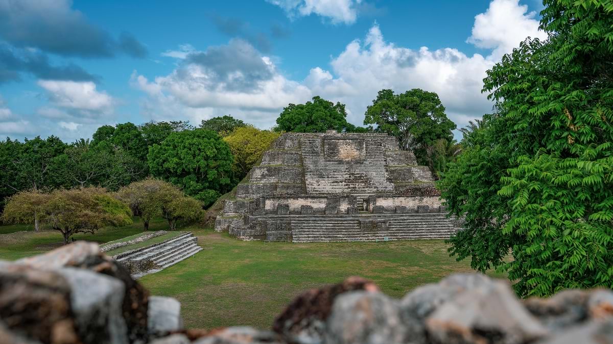
Altun Ha served as a trading hub, connected by river and sea to other Maya cities. Among the towering, stepped stone altars of the site, archaeologists unearthed remnants of an ancient marketplace anchored by a water catchment system.
To support and expand upon ongoing archaeological research, the Collaborative mapped Altun Ha using GIS and lidar-equipped drones. Those lidar datasets form the foundation of the site’s digital twin. From it, researchers can analyze architecture, pathways, water systems, and landscape features—across both excavated and unexcavated areas.
Belize’s intensifying wet season makes flooding a persistent threat to exposed structures and active dig sites. But elevation data within the digital twin allows archaeologists and conservators to identify flood‑prone zones and plan mitigation strategies.
Local voices enrich what’s captured by drones and lidar. These perspectives are integrated directly into the ArcGIS StoryMaps story as videos, photos, and audio files anchored by date and location.

Collaborative members interview the people who maintain, protect, and share sacred sites with visitors each day. Maya elders, guides, and archaeologists describe how ancient people lived, traded, and adapted to their environment. They also speak to the cultural and spiritual significance of specific structures, like a ceremonial plaza that once hosted hundreds of bloodletting rituals each year—considered the highest form of offering to the gods.
Interactive elements further transport the audience, like a 3D model of Belize’s most iconic archaeological find: the jade head of the Maya sun god Kinich Ahau. Unearthed at Altun Ha in 1968, the nearly 10-pound jade head is the largest carved jade object ever found in the Maya world. It’s a national treasure, even appearing on the country’s currency.
“The education component is really important to us,” said Hawthorne, whose passion for making spatial technologies accessible led him to found Citizen Science GIS in 2015. “Being able to bring people to these places virtually, while certainly not a replacement for in-person visits, it does complement that.”
Hands-on learning is central to the Collaborative’s work. Students from the University of Belize take part in all aspects of research, from meticulously planning drone flights to interviewing locals. Seeing their efforts come to life—in maps, models, and stories—has amplified student interest in GIS and drone mapping. Working to create a digital twin gives students experience with authentic spatial datasets and heritage management workflows used by professional archaeologists and conservators.
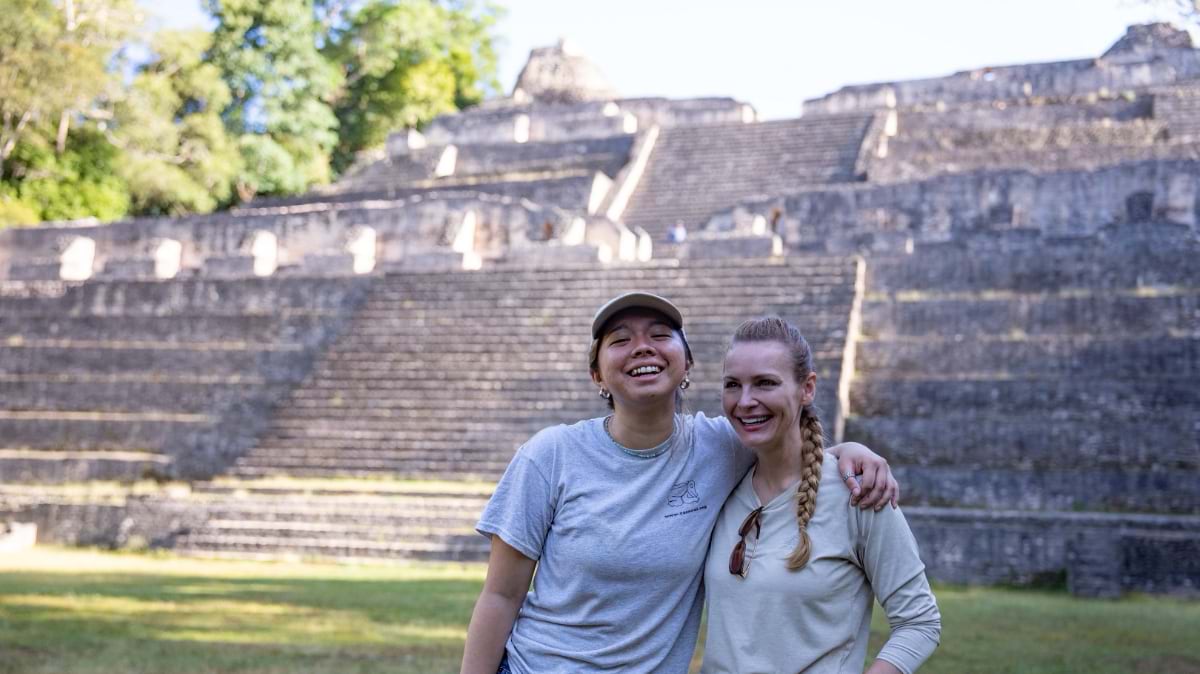
Antonio Cano, a GIS expert and lecturer at the University of Belize, cofounded the Collaborative. He sees his students engage at a new level with reality capture work.
“It’s exciting for me because I can tell that our work is going to spark something in the students,” Cano said. “It’s going to encourage them, and maybe they want to pursue a career in this field. Being an educator, that means a lot.”
Putting students and professors in the field alongside archaeological experts from the IA–NICH has opened new avenues of collaboration. While the IA and the University of Belize’s history department were already working together, partnerships now extend to the university’s science department, which Cano chairs.
“None of this is possible without the Institute of Archaeology,” Cano said. “You can’t just arrive at any Maya ruin and fly a drone. This requires permitting and written approval from the IA.” After the IA management team was impressed by the results at Altun Ha, it greenlit the second project at Cerro Maya (see the interactive story for Cerro Maya).
One of the oldest archaeological reserves in Belize, Cerro Maya is the only known Maya city built directly on the coast of Belize. It once played a vital role in the Maya trade network. As the shoreline has eroded and shifted over centuries, some structures are now underwater. Rising seas put the entire site at risk.
The Collaborative used GIS and drone mapping to document Cerro Maya. That data gives the IA researchers and conservators a clearer picture of what’s at risk. They can now focus on the structures most threatened to slow their deterioration and identify new areas for excavation.

Jorge Can, who works at the IA, talks about the challenges he faces as one of Belize’s only archaeological conservators. “I began to see that nobody was doing conservation here in Belize,” he said. “Most of the archaeologists were foreigners . . . we had to bring a specialist from Guatemala to do the work. So, I began to say ‘Oh, this is something that we need to do here in Belize.’”
Just as the ancient Maya practiced continual maintenance, today’s conservators must regularly replicate stonework and repair damage to preserve historical buildings, or risk losing precious details and entire structures forever. Digital twins support site management by helping agencies plan visitor access, assess infrastructure needs, and reduce physical pressure on vulnerable areas before changes are made on the ground. The IA strives to protect and conserve as well as ensure that site visitors have the best possible experience.
At Cerro Maya, Collaborative members interviewed a local hotelier and a boat maker. Both depend on tourism and are equally invested in preserving Maya heritage and sharing it responsibly.
“Every time someone we interview is talking about a site, whether they work on it or live near it or visit it, there’s so much pride,” Hawthorne said. “They say, ‘This is Belize, this is our community . . . We want others to see it.’”
The digital twins of Altun Ha and Cerro Maya are already reaching people worldwide—teachers assigning virtual field trips, researchers studying details from thousands of miles away, and visitors planning their next trip. With Caracol documented and more efforts on the horizon, the Collaborative is building an archive that puts Maya civilization within reach of anyone. The ancient cities of Belize are open to the world.
Learn more about how drone mapping software creates detailed 3D visualizations that archaeologists can use to query the past.