The blending tools in Map Viewer Beta are offering many new opportunities for rendering maps … and resurrecting some old ones.
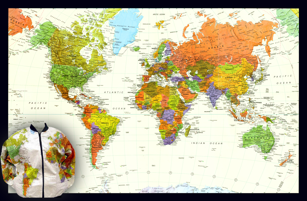
In the 1980s a mapping company called Interarts offered a series of very bright and attractive wall maps printed on Tyvek. This material is known more for its use in construction and packaging, but it is a surprisingly good print medium, and durable (Interarts also created a very popular ‘map jacket ’ in the same material). The maps were built using manual production techniques and were innovative for that time, because they succeeded in making the relief effect in the background (hillshade) take on the color of each country polygon.
In the mid-1990’s the company was sold to GeoSystems (later MapQuest), where I was employed. A group of us, working with erstwhile Interarts President Barbara Petersen, figured out a way of using Photoshop to recreate the blended color effect digitally. The map continued to be published under the GeoSystems and MapQuest brands for some time.
In 2000, two of us moved on to Rand McNally, and used the same process to refresh some of their long-standing wall map lines. Many of these products, from both companies, are still available if you hunt for them (although the jackets may be difficult to find!).
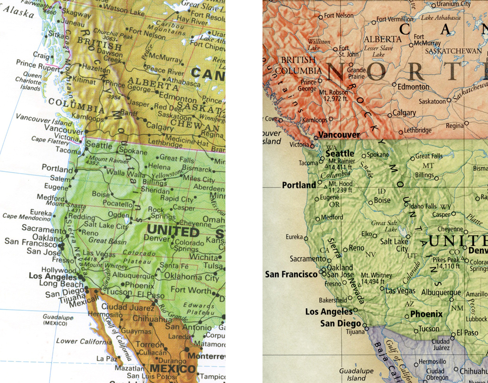
Detail of the ’Tyvek’ map (left) and Rand McNally’s ‘Classic’ wall map (right)
I moved to Esri in 2009. Despite efforts, I was never able to recreate this effect in Desktop or in ArcGIS Online… until now.
The Map Viewer
I and many of my colleagues are excited about the new ArcGIS Online Map Viewer Beta, and we hope you are too! The new blending tools are a highlight, and I’m looking forward to seeing some exceptional maps that exploit them over the next few months. But for me, my mind went straight back to those printed maps, and I wanted to know if I could reproduce the colored hillshade effect.
I was able to do it very quickly indeed. Here’s how:
Preparation
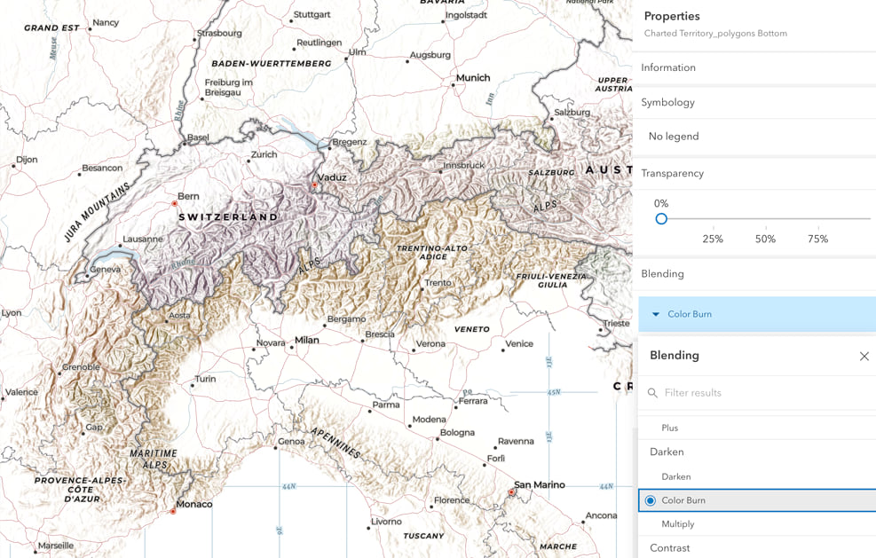
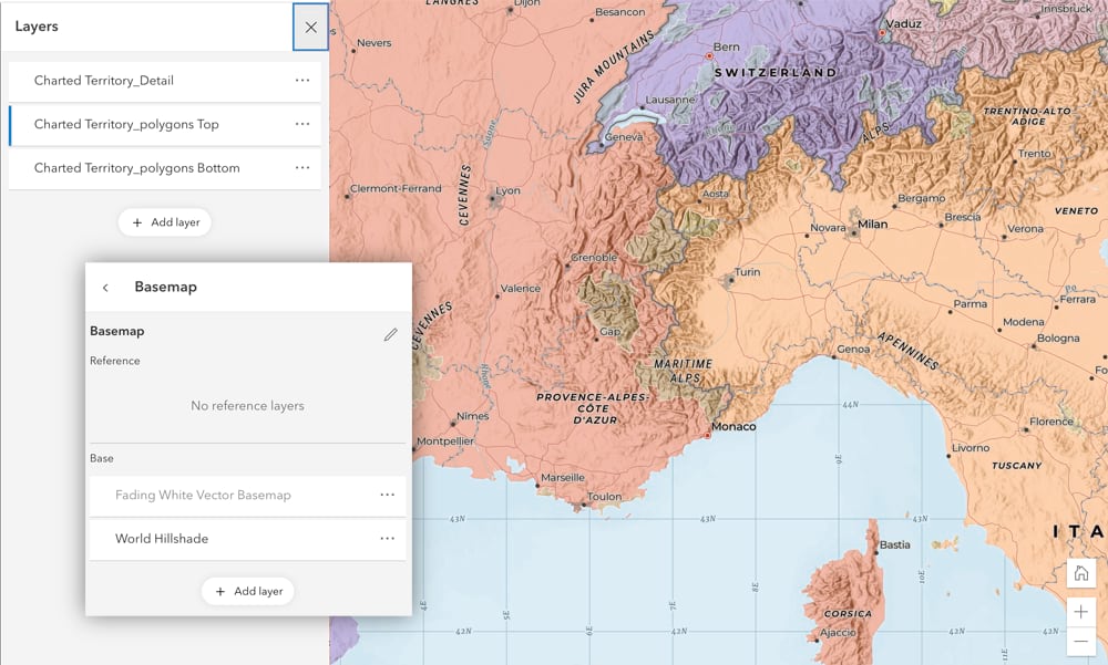
I started by taking the ‘Charted Territory’ basemap (created by Cindy Prostak from the Basemaps Team, and available in the Living Atlas). To get the effect that I wanted, I needed the colored country polygons to be on a separate layer. I used the Vector Tile Style Editor to break them out of the basemap and save them separately (I also took the opportunity to strengthen the colors). The other map detail was saved in a second vector tile layer for adding to the final map.
I added the ‘World Hillshade‘ layer to a new web map with two copies of my ‘Polygon’ layer and my ‘Detail’ layer. I was now ready to add the blending effects.
Creating the Blend
The web map was opened in the new Map Viewer. Using the blending tools, the lower polygon layer was set to ‘Color Burn’. This applied the polygon colors as a subtle tint to the World Hillshade layer below (an interesting effect in itself).
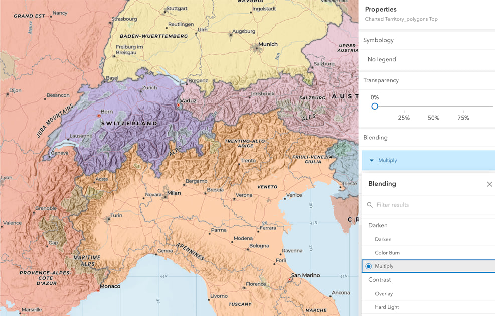
The upper polygon layer was set to ‘Multiply’, restoring the flat color over the top of my blended hillshade.
The ‘Multiply’ tool alone is a huge step forward. Although the transparency setting will still have its uses, it can be frustrating at times. I am sure many of you have faced the dilemma of balancing the strength of one layer against that of underlying layers, and ending up not happy with either:
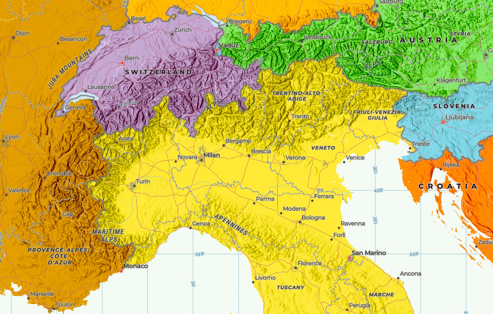
‘Multiply’ allows the full tonal range of both layers to be retained.
The Final Result
The web map can be viewed here (make sure to open it into ‘Map Viewer Beta’ if prompted). It replicates the effect that we used on those old wall maps, but with a multi-scale map I can do more.
I spent some time adjusting the scale ranges for the hillshade, then added a progressively transparent white overlay (based on John Nelson’s ‘blank basemap’) to fade the hillshade out at the smaller scales. At the larger scales (as in the original ‘Charted Territory’ map), the color fades away to reveal more map detail.
Click on the lower of the two polygon layers and try some of the other blend tools. In particular, try the ‘Color’ tool. This has a similar, but exaggerated colorizing effect on the hillshade, which is maybe closer to that original ‘Tyvek Map’ look.
Here I’ve tried to recreate that look more authentically (for licensing reasons, this is not available as a web map):
All of this work was completed online, using copies of vector tile layers available in the Living Atlas.
Note that at the time of writing, the new Map Viewer is in ‘Beta’, so capabilities may change.


Article Discussion: