Taking the Geographic Approach to Infrastructure
Learn how to use GIS and the geographic approach to improve the way you manage infrastructure and assets.
Learn how to use GIS and the geographic approach to improve the way you manage infrastructure and assets.
Multifactor authentication delivers an extra level of security for your organization. Here's how to set it up for members using ArcGIS logins.
Applying effects and blend modes to Media Layers is one of the latest ways you can customize your web maps.
With the new update to Map Viewer, you can export complex mapping content as a single group layer for easy sharing.
Now you can more easily manage date and time data using new field types available in ArcGIS Online.
Learn how you can leverage Forms in Map Viewer to elevate, customize, and optimize your data editing experience.
In this seminar, you will learn the ArcGIS Pro editing environment, including the user interface and key options to increase efficiency.
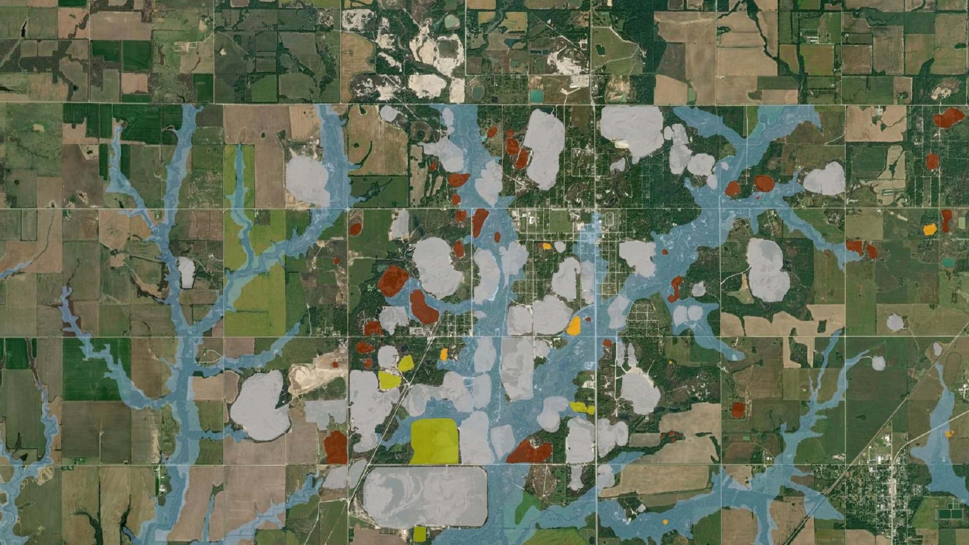
The Tar Creek Superfund site created one of the most toxic floodplains in the US. LEAD Agency is using GIS to advocate for environmental justice.
Countries around the world are using the Mountain Green Cover Index developed by the UN to monitor changing vegetation and improve conservation.
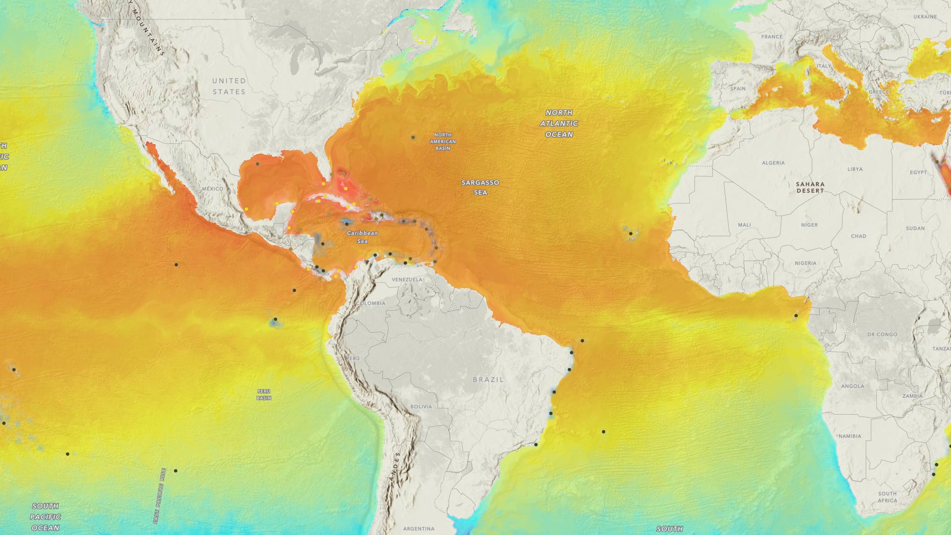
Learn to make a sea temperature and coral bleaching map in a minute using ArcGIS Online and ArcGIS Living Atlas of the World.
Now you can access a vast collection of satellite imagery with new EarthCache add-in for ArcGIS Pro.
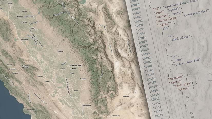
Edit and customize base labels and blur the lines of what's possible with your basemap.