In boardrooms around the world, a new reality is sinking in: Those organizations best able to marshal data to absorb, avoid, or reduce climate risk—and find opportunity in the tumultuous years ahead—will hold significant competitive advantage and better reflect society’s values.
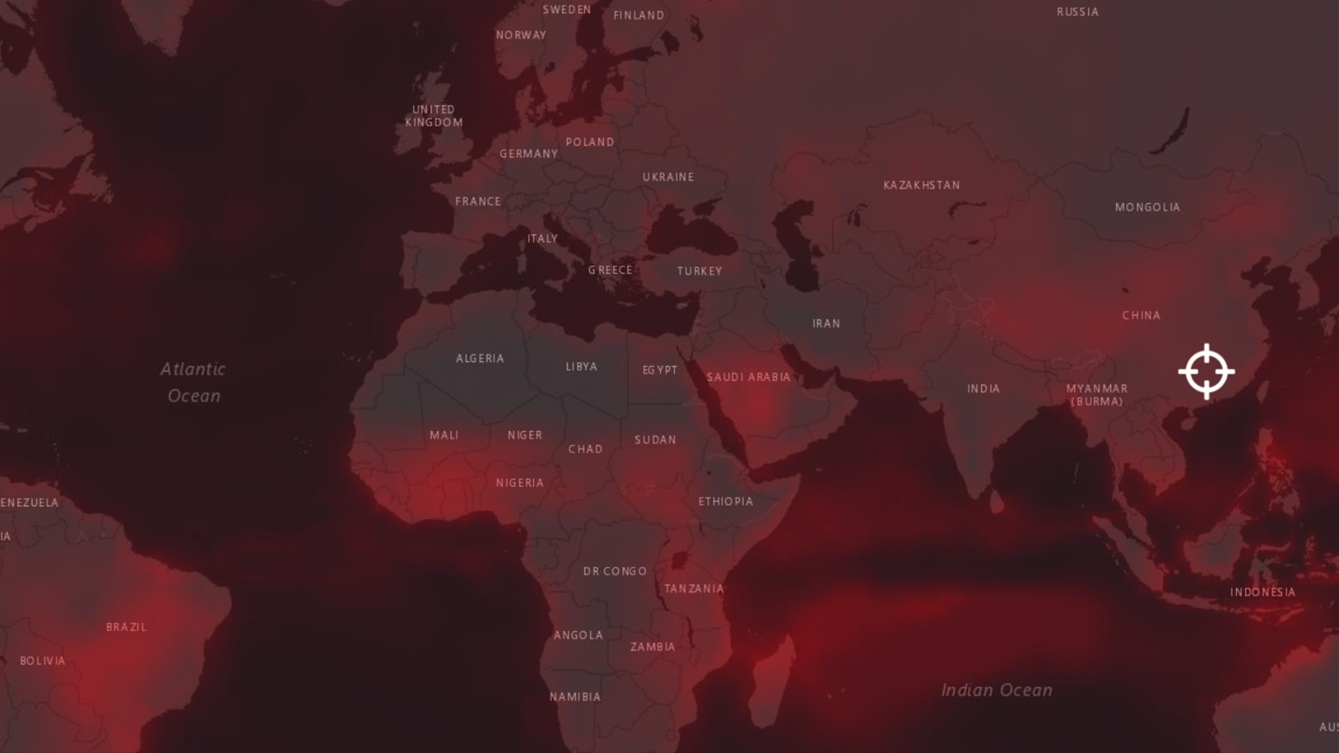
In the wake of an unbroken series of extreme climate events that have disrupted supply lines, devastated communities and businesses, and dramatically altered markets, company leaders are digesting the news that a global temperature rise of 3.2°C could wipe out nearly a fifth of global GDP—$15 trillion in today’s dollars—by 2050.
With disruption and uncertainty the new normal, what’s clear is that the traditional list of factors in any major business decision—revenue, brand identity, market share—now has another strategic layer: sustainability. The urgency behind the sustainability imperative is not just born of charitable intentions and corporate social responsibility; it’s recognized as a matter of basic business continuity and survival.
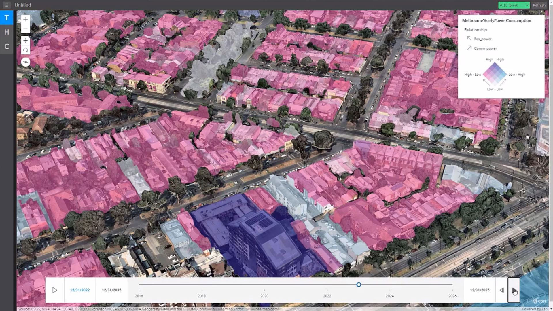
Geography looms large for scientists in the fight against climate change—likewise, executives are taking a geographic approach backed by data science to understand where assets lie in relation to climate threats, like flooding or excessive heat, and to visualize how company actions affect the environment. Some of the world’s biggest and most powerful retailers, shippers, and manufacturers rely on a modern geographic information system, or GIS, to supply this unified perspective on operations, vulnerabilities, and impacts.
The spatial awareness provided by GIS, known as location intelligence, reveals patterns and connections that would be lost in a spreadsheet. Executives can visualize business metrics, weather predictions, and other key data that vary dramatically by location. For instance, global warming might exacerbate floods that threaten offices in the US Midwest and South and make growth of coffee beans impossible in Guatemala or Rwanda.
International businesses must also navigate climate-related regulations and legislation unique to each country. With GIS, executives can analyze these complex data streams in a familiar format—a map—and easily share findings with fellow executive stakeholders.
Location intelligence can transform decision-making in the many places where sustainability meshes with daily business operations and long-term planning (see sidebar “How GIS Contributes to Sustainable Business”). For executives overseeing site selection, supply chain management, field operations, and sales and marketing, spatial analysis guides them toward a better relationship with the environment and a healthier business future.
Resilience and Reduction: The Twin Engines of a Climate Sustainability Strategy
In a sign of how seriously CXOs are taking sustainability, decision-making power around climate issues now often resides with the chief risk officer or CFO. These executives have defined two primary sustainability strategies: resilience and reduction.
Resilience efforts are about defending an organization against climate impacts and withstanding such impacts when they are impossible to sidestep. It’s a concept that lies at the heart of modern business continuity. Reduction, on the other hand, describes actions that companies take to minimize harmful impacts on the environment. For many companies, reduction takes the form of eliminating or minimizing greenhouse gas (GHG) emissions. According to a recent report, at least a fifth of the world’s biggest 2,000 public companies are currently committed to net-zero emission targets.
Resilience and reduction are two sides of the same coin: a company that optimizes transportation routes to reduce its carbon footprint, for instance, also creates a more streamlined network that may be less exposed to floods, storms, and other climate hazards. An organization that retools operations to use fewer natural resources also ensures a healthier supply of that resource in the future. Whether interrelated or taken apart, resilience and reduction strategies are best understood and implemented through the lens of location intelligence.
In the short term, GIS offers a “single pane of glass” through which decision-makers can anticipate weather events to ensure employee and customer safety, create location-specific mitigation strategies, and coordinate efforts to minimize disruptions and maintain continuity. In the long term, GIS-based modeling can flag the location of worsening climate conditions, prompting business leaders to harden or relocate assets and infrastructure that are needed to serve the next generation.
By modeling facilities or supply chains into a digital twin—complete with data from IoT sensors and satellite or drone imagery—executives gain a comprehensive view of business activity across land and sea. From this vantage point, they can analyze supply chain impacts, create more efficient routing, and ensure long-term responsible use of resources.
Thanks to the long reach of IoT data and location technology, companies can surface these insights without dispatching employees and vehicles to far-flung locations—another way for a business to meet net-zero and other reduction goals.
No Exit from a World of Climate Change
A host of motivations has forced climate onto the C-suite docket, and no industry or region has been spared. Business activity itself is slowed by worsening climate conditions: researchers have found that poor air quality reduces shopping activity, and rising heat cuts into worker productivity. The COVID-19 pandemic has demonstrated that in today’s globalized economy, knock-on effects can ricochet from loading docks in Vietnam to store shelves in Minneapolis within days and linger for months or longer.
Companies that rely on natural resources must guarantee that their source materials won’t be wiped out by rising temperatures, droughts, deteriorating biodiversity, or floods. Meanwhile, storms and cyclones have picked up in nearly every corner of the globe, wreaking havoc on assets and causing flooding that can shutter small businesses and restaurants. US flood insurance rates are set to increase for 77 percent of policyholders, according to a recent study.
Consumer sentiment is also changing dramatically, as younger generations leverage their wallets to reward organizations that practice holistic sustainability. On a recent WhereNext webcast, a snap poll revealed that competitive differentiation and brand leadership were the main drivers of sustainability efforts. Insurance firms are pushing companies to build climate risk analysis into asset evaluations, and Wall Street banks want to protect investments from long-term climate disruptions.
C-suite leaders are even feeling the effects of this turning tide on a personal level. A growing number of CEOs now find their bonuses tied to environmental goals. Meanwhile, activist investors are successfully pressuring some the world’s most powerful companies into taking the difficult steps necessary to cut carbon emissions.
BlackRock CEO Larry Fink, head of the world’s largest money manager, has been among the most vocal leaders in pushing companies to build sustainability into their business models, citing a “tectonic shift.” That shift and the urgency it reflects are written in the numbers: For the first time, banks are committing more financing to green bonds and loans than to fossil fuel, according to recent Bloomberg data.
GIS: An Organization’s Central Nervous System for Resilience and Reduction
For many C-suite leaders, resilience has been elevated to a top-line priority because weather events and other threats are affecting their ability to fulfill customer expectations day in and day out. Resiliency could roughly be described as a defensive posture—but as with any great defense, it contains elements of proactive offense.
GIS furnishes companies with a central digital nervous system that contextualizes and analyzes data. Leaders can use this system both to inform long-term resilience strategies and respond to near-term dangers triggered by weather or climate events. Location-savvy organizations—including one of the world’s largest retailers—rely on real-time, GIS-powered dashboards as the brain of emergency operations centers (EOC) and global security operations centers (GSOC).
As data on potential natural disasters flows to these centers of operational awareness, decision-makers can weigh complex factors and coordinate fast, precise responses.
By adopting a geographic approach, business leaders can see weather events developing and begin enacting location-specific mitigation strategies. Data layers showing climate patterns reveal where rainfall has historically led to river flooding, and how that might affect properties, employees, and communities. With advance knowledge of impending weather events, a tech company can warn employees not to commute into the office, a restaurant chain can stock up on shelf-stable goods, and a manufacturer can order components from an alternate supplier.
Location intelligence generated from GIS software empowers companies to not only improve their own resilience, but also strengthen the communities where they operate. The major retailer cited above orchestrates natural disaster responses with local and state governments and relief organizations. Dashboards can identify store parking lots where displaced families might gather, or where surpluses of critical supplies could be staged. During Hurricane Florence, the company’s spatial awareness enabled the emergency team to source and donate massive air conditioners, which were airlifted to a sweltering North Carolina shelter completely surrounded by water.
50- and 100-Year Business Continuity Planning
To ensure long-term resilience, companies are using cutting-edge tools like AI and machine learning in conjunction with GIS to map patterns in climate data decades into the future. By aligning investments with those predicted trends, a business can avoid pouring resources into areas with a high chance of being underwater in 30 years or wiped out by forest fire. Examples include:
- AT&T is carrying out advanced spatial analysis of climate risks that goes far beyond examining FEMA floodplain data. Through a partnership with the US Department of Energy’s Argonne National Laboratory, the world’s largest telecom company has created forecasts showing how infrastructure like cell towers or base stations could be affected by 50-year storms. The granularity of this data allows AT&T to anticipate with 95 percent confidence that a given 200 square-meter plot of coastal land will see 15 feet of maximum flooding in the coming decades. By layering those models onto GIS-based smart maps, decision-makers can make the call about which assets to strengthen or relocate, which in turn helps keep internet access on in challenging conditions.
- The furniture giant IKEA uses 700 million cubic feet of wood a year. That reliance on a natural resource and commodity that can take 140 years to mature has made sustainable forestry a vital interest for the company. The investment arm of Ingka Group, which operates the majority of IKEA stores worldwide, owns swaths of forest in the US and Eastern Europe. It uses location intelligence to guide ecologically sound methods of timberland management. Based on data from field agents and satellite imagery, the company’s location analysts can identify which tracts contain tree species most vulnerable to threats like the invasive bark beetle. With this information, they can prioritize areas that need protective treatments, staving off costly losses. Because much of this data can be tracked through technology like remote imagery, Ingka minimizes its own environmental impact on the regions where it operates. The company relies on GIS to monitor biodiversity measures like the health and population levels of animal, plant, and insect species on its properties. This holistic understanding of woodlands and the ecosystems they maintain is integral to maintaining long-lived, productive forests.
- Taylor Shellfish Farms, the largest shellfish producer in the US, with farms extending across 10,000 acres of Pacific Northwest tidelands, knows that keeping a sustainable supply of food and drink on our dinner tables requires resource planning on the scale of decades, not months. Company leaders use pH sensors and GIS to track the acidity of ocean water and determine how well oysters respond. By comparing farms and identifying techniques that lead to improvement, they’ve been able to grow in spite of climate-related disruptions that have crippled other hatcheries.
Companies across the manufacturing sector—from pharmaceutical giants to soda makers—are turning to location intelligence to assess and reduce water use, concerned that unchecked consumption could create long-term scarcity at production facilities and in surrounding communities.
The Net-Zero Zeitgeist
As many of the most influential companies in the world sign on to net-zero commitments, it’s increasingly evident that achieving these goals could fundamentally shift how businesses source and ship goods and materials and alter the kinds of partners they work with. In September, 86 companies including Salesforce, Procter & Gamble, and HP joined an Amazon-led initiative to be carbon-free in their operations by 2040. The list of businesses that have taken the Climate Pledge now numbers over 200, collectively employing more than seven million people. To cut greenhouse gas emissions and reach these lofty goals, businesses will need visibility into their own operations and a precise view of where they can make the biggest cuts.
In 2019, almost a quarter of greenhouse gas emissions came from industrial production, according to the US Environmental Protection Agency. With the effects of climate change already striking at the bottom line of many companies, executives can see that contributing to global warming will ultimately hinder their own success and viability. That’s made reduction a strategy for business survival.
By necessity, reduction strategies must extend beyond greenhouse gases to account for the natural world in all its complexity. Companies are becoming more mindful that diminished ecosystems lead to resource-poor environments and land that can’t recover from climate change. Farms and forests with strong biodiversity ratings are ultimately more resilient and productive. It’s yet another motivation for businesses to develop a detailed picture of how they use resources and impact the environment, and where efficiencies might escape the naked eye.
Reduction: When Less Is More
Location intelligence supports reduction efforts on a number of fronts, helping executives stay accountable as their organizations lower greenhouse gas emissions. Dashboards allow executives to monitor offices, stores, and factories, along with their GHG metrics. GIS-based planning is essential in sourcing natural resources sustainably, and the technology also aids communication: web-based smart maps help companies share reduction results with customers, investors, and the public.
The example of a large European grocery chain shows how the positive benefits of reduction can ripple through an organization. Already ranked first in global sustainability studies, the grocer decided to use GIS to move toward holistic sustainability. Reducing the CO2 emissions of its fleet of vehicles allowed the company to hone its competitive advantage both as a brand and an efficient operator. The company employed GIS to unite multiple data streams related to emissions—creating a big-picture visualization that empowered smart decision-making.
Using an algorithm that accounted for the effects of road slope, speed, load factor, and other parameters, company leaders were able to calculate the emissions for every engine type in its fleet, from diesel to electric, across all transportation routes. By feeding this information into smart maps, the company confidently predicted which engines would be most efficient for each route, identifying adjustments that would optimize fleet performance, eliminate carbon emissions, and reduce costs.
The Long Reach of Location Intelligence
Combining GIS with data from satellite imagery, drones, and IoT sensors gives decision-makers access to patterns that would have been invisible even a few years ago. By reducing the need for in-person visits to sites or assets in the field, companies gain accuracy and cost savings while reducing environmental impacts.
A recent investigation of deforestation in the Amazon shows the power of these technologies. An ecologist concerned about actions taken by a cacao company in the Peruvian rain forest relied on geospatial analysis and remote sensing to prove that old-growth forests had been illegally logged. A company could use the same tools to vet overseas partners or monitor the effects of its own operations.
Supply chains are attracting attention as a major source of carbon emissions and a place where route optimization could make a big impact on sustainability goals. According to analysis by the Boston Consulting Group, eight supply chains account for over 50 percent of greenhouse gas emissions each year.
New location-aware tools are helping businesses visualize how their footprints extend across global shipping lanes. For instance, the Seaport Simulator, developed by design and engineering firm Atkins, uses overhead lidar imaging to plot a seaport down to the height of seawater at the docks. This digital twin also extends across oceans, revealing partner ports, shipment data, population data, maritime travel routes, and climate patterns—a comprehensive, GIS-based picture of materials en route in all directions. Location analysts have been testing how resilient supply routes will be to climate disruptions, but a similar process could be used to run simulations on which alternate shipping lanes best support reduction and decarbonization.
Seventh Generation Decision-Making
When the world moved at a slower pace, society and businesses thought in generational terms. In the days when wines took longer to age, the truism was that you drank from the cellar your grandfather acquired, and bought bottles that your children and their children would one day share.
The Haudenosaunee or Iroquois confederacy is famous for its “seven generation” form of decision-making, in which leaders consider how today’s choices will affect descendants seven generations from now.
As climate change’s threats reshape businesses, this long-term view is taking hold in the most influential offices in the world. Ensuring the future requires a clear view of today’s operations and tomorrow’s repercussions, making location intelligence an invaluable part of achieving holistic sustainability across all facets of business activity.
The Esri Brief
Trending insights from WhereNext and other leading publicationsTrending articles

December 5, 2024 |

January 6, 2026 |
February 10, 2026 |

March 3, 2026 |

March 10, 2026 | Multiple Authors |

July 25, 2023 |