displaying 2619 results

A new initiative integrates AI and GIS to shed light on what factors influence the movement of encampments.
High-resolution drone imagery and ArcGIS Indoors helped create 3D indoor maps of The Henry Ford museum complex.

Enroll in this learning plan to prepare for the new ArcGIS Developer Foundation certification exam this May.

Cities use GIS to preserve green spaces while enhancing livability and sustainability through data-driven urban planning and park development.

A freak tornado during a festival revealed Virginia Beach’s fractured emergency management systems, spurring an 18-month transformation.

What’s the one skill GIS professionals should sharpen in the years ahead? A long-time manager shares her perspective in this frank Q&A.
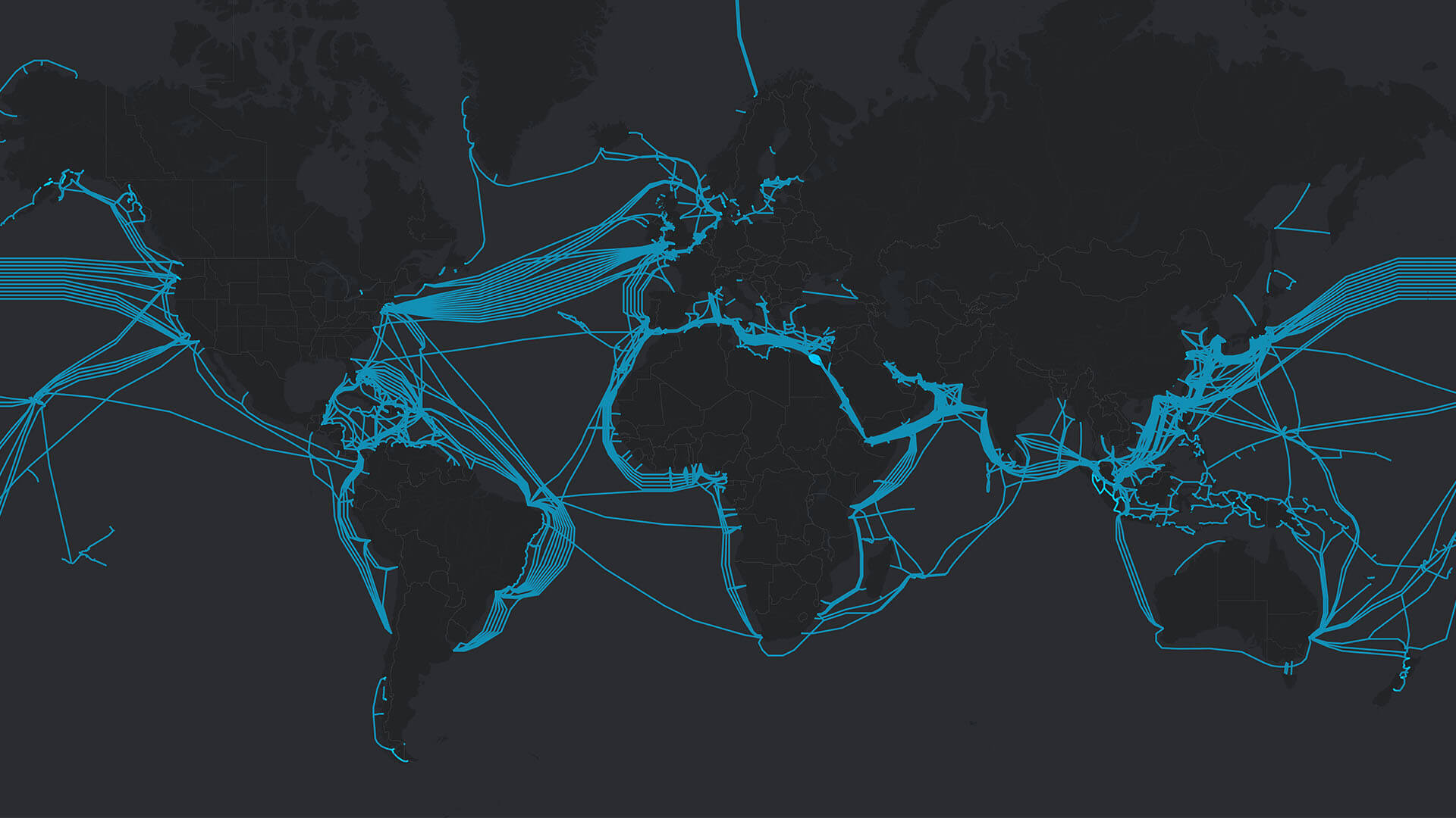
A data-first, location-centric analysis of emerging markets paid off for two companies expanding well beyond traditional strongholds.

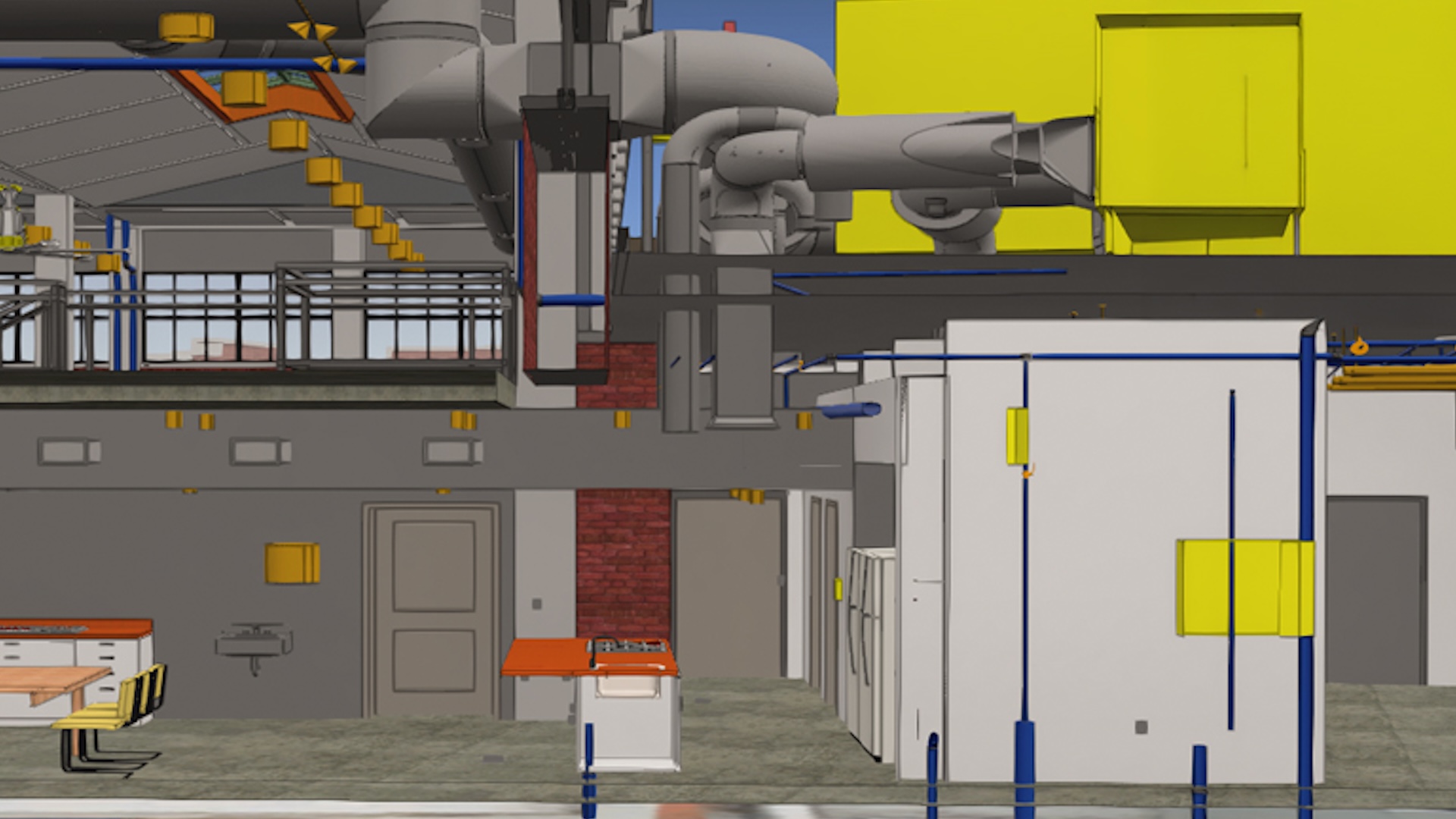
Engineers in Vietnam are creating a living 3D model that improves operations, safety, and long-term planning.

South Carolina’s Aquatic Planning Tool maps and models impacts on freshwater species, aiding proactive conservation and climate adaptation.

To combat the devastating risks of increased urban heat, the City of Sydney conducted a detailed analysis of urban microclimates.
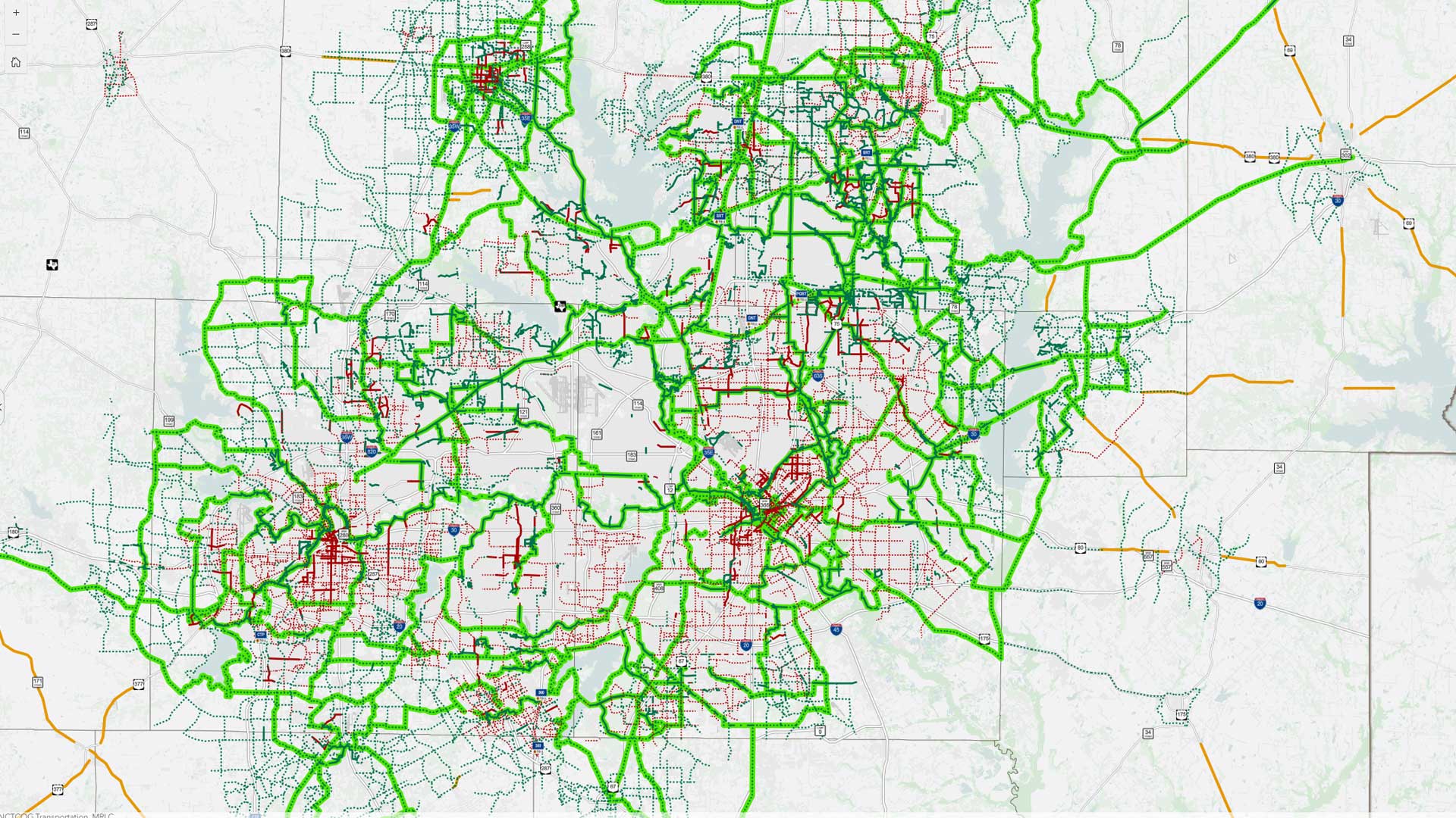
Learn how the North Central Texas Council of Governments went from a reactive GIS management approach to a proactive one.
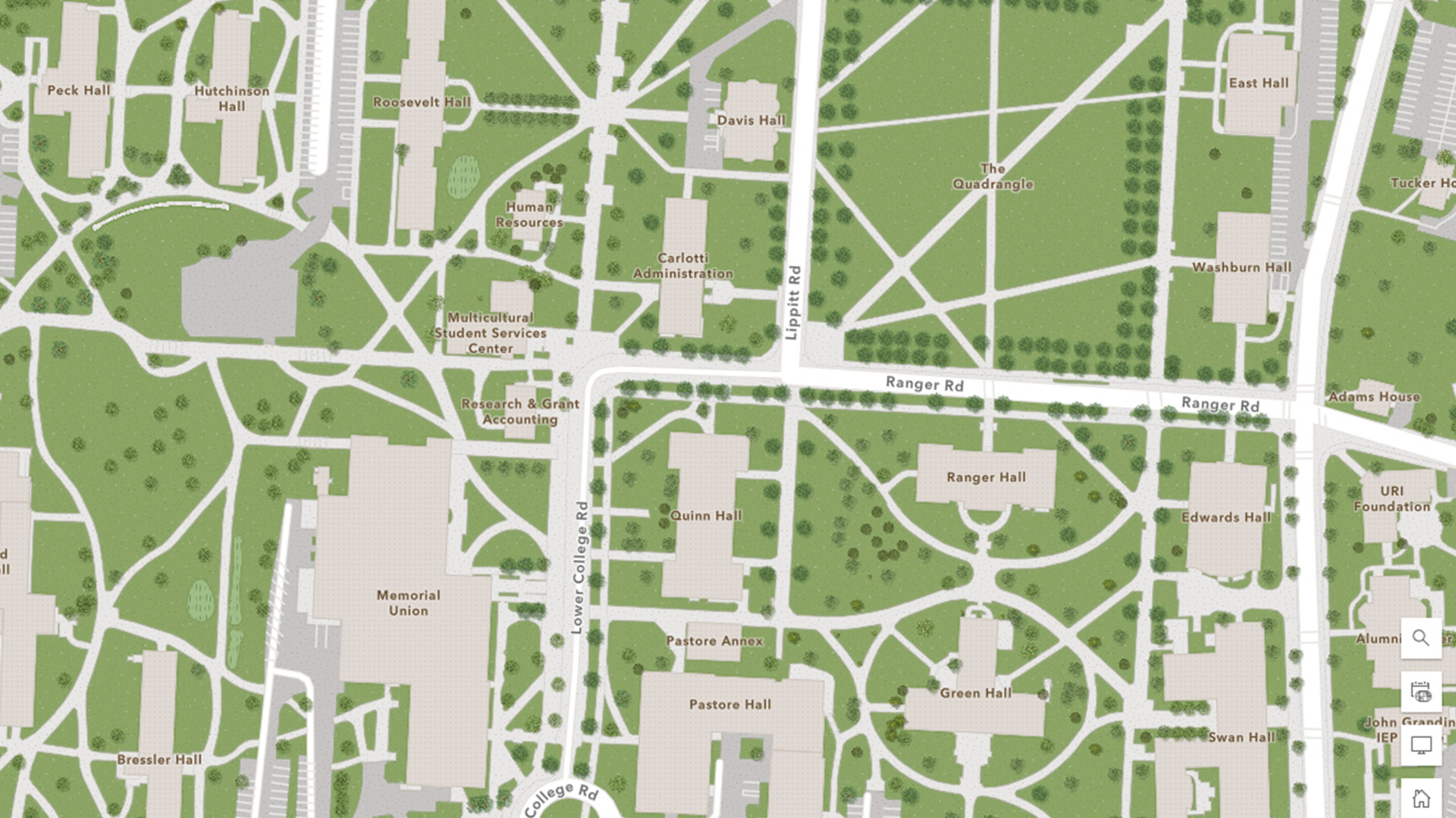
The University of Rhode Island’s spatial services team is taking steps to embed GIS in the fabric of campus operations.