The 46th Esri International User Conference (UC), July 13-17, 2026, in San Diego, CA, was a compelling week. I am fortunate to attend this keystone event, and one of the many benefits is a respite from the hot and humid weather back home in Charlotte, NC. This blog is a follow up to my pre-UC blog.
GIS Leadership Summit
My week started early as I participated in the 14th GIS Leadership Summit on Sunday, July 12. This is an impactful, energizing way to kick off your UC week. It is an all-day, interactive event full of networking, group discussions, and inspirational presentations.
This year’s was the largest ever, with over 500 attendees, including 100 executives. The group was highly diverse, with 57 different industries and 28 countries represented. If you are a current or future GIS leader or executive, please consider attending it in the future. Many attendees consider it the highlight of their week.
More information about it can be found in the GIS Leadership User Group on the Esri Community. I want to pass on my appreciation to everyone who helped make this such a huge success: the presenters, Esri colleagues, and the attendees.
UC Plenary
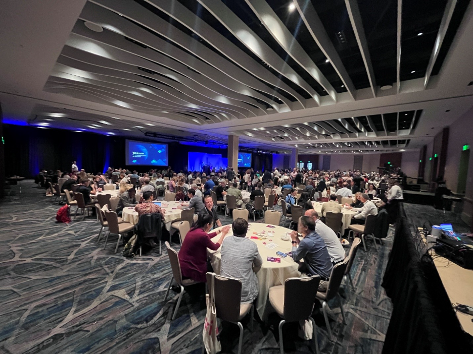
In the global GIS community, there is nothing like the UC Plenary on Monday. For over five hours, 15,000 people in person, and thousands more online, united to celebrate the people and technology that drive our industry.
This year’s theme was GIS – Creating a More Intelligent World and started with Jack Dangermond welcoming everyone and encouraging attendees to spend a few minutes meeting someone new, as this is an important part of the week and helps expand your personal network.
I met a gentleman who was attending his first UC. He works for an energy company in Japan. Meeting GIS users from abroad always reminds me of the reach of the GIS industry and how, no matter where we live or where we work, we are all very similar, dealing with the same challenges and sharing the same drive for the science of geography.
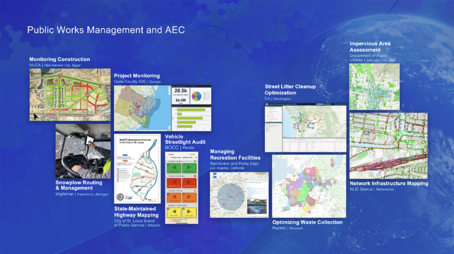
The work of our users is highlighted with examples from all industries and locations around the world. This included many public works users. Jack delivers his vision, and then colleagues review our work. Live demonstrations show off the latest developments. Users tell their stories, illustrating the impact of ArcGIS on their organizations and communities.
Recognizing GIS Excellence
Awards are given to those who excel in maximizing the impact of ArcGIS. This includes the Special Achievement in GIS (SAG) Award.
These winners represent 0.2% of Esri customers, so if you are looking for others to emulate success, check out the winners here.
My nomination for the Public Works industry was Houston, TX Public Works. Read more about them here.
Congratulations to:
- Austin, TX GIS Group, recipient of the Enterprise Award
- Government of Jamaica, recipient of the President’s Award
- Dr. David Maidment and the NOAA National Water Center, recipients of the Making a Difference Award
All of this wrapped up with a stirring keynote. This year’s was delivered by Kristine Tompkins of Tompkins Conservation.
If you were unable to see the plenary or want to relive it, you can find the videos here.
Monday was capped off with the opening of the Map Gallery and a lively reception, including food and drink, while attendees browsed hundreds of maps from every industry and across the globe, with a chance to speak with their creators and other special guests.
If you were unable to visit the Map Gallery, or want to revisit it, you can view the virtual Map Gallery here. Be sure to check out the award-winning maps.
Public Works Showcase
Tuesday kicked off my UC in earnest, with busy days of meetings, presentations, and helping users in the Public Works booth in the Expo.
At lunchtime, I hosted the Public Works Special Interest Group (SIG) meeting sponsored by Novotx, providers of enterprise asset management, citizen request, permitting, and licensing software. We had over 150 attendees.
I provided insight on the American Public Works Association’s (APWA) priorities, which include:
Policy Priorities
Other Priorities
- Modernization
- Streamlined Permitting
- Subsurface Mapping
I presented my vision of what a Public Works Enterprise GIS looks like, including support for all six Public Works focus areas:
- Operations & Maintenance
- Streets, Roads, & Bridges
- Field & Fleet Management
- Capital Project Design & Engineering
- Public Grounds & Facilities
- Emergency Response
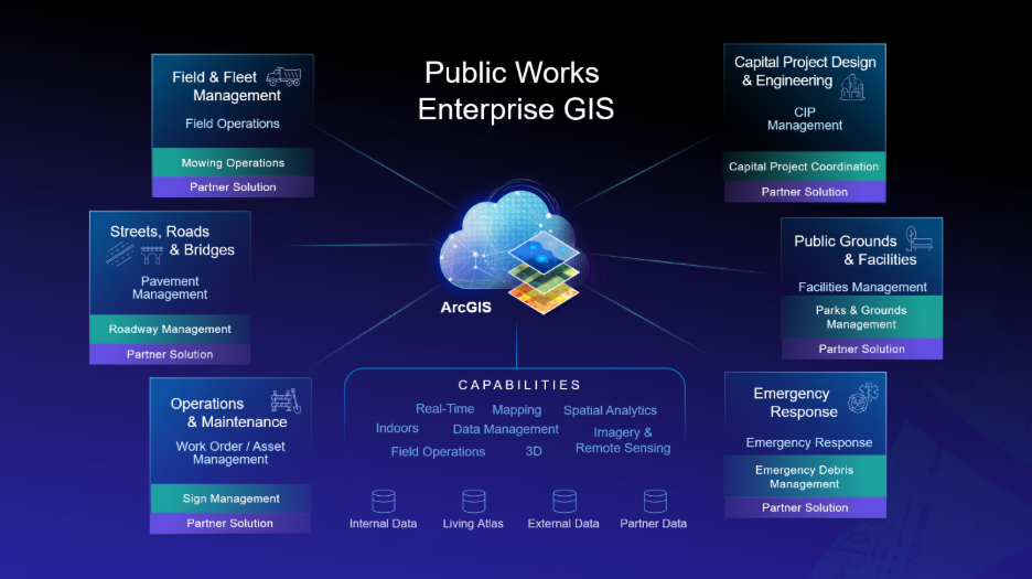
This vision shows the capabilities that ArcGIS delivers to an organization, the data that powers it, and how to support common workflows out of the box, with ArcGIS Solutions, and/or with Esri Partner solutions.
ArcGIS Solutions Update
Mike Dagle, Infrastructure ArcGIS Solutions Lead at Esri, provided an ArcGIS Solutions update that featured how the Road Closures solution now supports Google Maps and Waze, in addition to Apple Maps and TomTom, via the Esri Community Maps program.
This is a powerful solution that can have a real positive impact on traffic congestion in your community.
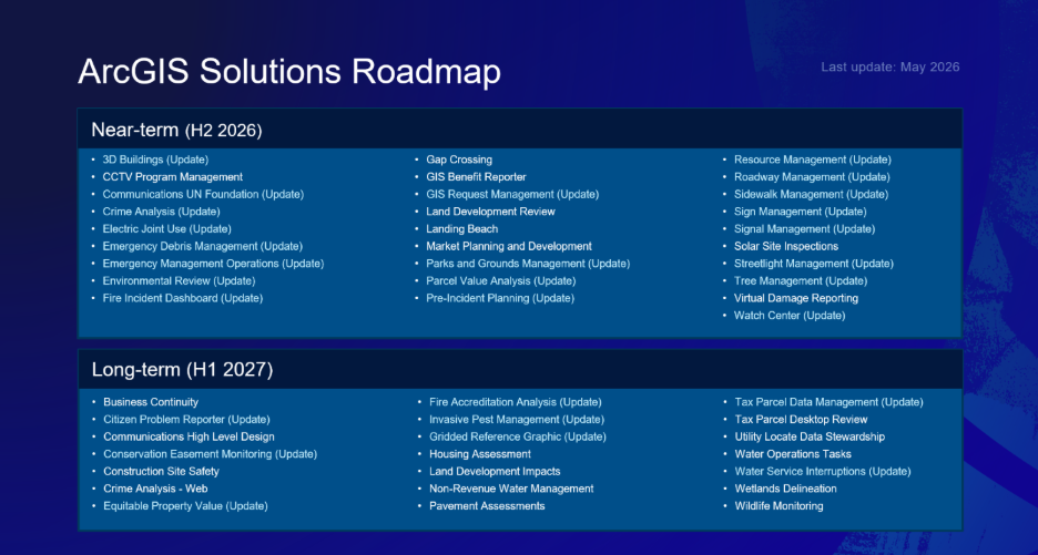
He also shared the latest ArcGIS Solutions roadmap and provided a sneak peek at upcoming enhancements that utilize the latest ArcGIS and AI capabilities related to Asset Management and Field Work Coordination.
Public Works Annual Special Interest Group
Next up at the SIG was a spotlight on the Public Works SAG winners.
SAG winners are nominated by Esri staff and exhibit the following characteristics:
- Be the lighthouse
- Follow best practices
- Innovate
- Serve the enterprise
- Deliver business value
- Transform the organization and community
- Tell your story
- Partner with Esri and our partners
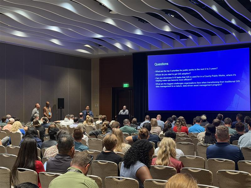
A SAG winner panel, made up of Anthony Powell, IT Assistant Director at Houston, TX Public Works; Rocky Agbunag, Information Systems Officer at St. Johns County, FL; and Kenneth Kleewein, GIS Manager at Matanuska-Susitna Borough, AK, fielded questions about their priorities.
Their priorities included:
- Keeping up with the latest technology
- Prioritizing projects to align with organizational initiatives
- Looking for opportunities to expand the use of ArcGIS
New Public Works Guide
Before the SIG concluded, I announced the debut of a new eBook:

Your Journey to Enterprise GIS for Public Works: Eight Ways to Maximize Your Investment
This book helps you find and prioritize opportunities for GIS to support your Public Works organization, along with examples from your peers.
Public Works Expo
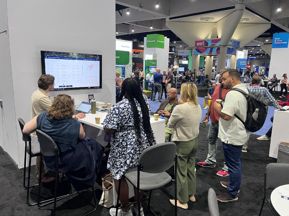
The Esri Public Works booth team stayed very busy in the Expo. We had five kiosks:
- Next-Generation Public Works
- Safer Streets & Sidewalks
- Connected Field & Fleet
- Smart Operations & Maintenance
- Capital Improvement Program
This is one of the highlights of the UC for Esri staff, helping users understand how they can use our technology to solve problems, transform their organizations, and improve their communities.
One of the most popular topics was the new Waste Collection Solver for ArcGIS Pro and the ArcGIS Network Analyst extension.
It is used by planners, public works teams, GIS professionals, and logistics managers to make data-driven decisions about how vehicles move, deliver, and operate. It can create service areas and solve high-density vehicle routing problems.
If your organization has a need for this capability, please check it out.
I had many productive meetings with partners, including:
One of the most interesting technologies I saw at the UC was a drone mapping demonstration from ES2 and Wingtra. They mapped 40 acres of Embarcadero Marina Park South in front of a crowd of over 100 people in about 15 minutes.
The data collection flight was used to create a True Ortho and Gaussian Splats dataset.
You can view the data here.
Looking Ahead
All my presentations were well attended and sparked engaging conversations with attendees. Though the week was exhausting, it was also invigorating.
Each year, my UC experience seems to get better, and I always leave wondering how I can top it next year, but it always seems to happen.
This event is truly the highlight of my year, and I am so thankful to be able to experience it annually.
I cannot wait for UC 2027!
Join the Conversation
Want to continue the conversation? Join the Public Works GIS community and connect with peers who are using ArcGIS to solve infrastructure, operations, and asset management challenges.