Skip to Content

Sustainable Energy

GIS for innovative clean energy strategies

Two squares with solar panels with wind turbines and a map with glowing blue dots showing where they are located

Unlock more significant renewable energy potential

As energy authorities prioritize sustainable energy strategies, GIS fuels advances in location-based scientific analysis. Identify sites of maximum energy potential and optimized economic development while minimizing environmental impact. Be empowered by science-based insights that ensure energy efficiency, greater energy security, and resilient and green buildings for a better quality of life.

Achieve substantial energy practices

Get science-based insights

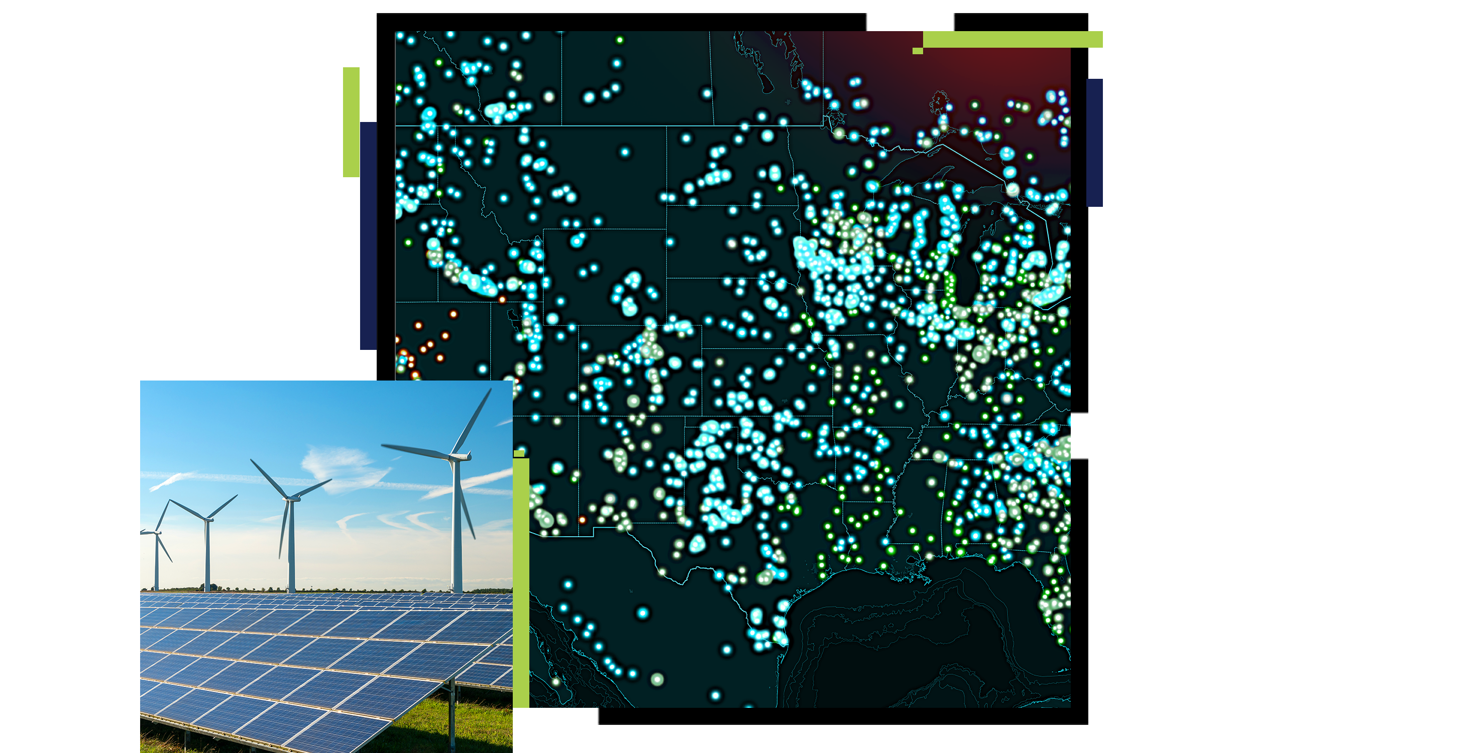
GIS technology is advancing location-based analysis that better identifies sites of maximum energy potential and optimized economic development while minimizing environmental impact. Deploy reliable technology that supports energy efficiency, greater energy security, and resilient and green buildings for a better quality of life.

Learn about grid modernization
Make renewable energy viable
A desktop computer with a screen showing insights with maps, bar graphs, and pie charts

Access big data quickly

An integrated centralized data repository underpinned by location intelligence enables everyone to find, share, and analyze the information when needed.

View energy data collections
A desktop computer with a split screen of a city with a river running through it and the country on a map

Bring clarity to troves of data

ArcGIS, vast data, and 2D and 3D tools enable deeper analysis of the environmental, commercial, physical, and social constraints of potential energy sites.

Read the WhereNext article
Utilities shift to renewables
A desktop computer with a split screen of identical coast lines, one of the images has brown dots indicating important data

Streamline mobile field collection

ArcGIS optimizes field data collection with improved coordination, moves from paper to digital field entries, eliminates redundancies, and increases efficiencies.

Go to ArcGIS Field Maps
Read field mobility case study
A desktop computer with a split screen of a field working looking at a laptop and a map showing his location

Work together better

Maximize your team and stakeholder engagement, communication, and data sharing.

Go to ArcGIS Hub
Find new ways to collaborate
A person sitting at a table with two colleagues talking

Create collaborative plans

Leverage a robust framework for iterative energy planning scenarios informed by predictive modeling and endorsed through stakeholder engagement to support optimal outcomes.

Learn about geodesign
Read about renewable energy
Solar panels and wind turbines in a grassy field on the outskirts of a large city and a map of a peninsula

VIDEO

Optimized energy resource management uses ArcGIS

The Tennessee Valley Authority (TVA), the largest public power provider in the US, uses ArcGIS to support its integrated resource management mission.

Products for Sustainable Energy

These collections of products and solutions will help kick-start your sustainable energy projects with improved data organization, analysis, and sharing.

Previous
Next

Contact sales

Contact us

Call us

Speak with a representative.

1-800-447-9778
(United States)
Outside the United States

Connect with the Esri earth science team