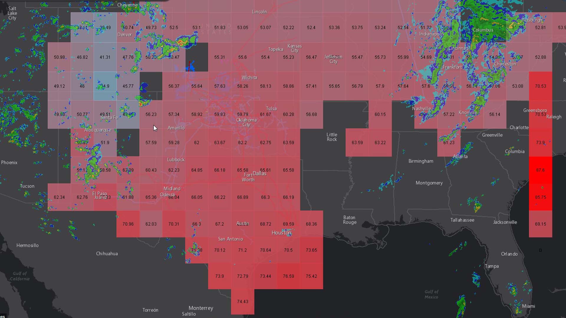
In an era of unparalleled climate volatility, CEOs need a new level of meteorologic awareness far more targeted than weather reports on the local news. With damages from extreme weather costing the US $165 billion in 2022 alone, C-suite leaders know they can’t be underinformed about the risks of natural hazards.
That’s why many executives are turning to GIS technology—an enterprise system employed by top companies in tech, banking, retail, and beyond—to model storm impacts and understand how weather events could affect buildings, people, and operations.
With the predictive insight that GIS provides—also known as location intelligence—executives can plan protective measures when time is of the essence.
Modeling Storm Impacts with GIS
This NextTech video demonstrates two key areas where location intelligence helps businesses in the path of natural hazards like wildfires, storms, or hurricanes: awareness and strategic response.
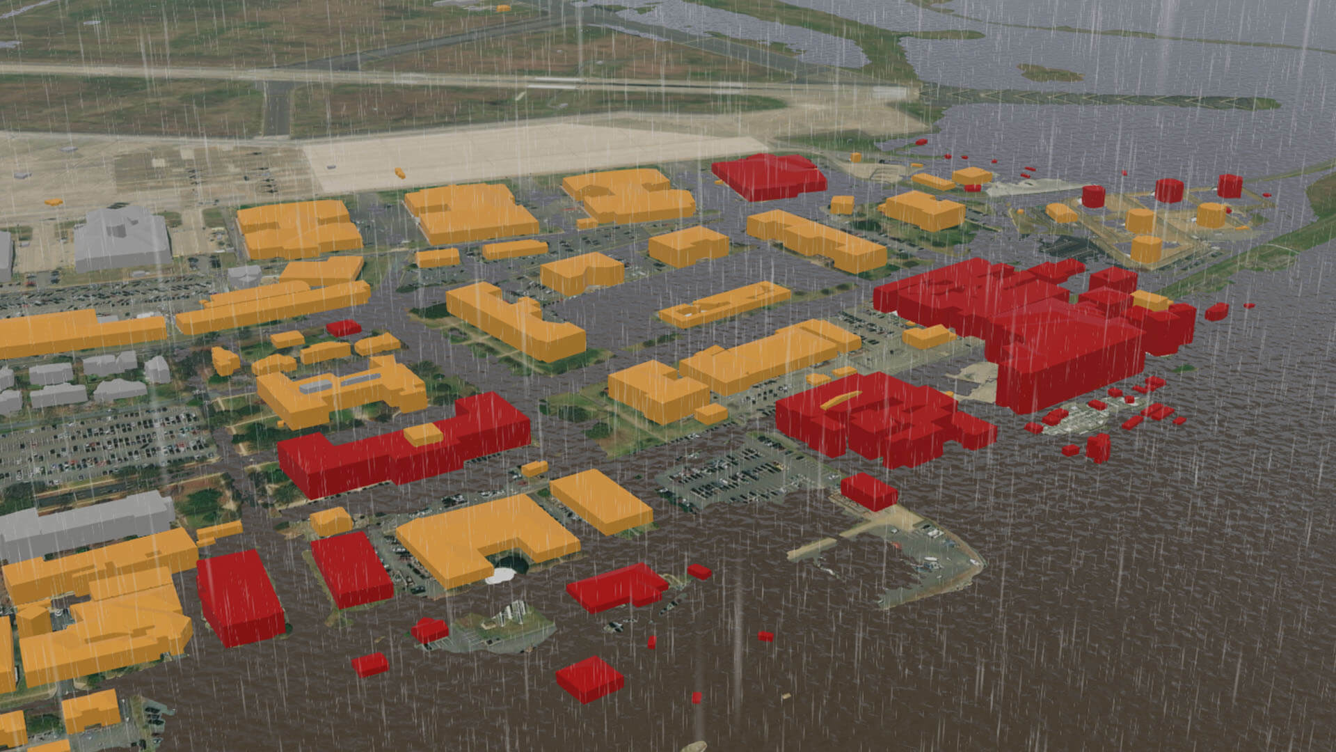
In this scenario, an AI-generated 3D model shows the potential effects of coastal flooding on what could be a corporate campus, military facility, or retail center. With this digital twin as a basemap, GIS models impacts ranging from the best-case scenario to the worst.
As the video shows, flooding of around 2 meters will leave most buildings unaffected. Change the forecast to 2.5 meters of flooding, and more severe damage becomes likely—now all the buildings colored red are directly affected.
If a category 3 hurricane were to hit the area, flooding could reach 3 meters. Company leaders could expect all structures colored yellow or red to be affected, with the southeast section of the property most vulnerable to inundation.
Armed with this location intelligence, executives can focus efforts and resources on protecting the buildings and areas most exposed to risk.
A Dashboard for Managing Weather Crises
In addition to predicting storm impacts, a GIS-powered dashboard is a powerful tool for managing storm response, as the next stage of the video demonstrates.
This single view of operations gives decision-makers the data and visuals to respond to a storm surge. Here, the GIS dashboard displays information about the deployment of sandbags to mitigate flooding. The technology calculates the average time needed to sandbag each building, as well as the costs of material and labor.
An edit feature enables operations managers to update data in real time and see changes reflected on the map.
If executives want to increase resilience measures around a building that contains sensitive materials, they can draw a sandbag barrier around the structure on the map and input data on the height of the barrier and the number of people working on it. The GIS software automatically calculates other variables like time estimated to finish the project.
Quick planning is critical when weather and natural hazards bear down on a business. A geographic approach gives executives the ability to anticipate multiple scenarios and plan accordingly, adapting storm response to conditions in real time.
The Esri Brief
Trending insights from WhereNext and other leading publicationsTrending articles

December 5, 2024 |

June 23, 2026 |

June 2, 2026 |

April 7, 2026 |

May 26, 2026 |

March 17, 2026 |