The cost of natural disasters in 2020 was nearly twice the previous year’s total, jumping to $210 billion from $116 billion, according to a new report by global reinsurer Munich Re. Losses hit the US particularly hard, totaling $95 billion, with damage from hurricanes, storms, and wildfires weighing most heavily. Combined with NASA’s analysis pegging 2020 as the hottest year on record (tied with 2016), the numbers point to accelerating climate risk.
The losses don’t just affect insurers like Munich Re; they also impact businesses and people. Most corporate directors already see climate risk affecting their organizations, according to a recent executive survey from Columbia Law School. The survey highlights multiple motivations for directors to prioritize climate risk in business strategies—from managing cost to practicing corporate responsibility to identifying new business opportunities.
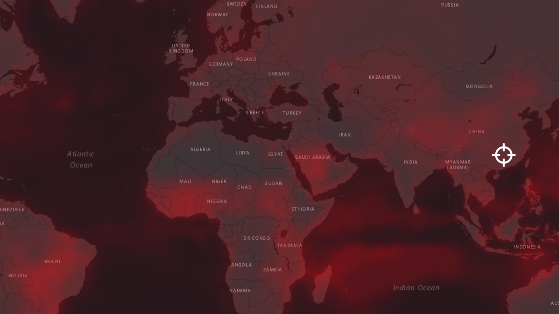
Companies worldwide are using technologies such as location intelligence and AI to predict potential climate risk and inform long-term planning. They’re also moving toward real-time situational awareness to become more resilient when responding to natural disasters and other business disruptions.
Predicting Climate-Related Risks
While no one can predict exactly where and when natural disasters or disruptions will occur, companies are analyzing historical data to predict the most vulnerable areas. This helps business leaders clarify long-term investments such as store locations, offices, manufacturing plants, and supply chain routes. For example, if location analysis shows that an area is often affected by flooding or may be in the future, supply chain managers can choose to ship or source goods another way, invest in more resilient equipment and assets, or shift key supply centers to safer areas.
Predictive climate risk analysis is fueled by weather data, AI algorithms, and location technology that connects predictions to places and assets. Standout companies across many sectors use a geographic information system (GIS) to map and analyze information relevant to the locations where they do business.
Tackling a problem as complex as climate risk prediction is not an easy calculation. The accuracy and scale of data, the precision of AI models, and the expertise needed to tie it all together shouldn’t be underestimated. But partnerships to enable this increasingly critical practice are becoming more common. When leaders at global telecom giant AT&T wanted to map the company’s climate risk for the next 30 years, they partnered with Argonne National Laboratory, and together they applied sophisticated AI models and GIS technology to produce actionable results.
Monitoring Disruptions for Quick Response
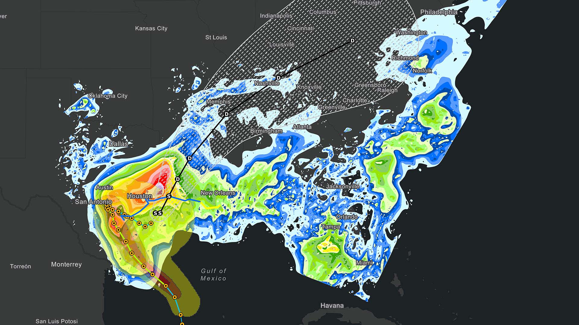
Beyond long-term climate risk management, business leaders can also apply location technology to improve short-term disaster response. In fact, the use of location intelligence often leads to business resilience when disaster strikes. As weather events threaten, smart maps can provide companies advance notice of where threats exist, helping them make operational adjustments, then measure impacts and recover.
Imagine that a hurricane is moving toward a coastal area. A business informed by GIS-driven location intelligence would use a smart map to see at a glance how the predicted path might impact operations. Risk managers could understand, for example, which business locations fall within the affected area, the volume of sales at these locations, the supply chain partners that are at risk, where vehicles will be at the time of predicted impact, and how to reroute deliveries around or through the danger zone. After a disaster occurs, teams can swiftly measure the impacts and coordinate recovery efforts.
Businesses with data and technology in place have an advantage—the quicker executives and managers understand the problem, the quicker they can make adjustments and recover. For example, risk management teams at global auto manufacturer GM have integrated location intelligence into their operations so they can see how a disaster will impact the business—down to specific vehicle parts and their journeys across the global supply chain.
Planning a Sustainable Future
Much has been said about the dangers of continuing to build and rebuild in areas where natural disasters often occur, especially with the frequency and cost of such events expected to increase with climate change. Enlisting predictive location intelligence to make the right decisions about where to build and invest isn’t simply a matter of profit and loss; it can directly affect lives. Munich Re reported 8,200 deaths in 2020 from natural disasters alone (to say nothing of the COVID-19 pandemic that may have some roots in climate change).
The significant increase in climate impacts in 2020 underscores the urgency of adopting changes quickly and at scale, supported by digital technologies such as AI and GIS. It also reminds us that corporate social responsibility efforts to combat climate change and ultimately create a more sustainable planet represent a worthwhile long-term strategy to mitigate the disasters already affecting lives and balance sheets today.
The Esri Brief
Trending insights from WhereNext and other leading publicationsTrending articles

December 5, 2024 |

June 23, 2026 |

June 2, 2026 |

April 7, 2026 |

May 26, 2026 |

March 17, 2026 |