ArcWatch: GIS News, Views, and Insights
July 2012
ArcGIS Online: Changing the Way You Think about Mapping and GIS
Share Your Geospatial Content with More People Inside and Outside Your Organization
Sharing maps and applications and other geographic information just became much easier with Esri's release of ArcGIS Online for organizations.
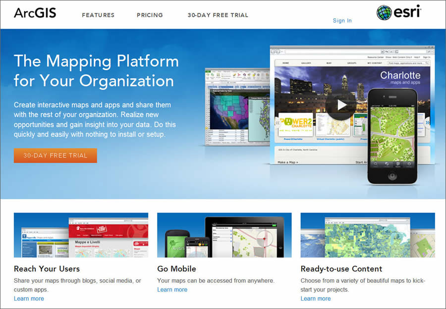
ArcGIS Online is delivered as a service, with nothing to install or set up.
This cloud-based, collaborative content management system for maps, applications, data, and other geographic information, launched in June 2012, is available on a subscription basis.
It provides easy access to authoritative content and the tools to create and share maps and applications. You can create interactive maps and custom applications quickly and then publish and share them in the secure Esri cloud. Do you want to keep the geographic information private or make it public? It's up to you.
ArcGIS Online is changing how GIS managers and professionals think about mapping and GIS. "ArcGIS Online provides us with an easy-to-use way to distribute our data out to the public," said David Kunz, GIS manager for Sussex County, New Jersey. "[People can] view applications like our polling place app and the bridge and road closures, so they're able to access information in a way that's easy to understand, up-to-date, and available 24/7."
Early adopters that have implemented ArcGIS Online as a mapping platform, like Sussex County, have already reaped benefits such as the following:
- Improved collaboration among teams and departments
- Capabilities that offer on-demand, self-serve mapping
- Making geospatial content accessible to a greater number of people within your organization or the general public, creating new insights and opportunities
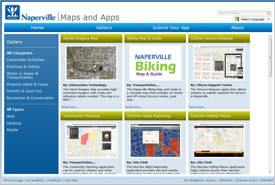
With ArcGIS Online, your organization can create a gallery that offers the general public self-serve maps and applications.
What ArcGIS Online Subscriptions Offer
By purchasing an annual subscription, your organization gets a private instance of Esri's secure cloud that's scalable and ready to use. No additional hardware or software has to be purchased or installed. Users in the organization will gain access to tools, authoritative basemaps, and other content to make and share maps and applications.
Users can catalog and find maps and applications; set up groups to collaborate on projects; and share geographic information with each other, the entire organization, or the public.
For example, users who are participants in an ArcGIS Online subscription can quickly share maps by embedding them in a website or blog, employing social media, or using a preconfigured web application template. There's no programming needed.
Since ArcGIS Online is integrated with ArcGIS for Desktop and ArcGIS for Server, maps created by GIS professionals within the organization can now be accessed by colleagues using the same system.
Everyone in the organization can view and interact with these maps via a browser or a smartphone, tablet, or other mobile device. Registering ArcGIS for Server services in ArcGIS Online only takes a few steps and puts these services into the hands of people who need this information to get their work done.
Non-GIS professionals, such as knowledge workers who have a need for GIS, now have a way to quickly create maps from the unstructured information they work with in spreadsheets and text files and share these maps with others who can access them on any device. This type of on-demand and self-serve mapping frees GIS professionals from having to respond to constant requests for maps and lets them concentrate on making and publishing authoritative information products instead. An ArcGIS Online subscription also includes access to an API that developers in the organization can use to extend the system or integrate a custom solution with the ArcGIS Online system.