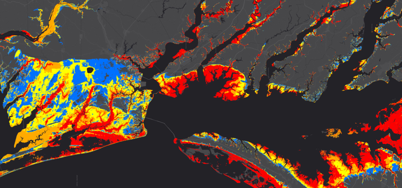
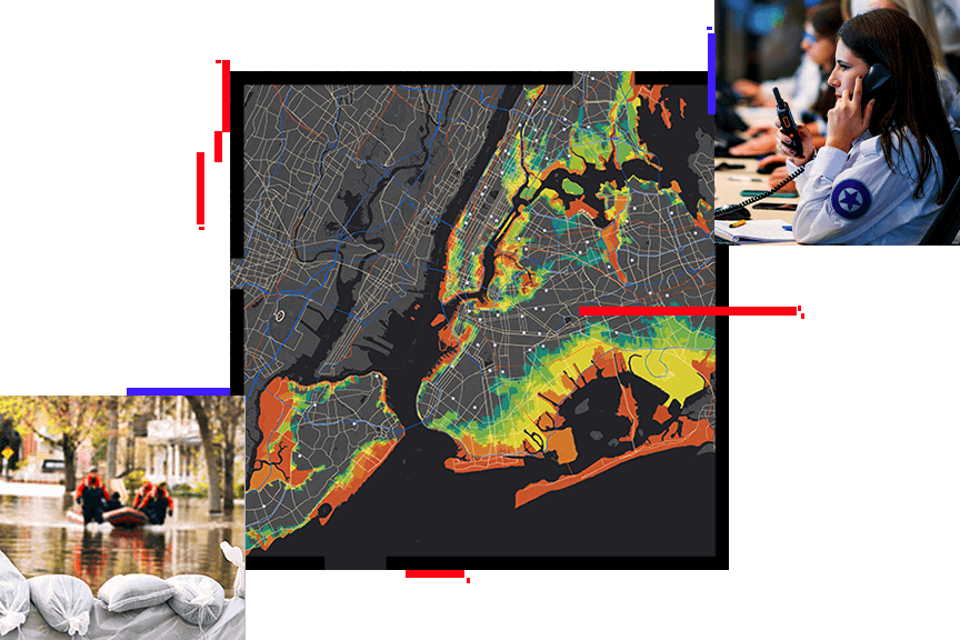
GIS in Public Safety

Emergency/Disaster Management

FEMA seeks to make emergency data available in real time

Providing federal, state and local agencies, and other partners with real-time access to critical data during emergencies.
Learn More

ArcGIS as a System

The ArcGIS provides a system for emergency/disaster management that supports all facets of the mission including preparedness, mitigation, response and recovery.
Learn More

Disaster Response Program Provides Support

Request assistance from Esri experts, augment software, explore content, and monitor events online. We’re there when you need us most.
Learn More

Upcoming Events

Join us at one of these upcoming events to meet members of the Public Safety Team, see the latest GIS solutions, and network with your peers.
Learn More

Partner Solutions To Meet Your Needs

Esri's network of partners provide leading solutions to meet your industry-specific needs. Find the right partner for your industry here.
Learn More

Emergency/Disaster Management

GIS is an essential technology for all phases of emergency management [PDF]: preparation, mitigation, response, and recovery. Find out how GIS provides a foundation for comprehensive emergency management [PDF].

To prepare for and mitigate emergencies, GIS can map and model potential disasters to help visualize critical vulnerabilities and damage consequences. As rebuilding begins, GIS aids local, state, and federal agencies with technology that supports collaboration between multiple agencies.

Field data captured with mobile GIS provides the ability to add updates from remote locations for more efficient incident management. It also supplies rapid damage assessment and more accurate recovery operations.

Public Safety Resource Center

Esri's Public Safety Resource Center provides free and open templates to jumpstart your GIS Platform for Emergency Management.

 
Contact Us | Privacy | Legal | Site Map