Most Recent in ArcGIS Blog
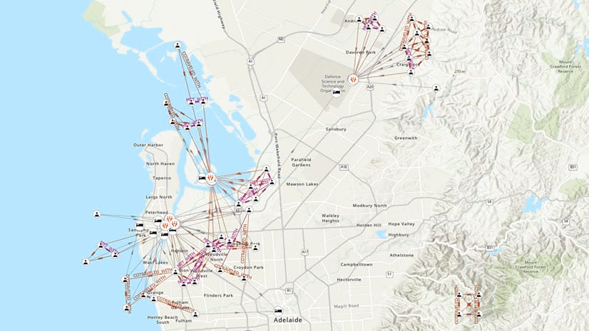
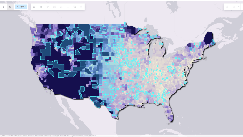
Tools for Advancing Analytic Tradecraft
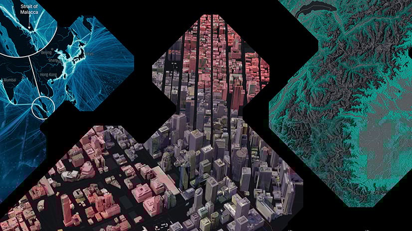
Intelligence analysis utilizing Esri’s analytical, graph, and motion imagery capabilities, all within the same workflow.
Seven Ways to Integrate Data with ArcGIS Online
Sarah Hanson | Data Management | July 8, 2024
Explore seven ways to integrate and keep data up-to-date with ArcGIS Online for visualization, analysis, and editing workflows.
Most Recent in ArcGIS Blog
Multiple Authors | ArcGIS AllSource | Jul 25, 2024
Intelligence analysis utilizing Esri’s analytical, graph, and motion imagery capabilities, all within the same workflow.

Michael Young | ArcGIS Online | July 24, 2024
ArcGIS Online has been operating with FedRAMP Moderate controls in place since 2022 and is now officially authorized.

Raluca Nicola | ArcGIS Maps SDK for JavaScript | July 23, 2024
Learn how to create animations for mesh geometry on the client side in ArcGIS Maps SDK for JavaScript.

Shane Matthews | ArcGIS Living Atlas | July 19, 2024
Esri's Basemaps continue to improve with over 180 new and updated communities, spanning 4 continents.

Multiple Authors | ArcGIS Enterprise | July 18, 2024
Esri provides versatile tools for chart automation.

Bern Szukalski | ArcGIS Online | July 17, 2024
Charts turn numeric attributes into more meaningful information. This article explains how to configure and use them in pop-ups.

Multiple Authors | ArcGIS CityEngine | July 16, 2024
Great cities start with great master plans. Learn how to use the ArcGIS Urban Suite for optimal urban planning.
Multiple Authors | ArcGIS CityEngine | July 15, 2024
Planning a city block, a neighborhood, or maybe a whole new city is a multifaceted task with no universal recipe to use. Can Generative AI help?
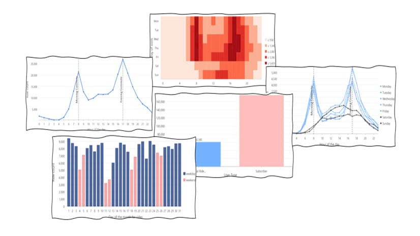
Belle Pandya | ArcGIS Pro | July 15, 2024
In this blog article, we'll explore BlueBikes data, a bike share service in bustling Boston, and uncover hidden insights through the power of viz

Multiple Authors | ArcGIS Living Atlas | July 15, 2024
The new Environment Basemap is dynamic and designed for displaying environmental data.

Bern Szukalski | ArcGIS Online | July 12, 2024
A comprehensive overview of the different ways you can use photos or other images in ArcGIS Online web map pop-ups,

Parrish Henderson | ArcGIS Mission | July 12, 2024
ArcGIS Mission introduces a new way to visualize a missions responder activity
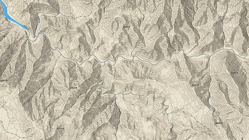
Andy Skinner | ArcGIS Living Atlas | July 12, 2024
Vector tile services for contours and hillshade offer new opportunities for integrating this content into your map or basemap.

Deane Kensok | ArcGIS Living Atlas | July 12, 2024
Esri is working with partners (Maxar, TomTom) to enhance our 3D basemaps with high-quality commercial data for elevation and buildings layers.
Emily Garding | ArcGIS Online | July 12, 2024
Learn how to use the Select by attributes tool to create queries for selecting and exploring features in ArcGIS Web Editor.

Multiple Authors | ArcGIS Online | July 12, 2024
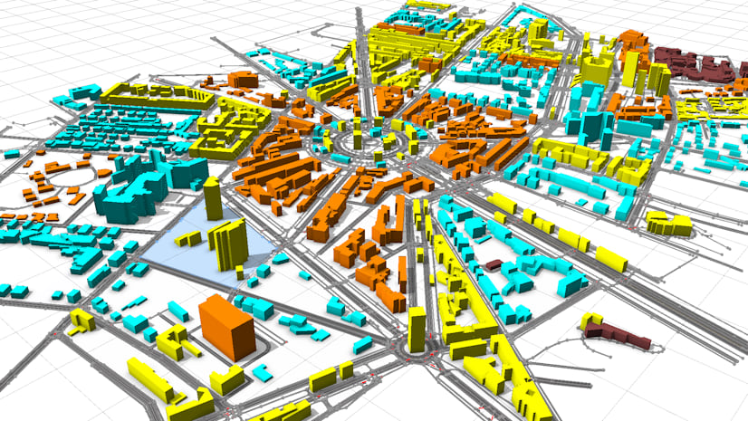
Creation of a Digital Twin in Seven Days with ArcGIS in Zurich

Ivonne Seler | ArcGIS Enterprise | July 12, 2024
3D layers are building blocks of digital twins and 3D applications. ArcGIS offers workflows to create large 3D web layers.

Robert Waterman | ArcGIS Living Atlas | July 12, 2024
World Imagery updates and enhancements from the past year and the road ahead.
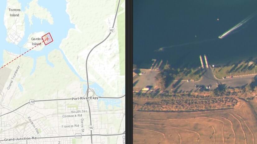
Lindsay Aazami | ArcGIS Excalibur | July 11, 2024
How to publish web enabled video, search and discover locations of interest within videos, discover tools for analysis, and export to share.
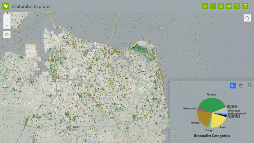
Lisa Berry | ArcGIS Living Atlas | July 11, 2024
Gain access to the largest collection of citizen science species observations in the world using the new Living Atlas live feeds layer in beta.
Deane Kensok | ArcGIS Living Atlas | July 11, 2024
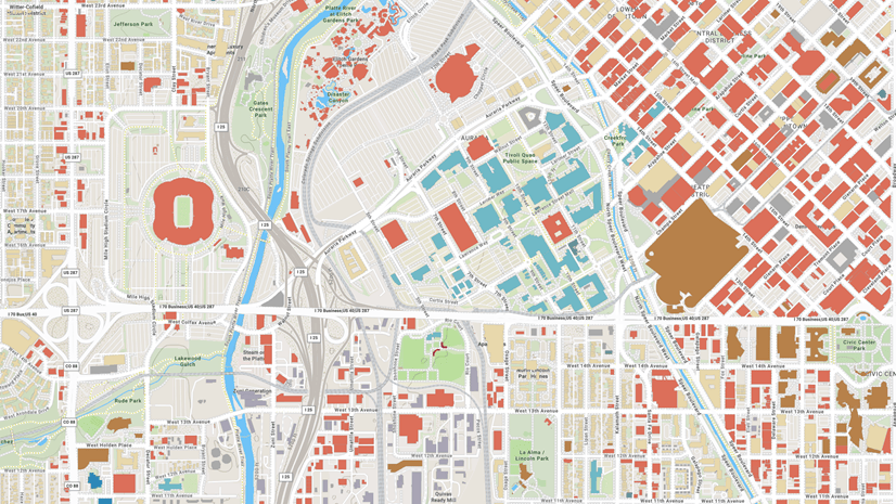
Discover a few ways in which Overture Maps open data will soon be available to ArcGIS users following its general availability release.
Allen Carroll | ArcGIS StoryMaps | July 11, 2024
Join us at a special "Storytelling with Maps" exhibition and fireside chats at the 2024 Esri User Conference.

Maria Jordan | ArcGIS Online | July 10, 2024
Use this quick guide to find all the Open Platform focused sessions and activities at the 2024 Esri User Conference.

Multiple Authors | ArcGIS Online | July 10, 2024
Your organization home page is the place visitors and organization members will start. How your home page looks will create first impressions.

Bern Szukalski | ArcGIS Online | July 10, 2024
Text elements are one of the ways you can add information to pop-ups. Here's the basics for creating effective text elements.

Multiple Authors | ArcGIS Pro | July 10, 2024
Esri users can leverage the Planetary Computer data catalog for geospatial analysis with ArcGIS for Microsoft Planetary Computer.