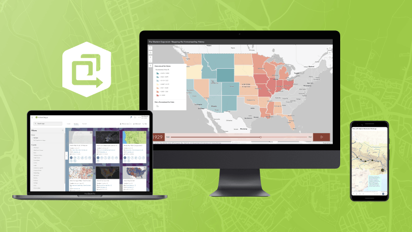
The June 2023 ArcGIS Online update introduces new features and key updates throughout the site. The same applies for ArcGIS Instant Apps, as we have introduced many updates and new features to our existing apps, further improved choosing and managing your apps on the Instant Apps home page, and addressed various bugs and enhancements to help stabilize and improve your experience across the site. See the highlights below.
Public Notification out of beta
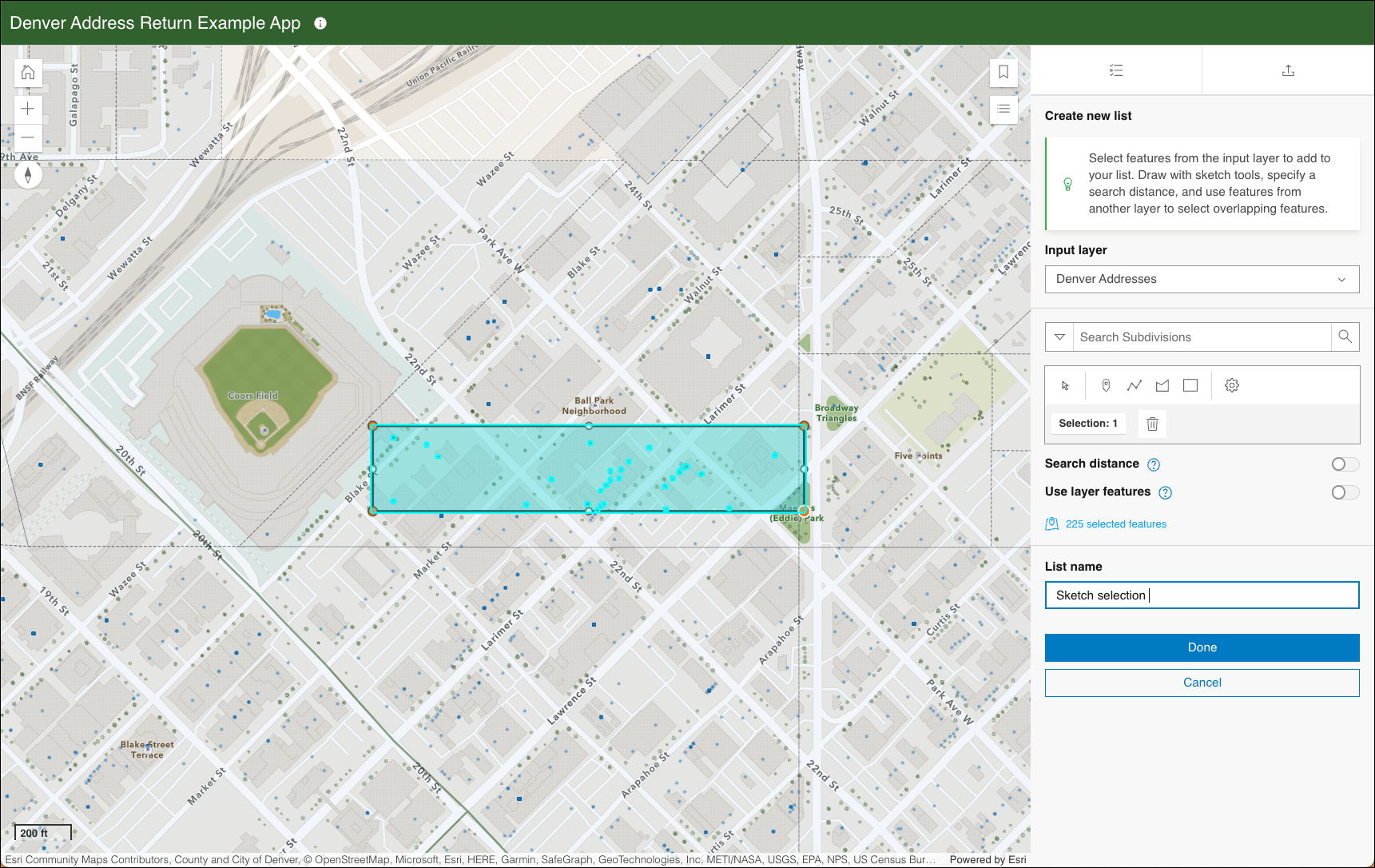
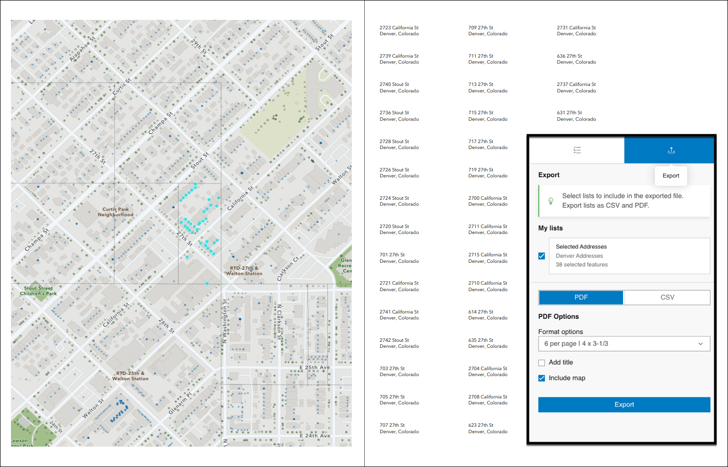
Create a list of features using a map that can be exported to CSV or PDF using Public Notification. Search for a single location or draw an area of interest using sketch tools to define a set of features. You can also use the geometry of an existing feature or apply a search buffer to expand the resulting features used to create the list. For example, alert locals about road closures due to a weather event by exporting their addresses out as a CSV file. Or, print a PDF list of public high schools contained in a proposed school district rezoning plan. Choose to include the map as part of the PDF to provide spatial context with the list.
For a deeper dive and an example of using Public Notification, take a look at ArcGIS Instant Apps: Introducing Public Notification.
Introducing: Observer (Beta)
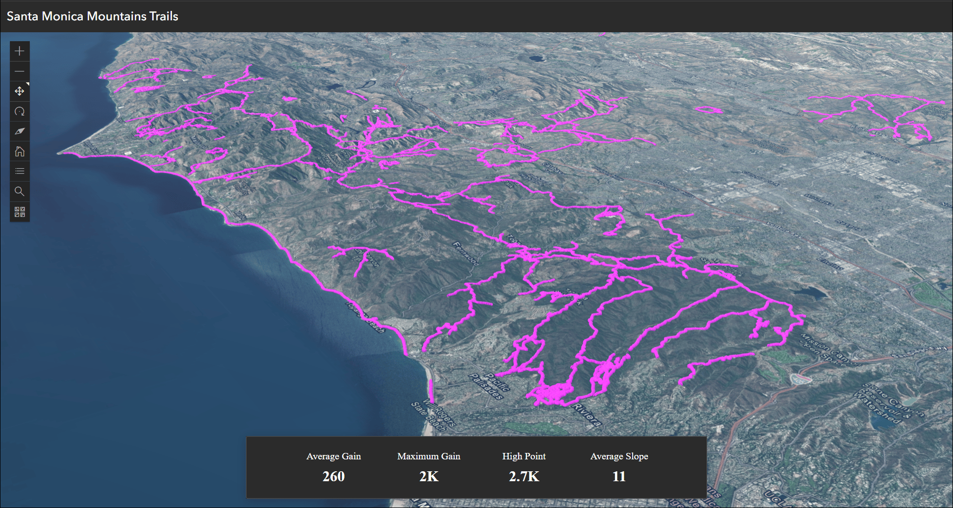
Summarize attribute information from data in a scene using a dynamic scoreboard with Observer (Beta). This new web scene based app allows you to include a basic set of scene exploration tools to help inspect locations and identify statistics that could be of interest to users. Set up the Scoreboard summary in the app configuration on the Observer tab to display statistics about features in the scene. Use operators such as average, count, sum, maximum value, and minimum value on feature attributes that will update dynamically as the extent of the scene in the app changes. For example, set up summary statistics to show key metrics about local trails such as the maximum gain and high point. Pan and zoom the scene to see these statistical values update for the visible extent of the data.
Leverage preset slides from the scene by enabling Display preset slides to offer quick navigation choices to different areas of interest. Other scene exploration tools include measurement tools for distance and area, layer list, and daylight animation.
Atlas (Beta) updates
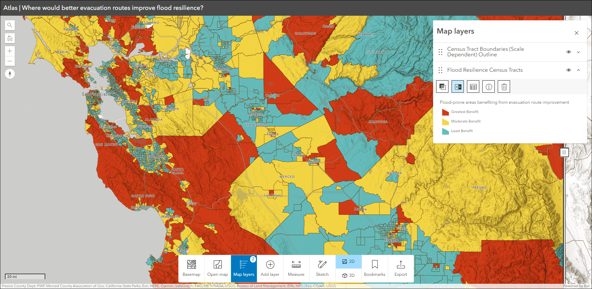
Atlas (Beta) provides viewers with tools to explore layers from a group with light weight mapping and data exploration capabilities. Viewers can open a map and add individual layers to it. They can utilize measurement tools, generate an elevation profile, toggle the view between 2D and 3D, use a swipe tool and adjust transparency on layers, and view data as a table. They can use the Share option to quickly generate a URL to share what they see with others. Atlas (Beta) now supports adding and viewing all 2D layer types. Add layers to the map using the Add layer button or open an existing map containing layers to explore.
For more details and further information about Atlas (Beta), check out Introducing: Atlas (Beta).
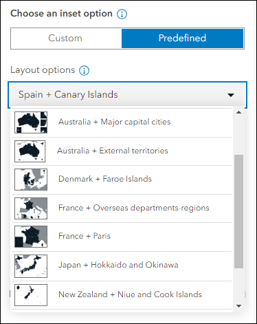
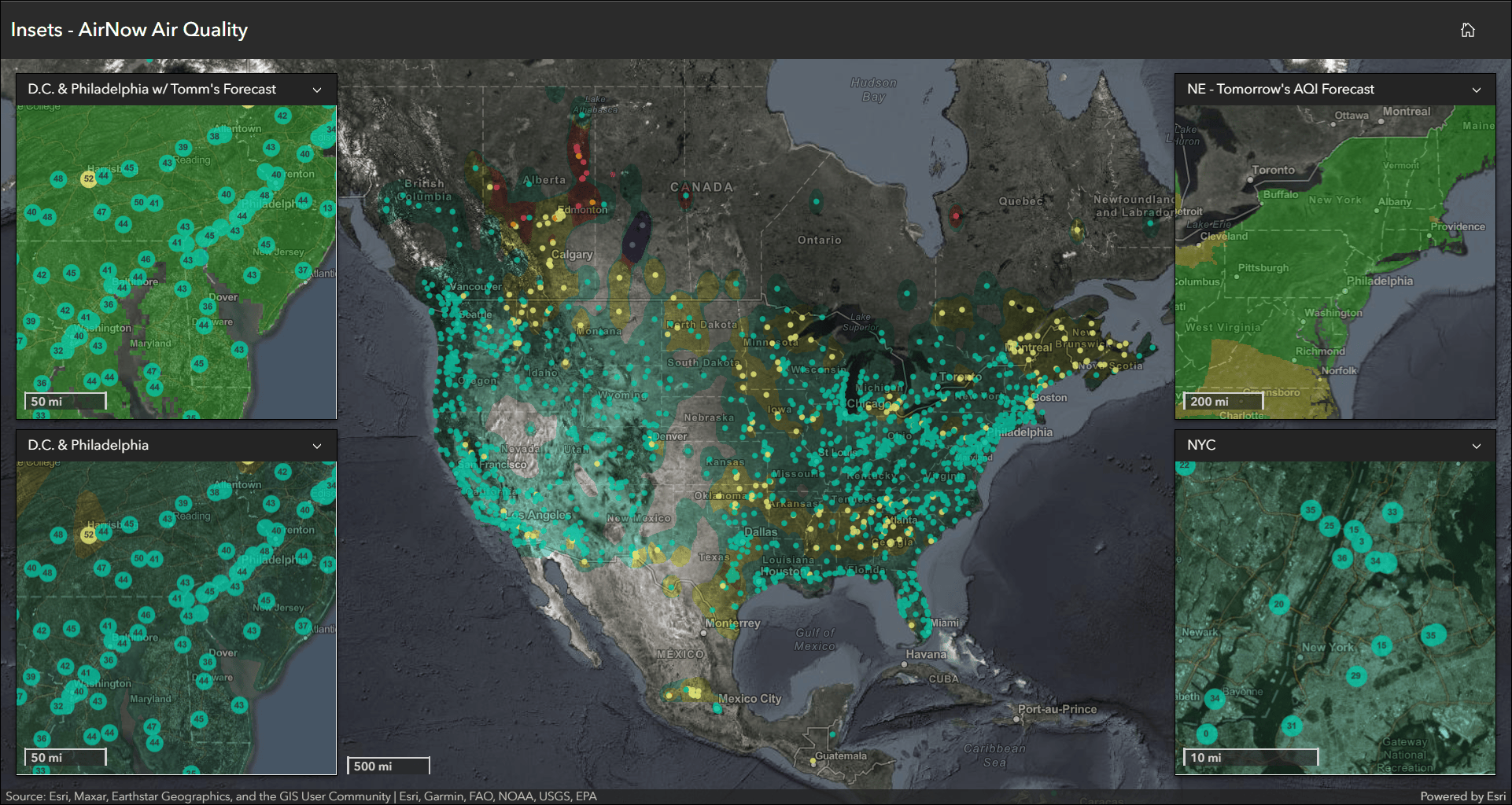
Insets updates
Display noncontiguous geographies and interact with data at multiple locations in a single app using Insets. Pick from a list of predefined geographic layouts or customize the inset locations with the option to use bookmarks from the map. Apply theming by picking an inset style and adding title headers. We have several exciting updates to mention. We have added more predefined layout choices covering Australia, Denmark, New Zealand, and France, with more on the way. Find these new layouts in the Predefined section of the app configuration.
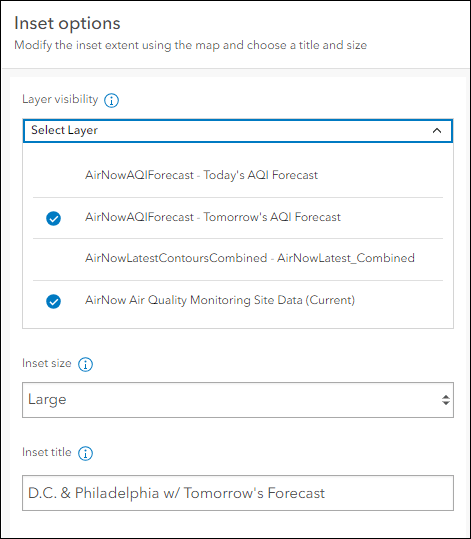
With maps that have multiple layers, control which layers are visible in the inset windows and main map. In Custom layouts, control layer visibility per inset using the Layer visibility drop-down within each inset edit window. For example, create several custom insets of the same location but alter the layer visibility for each one to detail how different layers impact the area. For Predefined layouts, enable the Layer list tool so that app users can toggle layer visibility throughout when viewing the app.
Scale reference can be important when viewing multiple locations at once if different zoom levels are used across locations. Enable Scalebar to include a scalebar for each inset window and the main map. This helps give context into the zoom levels used for each of the areas of interest in relation to each other. Find Scalebar within the Interactivity > Explore/navigate section of the app configuration.
For more details and a thorough introduction on configuring and using Insets, check out Instant Apps: Introducing Insets.
App configuration updates
Maintain focus on key map areas using the new Map area setting. This setting is included with Slider for this release, with plans to include it in all apps this year. Use this setting to set the best starting location for your app. Apps created using Instant Apps load your map or scene in the app using the default map view that is saved at the map or scene level. The new Map view setting offers a quick way to override that starting location to best serve the geographic area and purpose of your app. And this setting only applies within the app itself, it does not overwrite the map or scene which means it will not affect any other places that the map or scene is used.
For example, say you have a map showing store locations across the US and you are creating an app using Slider that shows the timeline of new store openings within the city of Denver. Use this setting to adjust the starting map view of your stores map from that of the whole US down to just the visible extent of the Denver area. When the app loads, the map will be conveniently focused on the Denver area and the original map’s default will not be overwritten.
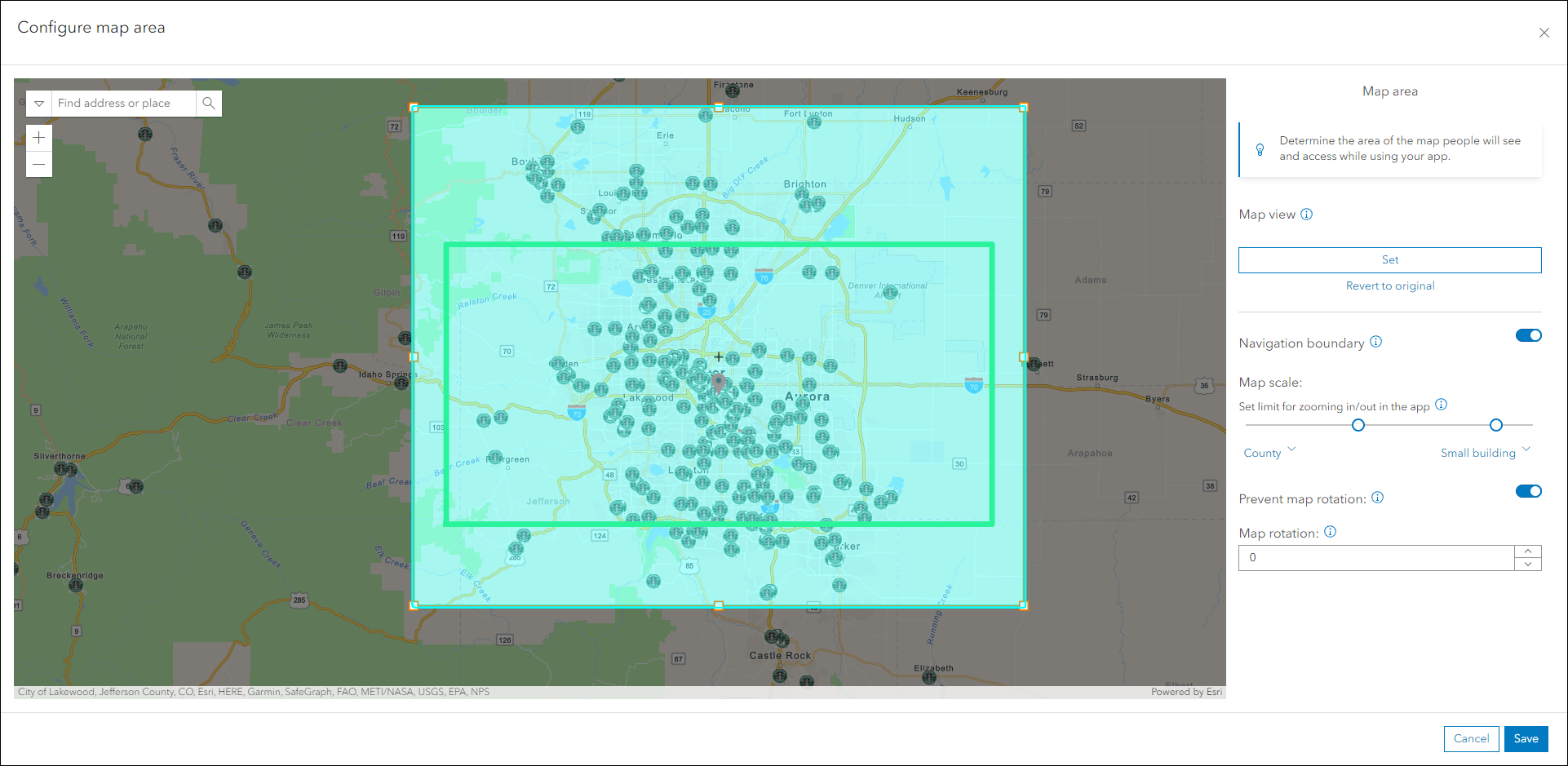
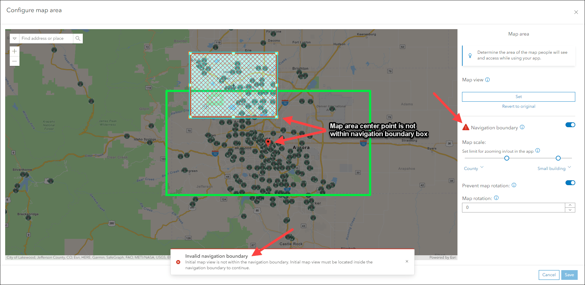
Further control the app’s map area by defining a Navigation boundary. This setting limits how far users can navigate the map’s extent and zoom levels. Use the bounding box to set the boundary, then apply upper and lower limits to the map scale to control how far the map can be zoomed in and out. These settings are optional, but it is important to note that the center point of the area defined in the Map view must be contained within the constraints chosen within the Navigation boundary. The configuration’s editor window will help ensure success on this by displaying a red warning icon when this invalid scenario occurs.
We’ve also improved the map details section of the Map tab in the configuration to offer a more organized display of information and details. Find the Map information section on the Map tab and click Details to access all information about the map in a full panel takeover. The Title, Owner, Created/Modified dates, and Description all show. The Description now allows for more space to show longer description text than before.
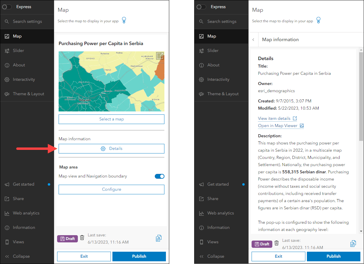
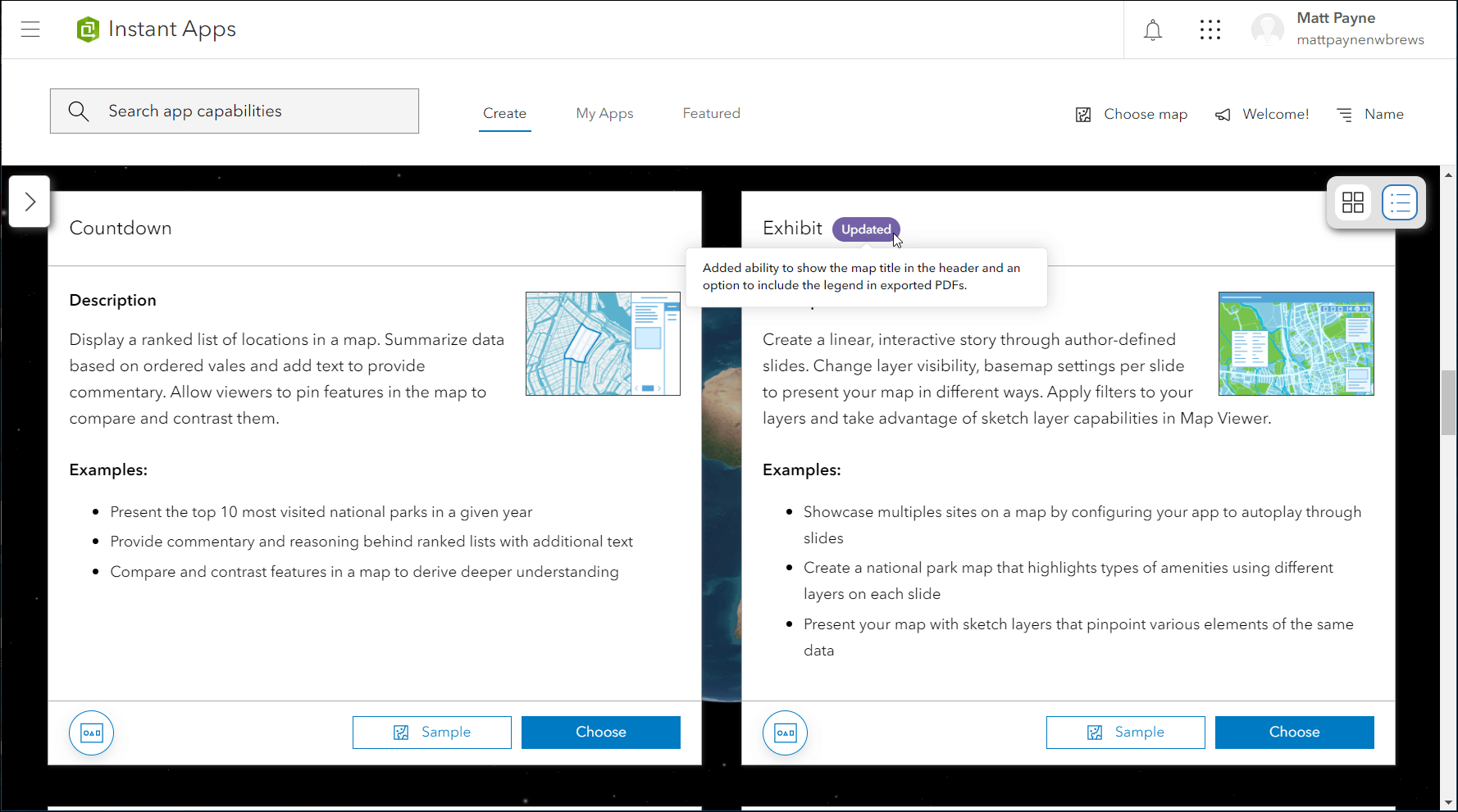
Exhibit updates
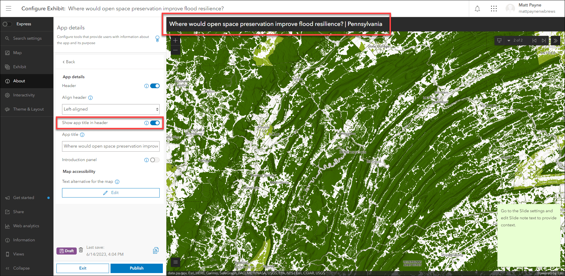
Design an interactive presentation of your map using Exhibit. Tell a linear story by choosing specific areas of your map to highlight using slides that offer interactivity options such as toggling layer visibility and choosing a unique basemap. We have added the ability to show the map or scene’s title in the app header alongside the slide titles. This helps preserve context of the app’s main theme as the app user navigates through the slides. Furthermore, the Export option has been enhanced to offer the choice of including the legend in the PDF.
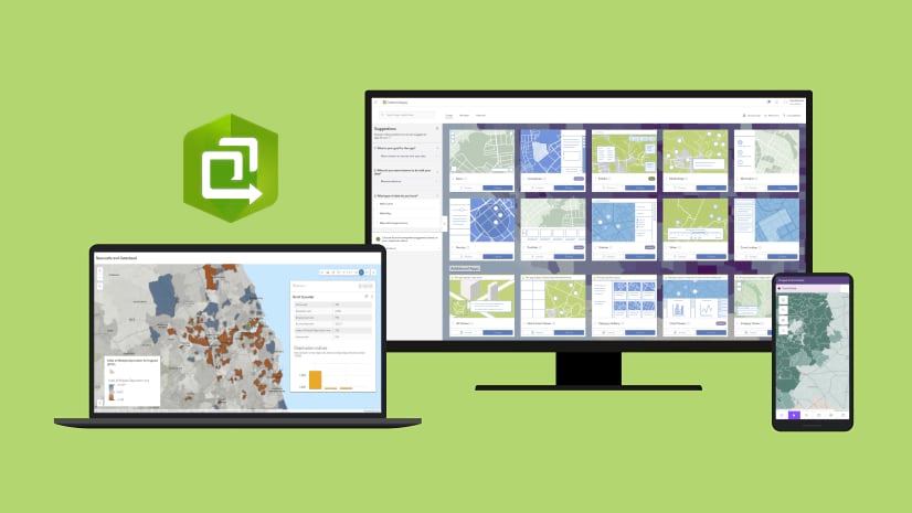
Instant Apps home page updates
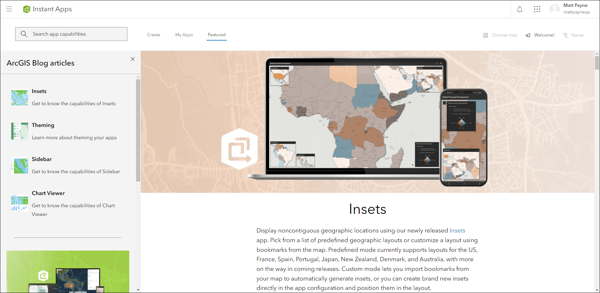
The Instant Apps home page offers a centralized place to browse, choose, create, and manage ArcGIS Instant Apps. On the Featured tab, the main article of content has been updated with a new topic to discover. Learn about displaying noncontiguous geographies and interacting with data at multiple locations in a single app using Insets. Use the side panel on this tab to reference other featured topics such as Sidebar, Chart Viewer, and applying theming to your apps.
Use the Create tab to find the app that is best suited for your work. Look for the purple Updated badges on specific apps that have received key enhancements. Hover over these badges to show information about what has been updated for that particular app. These badges are updated at each release to always reflect the newest changes to applicable apps and they are a quick and convenient way to see some of what has been improved.
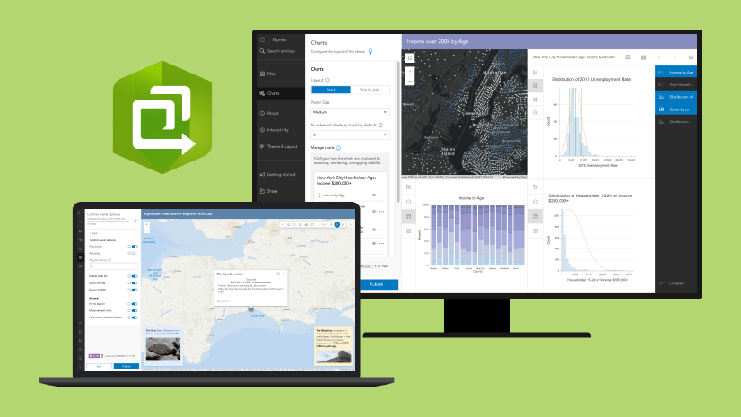
Sidebar updates
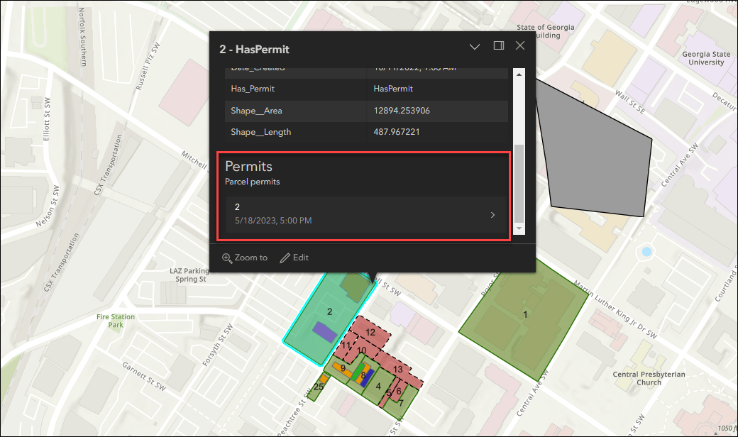
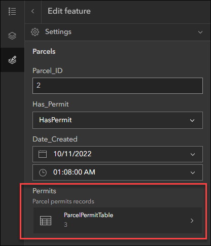
Sidebar offers a range of tools for exploring, understanding, and managing data. A panel containing these tools displays alongside the map and includes data editing, feature filtering, pop-up information, bookmarks, layer list, and more. New with this release we have included support for viewing and editing related records and their attribute values directly in the app. To offer editing, enable the Edit tools setting in the app configuration. Click features in the map to access their popup information, and click Edit to open the editing form in the side panel. Choose to modify attribute values from both the selected feature and its related records.
Sidebar offers general editing tools and options for creating, modifying, and deleting features in the app. In the configuration, choose which editable layers from the map that you want to offer these abilities for. Sometimes it is best to not expose editing of certain layers to your app audience and this new setting helps control that.
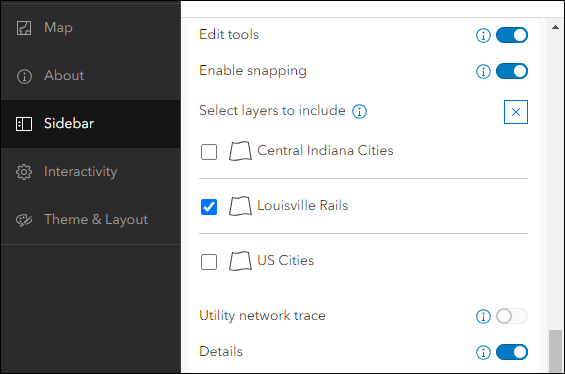
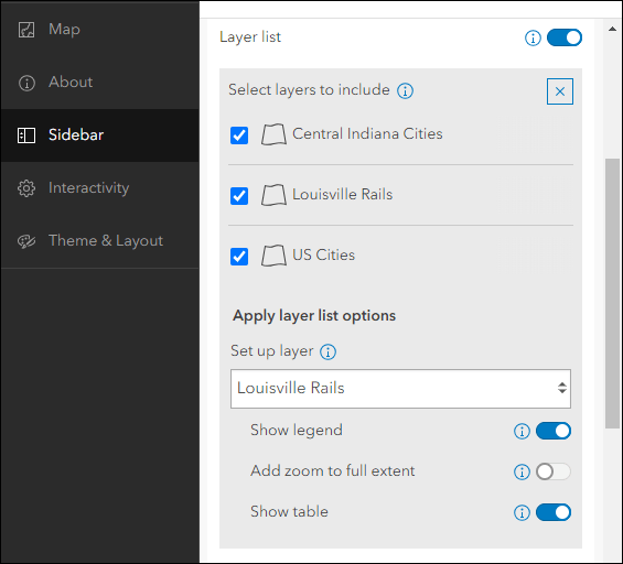
We have also improved the configuration experience for setting up the layer list. Enable Layer list on the Sidebar tab of the configuration to see a selection of layers to include. Options to include in the layer list such as showing a legend, zoom to full extent, and showing an attribute table are now organized neatly per layer underneath a layer drop-down. The Layer list will show in the side panel to maximize the amount of app space for your map.
Accessibility updates
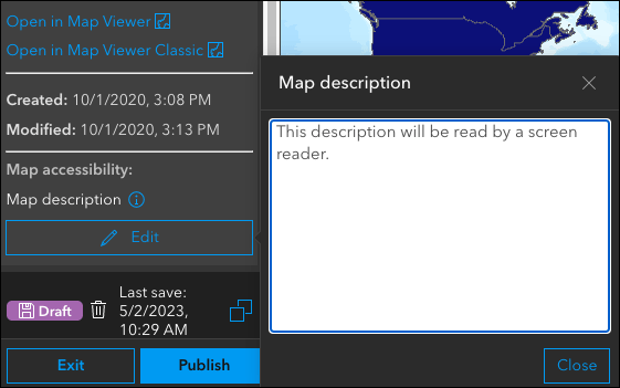
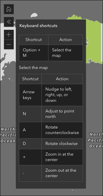
ArcGIS Instant Apps has added the ability for app creators to add a text-based description of their map. Additionally, the option to enable a list of keyboard shortcuts is now included in most app templates.
Deprecation Notice for ArcGIS Configurable Apps
As of the June 2023 update of ArcGIS Online, a deprecation notice has been issued for ArcGIS Configurable Apps. Deprecation does not impact the availability, functionality, and Product Lifecycle Support phase of ArcGIS Configurable Apps.
ArcGIS Configurable Apps continues to be available until it is officially retired, but will not receive new features or other enhancements. Before retirement, users are still able to create apps using ArcGIS Configurable Apps templates and existing apps will continue to work.
Retirement of Configurable Apps is expected to happen towards the end of 2025. Please take a look at our detailed announcement blog: Deprecation Notice for ArcGIS Configurable Apps.
More information
For more information please reference our documentation page where you can find details about getting started with creating and sharing ArcGIS Instant Apps.


Article Discussion: