Esri Infrastructure
Esri Infrastructure focuses on the planning, delivery, and operation of assets, networks, projects, and IT systems within organizations to support a modern, sustainable, and resilient future. By leveraging GIS, organizations can model and connect the built, social, and natural worlds. This enables advanced visualizations and analytics across the entire infrastructure lifecycle, helping to foster stronger relationships and more efficient use of resources.
Posts by this author

Enterprise GIS Drives Efficiency at Tillamook PUD
Tillamook PUD developed a custom GIS-based issue management system using ArcGIS Online, ArcGIS Field Maps with related tables.

HOTEC Improves Grid Visibility with ENER-i and ArcGIS
Using ENER-i, HOTEC integrated ArcGIS, AMI, and SCADA

Getting a GRIP with GIS: APS Charts a Resilient Future
APS used GIS spatial analysis and layered mapping to create a compelling, community-focused visual story.
Modernizing Con Edison’s Network with Digital GIS
Con Edison established a streamlined, end-to-end GIS-driven design and construction process aligning with real-world network conditions.
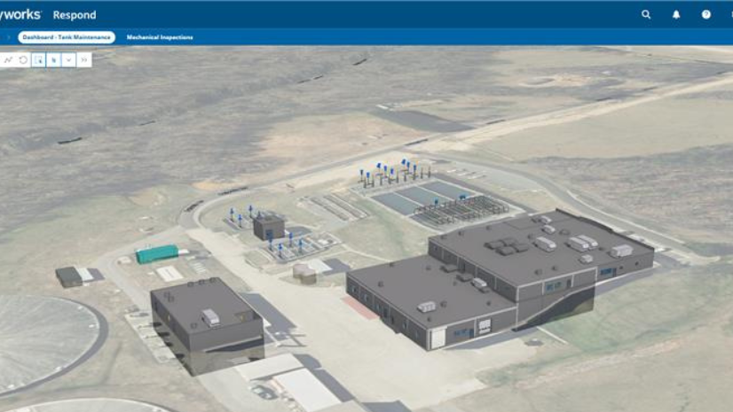
How Concord Water Facility Unified BIM, GIS, and 3D Workflows
For utilities operating within aging infrastructure, the shift is from reactive to predictive.

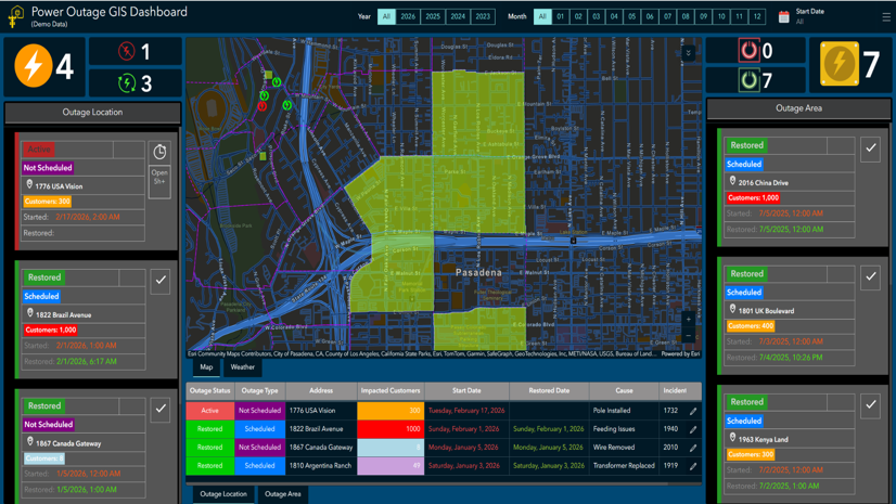
GIS Vision: Comprehensive GIS Solutions for Pasadena Power
The Power Division lacked advanced GIS capabilities, so they looked to the Water Division.
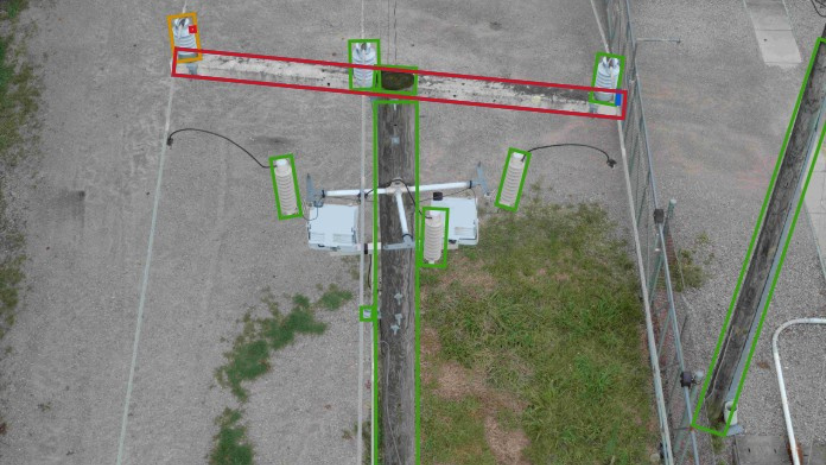
Dominion Energy Distribution Team Improves Reliability with Drones, Imagery Management, GIS, and visual Intelligence
As demand on the electric grid continues to grow, Dominion Energy is modernizing how it inspects and manages its infrastructure

City of Skarke, Florida, Achieves Big Impact with Imagery, AI, and GIS
With a population of just over 6,000, the City of Starke (Starke), Florida, operates one of the smallest municipal utilities in the state.

Turning Inspection Imagery into Enterprise Asset Intelligence at Sulphur Springs Valley Electric Cooperative
SSVEC has engaged AerialSphere's team to convert these photos into ArcGIS native content using their XPGEO Studio web app