The Esri Brief
Get location tech news in your inbox
Trending articles


Utility companies face two major imperatives for the foreseeable future—maintain customer services as volatile weather threatens critical assets and shrink carbon footprints to deliver on net-zero commitments.
Neither goal will be accomplished with yesterday’s approaches. That’s why executives across the utility sector—from gas and electric to water to telecom—are combining cutting-edge software and a geographic approach to take on these challenges.
As purveyors of essential daily services and the source of 40 percent of the world’s emissions, utilities aren’t just critical to today’s economy—they’re also key partners in securing the planet’s long-term health.
In this Fast Four video, Esri’s global industry director for utilities, Matt Piper, explains how location technology helps companies cut the risk of service interruptions while solving long-term net-zero challenges.
Watch the video or read the interview transcript below.
Chris Chiappinelli: Welcome to the WhereNext Fast Four series. We’ve created these videos as a quick way to explore the past, present, and future of location technology in different areas of the business world.
Today, we’re going to take a look at the utility sector, including electric and gas, water, and telecom. I’m here with Matt Piper to discuss how companies in this industry use location intelligence and GIS technology. Matt, let’s rewind a bit and maybe start at the beginning. What business challenge inspired the first uses of GIS in utility industries?
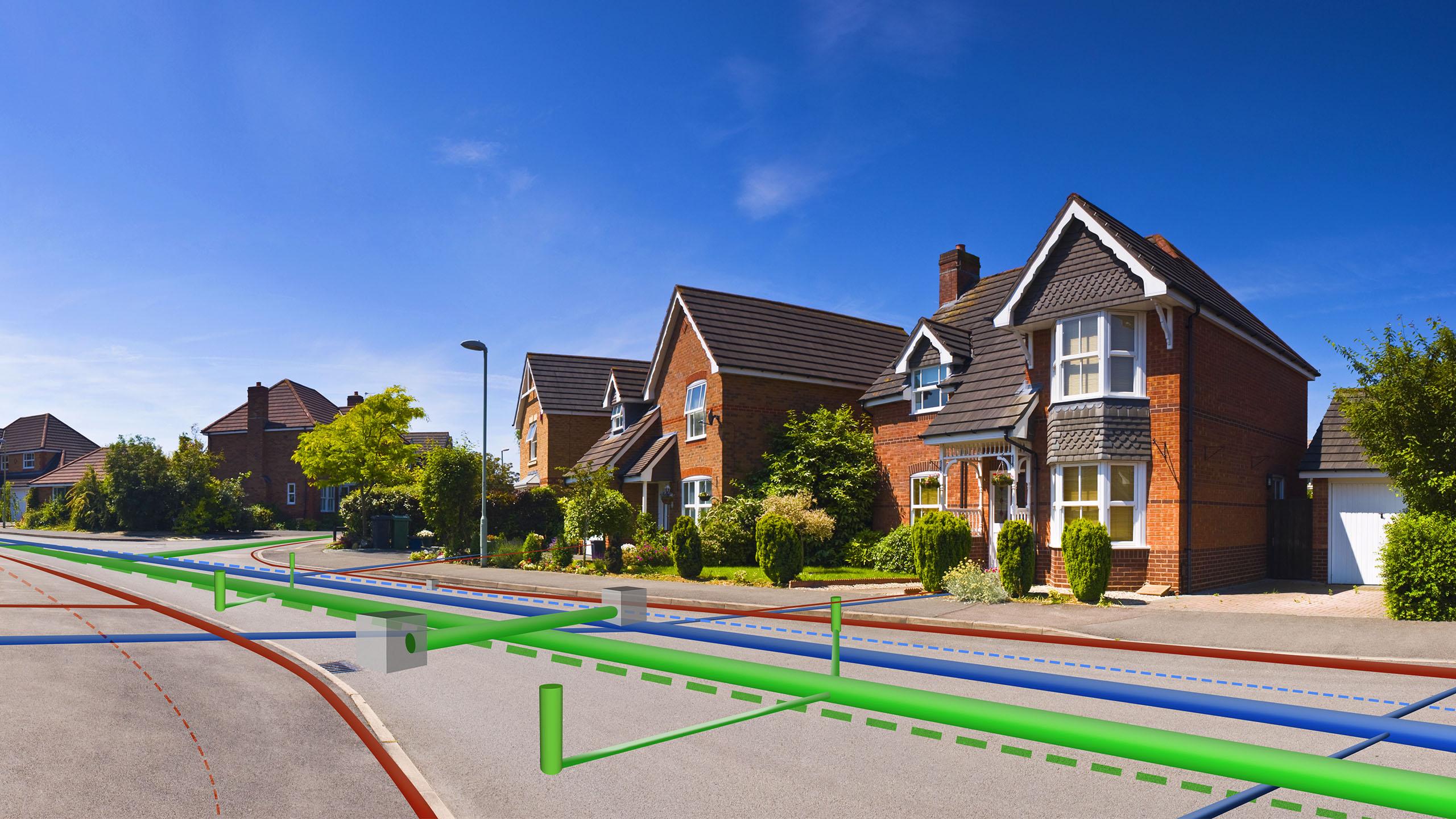
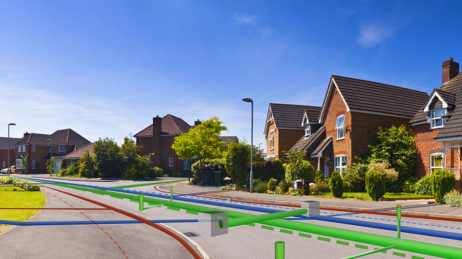
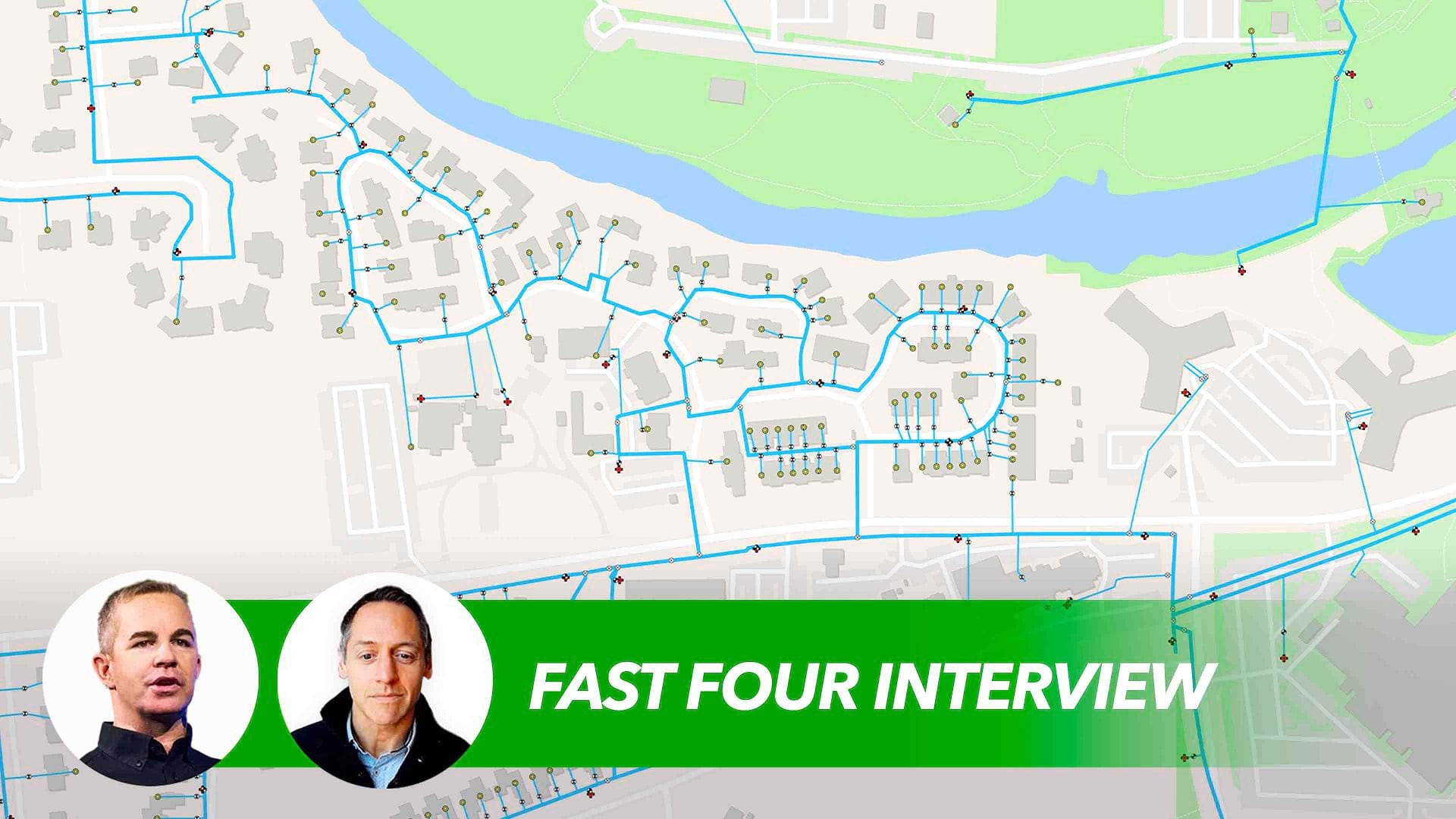
Matt Piper: Hi Chris, and thanks for having us. Look, I think the challenges that inspired the first use of GIS, way back when, [are] pretty much the same challenges that we still face today. When you think about it, the assets of any utility—whether it’s electric, gas, water, telco—they’re largely linear, right? And they spread out [across] large geospatial areas. And for as long as I can recall, that challenge has always been the same—that they’re trying to understand the assets, and they’re trying to understand where they are and how they can connect it or configure it.
And this understanding helps these organizations manage things like power outages and how to respond to customers quicker and know which customers are out of supply, whether it’s electric or water, and really how to navigate these crews safely so they can manage and repair these defects faster.
Chiappinelli: Okay, so basic operational awareness in the beginning so they could be better and quicker at their jobs. If we shift to present day, can you give us maybe a couple of examples of the way that utilities use location technology now?
Piper: When you think about how they use it now, it’s really trying to solve some big challenges. And one of those challenges that I see all the time . . . you go talk to a utility company on the West Coast, and it’s about, “How do we prepare and respond to wildfires?” These natural disasters at a global scale, they’re happening at a higher frequency and a higher ferocity than ever before.
So GIS, in that instance, is helping them prepare. It’s helping them understand their vegetation management programs to reduce the fuel. It’s helping them to understand where the wildfire is going to travel. It’s understanding if it rains after a wildfire, where are the potential landslide incidences?
And then if you move to the southern coast of the US, we’ve got large utilities there that are really trying to manage the resiliency due to hurricanes. And it’s a different problem, right? It’s planning the network, understanding the wind zones. It’s understanding what assets are vulnerable. It’s understanding, “How do we respond faster to get the restoration plan put in place to bring back the power in an equitable and efficient way?”
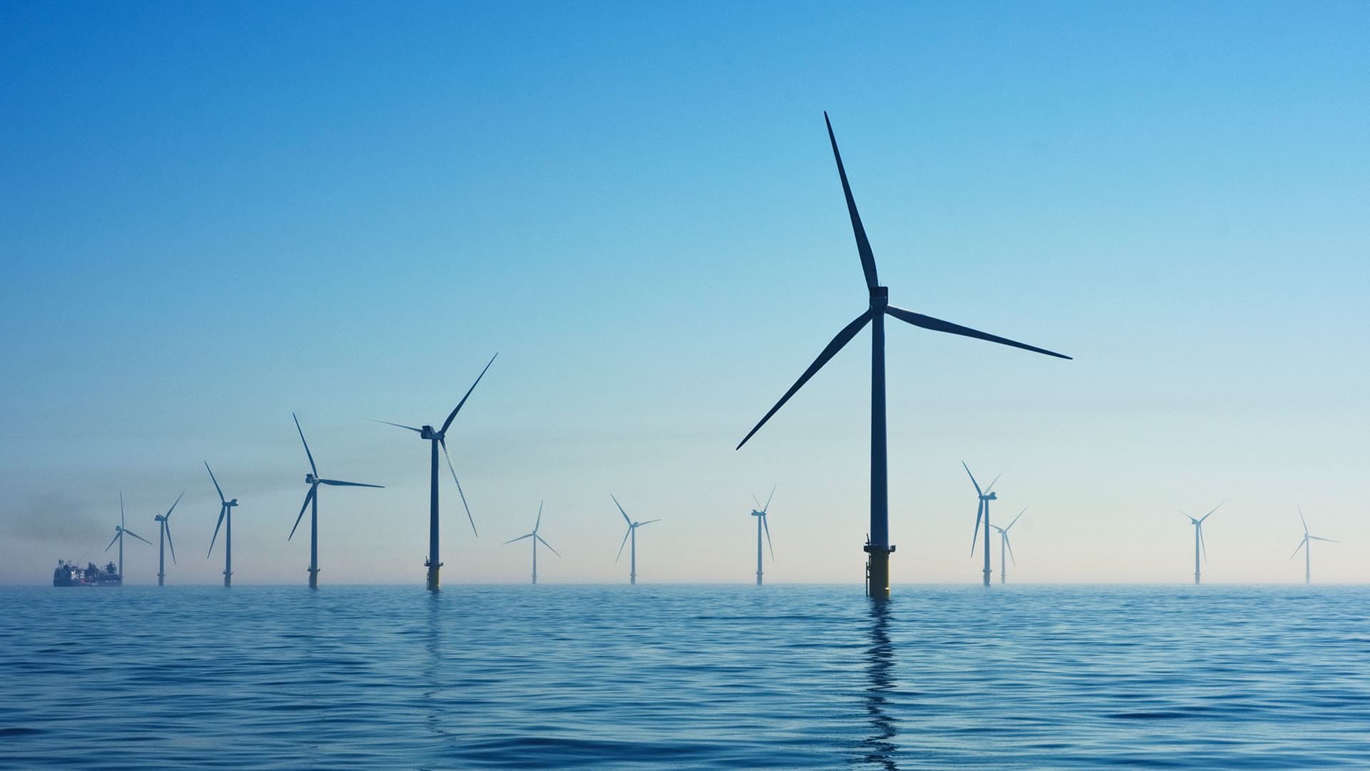
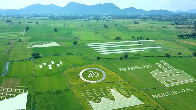
And then there’s this big challenge that you know about on sustainability, right? This is probably one of the biggest challenges we see today in that utilities are trying to understand how do they change the way that they’ve always done their work to deliver sustainable solutions? Because the grid that we had in the past is not going to be sufficient for what is required in the future. We need to change our design standards; we need to understand the impact of all these renewable energies; and we need to plan to hit these renewable targets that are coming in the 2030, 2040, 2050 targets.
Chiappinelli: If we think about the Where Next? question we always like to ask, is there a use case for GIS that you see maybe just emerging today that you expect a lot of utilities to be engaged in in the next few years?
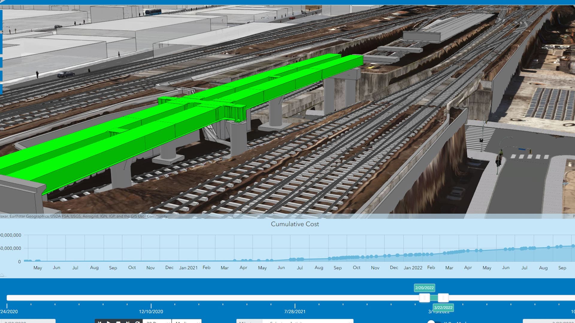
Piper: You pick any one of these industries, and they’re all starting to ask the question about, “We’re really trying to understand the living digital twin.” And it’s moving from not just understanding what’s happened in the past; it’s not just understanding the current situation awareness, but they’re really starting to look at, “Well, what’s going to be happening next?” And understanding and planning and forecasting those models to look at things in new ways about, “What will the future look like? How do we model for it? How do we plan for it?”
And GIS is really becoming critical in that, and there’s a number of solutions that are now integrated as part of this GIS. And, you know, my opinion is that GIS is no longer just a tool for the designer mappers. GIS is this enterprise system. It is something that is traversing across the entire organization, across all enterprise. It’s interconnected into your ERP systems and your operation management systems; it’s integrated into your customer management systems; and it’s bringing together this entire life cycle and sharing this information to everybody that needs it. It’s really quite exciting as we see this evolution of GIS capability.
Chiappinelli: Very interesting. A lot of innovation on the horizon there for this industry. Thank you, Matt, for sharing that context with us.
If you’re interested in learning more about the value of geospatial technology in the utility sector, check out the URL on screen, or if you’re watching us on WhereNext, see the link in the article. For the WhereNext Fast Four series, I’m Chris Chiappinelli. Thanks for joining us.