June 25, 2025 | Diana Muresan | Announcements Spatial data management at the Esri User Conference 2025
June 24, 2025 | Rajinder Nagi | Announcements Lidar derived high resolution data updates to Living Atlas World Elevation Layers (June 2025)
June 23, 2025 | Nathan Easley | Data Management What’s New in ArcGIS Roads and Highways and ArcGIS Pipeline Referencing: May 2025
June 18, 2025 | Geoff Cook | Architecture, Engineering, and Construction GIS and BIM/CAD at the 2025 Esri User Conference
June 16, 2025 | Multiple Authors | Analytics Optimize performance for appending feature services in ArcGIS Pro (June 2025)
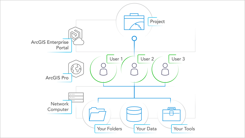
June 13, 2025 | Multiple Authors | Data Management Manage geodatabase upgrades in a service-based architecture
June 11, 2025 | Multiple Authors | Data Management Utility Network at the 2025 Esri UC: The Complete Guide
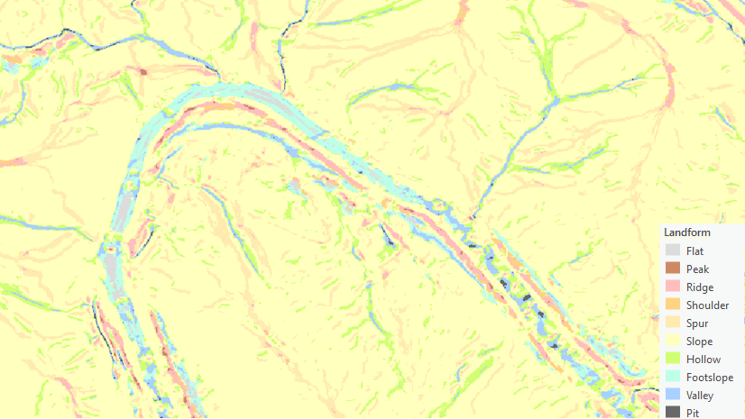
June 10, 2025 | Xuguang Wang | Analytics Use the Feature Preserving Smoothing tool on elevation surfaces
June 9, 2025 | Multiple Authors | Imagery & Remote Sensing Discover the Unexpected with the Anomaly Detection Wizard in ArcGIS Pro
June 5, 2025 | Diana Muresan | Data Management Create domains and contingent values from existing data
June 4, 2025 | Rajinder Nagi | Announcements Esri’s World Elevation 3D and Hillshade Layers Updates including Maxar’s Precision3D (June 2025)
June 2, 2025 | Multiple Authors | Architecture, Engineering, and Construction Seeing is Believing: AEC Workflow Strategies with Remotely Sensed Data Unveiled
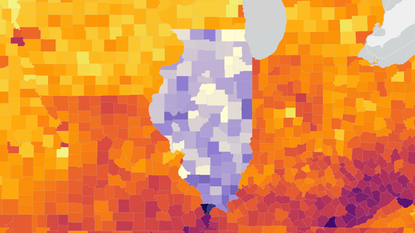
May 29, 2025 | Multiple Authors | Data Management Got five minutes? Get to know local data in ArcGIS Business Analyst Pro
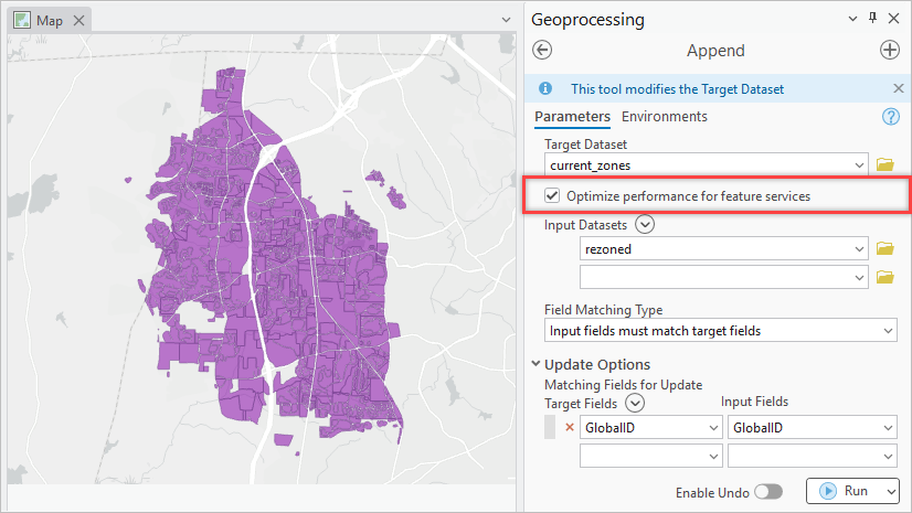
May 27, 2025 | Margaret Crawford | Analytics Improve your geoprocessing productivity with Append To Existing in ArcGIS Pro (May 2025)