To combat the devastating risks of increased urban heat, the City of Sydney conducted a detailed analysis of urban microclimates.
Letter from the Editor
Pervasive GIS Is What’s Next
Making location intelligence more universally available—a promise made just six short years ago at the Esri User Conference—is being realized through the widespread adoption of Web GIS. The Web GIS pattern leverages web services that make exponentially growing data streams readily accessible for visualization and analysis.
By empowering non-GIS staff, Web GIS enables both GIS professionals and non-GIS knowledge workers in organizations to get more meaningful work done. It relieves GIS professionals from previous roles as data gatekeepers and on-call mapmakers so they can engage in analytical activities that provide greater value to their organizations.
The power of data integration and computational geography can be available to every-one in the organization. Through converting massive amounts of data into actionable information, web maps are becoming a kind of language that supports problem solving.
Using apps, this work can be shared and taken everywhere: referenced and updated in the field, presented in the boardroom, and disseminated on the web. The Web GIS pattern brings together web maps, web apps, hubs, location analytics, and other technologies that improve understanding, collaboration, and communication.
Since their introduction six years ago, Esri Story Maps apps have become a communication medium that is used to tell the stories of individuals, organizations, communities, events, and processes. The more than 600,000 story maps that have been published have been viewed millions of times.
The Special Section in this issue highlights how story maps are used to promote the unique characteristics of communities, present city council agenda items in context, and share the significance and beauty of collections maintained by the Library of Congress.
With Web GIS, location intelligence is easier to apply and more accessible so society can truly benefit from The Science of Where.

Monica Pratt
Editor
Explore how St. Johns County, Florida uses GIS to coordinate investigations of damaged or abandoned vessels across the county.
The world of GIS is changing fast. Staying ahead of the curve means learning how to evolve with it.

Briefly Noted
Learn about new ArcGIS integrations for Microsoft Fabric, session usage pricing for basemaps, and the NbE GeoPortal.

Seamlessly Swap Data Sources in ArcGIS Dashboards
Working with data sources in ArcGIS Dashboards is now simpler and faster.

Organize Your Data with ArcGIS Hub Catalogs
The configurable catalog in ArcGIS Hub enables you to organize content and customize the experience for site visitors.

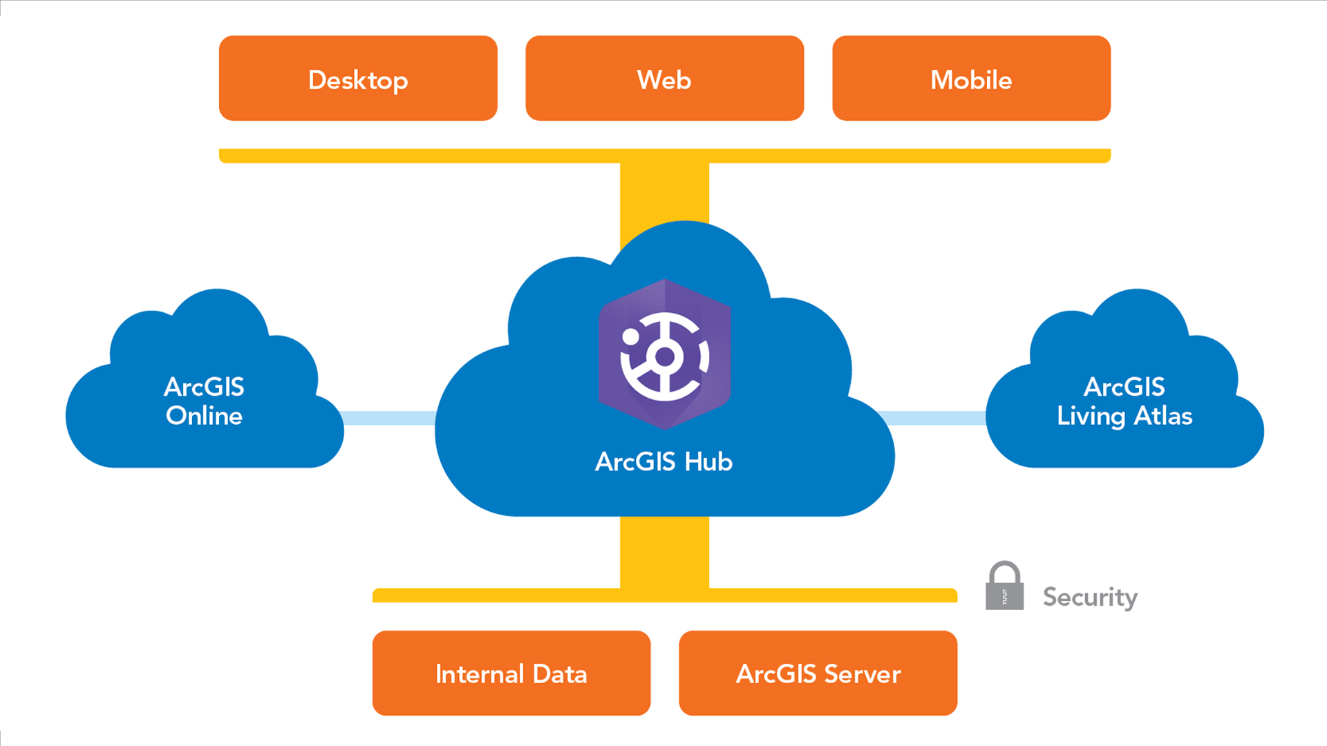
Understanding the Self-Service Mapping, Analysis, and Sharing System Pattern
Learn about this ArcGIS system pattern within the ArcGIS Well-Architected Framework that can fit your organization’s needs.
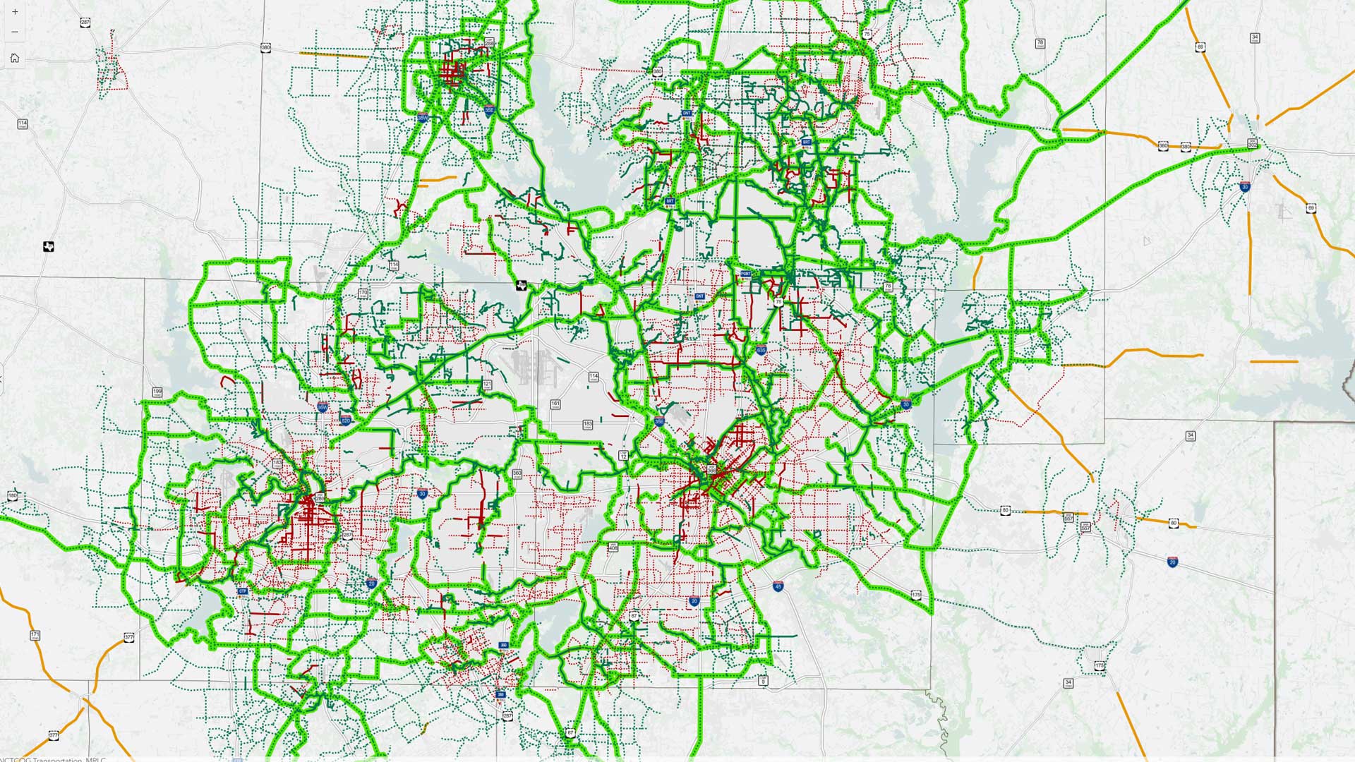
ArcGIS Monitor Brings New Insights to New Complexities
Learn how the North Central Texas Council of Governments went from a reactive GIS management approach to a proactive one.

Empowering a University with Smart Campus GIS Solutions
The University of Rhode Island’s spatial services team is taking steps to embed GIS in the fabric of campus operations.

A GIS-Driven Approach to Property Management and Environmental Stewardship
To address growing operations, Renewable Water Resources needed to develop a new comprehensive property inventory.
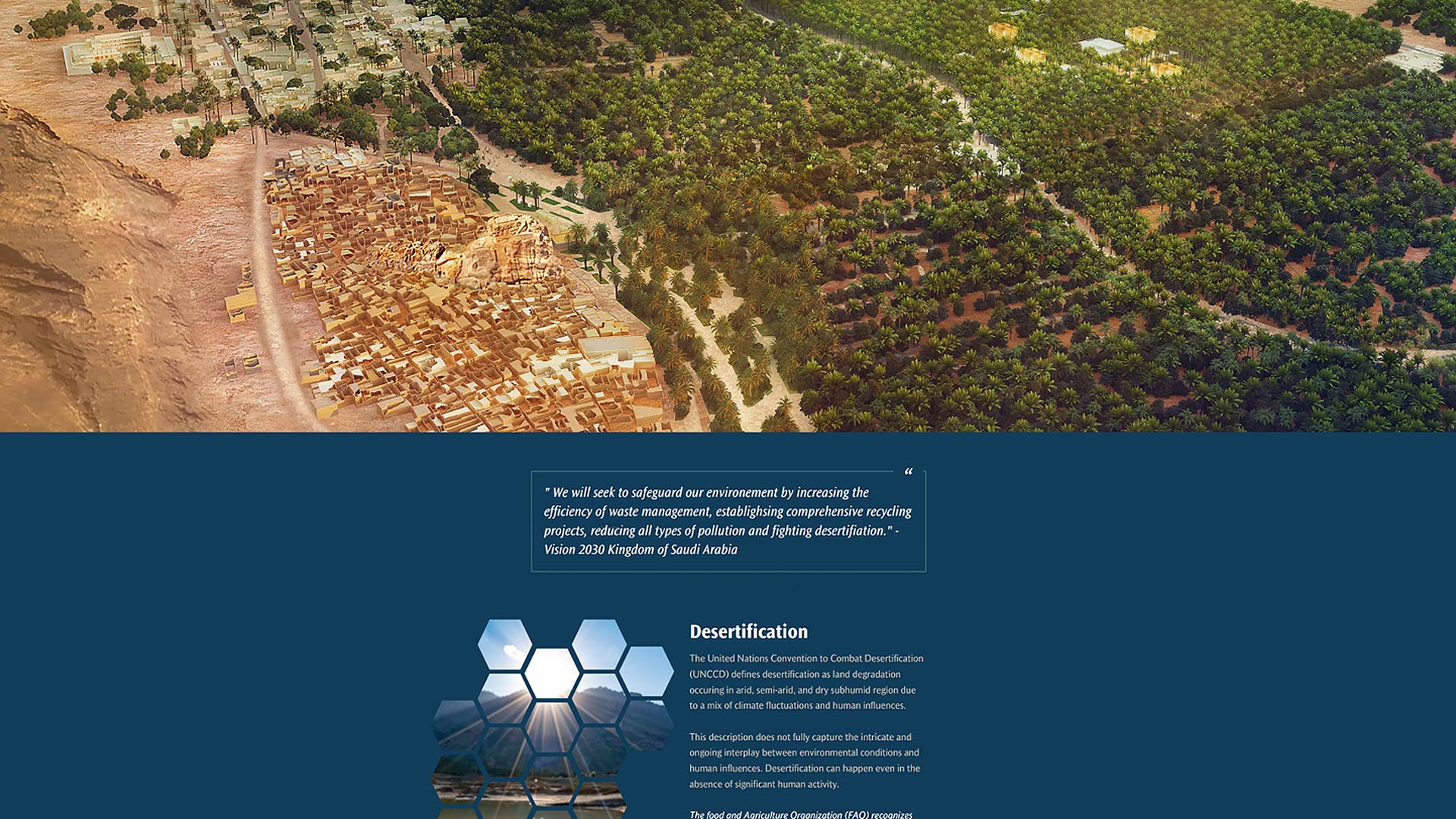
Halting the Spread of Desertification in Saudi Arabia
Desert blankets the Kingdom of Saudi Arabia—but not all of it. Saudi Aramco turned to GIS to preserve the country’s fertile land.

Python Aids Rat Mitigation Efforts in New York City
ArcGIS API for Python is a powerful tool in NYC’s search for a safer alternative to traditional rodenticides.
The Benefits of Integrating GIS and Data Science
GIS and data science each naturally support the work of the other. Your organization should treat them that way.

Future-Proofing Custom Widgets in ArcGIS Experience Builder
Integrating ArcGIS experiences into your apps? Use ArcGIS Maps SDK for JavaScript web components.
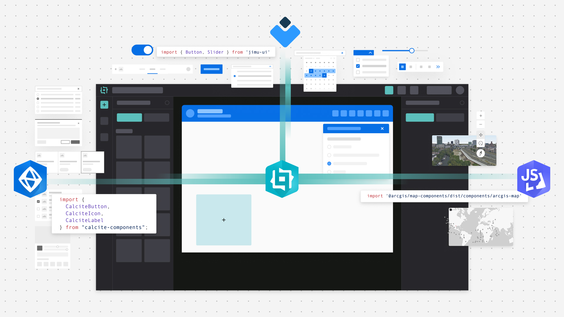
Optimize Your Custom Widget Experience
Understand when and how to use each component system library to optimize your app development experience.
Bookshelf
Map Use: Map Reading and Design, Top 20 Essential Skills for Imagery and Remote Sensing, and Security First
Create a Mobile Style for Native Apps
You can use a mobile style to make your map or app stand out, match organizational guidelines, or add emphasis to your data.

From Survey to Surface with ArcGIS for AutoCAD
ArcGIS for AutoCAD and ArcGIS Enterprise empower civil engineering teams to work concurrently on designs in Autodesk Civil 3D.
Prepare Offline Maps Ahead of Time
Taking maps offline is essential when internet access is limited. Explore how to download offline map areas prepared ahead of time.

Designing Lego Maps, Brick by Brick
Atlas Guo, a PhD student at the University of Wisconsin-Madison, talks designing maps in a LEGO brick style.
Share this page