Historically significant buildings are vanishing across West Africa. GIS and 3D modeling can digitally preserve the area’s built heritage.
Letter from the Editor
Pervasive GIS Is What’s Next
Making location intelligence more universally available—a promise made just six short years ago at the Esri User Conference—is being realized through the widespread adoption of Web GIS. The Web GIS pattern leverages web services that make exponentially growing data streams readily accessible for visualization and analysis.
By empowering non-GIS staff, Web GIS enables both GIS professionals and non-GIS knowledge workers in organizations to get more meaningful work done. It relieves GIS professionals from previous roles as data gatekeepers and on-call mapmakers so they can engage in analytical activities that provide greater value to their organizations.
The power of data integration and computational geography can be available to every-one in the organization. Through converting massive amounts of data into actionable information, web maps are becoming a kind of language that supports problem solving.
Using apps, this work can be shared and taken everywhere: referenced and updated in the field, presented in the boardroom, and disseminated on the web. The Web GIS pattern brings together web maps, web apps, hubs, location analytics, and other technologies that improve understanding, collaboration, and communication.
Since their introduction six years ago, Esri Story Maps apps have become a communication medium that is used to tell the stories of individuals, organizations, communities, events, and processes. The more than 600,000 story maps that have been published have been viewed millions of times.
The Special Section in this issue highlights how story maps are used to promote the unique characteristics of communities, present city council agenda items in context, and share the significance and beauty of collections maintained by the Library of Congress.
With Web GIS, location intelligence is easier to apply and more accessible so society can truly benefit from The Science of Where.

Monica Pratt
Editor
In this interview, Jeremiah Johnson provides guidance and suggestions for anyone interested in the burgeoning field of drone piloting.
The final issue of ArcUser revisits popular articles, examines how geography illuminates our past, and covers how GIS drives the future.

Briefly Noted
Learn about ArcGIS Pro Shorts, ISO certification, and real-time terrestrial mapping with Pix4D.

Bring Out Your Bugs
Technical support cases are critical to improving ArcGIS Software. If you notice a bug, report it.

AI Helps Clean Up LA
The city of Los Angeles produces nearly 100,000 tons of waste daily. An integration of AI and GIS tools is keeping its streets clean.

A Cartographer’s Quest to Map US History
Esri cartographer Charlie Frye’s work on Ken Burns’s The American Revolution was an extension of a passion project that mapped his ancestry.

Smoothing Out Türkiye’s Road Network
Türkiye’s road network is vital for cargo and freight. Learn how the country uses GIS and AI tools to keep up with maintenance needs.
Tracking Plans and Places in Kenton County
Kenton County has streamlined its ability to track development activity for residents and stakeholders.

Johns Hopkins University Elevates Drone Education
Learn how Johns Hopkins’s hands-on drone program gives students a competitive advantage.

Get to Know Cobb County’s GIS Chatbot
Explore how Cobb County’s chatbot makes the county’s GIS data more transparent and accessible.

One Public Utilities Platform, Thousands of Users
San Diego’s CompassGIS Viewer delivers critical GIS information to public utilities staff quickly and reliably.

GIS Protects the Past from Wildfire
Archaeological sites across Florida are at increasing risk of wildfire damage. GIS can help protect them.

GIS Governance for the AI Era
Advances in AI have created new and unfamiliar governance challenges. How can your organization best equip itself to handle these changes?

Keeping Utah Moving with a Solid Geospatial Foundation
Explore the Utah Department of Transportation’s holistic approach to the business of GIS.

GNSS Accuracy Unlocked: How Correction Methods Improve Field Data Collection
Understanding what methods deliver GNSS precision can mean the difference between efficient operations and costly mistakes.

Bookshelf
Map Use: Map Reading and Design and Top 20 Essential Skills for Imagery and Remote Sensing.
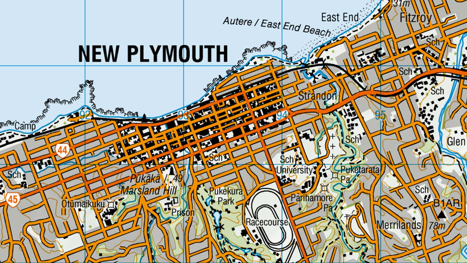
Make Maps People Want to Look At: Five Design Principles for Cartography
These five cartographic principles are essential in helping you create maps that successfully communicate geographic information.
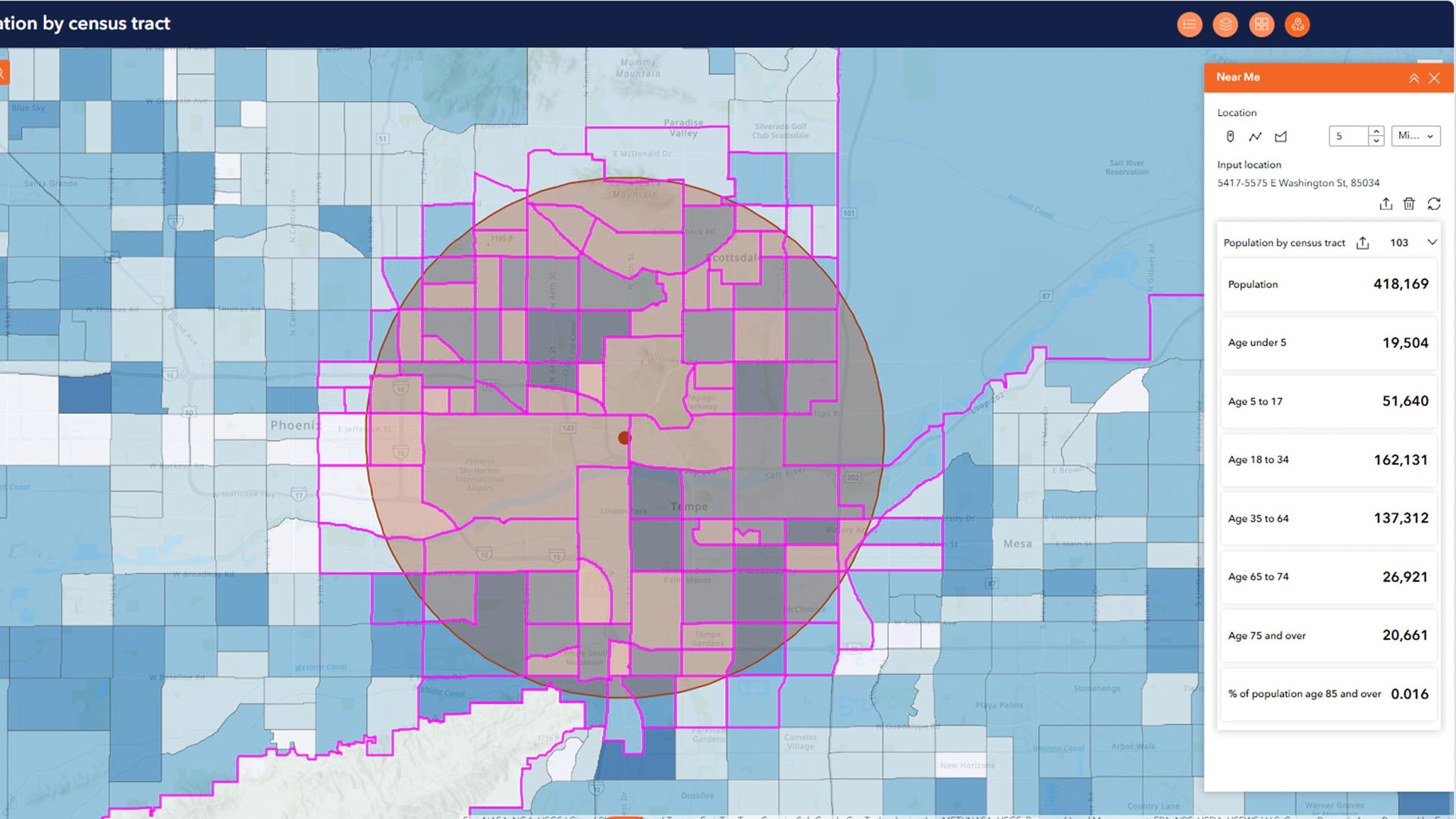
Create New Variables with the Near Me Tool in ArcGIS Experience Builder
The Near Me tool expedites data processing and analysis for a variety of applications. Learn how to use it in ArcGIS Experience Builder.
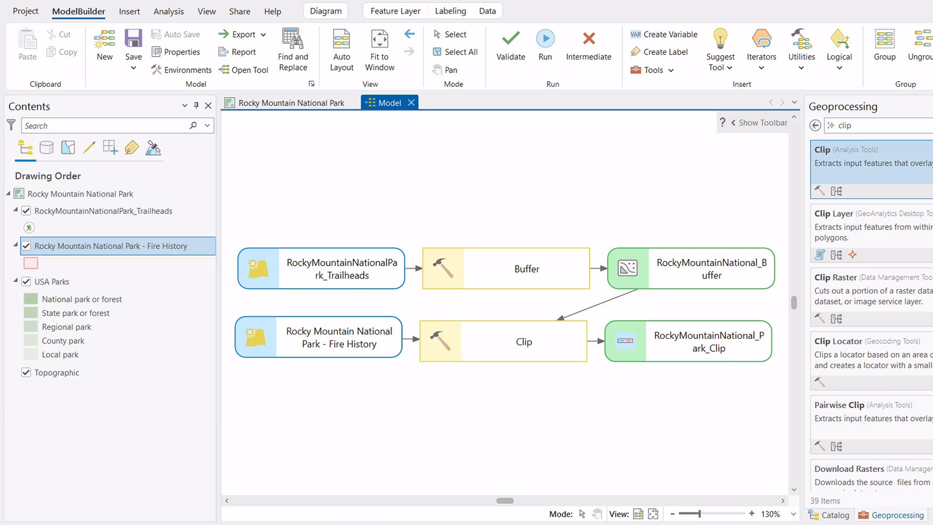
How ModelBuilder Can Streamline Your GIS Workflows
If want to use ModelBuilder to streamline your ArcGIS Pro workflow, this simple five- or six-step process can get you started.

The First Responder Who Aided Alaskan Villages She’s Never Visited
From a command center in Anchorage, Faith Espinosa and her team used GIS to help residents of remote villages recover from a typhoon.
Share this page