Metadata – the documentation that describes your data – is all around us. Good metadata support effective content sharing and is essential to quality data that are findable, accessible, interoperable, reusable (FAIR), and decision-ready.
But creating metadata isn’t always easy. Standards are complicated, and metadata editors, with different user interfaces, can be challenging to use. It’s time for a change.
With the ArcGIS Online summer 2023 release, we introduce the metadata editor beta, a streamlined experience for creating high-quality geospatial metadata. The new editor enables you to:
- Quickly complete what’s needed, creating essential metadata compliant with international open standards.
- Complete more robust documentation, including optional metadata elements.
- Search and find metadata elements.
- View, download, and overwrite metadata records.
Enable the metadata editor beta
For organizations that have enabled metadata editing, the Metadata and Open in Metadata Editor Beta button are available to item owners and administrators to create and edit metadata.
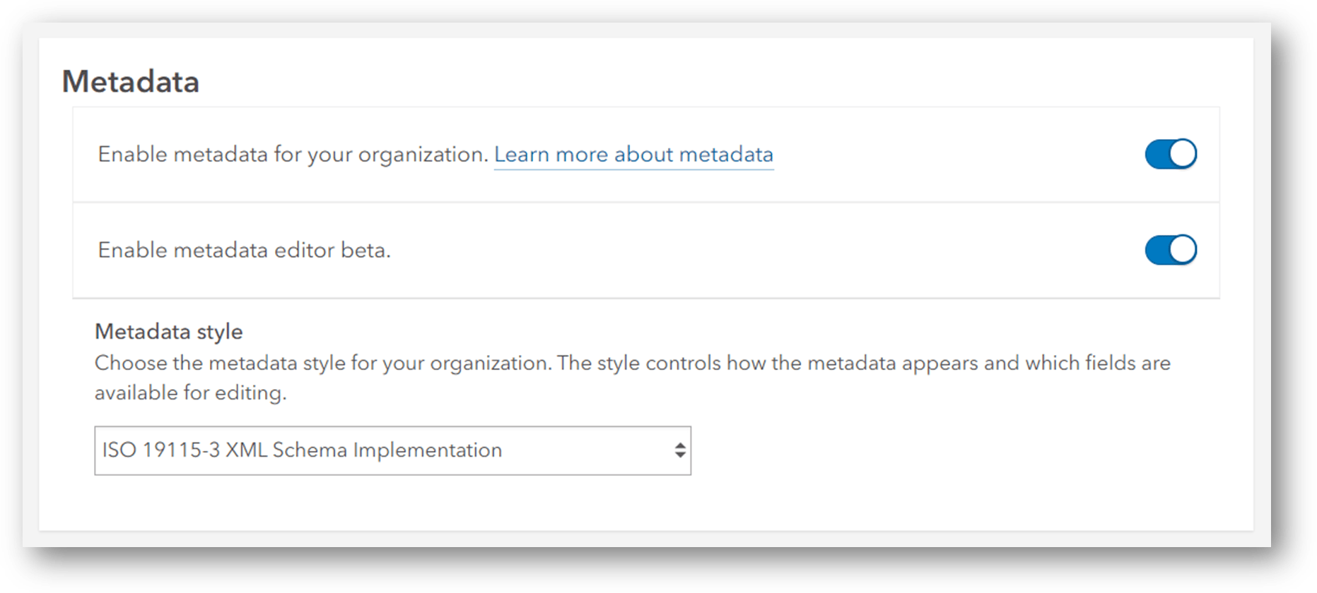
Note the ISO 19115-3 XML Schema Implementation metadata style is also part of the summer release for use with the metadata editor beta.
Explore the metadata editor beta
In the ArcGIS Online organization, go to the Contents tab and open an existing item. In the item details page, click the drop-down on the Metadata button to open the metadata editor beta.

Documenting essential metadata
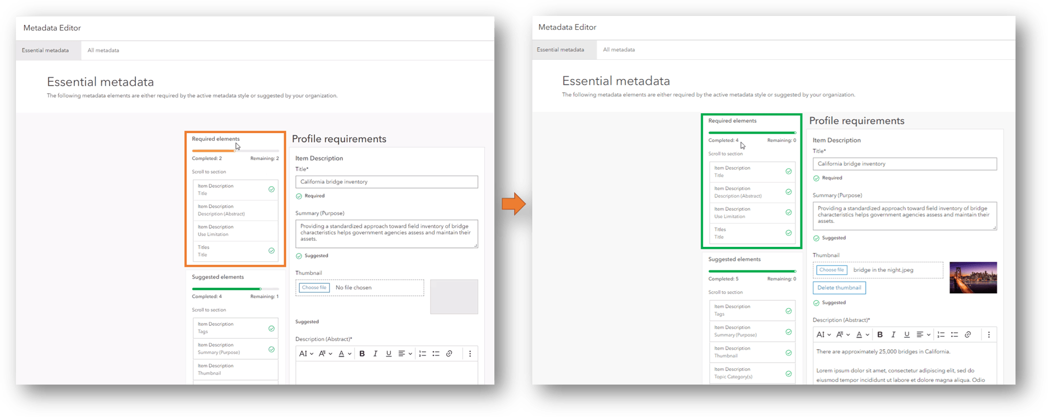
The Essential metadata tab streamlines metadata creation by presenting only the required and suggested metadata elements for the active metadata style.
To create a minimally compliant metadata record, tab through each element, completing the required and suggested information. Validation messages show a green checkmark for completed information and focus so you can quickly achieve what’s needed.
Documenting all metadata
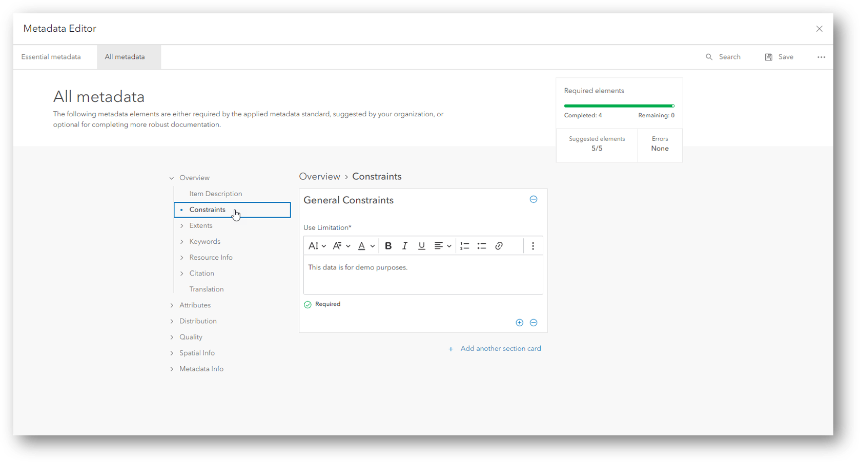
The All metadata tab provides a complete experience, including all required, suggested, and optional metadata elements for the active metadata style.
Choose a section in the left navigation and tab through the metadata elements in that section, completing the required, suggested, and optional information as desired. Validation messages show a green checkmark for completed required and suggested elements. Navigate through each section. Click through the remaining validation messages to achieve the desired result.
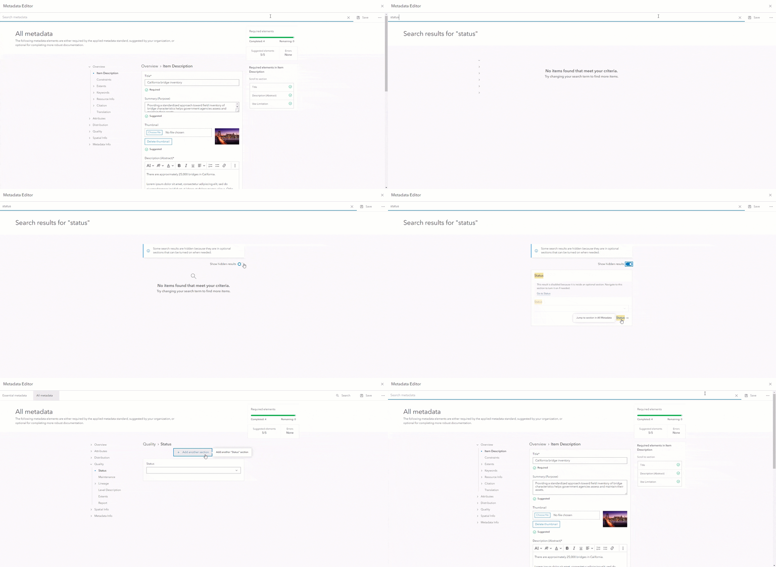
Use the new Search feature to find matching metadata elements. Some metadata elements are in optional sections that can be turned on as needed. Search results do not show these optional sections by default. During a search, you have the option to show hidden results.
Road ahead
We believe metadata management can be a delightful experience that powers rich data catalogs and drives relevant search results. The metadata editor beta starts this journey. The long-term roadmap is to reduce the complexity, enhance, and unify the metadata editing experience across ArcGIS.
Ready to give it a try?
Explore the Metadata Editor Beta in ArcGIS Online. Then share your feedback on the Metadata, Catalogs and Search Esri Community.



Commenting is not enabled for this article.