ArcGIS Enterprise 12.2 for Windows and Linux is here. This release provides enhancements and new functionality for GIS administrators, GIS developers, and GIS analysts. Updates include new API-based disaster recovery capabilities, new AI capabilities like Model Context Protocol (MCP) support, and observability enhancements. In this blog, we will guide you through the updates tailored to your role and explore how they can make your work more efficient.
Key Features of ArcGIS Enterprise 12.2:
- Introducing Esri Announcements, bringing relevant product information directly to ArcGIS Enterprise through the ArcGIS Enterprise portal.
- New API-based disaster recovery capabilities help administrators automate backup and recovery operations.
- Model Context Protocol (MCP) support enables users to connect third-party AI agents to ArcGIS Enterprise, providing access to authoritative GIS content.
- Integrate a cloud database service with the relational store. Administrators deploying ArcGIS Enterprise in the Amazon Web Services (AWS) or Microsoft Azure cloud can optionally configure a supported cloud database service to use as the relational store database.
- Organizations can use vector tile content as the source for raster tile map services, extending modern basemaps to clients and workflows that require raster content.
- New ArcGIS Server Manager (beta feature) provides a modernized experience for administering ArcGIS Enterprise web services, enabling administrators to manage, monitor, and configure services more efficiently through familiar workflows in a streamlined interface.
- Enhanced built-in observability (beta feature) through ready-to-use dashboards for insight into system health, content usage, user engagement, and system performance.
Quick Links
Jump to a section in this blog to start exploring.
• GIS Administrators
• GIS Analysts
• More Across ArcGIS Enterprise
GIS Administrators
ArcGIS Enterprise 12.2 helps GIS administrators run more resilient and scalable deployments with additional insights into the health and activity within their systems. New capabilities include more streamlined backup and recovery, bring important product updates directly into the portal, expand options for cloud-based system storage, and provide clearer insight into system health and performance. Together, these enhancements reduce routine administrative effort and help teams maintain a secure, reliable GIS environment as organizational needs evolve.
Organization administration
ArcGIS Enterprise 12.2 gives organization administrators new ways to keep members informed, improve content quality, and make information easier to discover. Staying ahead of critical changes, enriching content with AI-assisted metadata, and simplifying identity management all reduce routine effort. Together, these capabilities help you run a more useful, well-managed GIS.
Esri Announcements delivers relevant product updates directly in the portal. Keep the Receive announcements from Esri toggle turned on. Your organization will then contact an Esri-hosted message server every 24 hours for updates curated to your deployment. Announcements are based on your operating system (Windows or Linux), your ArcGIS Enterprise version, federated server types, and configured data stores.
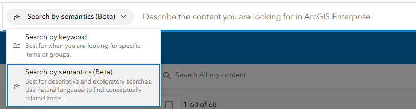
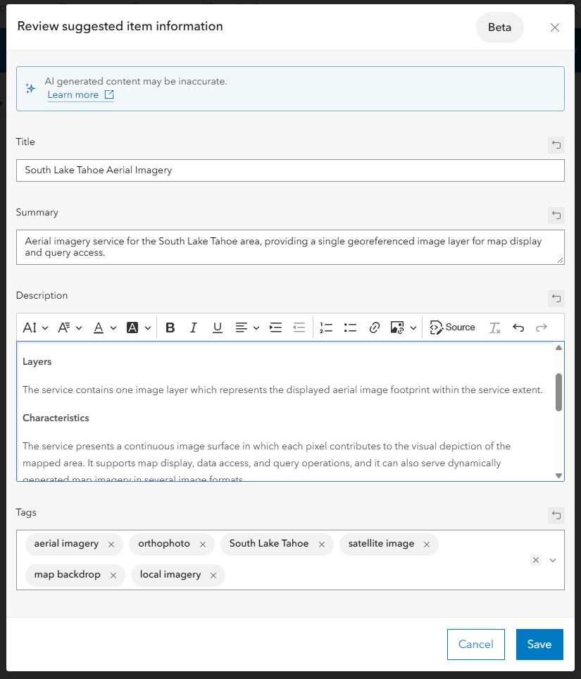
The item details assistant and semantic search help teams create richer metadata and find authoritative content more efficiently. The item details assistant (beta) capabilities now support additional item types, making it easier to create high-quality metadata across more geospatial content. Administrators or those with administrative privileges will need to configure AI assistants for members of their organization to access the item details assistant. This works like the World Geocode Service or other utility services that require stored ArcGIS Online credentials. Semantic search (beta) enables organizations to explore the new search experience in ArcGIS Enterprise. An administrator must configure semantic search for the organization and provide ArcGIS Online credentials to access the embedding service.
Administrators can change member login types, such as moving from ArcGIS logins to SAML or OpenID Connect, without re-creating user accounts. This preserves members’ content, groups, and licenses. It also reduces administrative overhead as authentication needs change over time.
With new API-based disaster recovery capabilities, administrators can programmatically create, restore, schedule, and manage backups through REST APIs. This removes the need to run WebGISDR directly on component machines. Improved logging, job history tracking, webhook integration, and email notifications add automation, observability, and operational efficiency.
Gain clearer insight into system health with built-in observability (beta). Available as a beta feature, the optional observability store collects observability data from the ArcGIS Enterprise metrics API. It powers Esri-provided operational dashboards that show system health, content usage, and user engagement. These ready-to-use visualizations in the portal reduce the effort needed to access key system metrics. Organizations that want more customization or third-party monitoring integration can still configure Prometheus to scrape the ArcGIS Enterprise metrics API.
A modernized ArcGIS Server Manager (beta) experience is available as a beta feature at ArcGIS Enterprise 12.2, giving GIS administrators a more intuitive and streamlined way to manage ArcGIS Server. Updated experiences for services, logs, security, storage, usage statistics, and other common administrative tasks bring important operational information and controls together, helping administrators more efficiently configure services, monitor activity, and troubleshoot their ArcGIS Server sites.
System Storage
ArcGIS Enterprise 12.2 offers greater flexibility in how critical system data is stored and managed. Deployments in AWS or Microsoft Azure can use a supported cloud database service for the relational store database, helping organizations take advantage of the scalability, reliability, and performance benefits these cloud services can provide. These options make it easier to align storage architecture with operational requirements and support a resilient GIS as demand grows.
Extend vector basemaps to raster workflows. Organizations can use vector tile content as the source for cached map image layers, extending modern basemap content to applications and workflows that require raster tiles. This allows teams to reuse existing vector basemaps across legacy desktop GIS applications, offline and disconnected workflows, map exports, WMS, and WMTS, while reducing the need to separately maintain raster and vector source content.
GIS Analysts
ArcGIS Enterprise 12.2 delivers powerful new tools and enhancements for GIS analysts, expanding capabilities across mapping, visualization, and analysis. With updates to Map Viewer, Scene Viewer, and core analysis tools, this release helps analysts work with data more expressively and efficiently.
With ArcGIS Enterprise 12.2, organizations can take advantage of new AI capabilities designed to enhance and streamline GIS workflows, from interacting with maps and data using natural language to generating metadata and supporting code development. These capabilities give teams new ways to work more efficiently while keeping adoption flexible. AI features are available when organizations choose to enable them, allowing organizations to maintain control over whether and how AI is enabled. Explore these blogs to learn more about AI capabilities in ArcGIS Enterprise 12.2 and across the ArcGIS platform.
Map Viewer
In ArcGIS Enterprise 12.2, Map Viewer introduces new capabilities for working with enterprise data, bringing richer GIS content into web maps, and creating more dynamic and expressive visualizations.
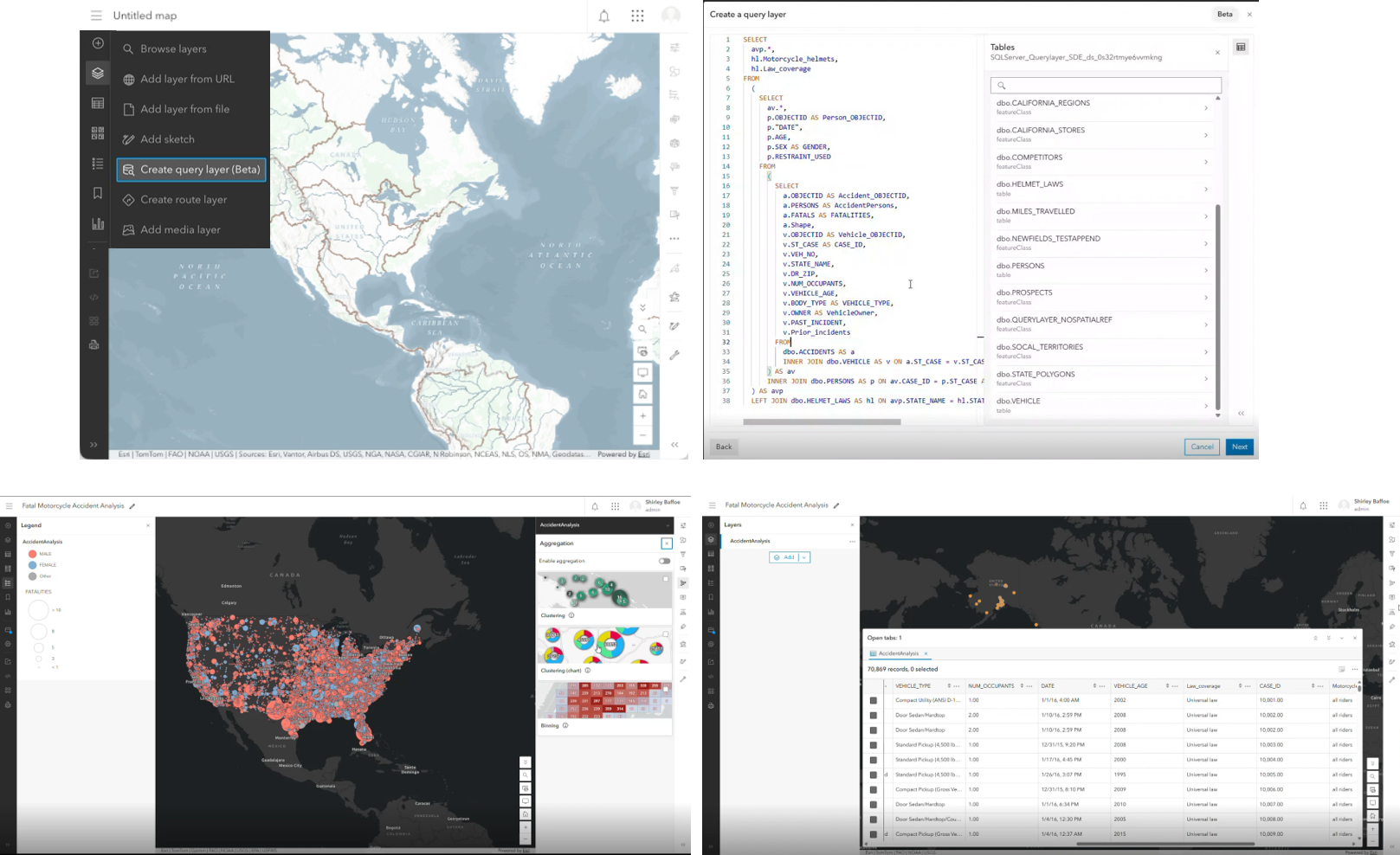
Support for creating query layers (beta) in Map Viewer is new in this release, offering a more streamlined way to integrate external data from SQL Server, PostgreSQL, and Oracle databases with ArcGIS Enterprise. While creating query layers previously required ArcGIS Pro, you can now use SQL to define the data you are interested in and build self-service query layers directly in Map Viewer without ever leaving your web browser.
Display annotation and dimension feature layers (beta) are introduced in this release. You can display annotation and dimensions on a map, view these layers in the layer list, and save them to a web map. An annotation is a type of feature that consists of text with position, layout, and style attributes. A dimension may indicate the length of a side of a building or land parcel, or the distance between two features, such as a fire hydrant and the corner of a building.
New visualization capabilities provide more ways to communicate patterns and change. Animation Along Lines brings movement to line features by animating symbols or patterns along a path, making it easier to visualize routes, flows, and journeys.
You can now configure time series animation directly in Map Viewer to visualize change over time by using column‑based data, where multiple time values are stored as attributes on a single feature rather than repeated across many rows. Sketch enhancements expand curve support and improve drawing flexibility. Sketch now includes the full range of curve types available in the editor—such as bezier, tangent, and arc segments—and allows users to seamlessly switch between curved and straight segments while drawing lines or polygons.
New fonts in Map Viewer expand cartographic flexibility while improving readability and accessibility across maps. Map Viewer now supports complex character sets that were previously difficult to render, enabling labels to display accurately as part of a cohesive web map designed for specific language contexts.
Sketch now supports bezier, tangent, and arc segments, with the ability to switch between curved and straight segments while drawing lines and polygons.
Explore more details in these blogs:
What’s New in Map Viewer (June 2026)
Bringing Annotation and Dimension Layers to Life on the Web
Scene Viewer
Scene Viewer in ArcGIS Enterprise 12.2 expands support for photorealistic 3D visualization and more flexible analysis workflows. New Glow effects make supported symbology appear illuminated and visually prominent in your scenes, adding a more realistic look and feel. Street lights look like they’re actually on, a flight path is easier to pick out when there are thousands on screen, and areas of activity stand out instead of blending in around them.
Oriented imagery helps you validate, inspect, and understand assets with real-world visual context. With the new Location tool, you can get an on-the-ground view alongside the scene, connecting a bird’s-eye perspective with real-world conditions in the same place.
For teams working with Gaussian splats, this makes it possible to go beyond visualization to analysis within the browser. Slice through Gaussian splats with the slice tool, evaluate visibility with the line of sight tool, and extract elevation profiles to better understand elevation change over distance.
Accurate volume calculations have traditionally required specialized desktop GIS workflows. The new interactive Measure volume tool (beta) brings these calculations directly into Scene Viewer, giving teams client-side analysis for exploring spatial relationships, understanding site context, and informing early decisions before moving into production-grade analysis.
We are excited to announce that the Google Photorealistic 3D basemaps, Photorealistic and Photorealistic Hybrid, are in preview in ArcGIS Enterprise. The Google Photorealistic 3D Basemap provides a seamless, high-resolution 3D model of the real world, covering over 2,500 cities across 49+ countries. Using these basemaps, organizations can explore buildings and environments from multiple angles with accuracy and realism and create immersive, photorealistic 3D web scenes for use within the organization.
What’s New in Scene Viewer in ArcGIS Enterprise 12.2

Semantic search (beta)
ArcGIS Enterprise 12.2 introduces semantic search (beta), making it easier to find relevant content based on meaning and context of a query rather than exact keywords. The semantic search experience makes it easier to discover related content, explore large collections of items, and search across multiple languages. Semantic search matches results based on the meaning of a query opposed to the keywords used. As a result, semantic search makes it easier to discover content when the users don’t know the exact keyword of the content they are searching for by providing similar results to the meaning of their query. Semantic search also provides the ability to search across language by returning results with a similar semantic meaning in a language different from that of the search query. Semantic search must be enabled by the organization administrator.
Item Details assistant (beta)
In addition to hosted feature layers, views, and tables, the assistant can now provide intelligent metadata suggestions for imagery layers, map image layers, web tools, and more. These enhancements help improve content discoverability, reusability, and AI readiness.
Analysis
The 80-20 Analysis tool performs Pareto analysis and creates point clusters, lines, or polygons based on the number of associated incidents. In the context of geography, Pareto analysis (also known as the 80-20 rule) posits that a disproportionate number of incidents (80 percent) occur at a small subset of locations (20 percent). The 80-20 Analysis tool calculates a cumulative percentage field to identify the locations where incidents are disproportionately occurring.
The Detect Target Using Spectra tool computes a matching score for each pixel in an input raster based on how well the pixel’s spectrum matches the target spectra defined by an input spectral signature file.
The Detect Image Anomalies tool creates an anomaly score raster from an input multiband or hyperspectral image. The anomaly score raster is a single band raster with values between zero and one.
The Resample Library Spectra tool resamples input library spectra to match the number of bands and wavelength range of target spectra from a target sensor, custom spectral library file, or custom image.
More Across ArcGIS Enterprise
ArcGIS Reality Server
Reality mapping has become an essential part of modern GIS, helping organizations create the authoritative 2D and 3D content that powers analysis, decision-making, and digital twins. As demand grows, organizations need solutions that can scale across teams, projects, and infrastructure while meeting security and operational requirements. That’s why we’re introducing ArcGIS Reality Server, a new self-hosted capability for ArcGIS Enterprise that brings enterprise-scale reality mapping directly into your GIS. From drone missions to aerial and satellite projects, ArcGIS Reality Server helps organizations turn imagery into trusted geospatial intelligence while keeping processing workflows under their control. ArcGIS Reality Server is available with ArcGIS Enterprise 12.2 on Windows and Linux.

ArcGIS Hub (formerly ArcGIS Enterprise Sites)
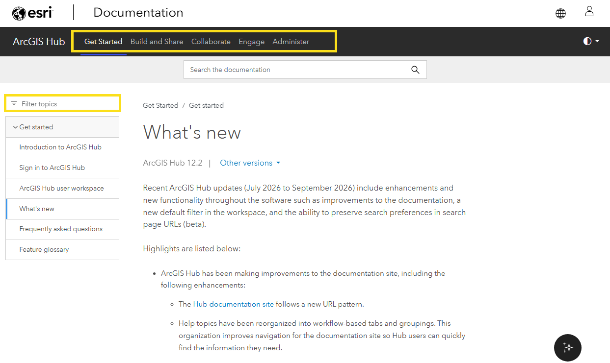
With the ArcGIS Enterprise 12.2 release, the name for ArcGIS Enterprise Sites has changed to ArcGIS Hub in ArcGIS Enterprise. This new name brings consistency across ArcGIS and follows the same pattern used for apps like ArcGIS Experience Builder and ArcGIS Instant Apps, which share one name in both ArcGIS Enterprise and ArcGIS Online. In addition to the name change, improved documentation of workflow-based topic organization and topic filtering make it easier to find what you need faster. ArcGIS users can now also create maps in Map Viewer by adding layers that you can access from a Hub catalog, plus content and groups now have the My content or My groups filter applied by default in the user workspace, saving you time in finding the items relevant to you.
ArcGIS Business Analyst Enterprise
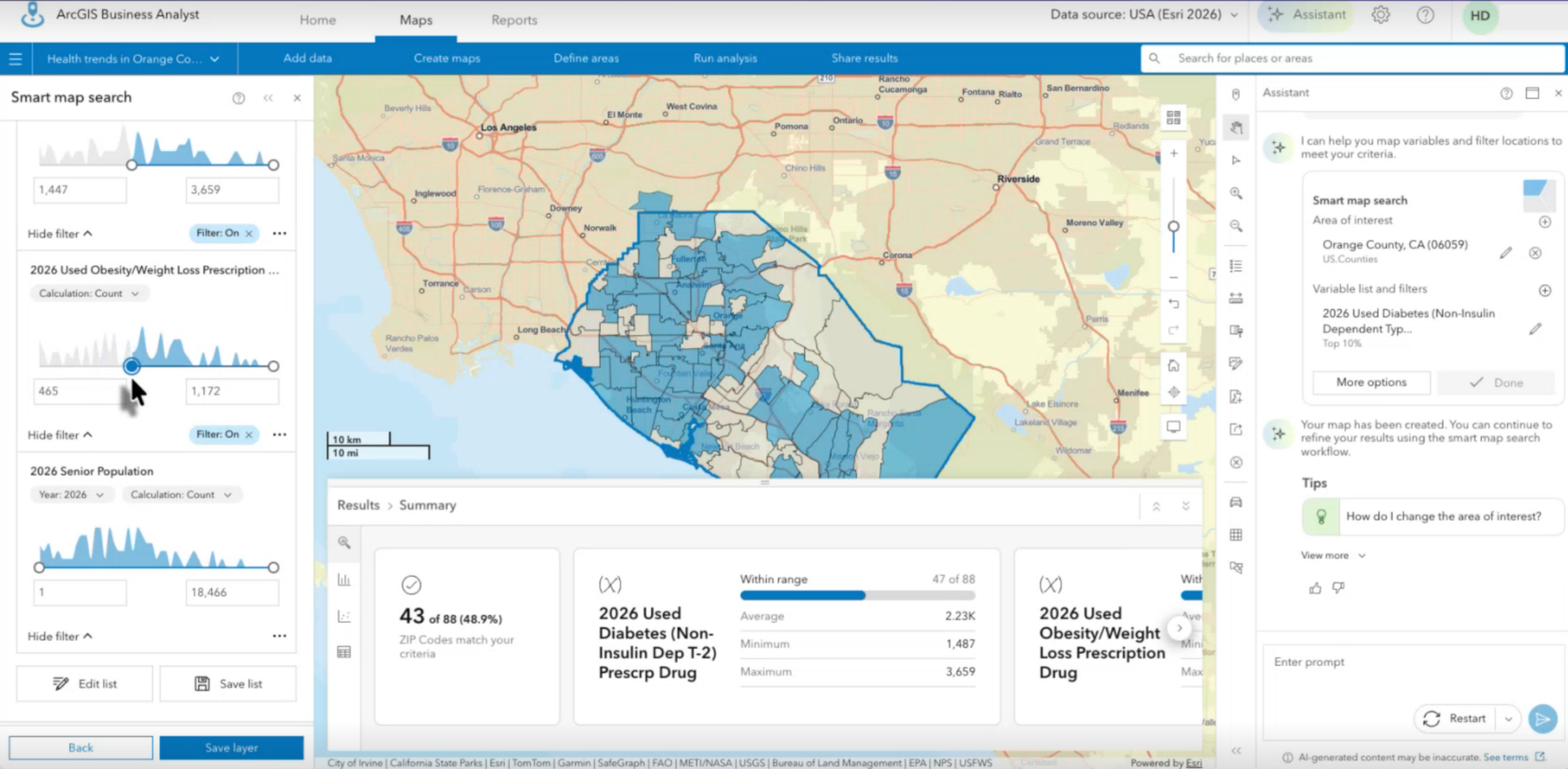
ArcGIS Business Analyst Enterprise helps you make market planning, site selection, and customer targeting decisions with confidence, all behind your infrastructure. The November 2026 release of ArcGIS Business Analyst Enterprise 12.2 brings AI to your analysis for the first time with Business Analyst assistant (beta), gives you more control to spotlight the results that matter with Results pane improvements, and makes it faster to turn your analysis into compelling stories with a redesigned share to a story workflow.
ArcGIS Dashboards
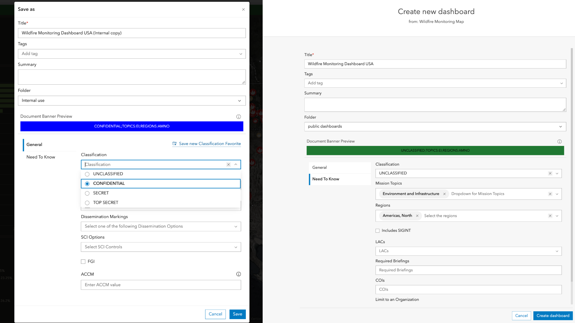
ArcGIS Dashboards in ArcGIS Enterprise 12.2 introduces new features and enhancements, including classification labels for sensitive information. Users can now apply organizational classification labels to dashboards to help communicate data sensitivity and support information governance requirements. Classifications make it easier for teams to understand how dashboard content should be handled and shared across the organization. Within the Header options, the Enable focus mode option allows users to expand the element when enabled by dashboard authors. New support for dashboards in group content migration makes it easier to move complete dashboard experiences between environments. Administrators can export dashboards with their dependent maps and layers and import them elsewhere, supporting workflows such as backup and recovery, development-to-production migration, and sharing with disconnected environments.
ArcGIS Data Pipelines
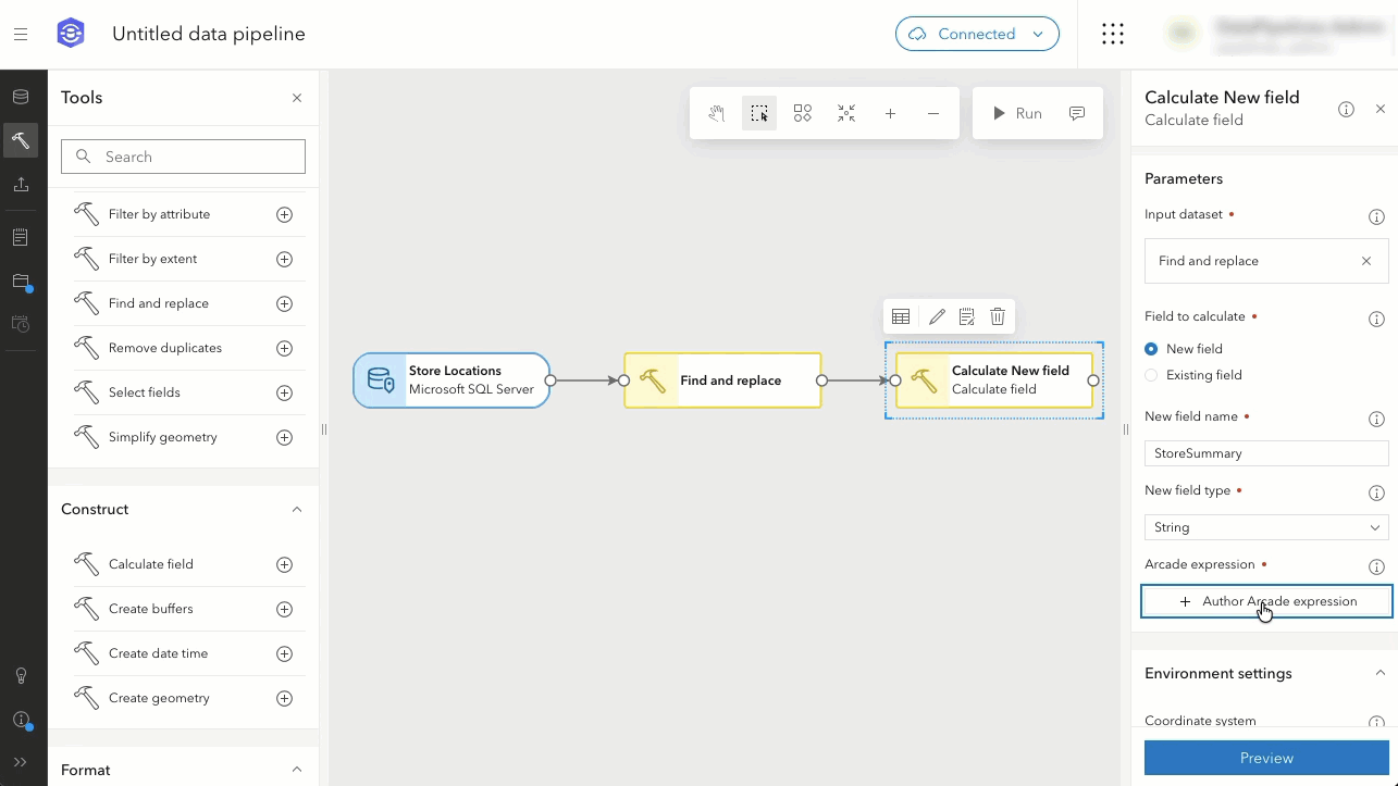
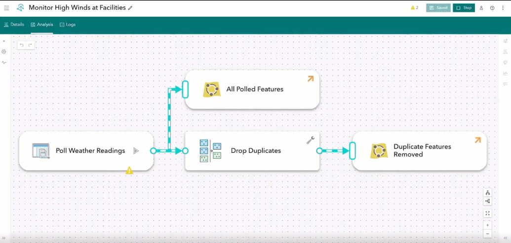
ArcGIS Data Pipelines is a no-code, visual data engineering capability that comes included with ArcGIS Enterprise Advanced. In ArcGIS Enterprise 12.2, ArcGIS Data Pipelines now supports new data sources, processing tools, output formats, and administrative and automation capabilities to help you streamline your workflows.
You can now use records from tables in Microsoft SQL Server, Oracle, and PostgreSQL as inputs to your data pipelines. Supported tables can come from an enterprise geodatabase—using non-versioned data or the Default version only—or from a relational database that is not enabled as an enterprise geodatabase.
Two new data processing tools have been added, including Create buffers and Find and replace, giving you more control as you prepare and integrate data with ArcGIS Enterprise. You can also write results directly to Files in your content, with support for creating or overwriting CSV, GeoJSON, or Apache Parquet files. This provides greater flexibility in how data is shared across your organization.
Finally, administrators can now manage their Data Pipelines Server site directly from the Data Pipelines app as an alternative to the REST Admin API. In addition, a new Max cores per worker setting also lets administrators define the exact number of processor cores available to each compute resource. Additionally, users can now automate data pipeline workflows using the ArcGIS API for Python or ArcGIS REST APIs.
To learn more, see What’s New in ArcGIS Data Pipelines in ArcGIS Enterprise 12.2.
ArcGIS Experience Builder
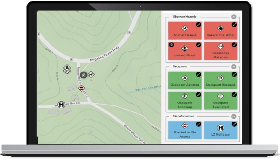
This release of ArcGIS Experience Builder in ArcGIS Enterprise brings new capabilities for multilingual apps, data collection, imagery analysis, and accessibility. Highlights include a new translation system and Language Switcher widget, the QuickCapture and Image Change Detection widgets, dynamic attributes created with Arcade expressions, and data source-level message actions. The release also delivers numerous enhancements across widgets, data sources, themes, and accessibility.
Learn more in the What’s New in ArcGIS Experience Builder blog.
ArcGIS GeoBIM
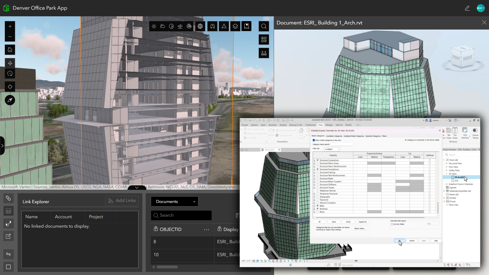
This release on ArcGIS Enterprise 12.2 enhances BIM-to-ArcGIS workflows with Autodesk Forma (formerly Autodesk Construction Cloud) by giving teams greater control over how BIM data is synced for use in ArcGIS. With improvements for filtering Autodesk Revit models, post-sync diagnostics, and georeferencing of Industry Foundation Classes (IFC) files, teams can improve data quality, reduce rework and coordinate more efficiently to keep projects moving forward.
ArcGIS Instant Apps
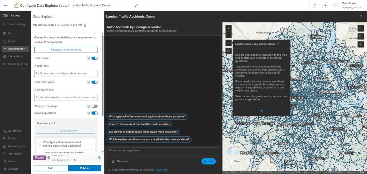
The ArcGIS Instant Apps Data Explorer template (beta)* is a new way to create agentic mapping applications and to interact with them using a natural language AI-powered chat interface. The template is powered by AI agents that can help users look for patterns, compare conditions, and better understand their data. Users can ask questions about the data in the map and can filter features to support exploration with natural language.
For example, ask, “Since September 27, 2022, what are the average, maximum, and minimum sale prices of three-bedroom homes with two or more bathrooms within 10 miles of San Diego?”. Or “Zoom to Cook County and show me the area where bear and wolf sightings are concentrated.”
To use Data Explorer (beta), your organization must support the use of AI assistants. Please consult with your organization administrator about enabling AI assistants if you do not see Data Explorer (beta) as a choice when choosing a template in Instant Apps.
Learn more at ArcGIS Instant Apps: Introducing Data Explorer (beta).
*Please be advised that beta features are subject to change and are not guaranteed to enter general availability.
ArcGIS Knowledge
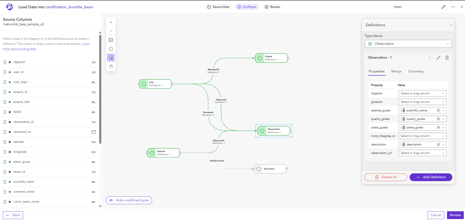
ArcGIS Knowledge 12.2 for ArcGIS Enterprise 12.2 expands how organizations create, analyze, and share knowledge graphs. Users can now use knowledge graphs as data sources in ArcGIS Experience Builder and create knowledge graph replicas in ArcGIS Pro for disconnected workflows. In ArcGIS Knowledge Studio, a new data-loading experience simplifies adding tables and feature services to knowledge graphs.
ArcGIS Monitor
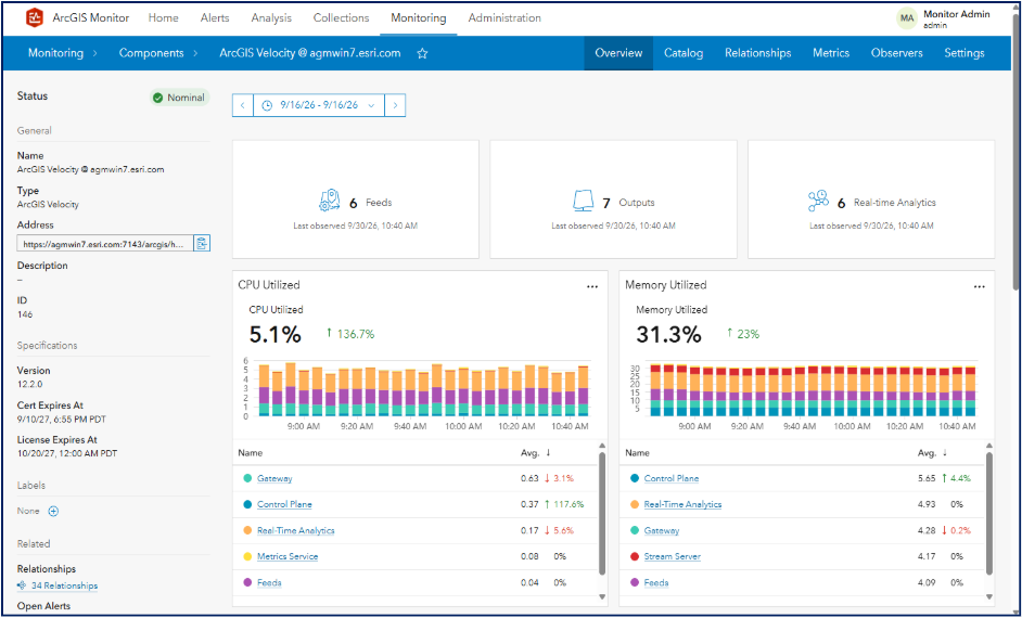
ArcGIS Monitor will now collect metrics on the health and performance of ArcGIS Velocity for ArcGIS Enterprise deployments on Windows and Linux, as well as the Spatiotemporal Data Store that powers many real-time and big data GIS workflows. As organizations increasingly rely on real-time GIS to support mission-critical operations, performance issues or service disruptions can have significant operational impacts. With this release, administrators proactively manage ArcGIS Velocity by gaining earlier insight into potential problems, faster troubleshooting capabilities, and greater confidence in the reliability and performance of their real-time GIS infrastructure.
ArcGIS Monitor is introducing a beta capability that exposes its collected data via Model Context Protocol (MCP). This is moving from private to public beta with 2026.1. Administrators can interact with Monitor using AI and natural language questions to investigate system performance, identify issues, and better understand operational conditions. As ArcGIS environments grow in scale and complexity, troubleshooting often requires specialized expertise and significant time to correlate data across multiple systems. This capability helps make monitoring insights more accessible, accelerates root-cause analysis, and can reduce the time and effort required to diagnose and resolve issues, enabling organizations to maintain reliable, high-performing GIS operations more efficiently.
ArcGIS StoryMaps
Bring more interaction and flexibility to your storytelling with the latest enhancements in ArcGIS StoryMaps. Engage audiences with interactive quizzes, visualize information with new infographics and chart options, and create more dynamic frames and briefings with map actions, swipe experiences, flexible layouts, galleries, and synchronized map navigation.

ArcGIS Velocity
The latest version of ArcGIS Velocity expands real-time capabilities with new feeds, analytics, outputs, and deployment enhancements. Connect to more streaming data sources with new feeds, streamline analysis with new tools for real-time workflows, and share real-time information with external systems to take action. Integration with ArcGIS Monitor, multi-site federation, and resiliency and security enhancements help organizations more effectively deploy, monitor, and support real-time applications across their mission-critical enterprise applications.
Other Updates
The initial release of ArcGIS Linear Referencing is with ArcGIS Enterprise 12.2 and ArcGIS Pro 3.8. This product is the consolidation of ArcGIS Roads and Highways and ArcGIS Pipeline Referencing.
ArcGIS Mission has been deprecated, and its final release will be alongside ArcGIS Enterprise 12.3, expected in Q2 2027.
Closing
As you explore the new capabilities in ArcGIS Enterprise 12.2, take advantage of the documentation, best practices, and resources available to help you get the most from this release. Also, stay tuned for the ArcGIS Enterprise on Kubernetes release blog, coming soon, to learn about new enhancements. Stay up to date on all things ArcGIS Enterprise by following us on social media and subscribing to the newsletter for timely updates. We invite you to join the conversation in the Esri Community, where your feedback helps shape the future of the platform.




Commenting is not enabled for this article.