Last summer, we introduced a new OpenStreetMap Vector Basemap. Since that time, we have made numerous updates to the basemap and improved the integration with ArcGIS Online. With our update last week, we’ve added new styles and another tile scheme to the OpenStreetMap group.
Esri hosts a live replica of the OpenStreetMap (OSM) data, which we reference with ArcGIS Pro to build and publish a hosted vector tile layer in ArcGIS Online. Because it is a vector basemap, Esri and our users can re-style the basemap in many ways. The initial style mimics OSM cartography. We created two more styles built on the OSM data. We created map items in the Esri Street Map style as well as Esri Hybrid Reference style intended for display over imagery.


Vector Tile Style Editor
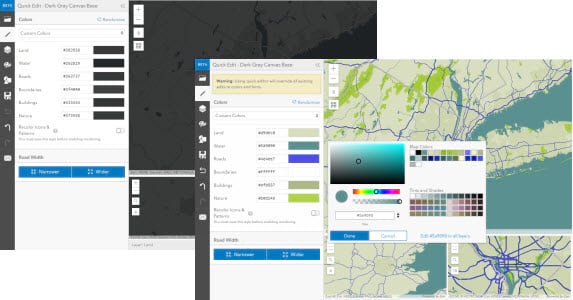
If you’d like to create your own style, you can do that through the Vector Tile Style Editor! The Vector Tile Style Editor app supports re-styling the OpenStreetMap basemap through the Quick Edit tools, along with the other Esri basemaps. You can select the OpenStreetMap style to get started, use the Quick Edit tools to quickly re-style the many layers in the map to make it your own, and then save the custom map to your ArcGIS Online account. The Vector Tile Style Editor can also be accessed through the ArcGIS Online Map Viewer.

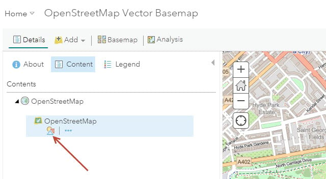
As an alternative to the stand-alone style editor app, sign in to ArcGIS.com and add a vector tile layer to the contents of the Map details panel. Click the icon under the layer to launch the style editor app. The editor is accessible from a vector tile layer within or outside of the basemap.

WGS84/GCS
For those looking for WGS84/GCS tiling scheme, we’ve released a separate GCS tile set (OpenStreetMap_GCS_v2) with the same map styles as the OSM in Web Mercator Aux. Sphere: OSM cartography, Esri Street style, and Esri Hybrid Reference.

Accessing the Map
The OpenStreetMap vector basemap hosted by Esri is freely available to any user or developer to use in your map or app! The OpenStreetMap vector basemap hosted by Esri is provided under a Creative Commons by Attribution (CC BY 4.0) license so that it may be used freely, and without transaction limits, in your internal and public facing maps. You just need to give appropriate credit for use of the map (i.e. “Map data © OpenStreetMap contributors, Map layer by Esri”) in your work.
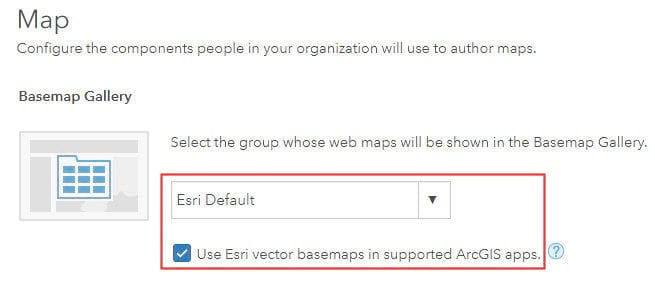
The OpenStreetMap vector basemap is available in the ArcGIS Online basemap gallery. This is the case for anonymous users, new organizations, as well as ArcGIS Online organizations that have configured the Basemap Gallery to use the Esri Default maps and have enabled use of Esri vector basemaps. If your organization has not yet enabled use of Esri vector basemaps, we encourage you to do that now.

You can also access the map through the OpenStreetMap Vector Basemap group. If you are a developer, or a user embedding the map in a website or story map, we encourage you to use the web map referenced in this group, and also part of the Living Atlas.
GeoNet: The Esri Community
Finally, ask questions, share updates, and browse the space for the content you need! Visit the ArcGIS Living Atlas of the World product page.


Commenting is not enabled for this article.