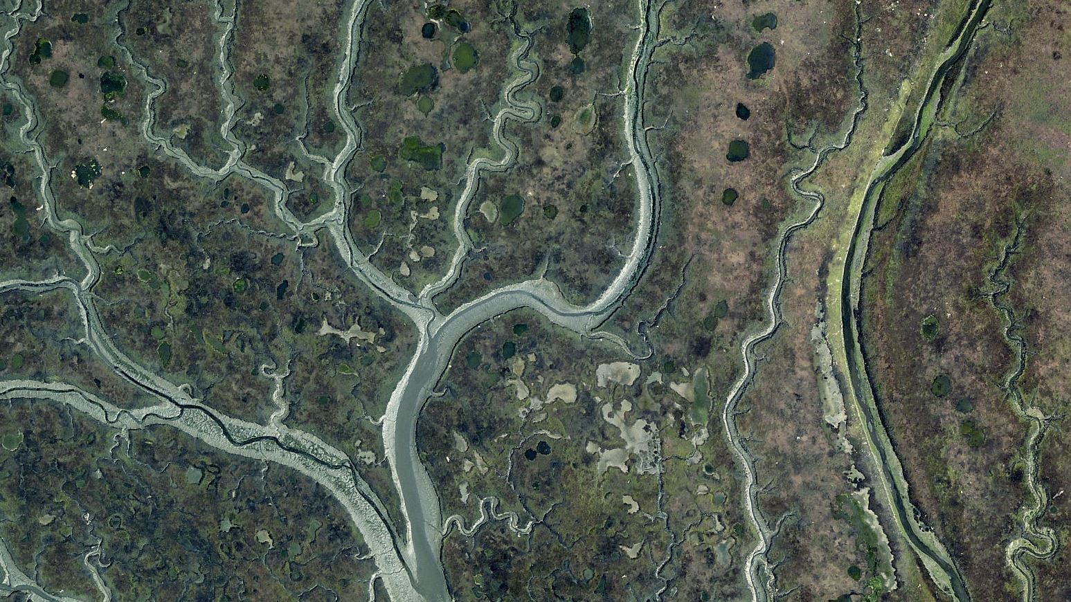
San Luis Obispo County, CA has just published their latest imagery to ArcGIS Online. This high-resolution submeter imagery will serve stakeholders throughout the county. This updated imagery will especially benefit county and city local government operations and California Polytechnic State University (Cal Poly) on a variety of levels.
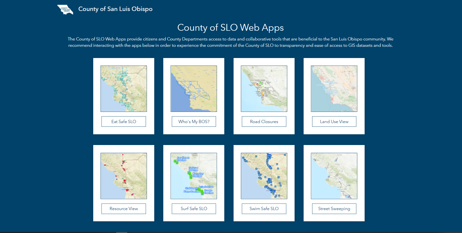
Submitting imagery through Esri’s Community Maps Program enables the county to share it with public and internal users by incorporating Esri’s hosted image service in mapping applications. These applications provide citizens access to data and collaborative tools that are beneficial to the entire San Luis Obispo community.
Sharing imagery with Community Maps cuts down on San Luis Obispo County IT infrastructure costs because Esri does the hosting. Additionally, freely hosted imagery increases labor savings from our staff not having to cache the imagery. Since this imagery was purchased by the government, we believe that imagery paid for by citizens tax dollars should be in the public domain.
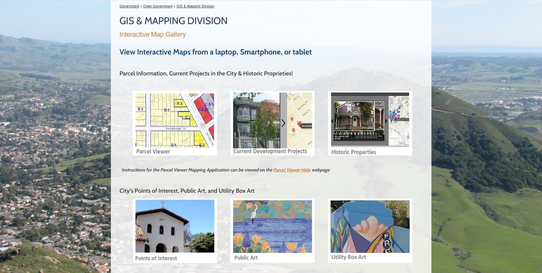
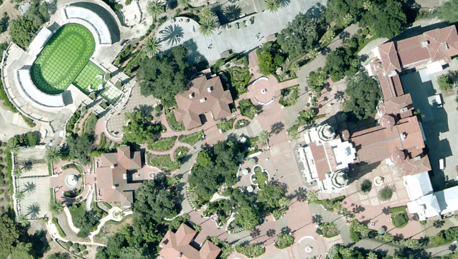
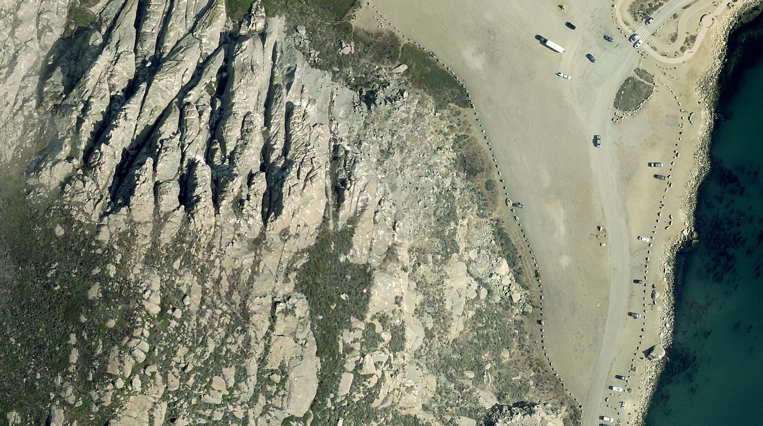
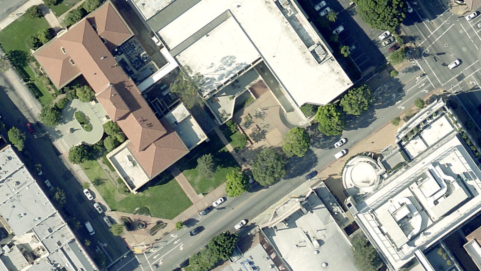
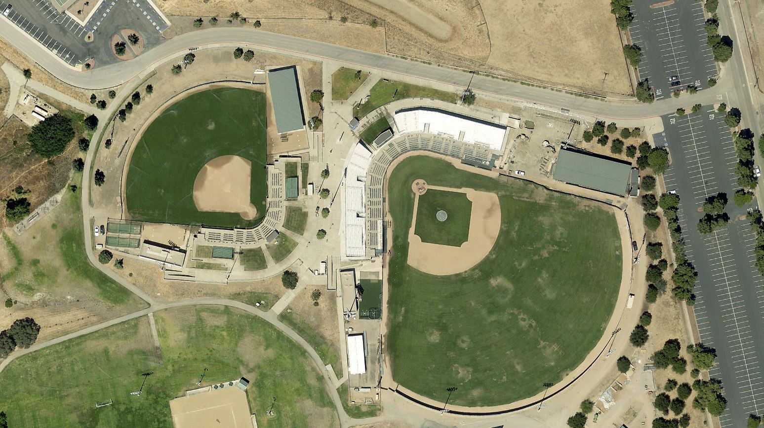
The image gallery below shows examples of the stunning imagery the county has shared with the Community Maps Program.
-
...
Cal Poly certainly sees the value in having access to this community-sourced imagery, as it directly supports campus basemap efforts. Cal Poly joined the Community Maps Program in 2019. They participate by submitting edits directly by way of the Community Editor App and sharing GIS data. Considering that adding and editing map features using the Community Maps Editor requires digitizing features while using imagery as a reference, this is a huge win for Cal Poly and will take their basemap creation potential to the next level.
Use the swipe tool below to compare imagery before and after the update.
Cal Poly will continue to build out campus features and this updated imagery is sure to be a game changer. The gallery below exposes the great accomplishments of students on the Cal Poly basemap team.
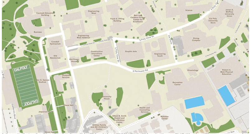
Esri’s basemaps provides a useful foundation for maps and apps that support students, faculty, facility management, campus security, campus event planners and visitors.
Having a contemporary and useful campus basemap is important. Navigation is the big one. Finding where you're going is something Google Maps and our current campus app can't achieve. There are many campus resources students need to find. There's also a lot of new construction on campus, we need to keep pace for the student and faculty populations.
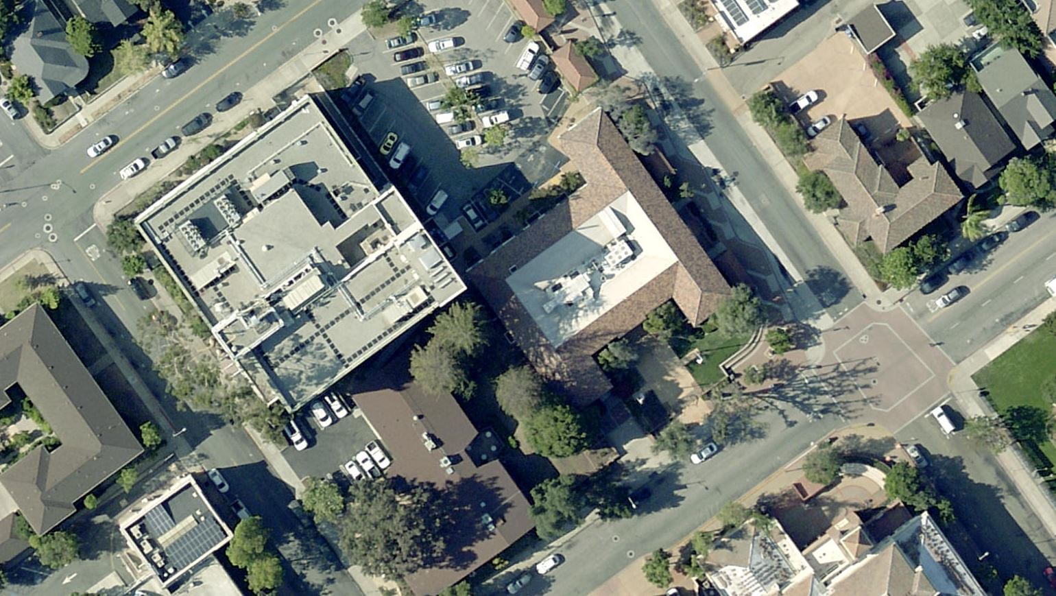
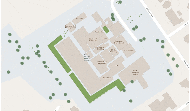
The Cal Poly basemap team’s efforts are not limited to their campus. Students and faculty at the university are also supporting the City of San Luis Obispo by adding large-scale content to the surrounding community. This past year students digitized key locations that were administering COVID tests and vaccinations, like hospitals, medical centers, foodbanks, and shopping areas.
Working on enriching basemap features during the COVID-19 pandemic to include things such as hospitals, testing centers, and foodbanks was a rewarding experience. I liked seeing how an Esri product could be applicable in times of need for public use. In addition, I thought the interface of the Community Maps Editor was easy and straightforward to work with. I had a great team of students and faculty supervisors to work with as well which enabled us to update the basemap in great detail.
The landscapes in Cal Poly and the City of San Luis Obispo are changing rapidly. We need to have current information on the map to make an informed decision. Cal Poly students have a long tradition of helping the community by working on projects as classwork. Students get real work experiences such as planning for the task, identifying and solving issues, and ultimately completing the work on time.
Students on the Cal Poly basemap team are not only contributing to an ongoing effort to build a useful campus basemap, they are a part of a broader process of learning new technical skills, improving spatial thinking and utilizing WebGIS.
The interactive campus basemap below exposes the great work the Cal Poly basemap team has accomplished.
This project gives students a completely different experience from class assignments.
Students see the need because they can use it every day. This ongoing basemap project shows them the power of crowdsourcing, starting large projects and adding incremental contributions. Seeing their edits on the map is very rewarding. Cal Poly supports the surrounding community. A near endless stream of student interns and employees working at nearly all levels of government and across private industry. We have a close working relationship with the City and County and work on numerous collaborative projects.
Esri’s Community Maps Program not only develops a suite of authoritative maps, it also brings communities together, builds relationships and promotes collaborative projects that serve everyone.
Join the Community Maps Program

Article Discussion: