There are lots of names for the same thing. It’s what makes the English language a rich and wonderful dog’s dinner.
For example, if you were an old-time settler traveling west (and naming stuff as you went, I suppose), you’d definitely keep an eye peeled for mercifully-navigable passages through otherwise really inconvenient mountain ranges. You know, these sorts of things…
Not just a valley, which might lead you right to a beautiful but ultimately perilous dead end, but an honest to goodness way through. Some time ago I was traveling through the Smoky Mountains and came across something or another that told me the term “Gap” was used in that area, while “Pass” was a more common name further west. Inspired by the beautiful work of Topi Tjukanov and Derek Watkins, I thought I might see with my own eyes if this talk of regional gap/pass naming rang true.
Conveniently, we have GIS Goggles, which let us slip various GIS Goggle filters into our GIS Goggle frames to see the world in impossible precision and clarity.
Double great.
So I downloaded an absurdly huge text file (for realz, it unzips to over 300 megabytes) of named places from the U.S. Board of Geographic Names and added it as XY data into an ArcGIS Pro geodatabase (after replacing the pipe delimiters with tab delimiters), which you can download and play with if you want, and POW…
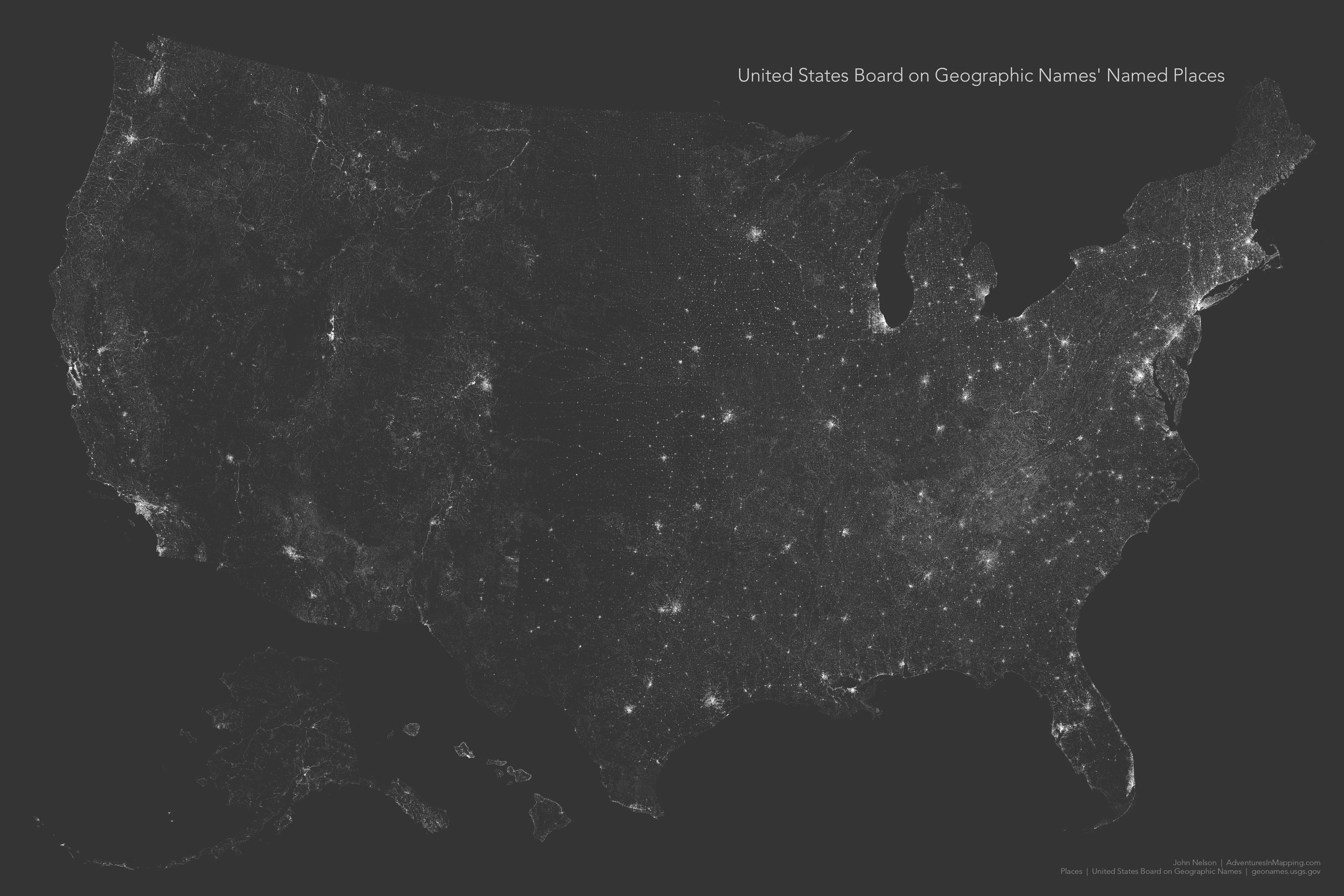
Whoahhhhhh. Let’s pull back on the reigns for a second here. Check that out! This is just a map of 2.3 million dots. It isn’t a map of the earth at night, it’s not a map of rivers or rail lines or highways or coasts. It’s just a pile of named places. But humans name places so the first order structure that arises at broad scales is that of humanity’s settlement patterns along paths of convenience. So it becomes an emergent map of rivers, transportation, valleys, and coasts—a pointillist portrait of us as the existential minutiae that settles into the folds of earth.
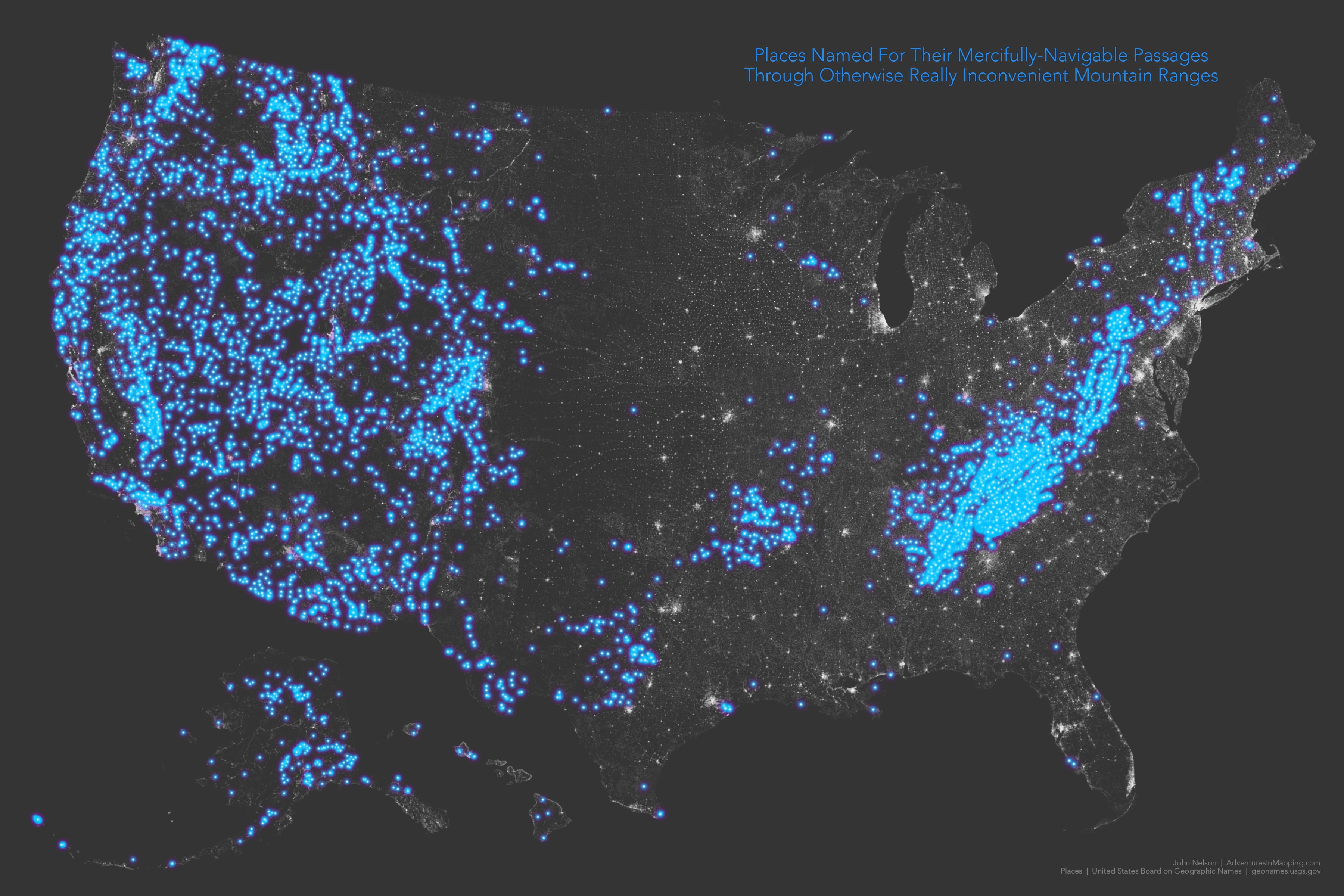
I’m sorry, where was I? Blipped out there for a second. Oh, right, passes and gaps and stuff. Here are those sorts of things, as categorized by the U.S. Board of Geographic Names…
Turns out there are more names for these things than just gaps and passes. They are also called notches and saddles, helpfully pointed out to me by Ethan Wolff-Mann, a writer for Yahoo Finance (maps bring people together, that’s why). Let’s parse this, shall we?
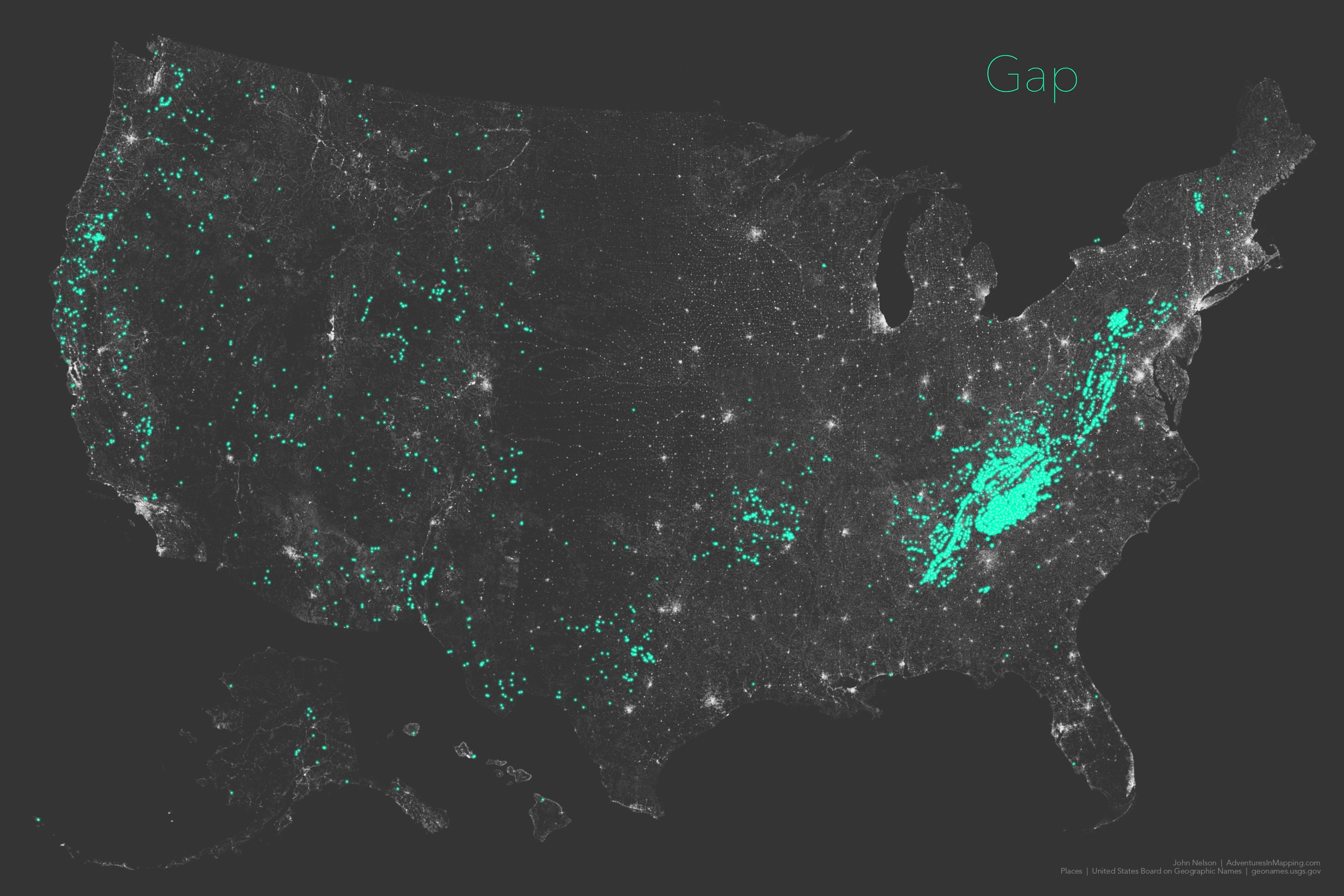
Sure enough, “Gap” was the nom de jour for those traversing Appalachia back in the day. Makes sense. There’s a gap, let’s go though it, name it, maybe a little settlement will develop. Cumberland Gap, being probably the best known example.
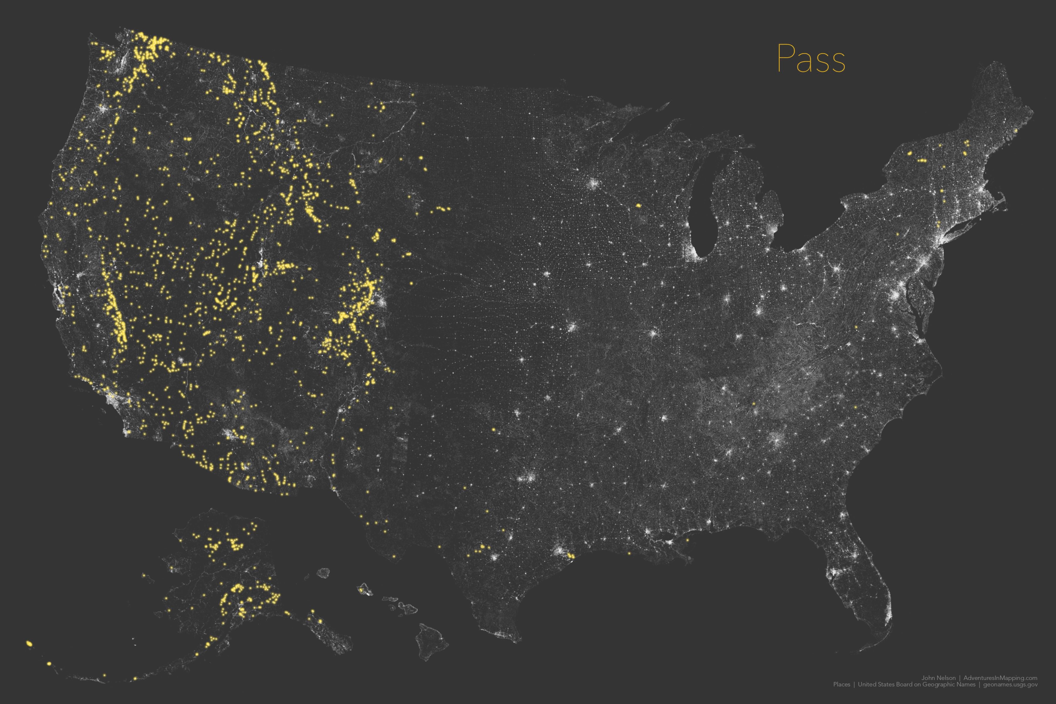
Wagons west! By the time mountain passages were getting English names out west, “Pass” was all the rage. I wonder why the word pass would appeal more than gap? Maybe because those traveling west had a more goal-oriented mission of hitting the Pacific. So when you encountered a mountain, by golly you just needed to pass through them.
Moving on…as it were…
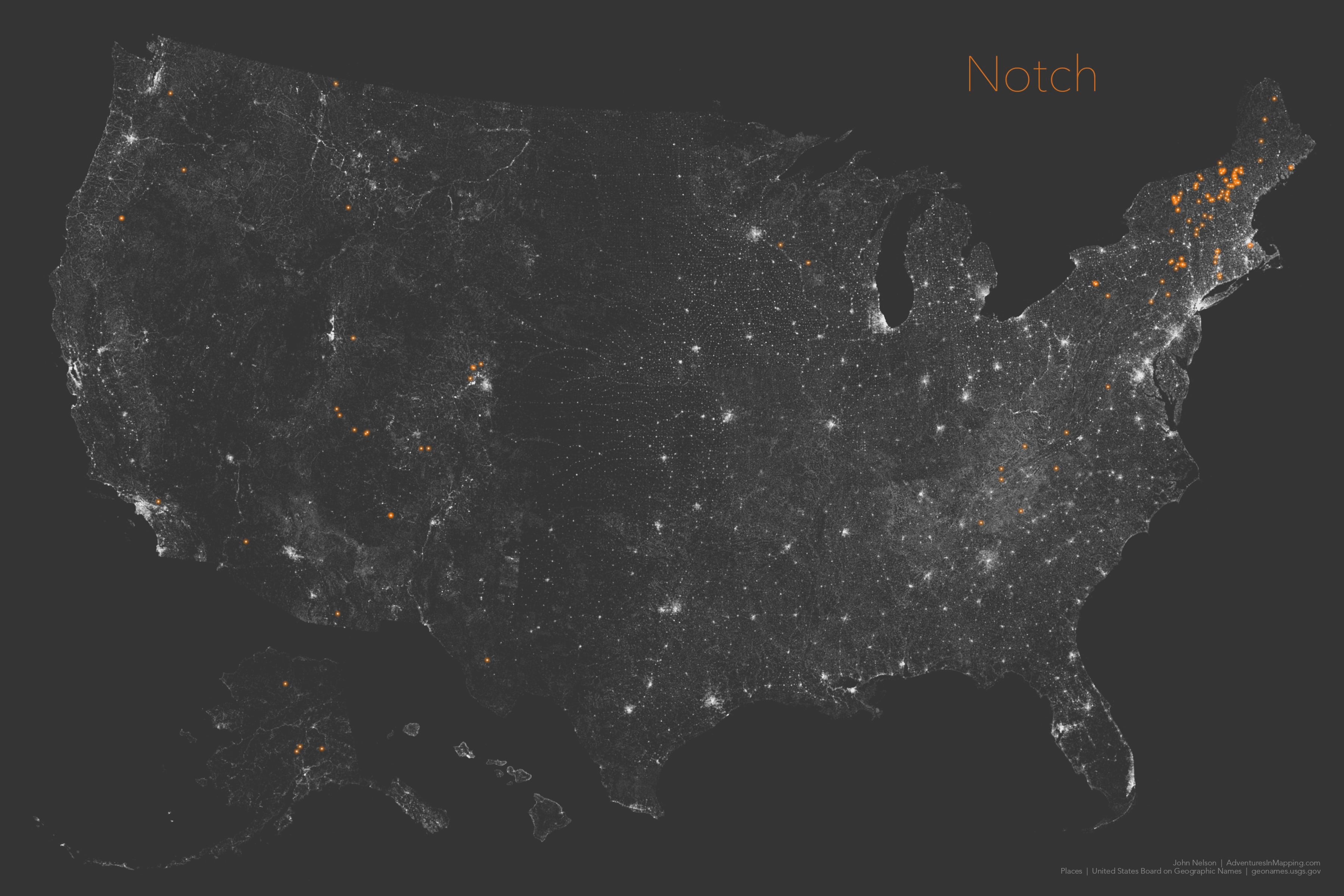
Wicked, look at that regionalism. “Notch” is certainly the preferred nomenclature of New Hampshirites. Why is it so concentrated in New England? IDK. I honestly DK.
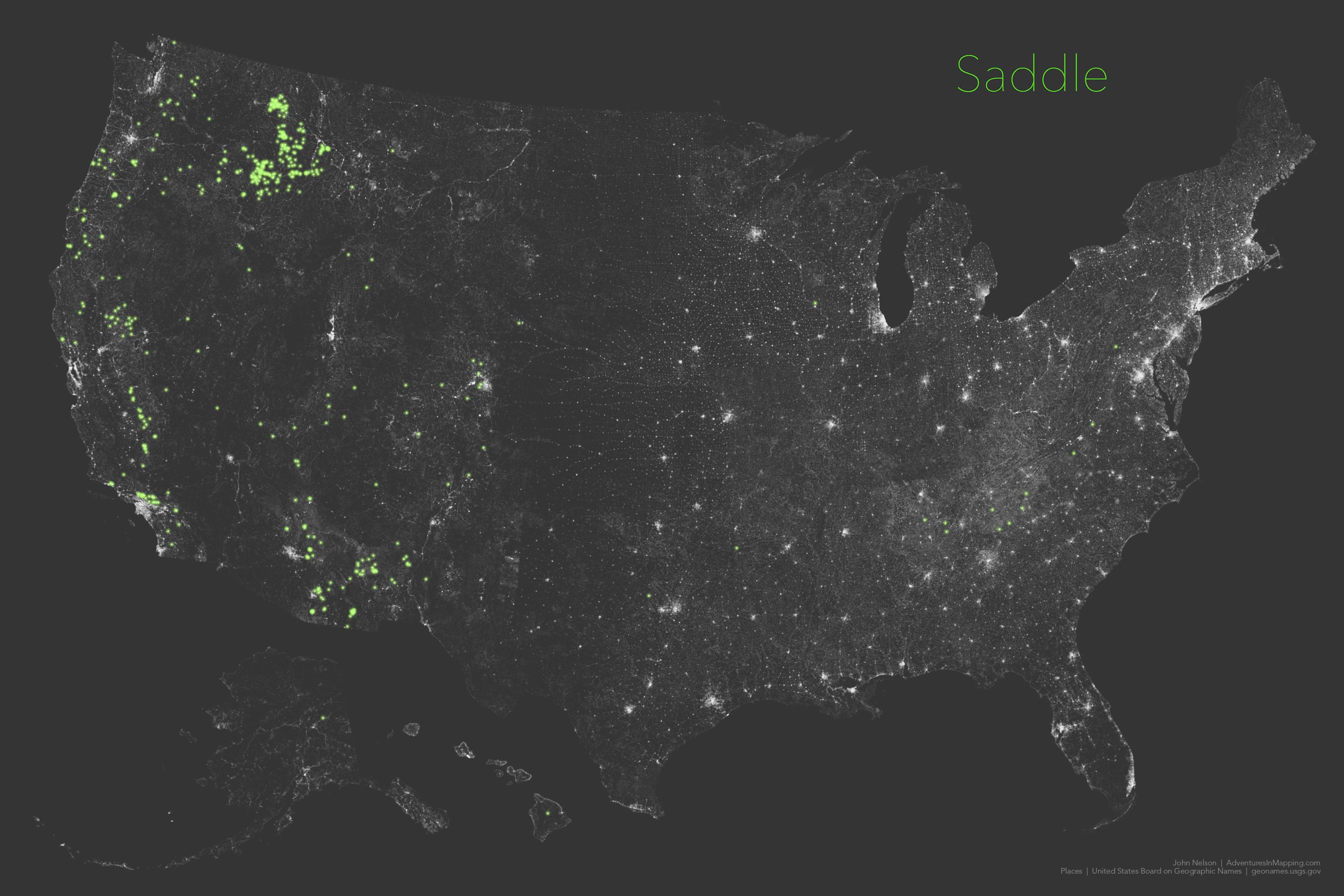
Lastly, if you are the sort of grizzled old-timer to name an alpine passage “saddle” then you were likely blazing trails in what is now Idaho. I mean my goodness. Saddle is actually the best description of these things, IMHO. You still have to hike uphill, but the hills on either side are still taller. Everything is relative. I like the sense perspective that someone who calls these things a saddle brings. And they probably had a very practical, very tactile, understanding of the second-order polynomial surface of a saddle. Old school.
Are you geologists wondering why I didn’t make a map of places with the name, “Col”? Because there were surprisingly few mountain passages (17) with that name.
You may be thinking, there’s no way this guy is going to show a map with all these names at once. That’s the beauty of the Vantasner Danger Meridian. It is so reckless to show all name types at once that you wouldn’t be prepared for it, and the result just may overwhelm your defenses…
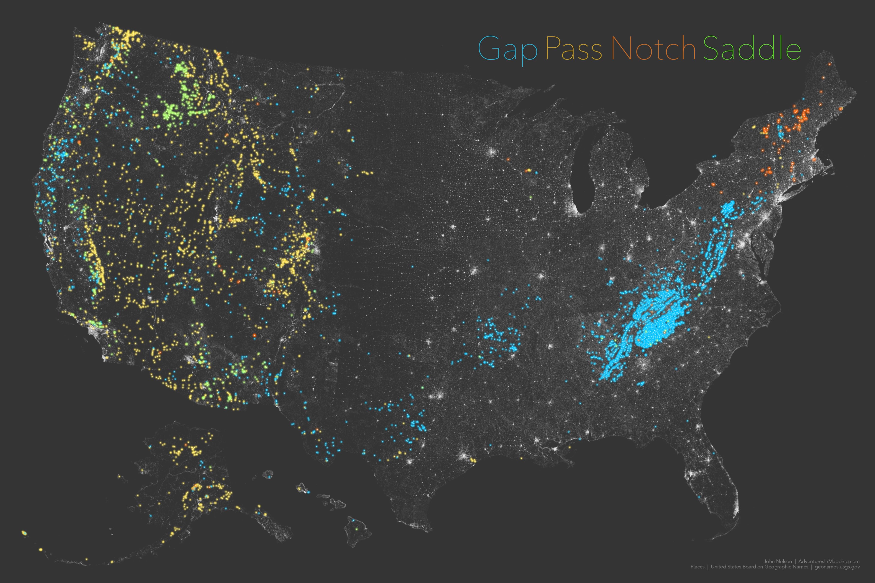
Did it work? Did you appreciate that map in spite of your best laid plans to reject something like it? Gooood good. Now download that geodatabase and get to making your own maps already!
Happy Place Name Mapping! John

Commenting is not enabled for this article.