The Intelligence Configuration for ArcGIS Pro (ICAP) was released back in August 2018, and we recently released version 2.0 in January. In this latest version we were excited to include new functionality to visualize your time enabled data on a timeline, and, to utilize ArcGIS LocateXT to extract and create locations from unstructured data.
Timelines
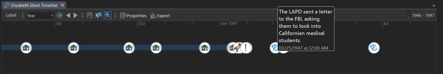
The Timeline is a way to visualize data along a temporal axis. We are used to visualizing data spatially in ArcGIS, now in ICAP you can visualize the same data concurrently to see where in time the data falls. Multiple layers can be viewed on the same Timeline as points if they have single timestamps, or as lines if they have start and end times. The Timeline scale is interactive allowing you to visually inspect specific events or time periods, in much the same way as you would use the map scale to zoom in and out of a map. In addition, selecting data in one view (timeline, map, link chart, attribute table) selects it all views for ease of editing and visualizing.
Time image below displays temporal data from the Black Dahlia cold case. The Timeline shows both specific events as points and timespan events with start and end timestamps, plus a point label.
Text to Features
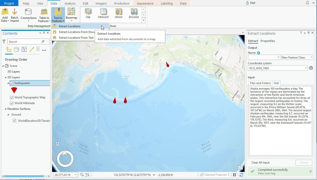
ICAP now utilizes the ArcGIS LocateXT extension by enhancing the Data ribbon with a Text to Features button for ingesting structured and unstructured data. This allows you to extract location data and places points on the map. LocateXT can extract data from almost any unstructured data, including messages, reports, briefings, and even social media. This functionality allows you to discover and map data from Microsoft Office documents (Word, Excel, PowerPoint), Adobe PDF, XML, HTML, text files, and more. ICAP has the capability to search large blocks of text for locations and process many folders and files at once.
In the generic example below, we have taken some unstructured text and simply pasted it into the Extract Locations pane and used a Scene to display the results.
Alaska averages 100 earthquakes a day. The tectonics of the region are dominated by the interaction of the Pacific and North American plates. This interaction has accounted for three of the largest recorded earthquakes in history. The largest, measuring 9.2 on the Richter scale, occurred in the Prince William Sound (60.91°N, 147.34°W) on March 28th, 1964. The second largest Alaskan earthquake, measuring 8.7, occurred on February 4th, 1965, near the Rat Islands (51.25°N, 178.72°E). The third, measuring 8.6, occurred on March 9th, 1957, near the Andreanof Islands (51.50°N, 175.63°W).
Additional Resources
Get an overview of Intelligence Configuration of ArcGIS Pro
Commenting is not enabled for this article.