Whether you want to find locations that are most suitable for commercial real-estate development, retail market planning, healthcare facilities, community centers, office space relocation or global siting of data centers, you often want to determine which among the multiple potential locations is the best or worst location for your location criteria. The suitability analysis workflow in Business Analyst Web App helps you make such decisions by ranking and scoring locations based on multiple weighted criteria.
Often times, your organization stores and manages the layer of existing and potential locations in ArcGIS Online or ArcGIS Enterprise. This blog highlights a new feature that helps you leverage existing ArcGIS layers in the suitability analysis workflow more effectively. Here is how:
Bring Your ArcGIS Layer in Suitability Analysis
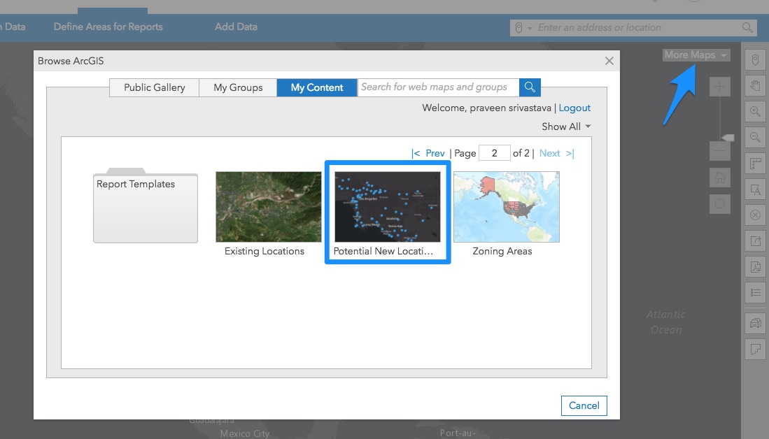
In BA Web, access your organizational content from More Maps > Browse ArcGIS. Find and add the ArcGIS layer you want to use in Suitability Analysis.
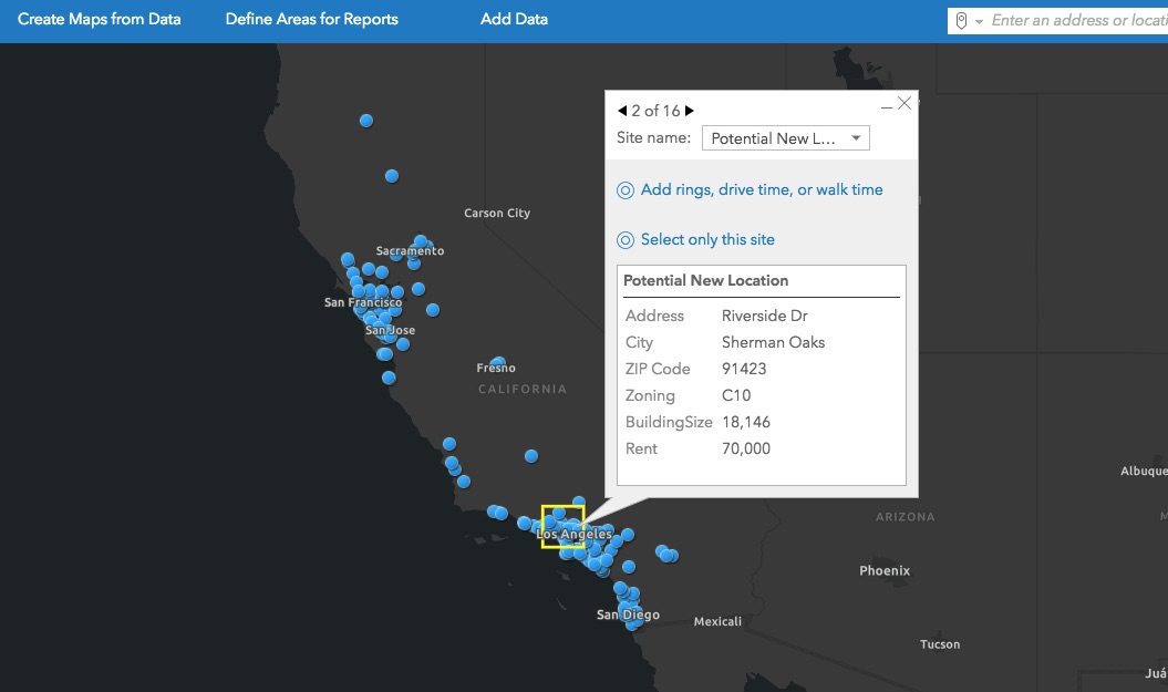
For example, add the point layer of all potential new locations for a grocery store in California. Click any location to review its attributes such as address, zoning, rent, and building size.
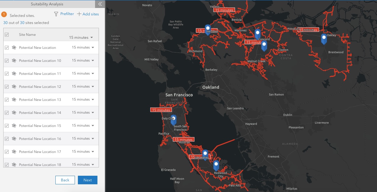
Prepare Candidate Locations for Suitability Analysis
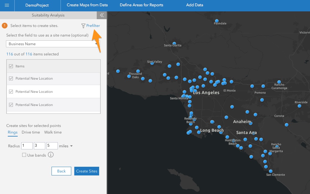
Go to Create Maps from Data > Suitability Analysis and choose Start with features on map. Click the new Prefilter button at the next step.
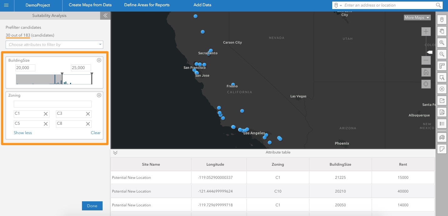
The prefilter capability lets you screen and filter candidate sites at the beginning of the workflow. This helps you prepare the right candidate locations for suitability analysis by eliminating the sites that don’t meet minimum criteria.
For example, eliminate the sites that are too small for a grocery store (let’s say less than 20,000 sq. ft.) and consider the sites that are only in land use zoning permitted for grocery store development (let’s say zoning codes C1, C3, C5, and C8). Choose the attributes to filter by and set up ranges for the right candidate locations. While doing prefiltering, you can use the attribute table of the layer as well as the map to visualize the filtered candidate locations.
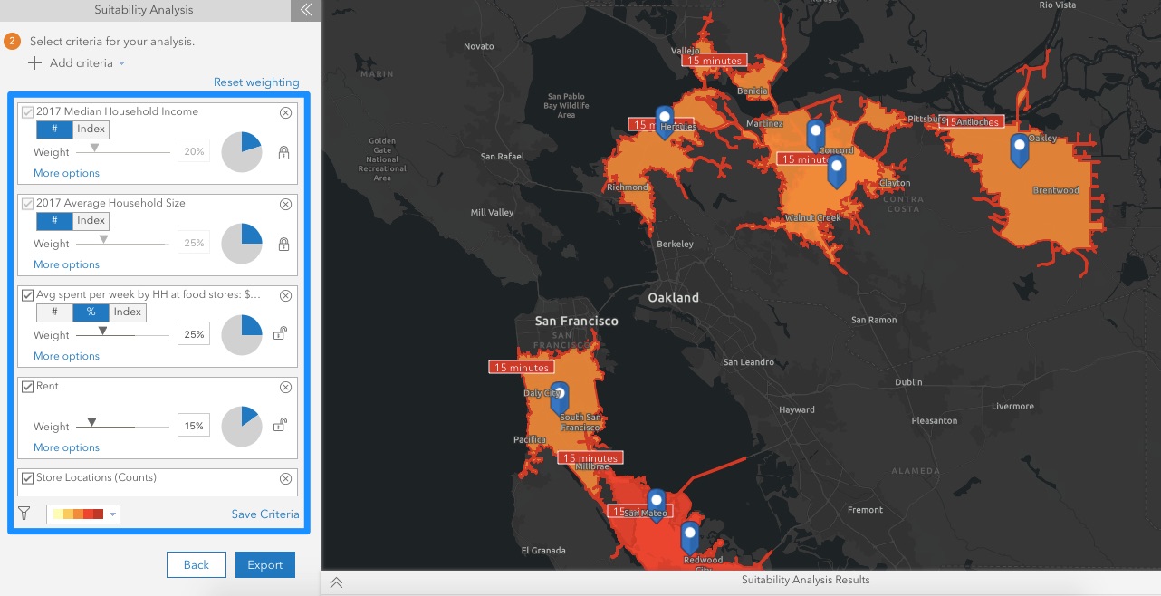
Create Sites and Weighted Criteria and Run Suitability Analysis
Once you have the candidate locations, create the desired study areas for them. For example, 15 minutes drive time trade area in this case – a typical time or less that people drive to go to grocery stores.
Model your location criteria using three types of parameters:
- Data variables (e.g. population, household size, income, age) or your own data variables (e.g. numbers of customers, sales)
- Location attributes (e.g. rent, number of parking spaces)
- Points locations layers. This could be competing (e.g. other grocery stores) or companion locations (e.g. restaurants, shopping locations) that might help or cannibalize bringing your target demographics to the new location.
Set desired weights for each parameter as certain parameters may be more important than others to the overall decision. As you define or change criteria, suitability analysis is performed dynamically – helping you do various what-if scenarios on the fly as asked by stakeholders or executives. You can review the scored sites on the map (in this case, darker the site on the map, more suitable that is for the criteria set) and in the results table.
You have the option to save the modeled criteria. This helps you run the same suitability analysis for another set of locations. For example, the same suitability analysis for a new grocery store in Oregon.
Save and Reuse Suitability Analysis
Export suitability analysis including the ranked sites, attribute table, and modeled criteria in one resulting layer. This helps you easily reopen and use suitability analysis and change it as needed.
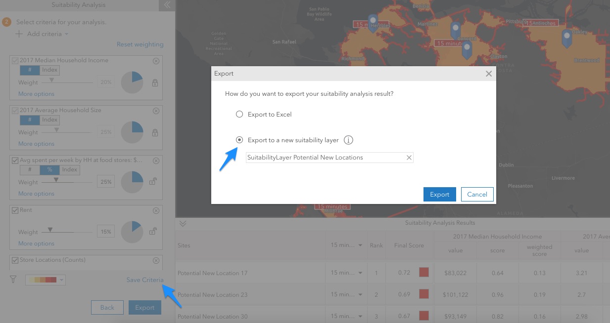
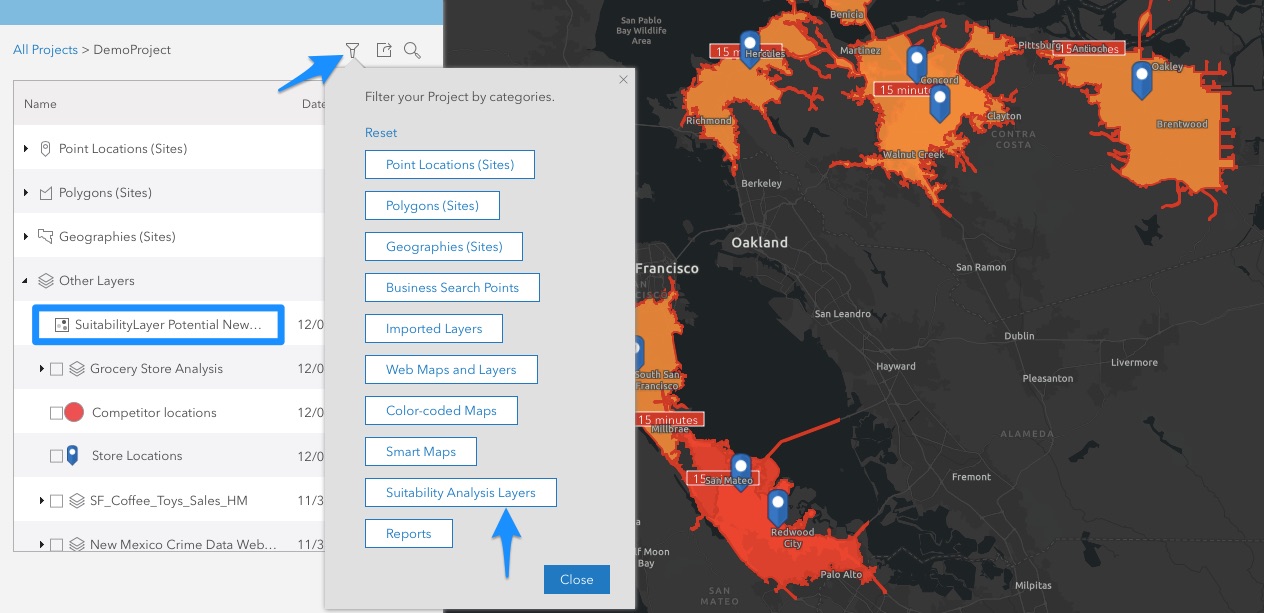
Easily find the exported suitability analysis layer in your project by using the Suitability Analysis Layers filter.
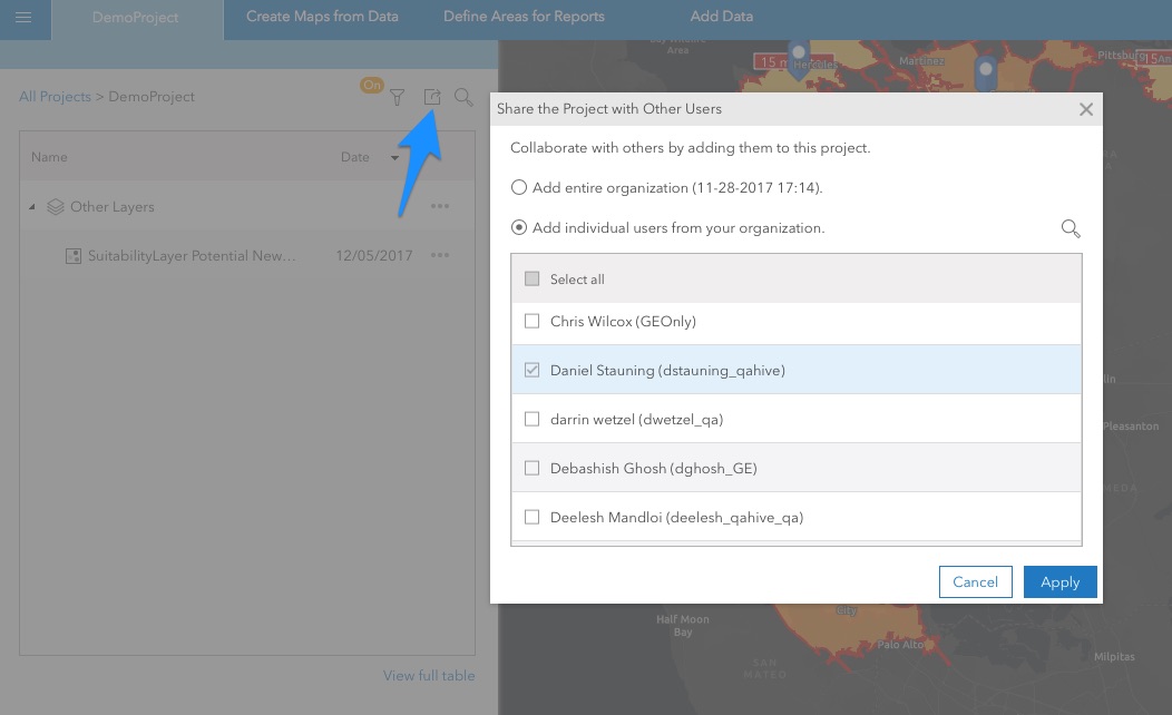
Share Results with Others
Add others to your project and share your suitability analysis results with them. They just need to open the layer to review the criteria defined, map of the ranked sites and the results table with weighted scores.
Need to learn more about Suitability Analysis? Get started here.

Commenting is not enabled for this article.